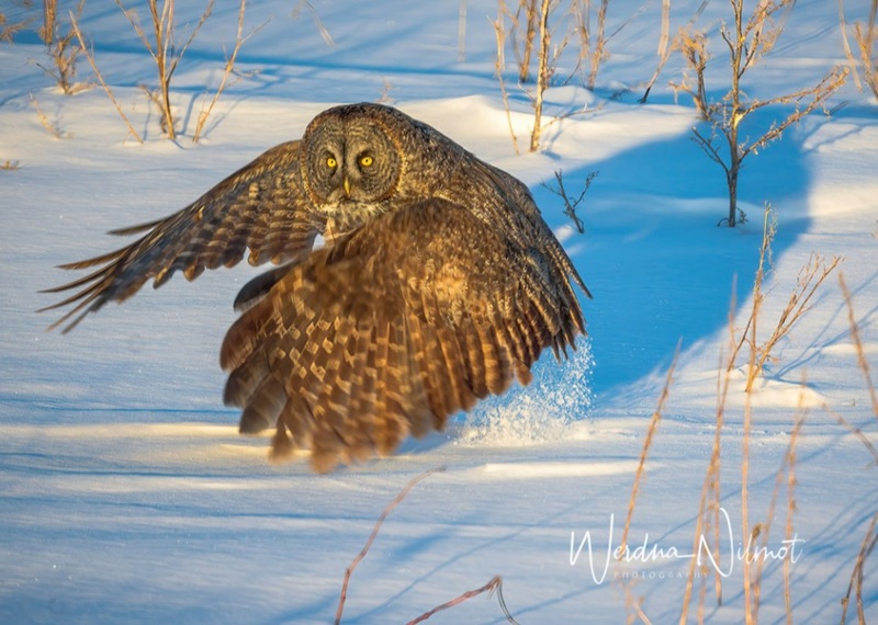
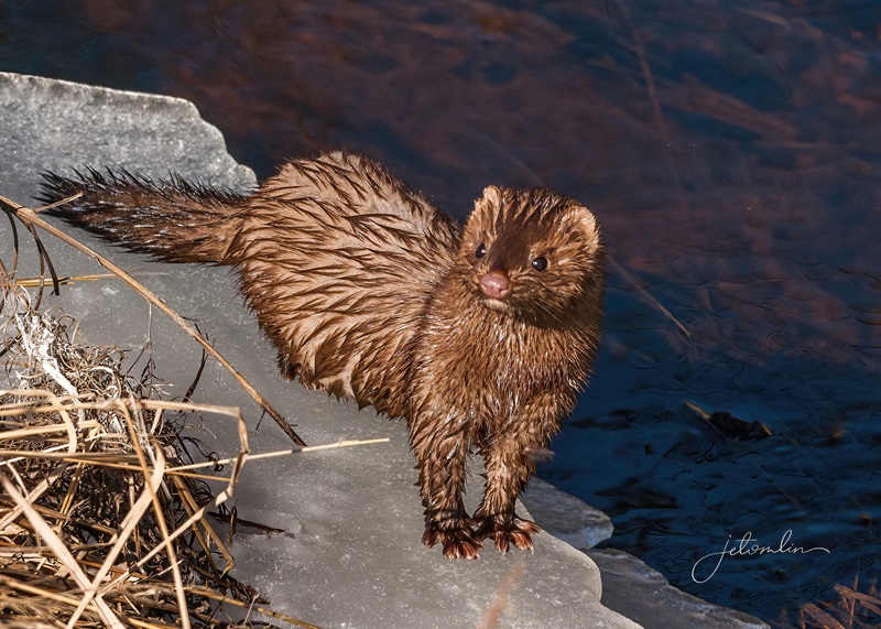
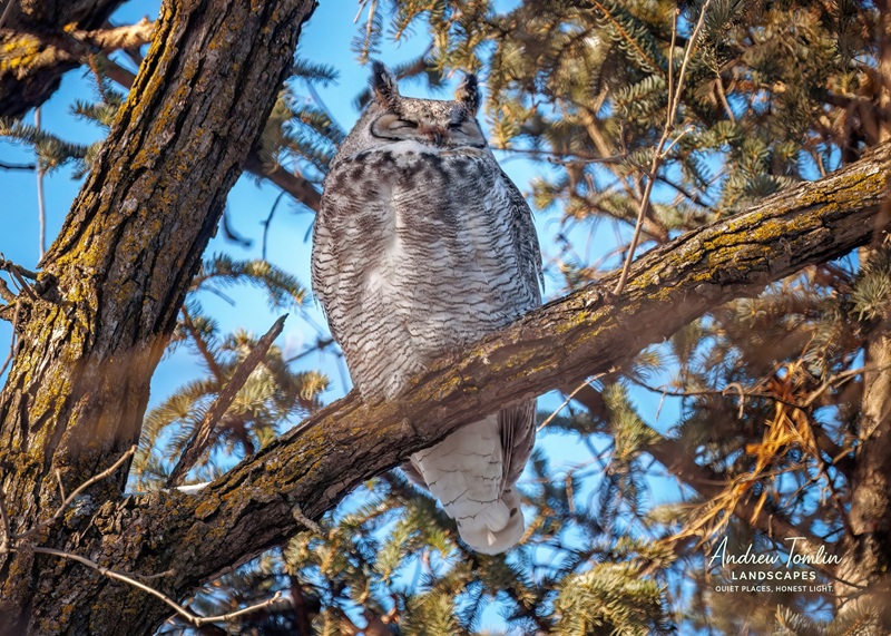
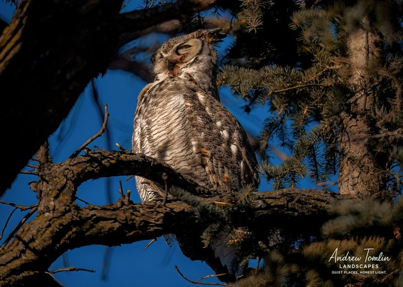
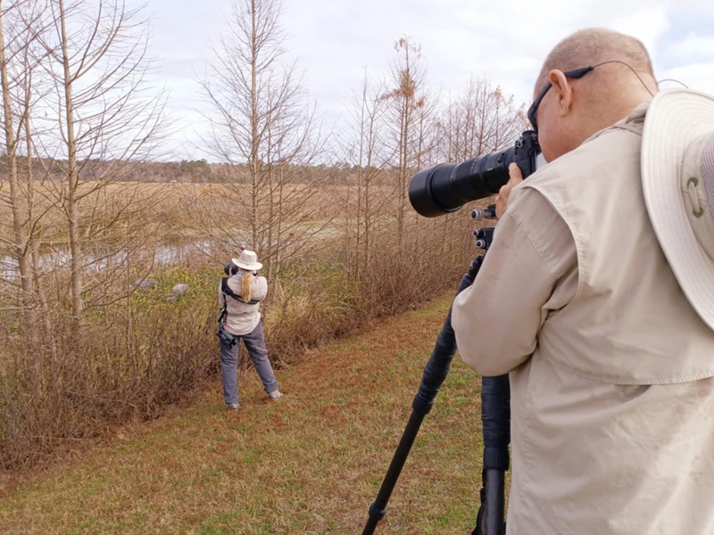
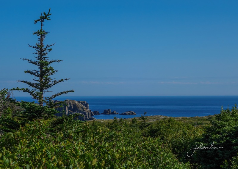
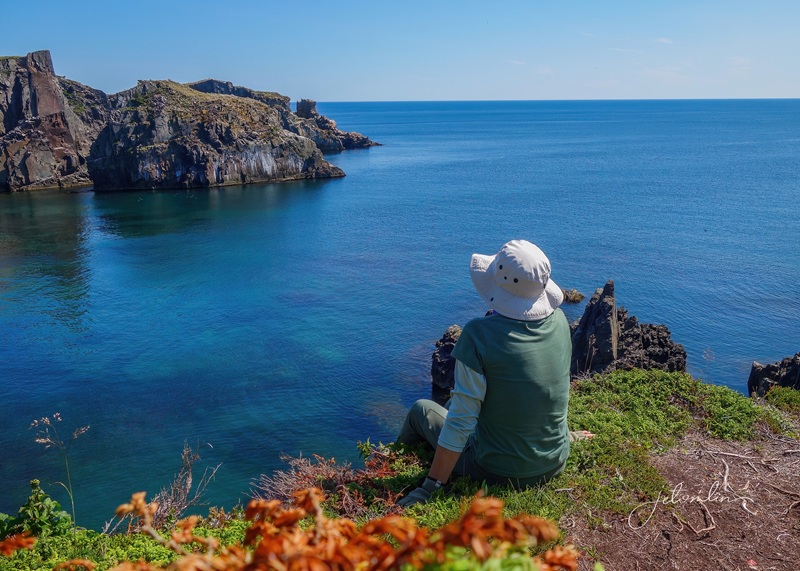
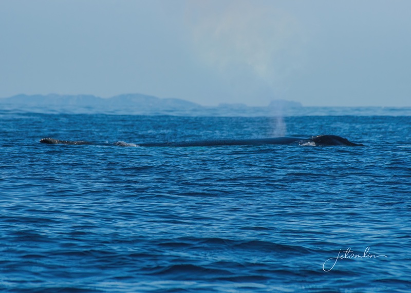
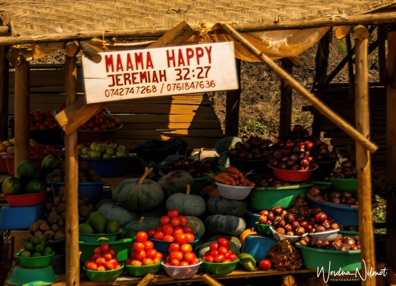
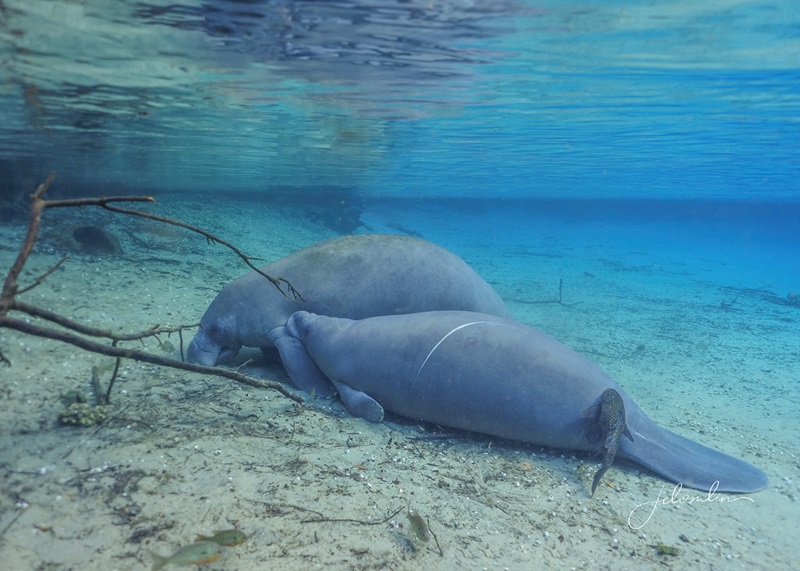
In 2022, 23, and 24, we traveled to Northern Minnesota’s Sax Zim Bog in the middle of winter to photograph owls. We always had a magical time and were fortunate to see everything from great grays hunting in the snow to a playful mink who seemed to enjoy posing for us as much as we enjoyed photographing her.
great gray owlminkclick on photos to enlarge
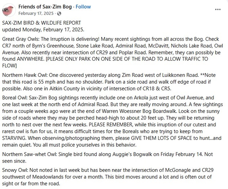
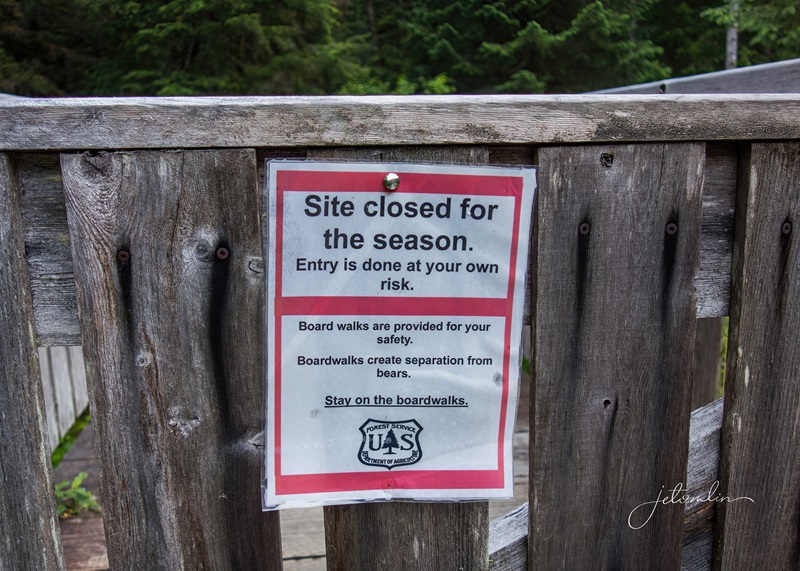
With Uganda already on our 2025 travel schedule, we were unable to make a trip north that winter. Unfortunate timing for us, as it was an “irruption year,” a rare event that occurs when there is a sudden increase in the population of certain owl species, including great grays.
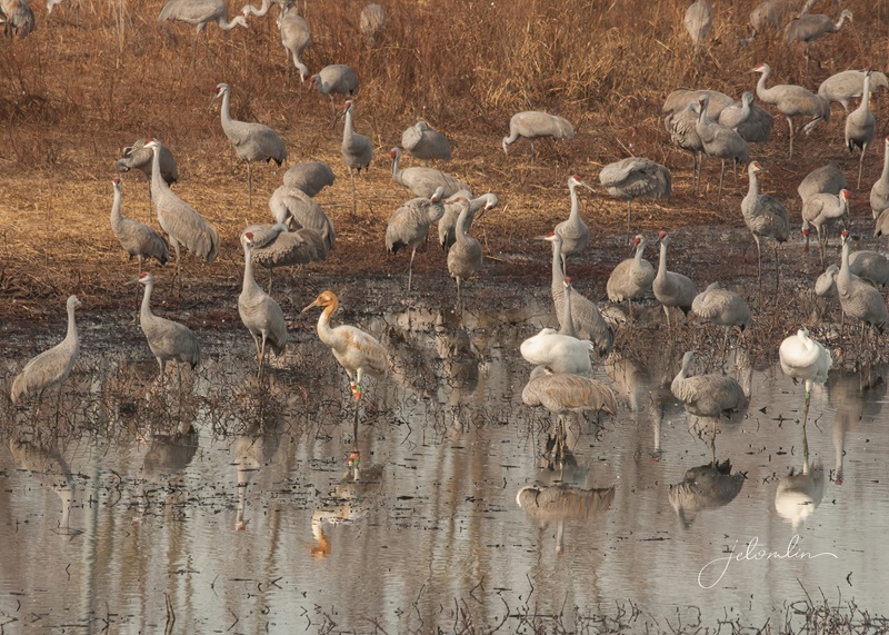
SZB Bird & Wildlife Report, February 17, 2025
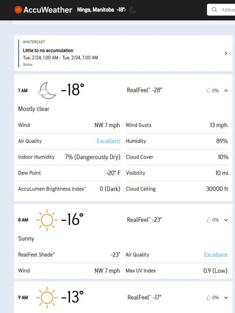
We hoped for the best in 2026, but by mid-January, it was clear that this winter was nothing like the last. Sightings of any owls were scarce, and great grays were non-existent.
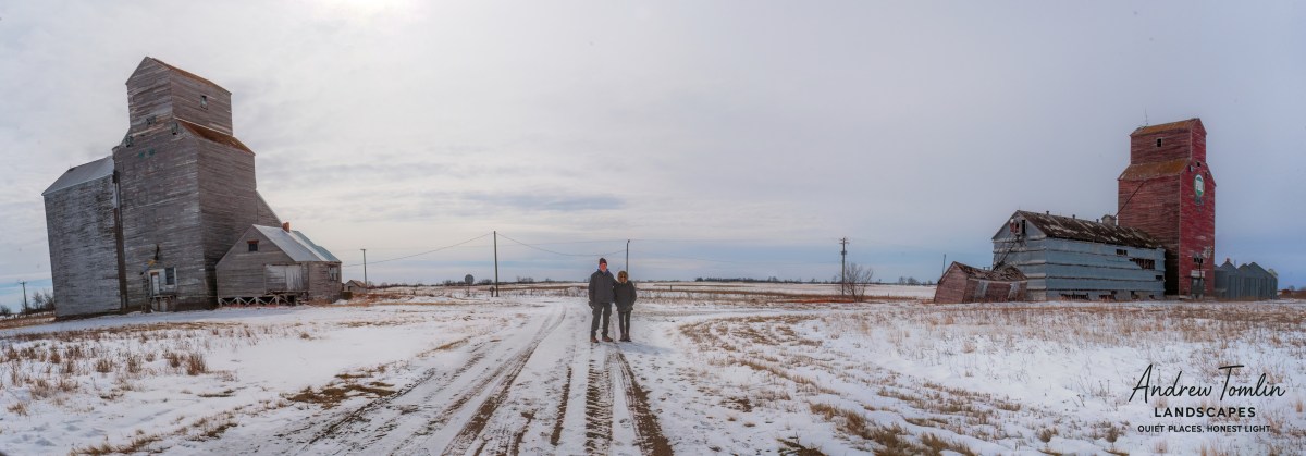
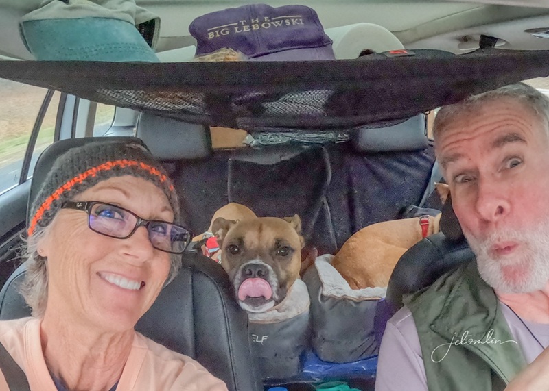
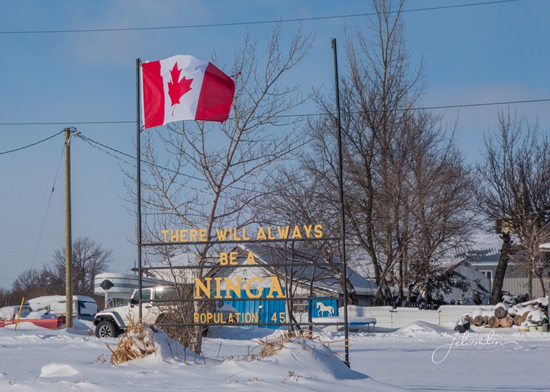
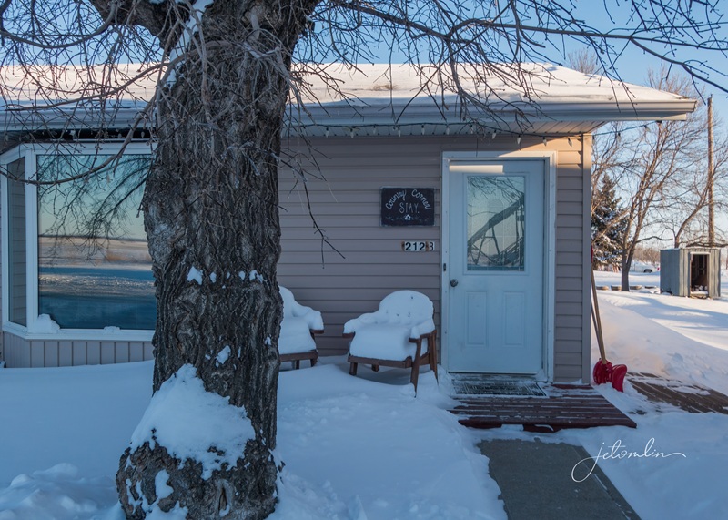
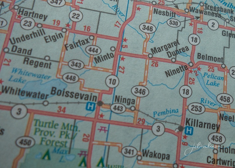
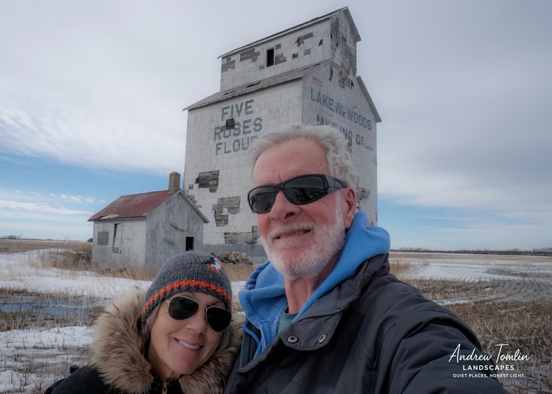
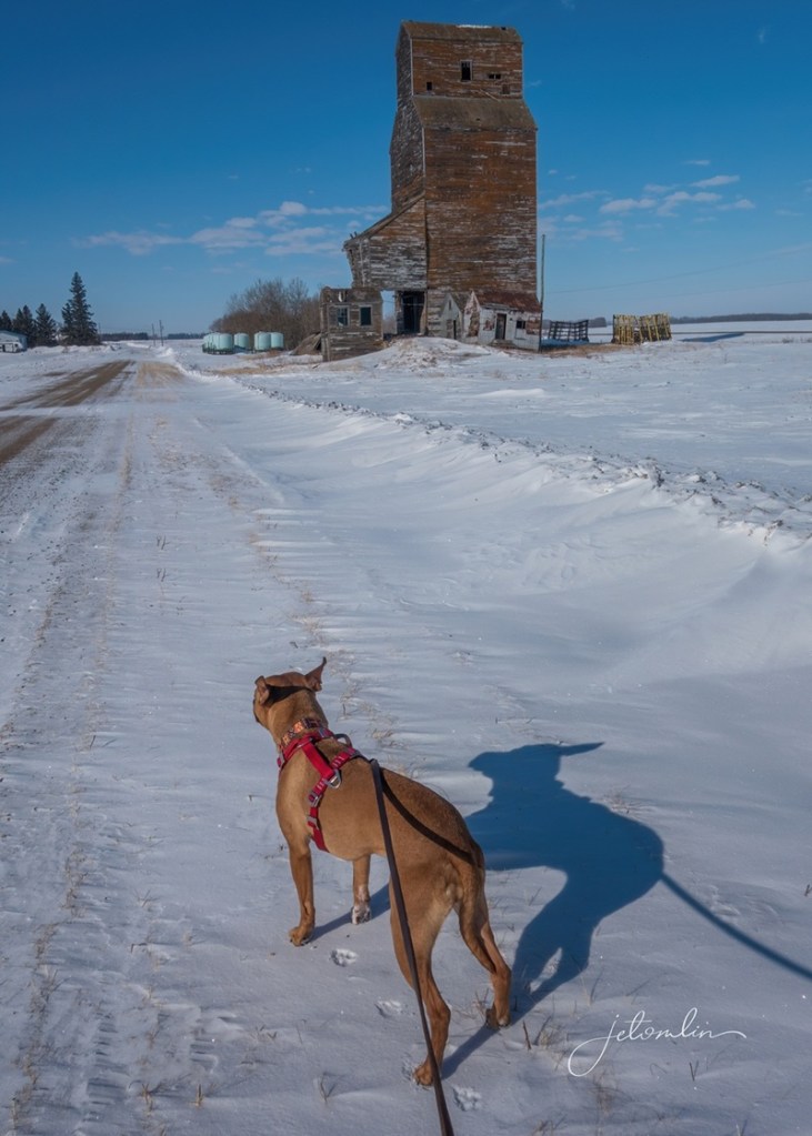
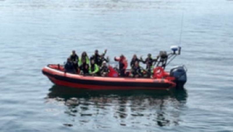
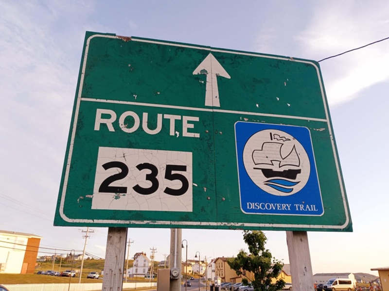
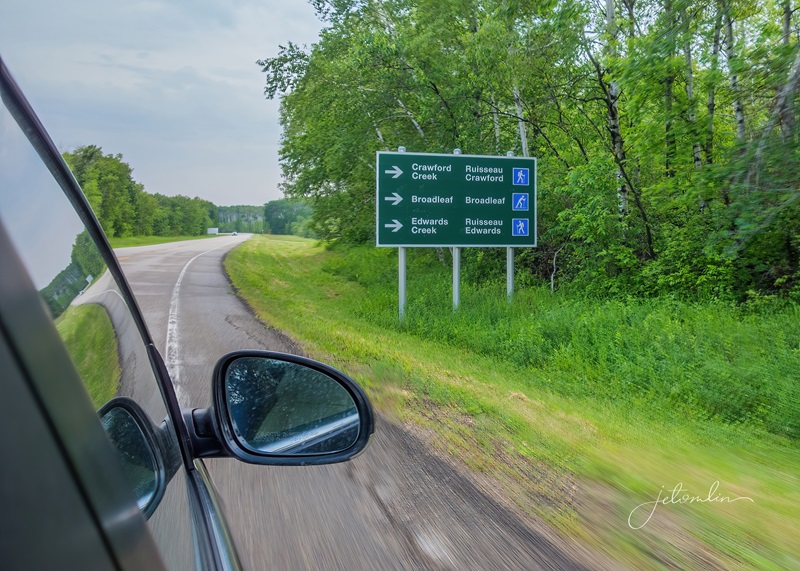
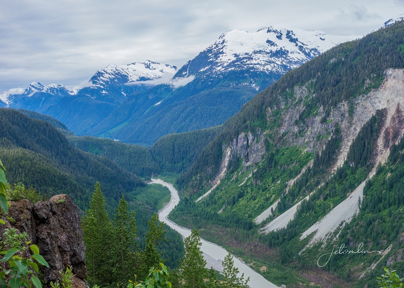
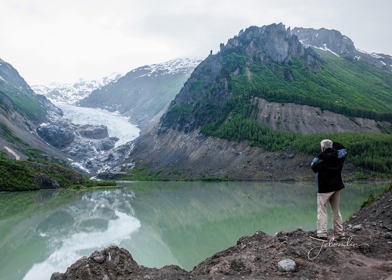
It didn’t make sense for us to travel all that way only to be disappointed. We felt that by going further north, we might have better luck with our wildlife sightings, so TG found an affordable Airbnb in the small town of Ninga, Manitoba.
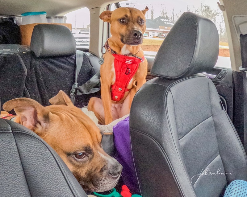
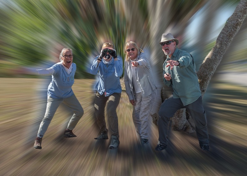
Oscar & Maddie: such good travel buddies!
1800 miles in the car
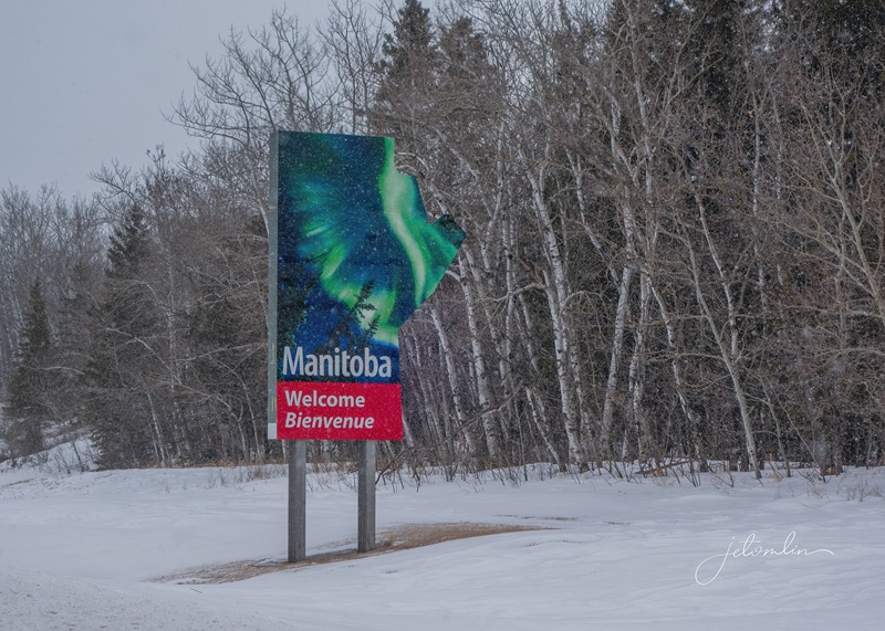
Welcome to Manitoba!
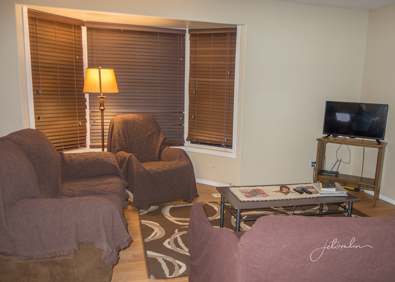
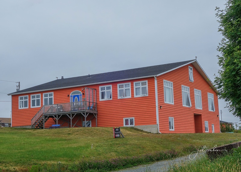
Bethany’s Country Corner Stay was a charming duplex and perfectly suited our needs.
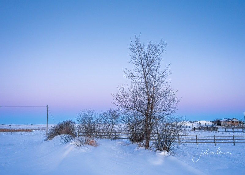
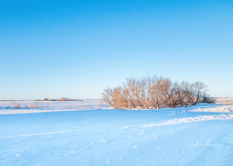
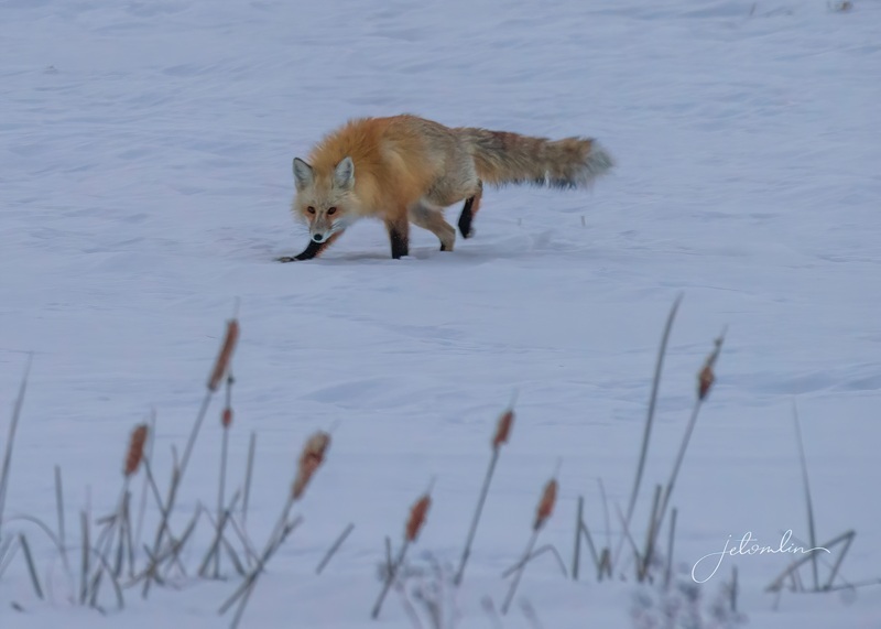
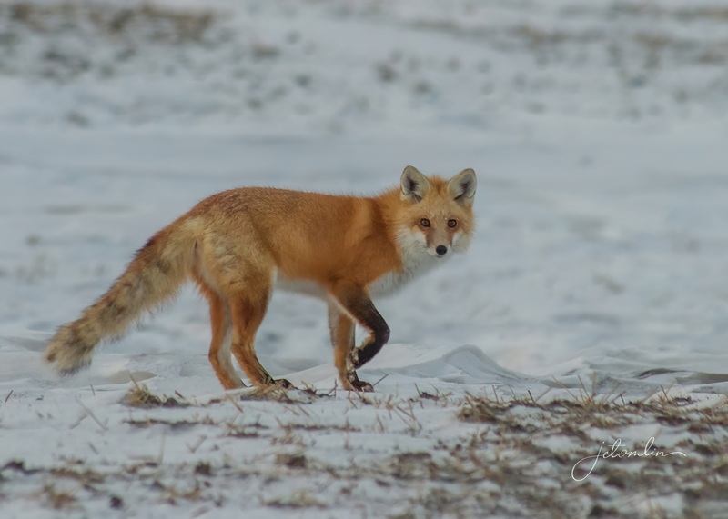
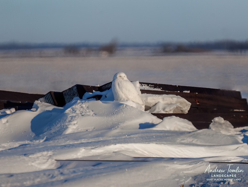
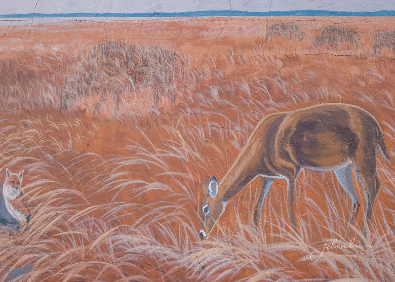
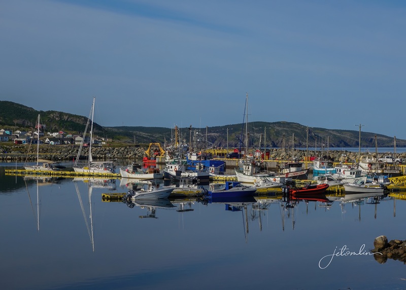
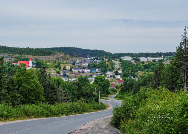
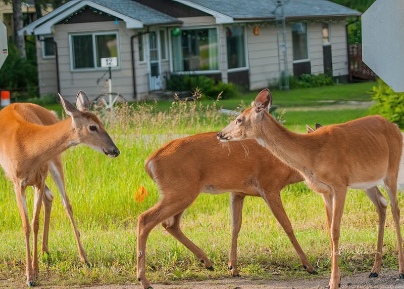
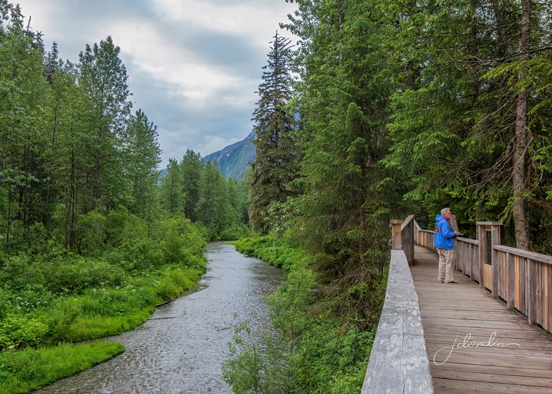
The forecast called for warmer temps in the coming weeks, so on our first full day, we made a quick grocery run to Brandon and then stayed close to home. Still, on that first drive we saw a red fox running across a snowy field, several white-tailed deer, flocks of snow buntings, a magpie, and, to our delight, a snowy owl. The area seemed promising! We also took a few walks around the tiny village of Ninga: population 45.
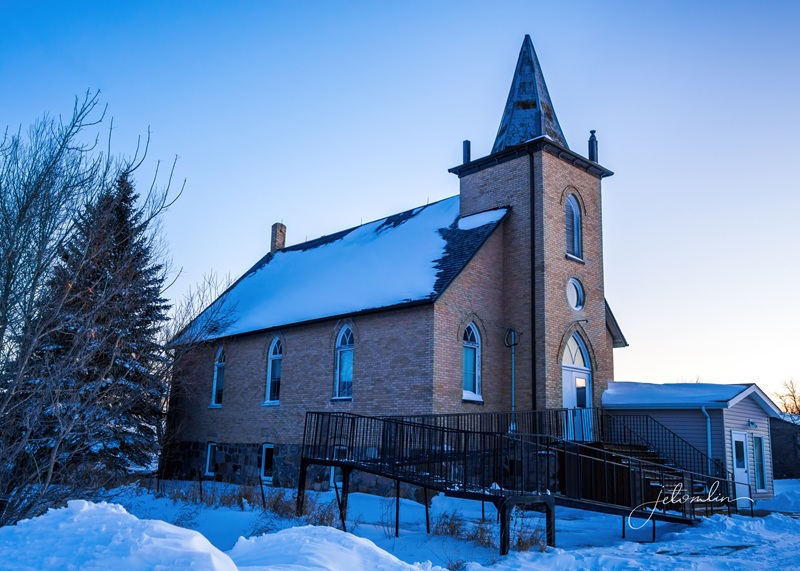
sunrise reflection to the westNinga Presbyterian Churchour view to the southNinga sunriseclick on photos to enlarge
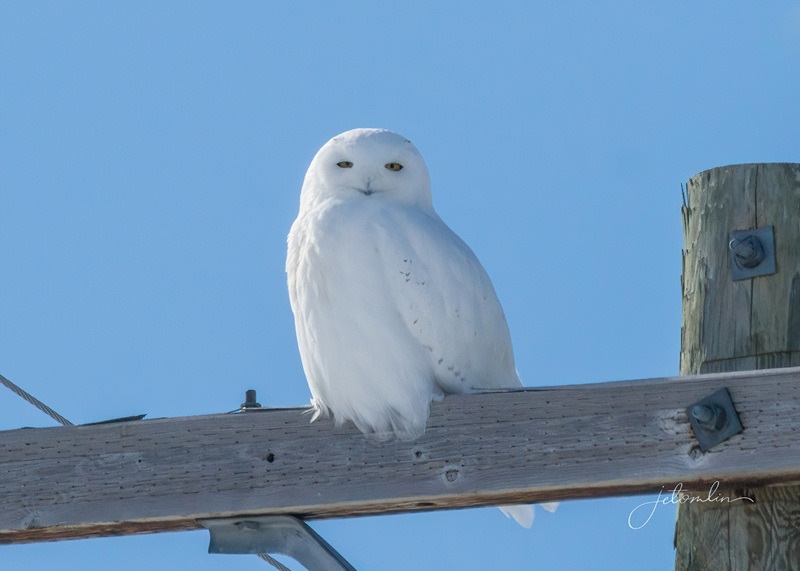
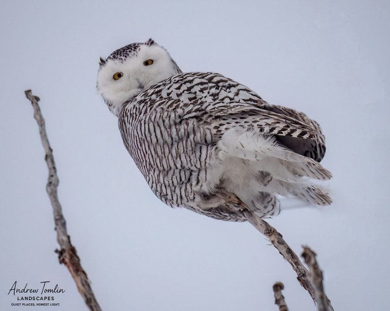
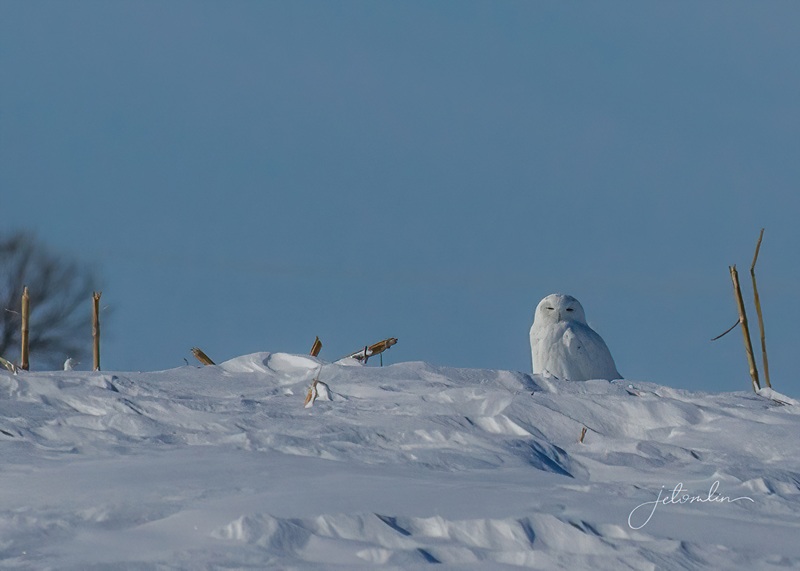
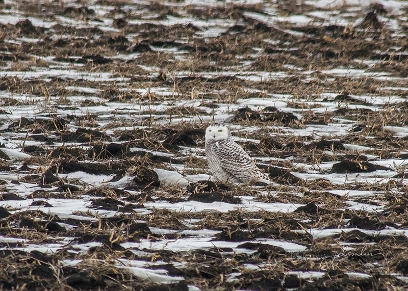
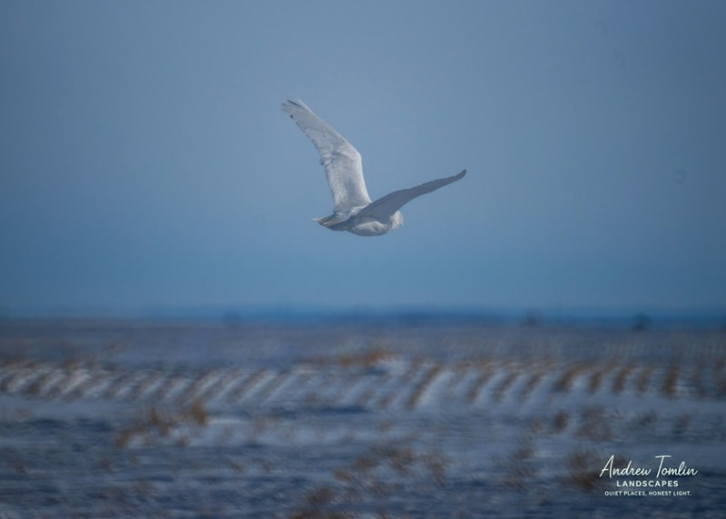
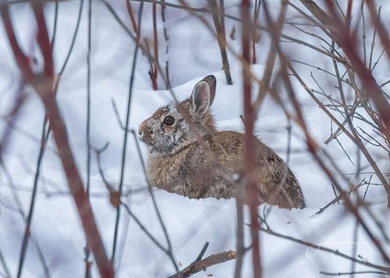
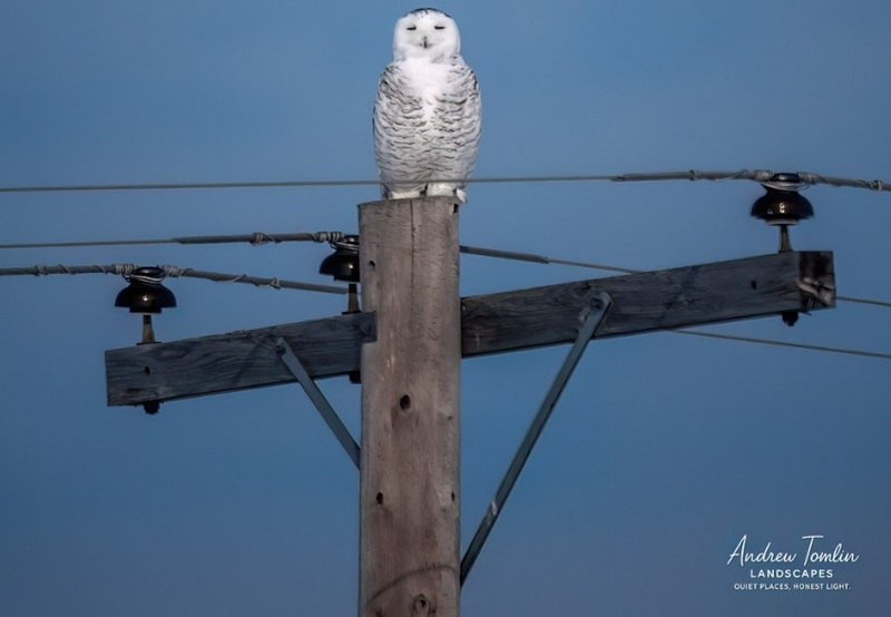
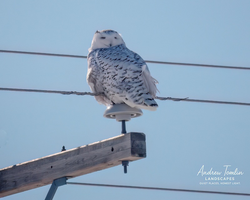
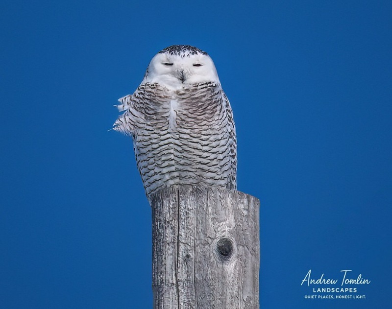
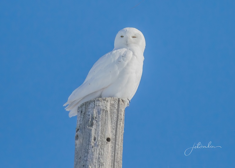
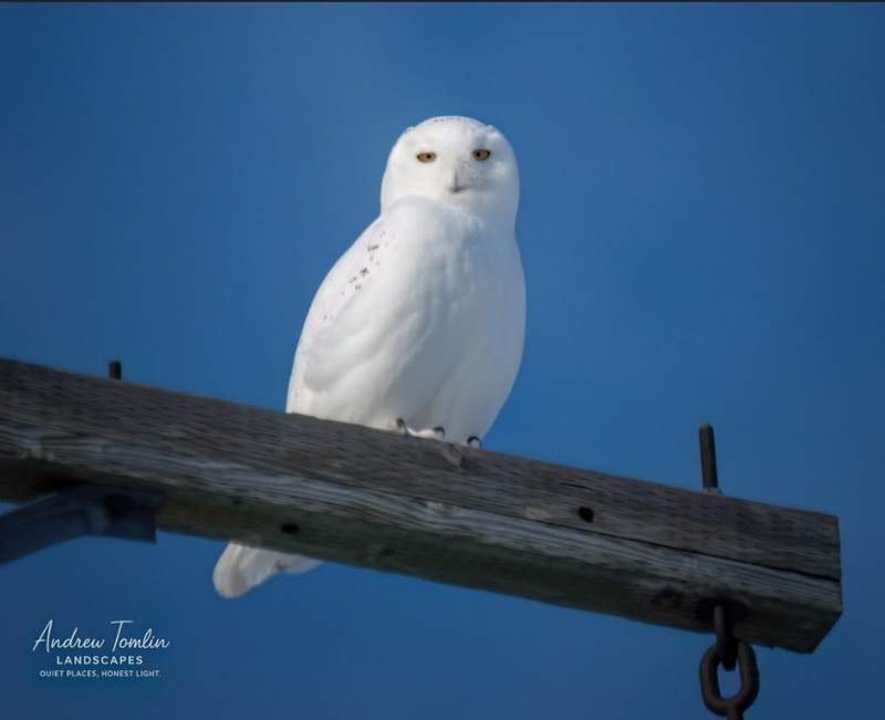
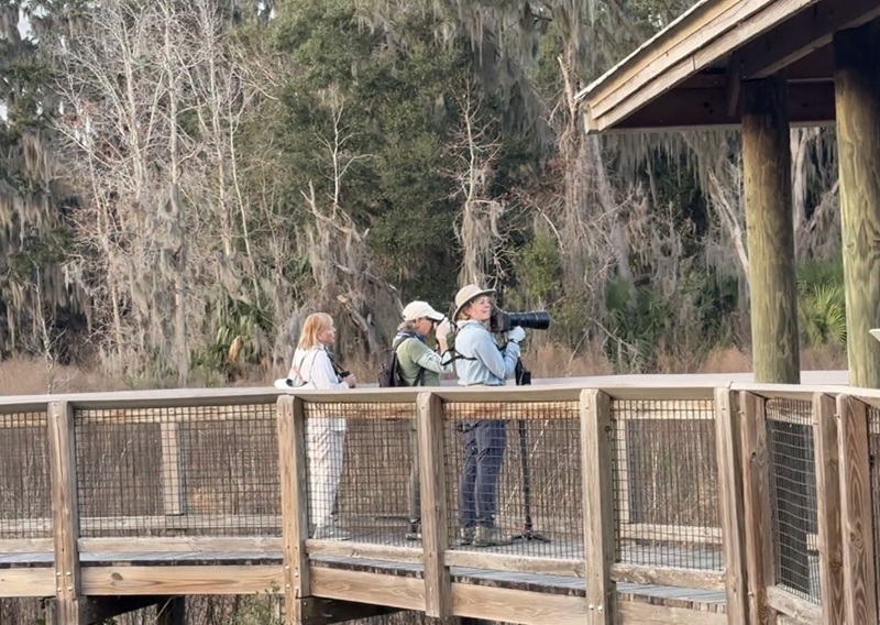
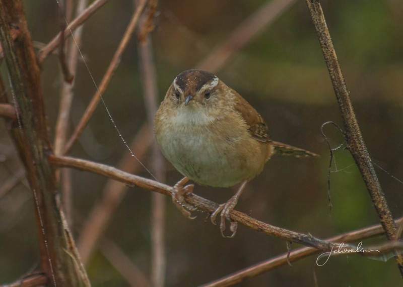
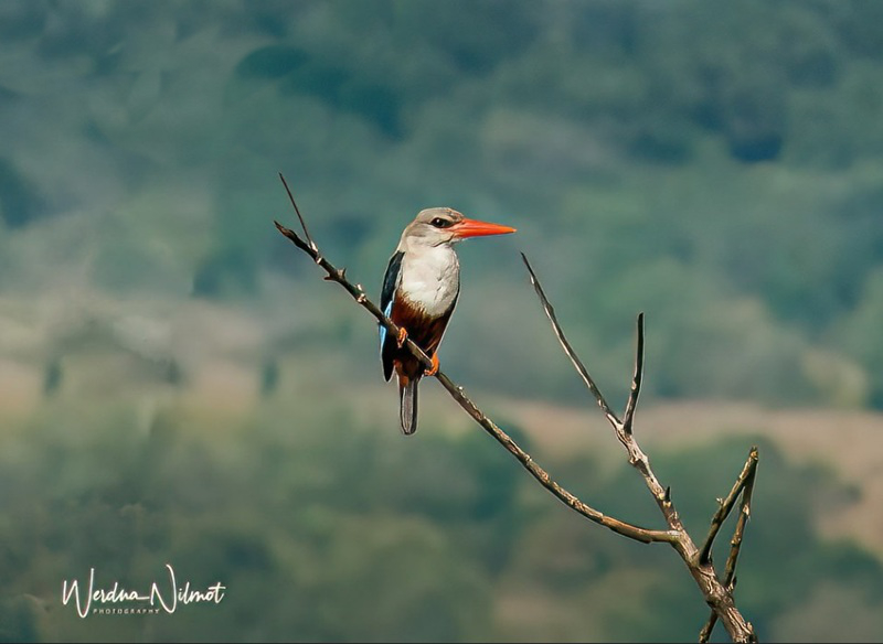
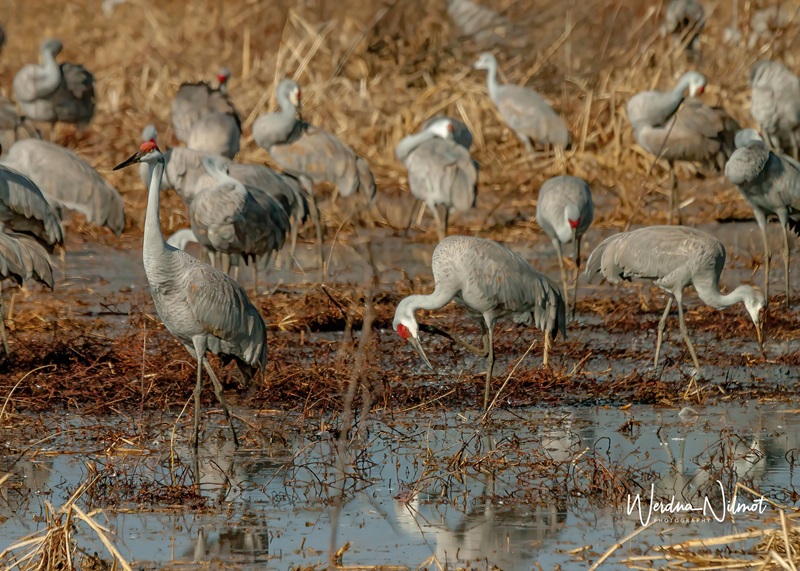
We quickly settled into a routine. Every morning, we woke early and planned our photo safaris. Since we were in snowy owl country, we were confident we’d have good luck no matter which road we took. Over the four weeks, we saw 28 snowy owls.
male snowy on a power pole
female snowy at the top of a tree
male snowy on a snow drift
female snowy in a field
As a local said, “This is wheat country, and where there is wheat, there are rodents. And where there are rodents, there are owls!”
“This is wheat country, and where there is wheat there are rodents…”
“And where there are rodents, there are owls!”
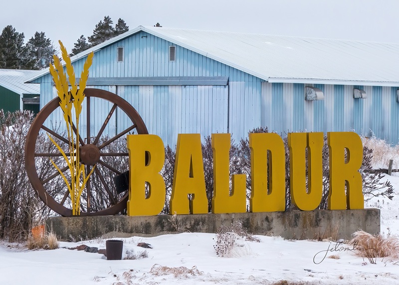
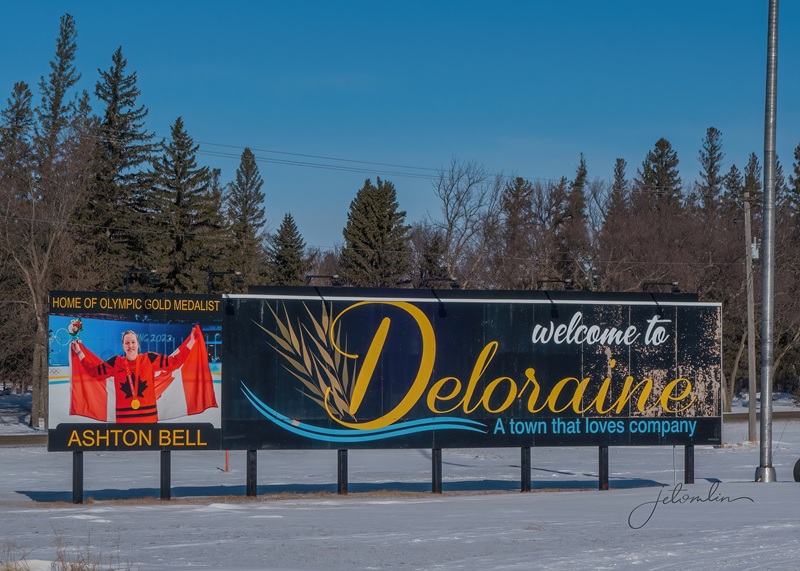
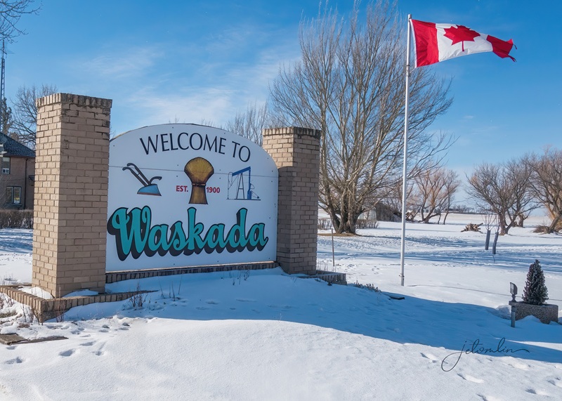
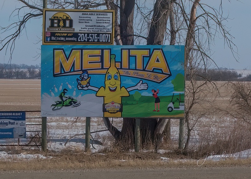
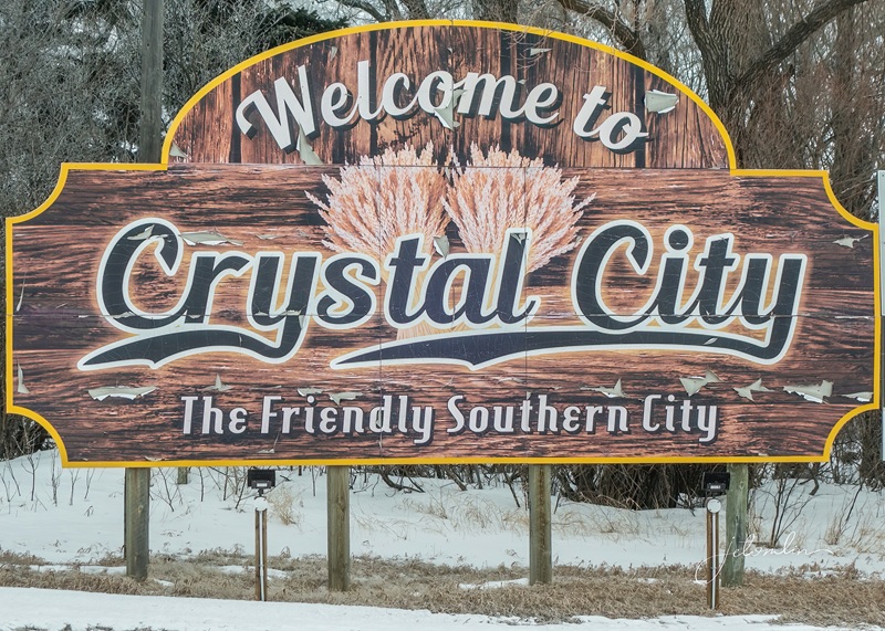
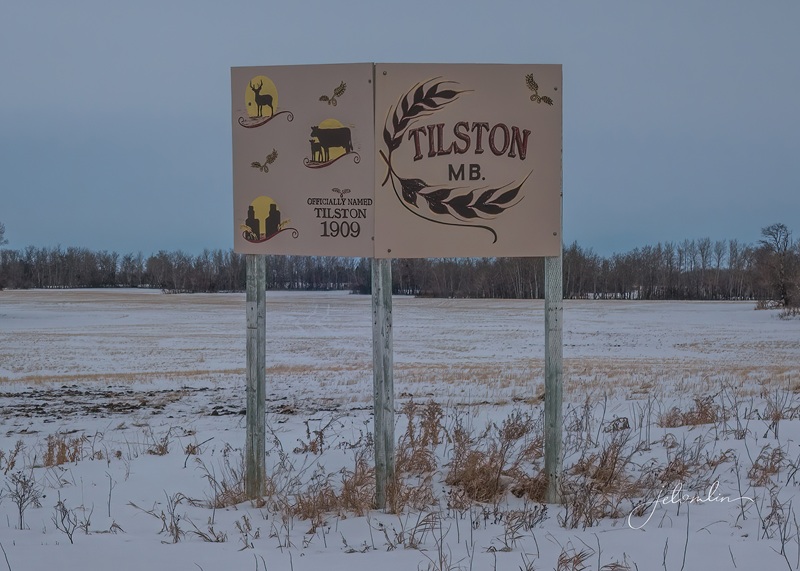
BaldurDeloraineWaskadaMelitaCrystal CityTilstonEach town has its own way of showcasing its agricultural heritage (click on photos to enlarge)
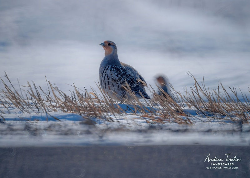
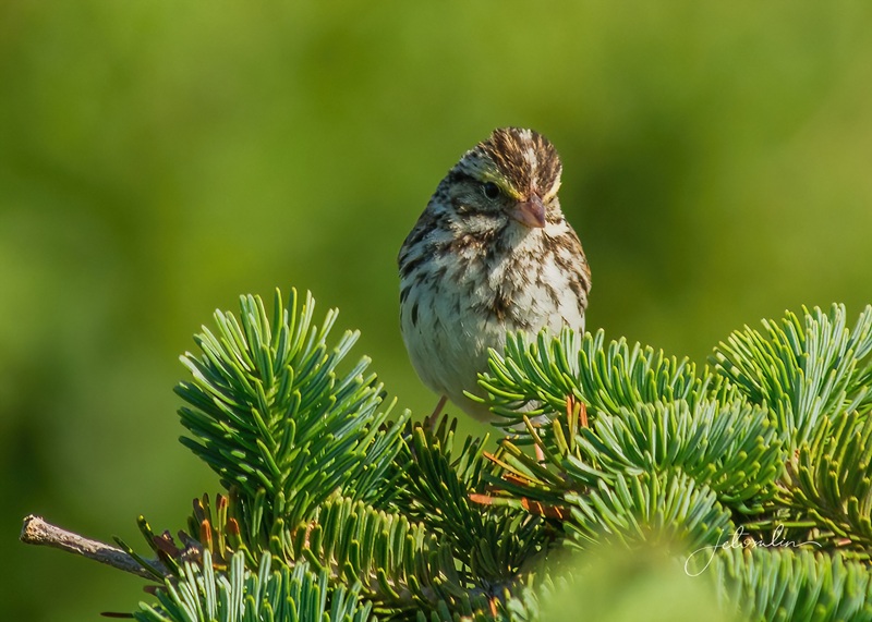
While searching for owls, we also hoped to photograph other prairie birds such as gray partridges, snow buntings, and grouse.
gray partridge
We wanted to get close-up photos of the red foxes we saw running through the fields,
red fox at dusk
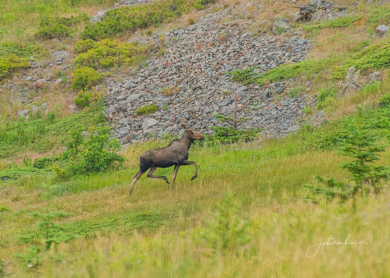
And maybe even spot a moose or two.
moose cow & calf at sunrise (with a tip of the hat to Bullwinkle J. Moose)
The cold weather meant we stuck to driving safaris. Even though we planned our routes each day,
We often ended up turning onto side roads. That was part of the fun and led to some unexpected adventures!
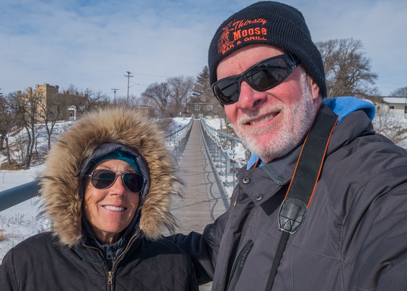
A slight detour took us to the Swinging Bridge in Souris
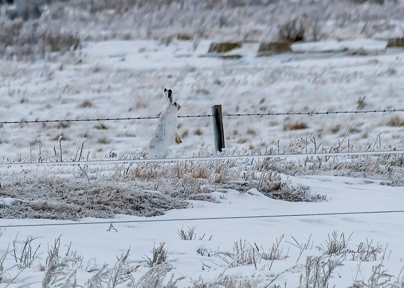
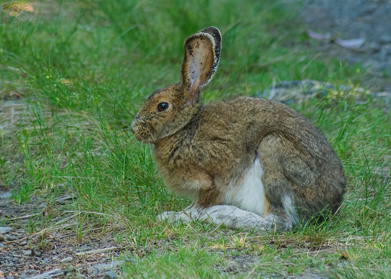
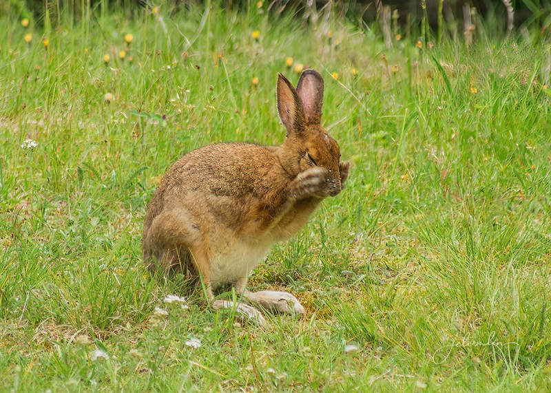
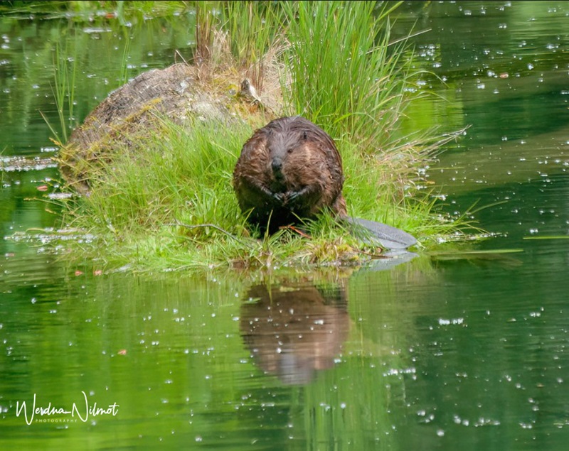
snowshoe hare
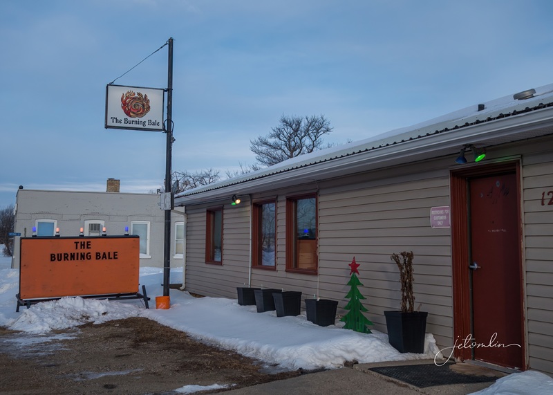
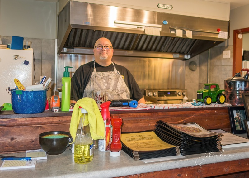
The Burning Bale in the tiny town of Elgin had amazing food!
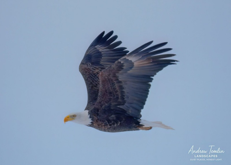
bald eagle
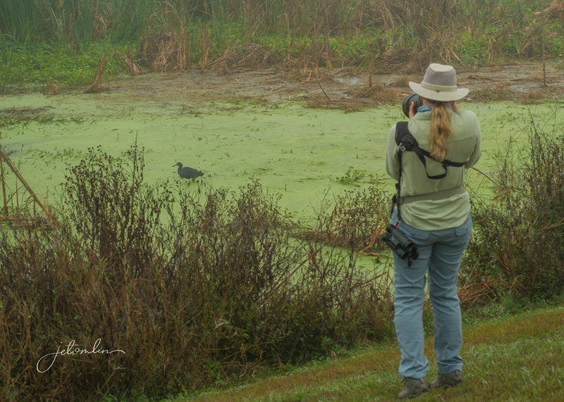
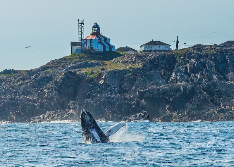
Based on eBird sightings, we had reliable intel of a great horned owl on a nest in Winnipeg, about a three-hour drive from Ninga. I wanted to check out the Via Rail train station anyway, so we made a day trip out of it.
sunrise on the way to Winnipeg
Hwy 2
Union Station, Winnipeg
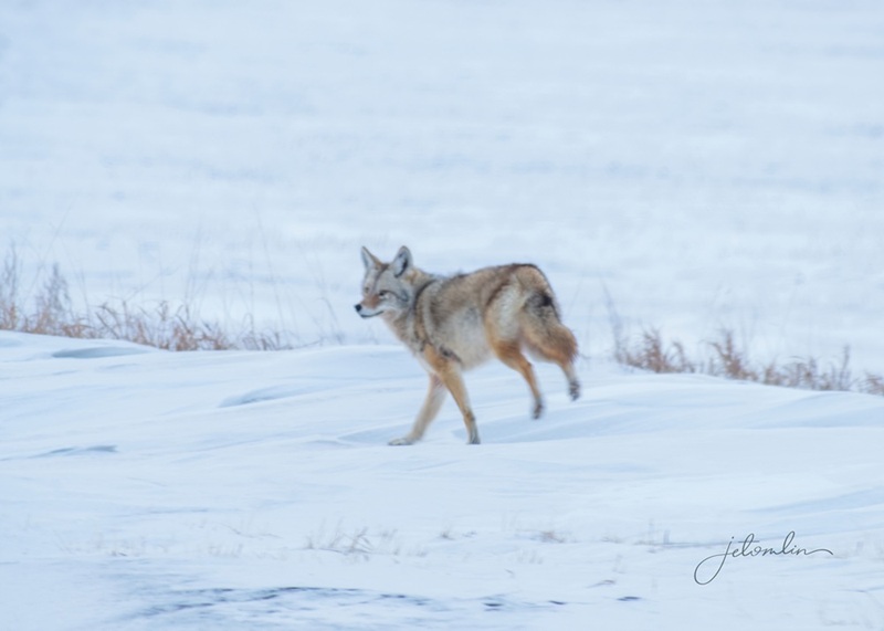
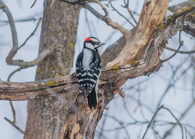
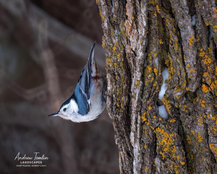
We didn’t have any luck finding the GHO that day, even with help from a friendly local named Ray—“as in Ray of Sunshine.” But we did hike over 10,000 steps, which felt great after long days of sitting in the car. Our other sightings made up for it: lots of beautiful birds in the park, and on our drive, a cooperative red fox, five coyotes, big herds of white-tailed deer, and four snowy owls!
red fox
coyote
downy woodpecker
white-breasted nuthatch
Eastern cottontail
female snowy on a power pole (Hwy 2)
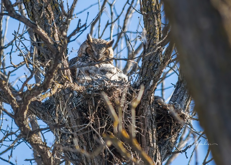
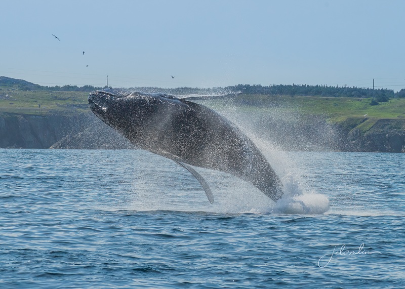
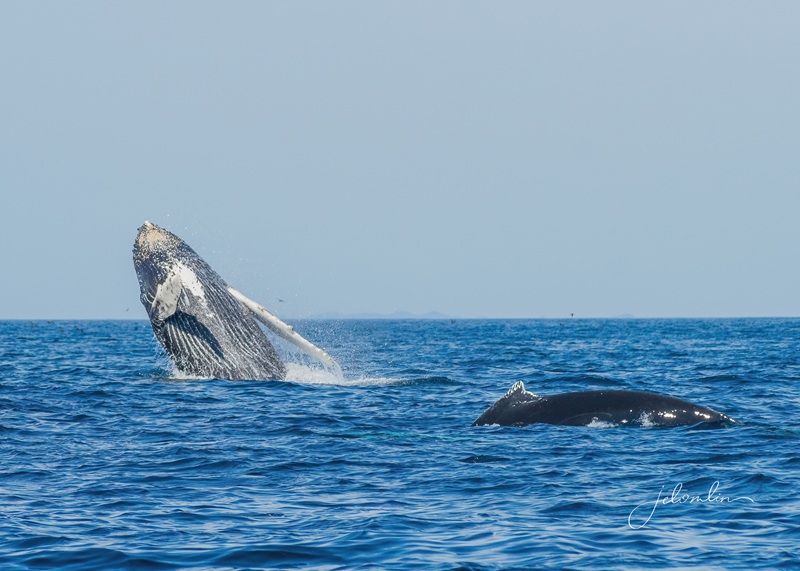
Two weeks later, we learned that the GHO owlets had hatched. With clear directions this time, we drove back to Winnipeg and were delighted to find mama and her two babies in the nest, while papa kept watch from a nearby tree.
papa watching from a nearby tree
mama watching over her babies in the nest
And, on our drive, we spotted two more snowys. Altogether, it was a six owl day!
female snowy owl on a power pole
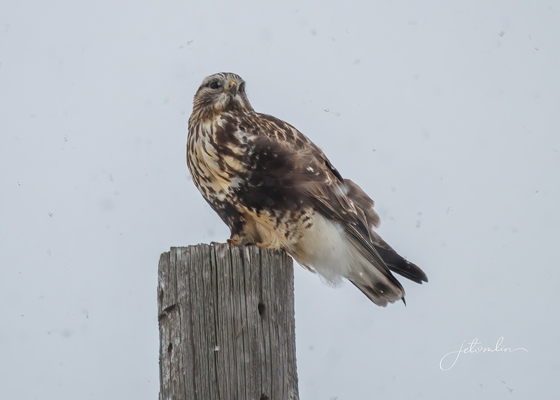
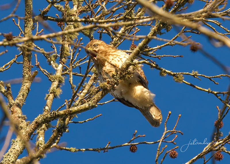
We were almost home when it began to snow. Even though we needed to keep moving, a beautiful rough-legged hawk landed on a pole right in front of us, so we stopped to take a few photos.
rough-legged hawk in snow flurries
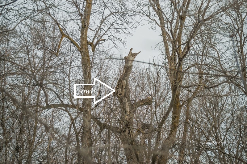
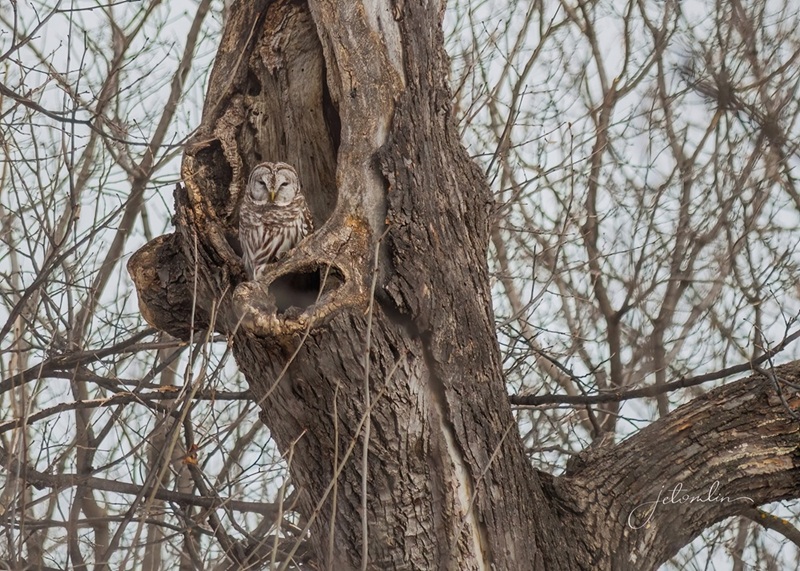
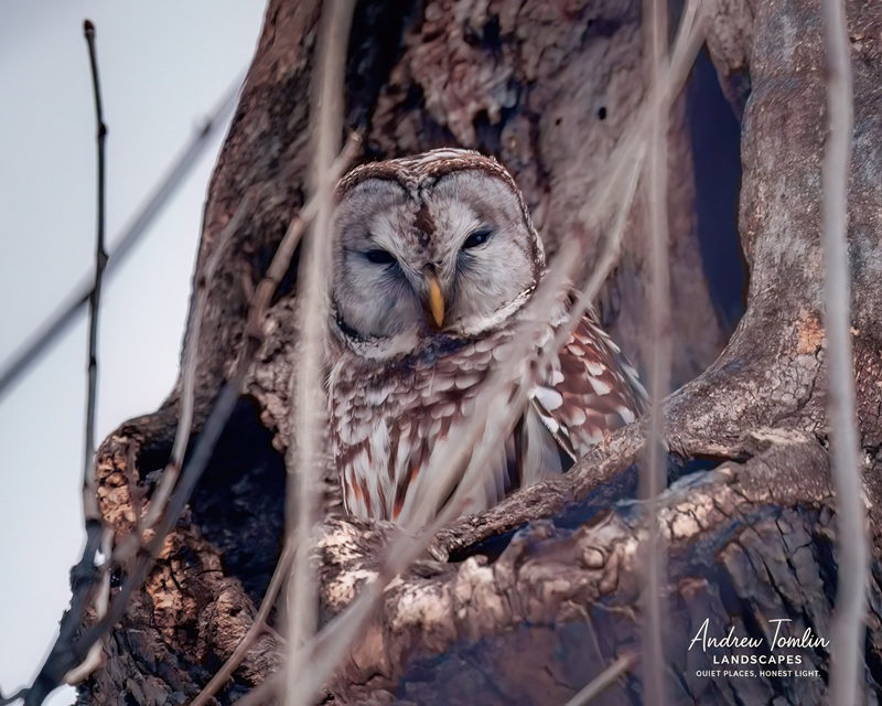
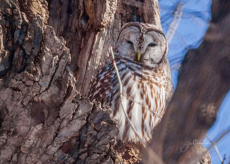
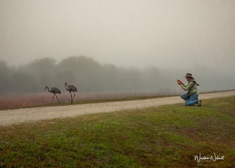
Almost daily, a barred owl was listed on E-bird at a park about two hours away. After two failed attempts to locate her, we had given up, unsure if another search was worth it. One night TG received a message from a fellow bird-lover with a map, GPS coordinates, and a recent photo. Armed with that intel, we found her, and she certainly was worth the effort!
She was in a cavity in a tree across a creek, about 100 yards away.
If we didn’t know which haystack, we never would have found the needle!
barred owl
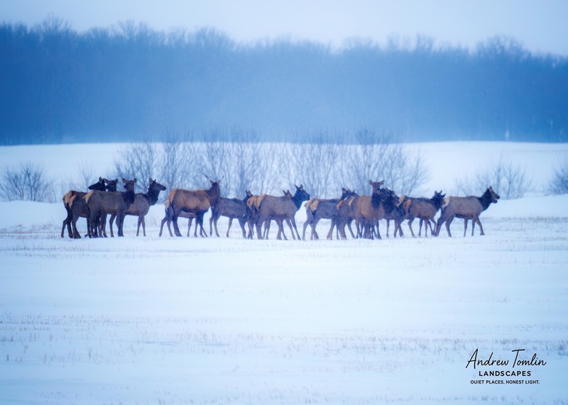
Everywhere we went, we were asked if we had seen any elk. “Not yet,” we’d reply. On our drive home that afternoon, we finally saw a large herd standing in a snowy field.
elk herd
We had heard about a screech owl at a park in Winnipeg but weren’t sure we’d be able to make a third trip before heading home. However, a beautiful Monday changed our minds.
another beautiful sunrise drive to Winnipeg
Since we were already in the area, we also decided to check in on the great horned family and say goodbye to the barred owl. On our drives to and from Winnipeg, we spotted four more snowys—three males and a female.
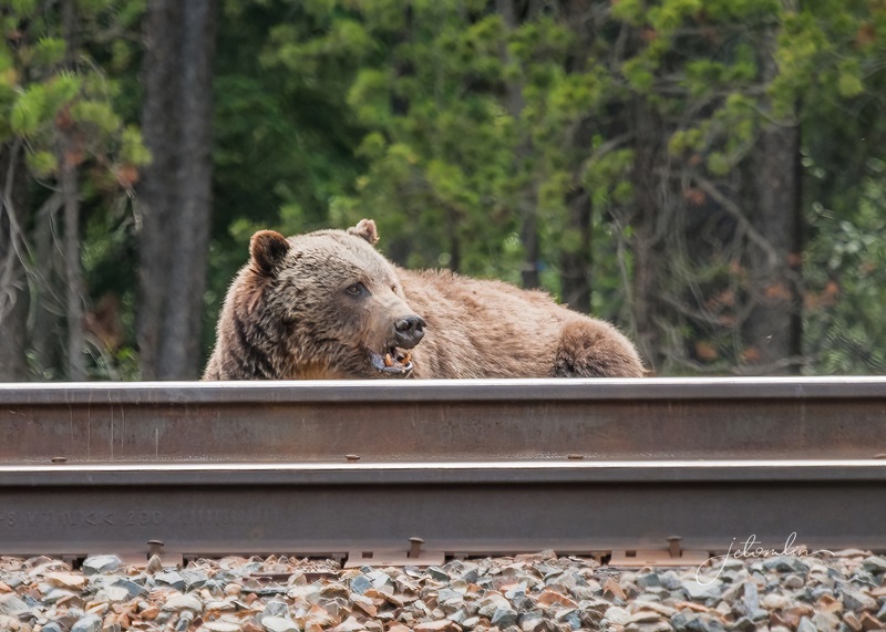
male snowy on a pile of railroad ties
papa great horned
mama great horned and her two babies
female snowy
barred
male snowy
The screech owl was not at home in her tree, but it was still a three-species, nine-owl day!
nobody home!
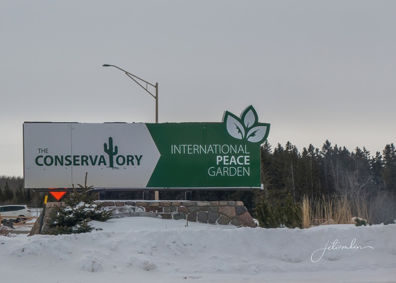
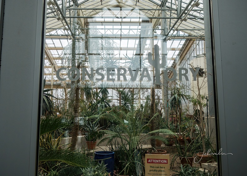
The International Peace Garden was established in 1932 to promote peace, cooperation, and friendship between the United States and Canada. This 3.65-square-mile botanical garden sits on the border between Canada and North Dakota and features 150,000 flowers, fountains, various structures, and an 18-foot floral clock.
The garden sits on the border between Canada and North DakotaThe Conservatoryclick on photos to enlarge
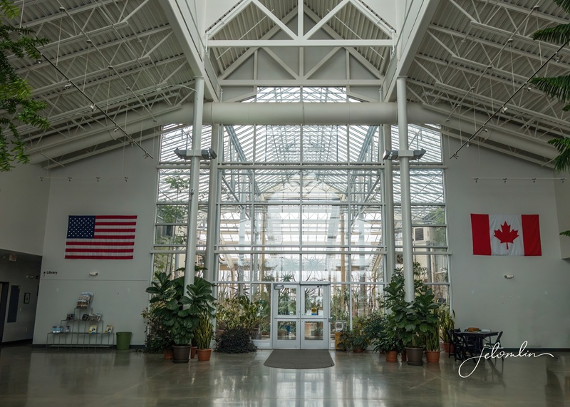
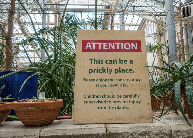
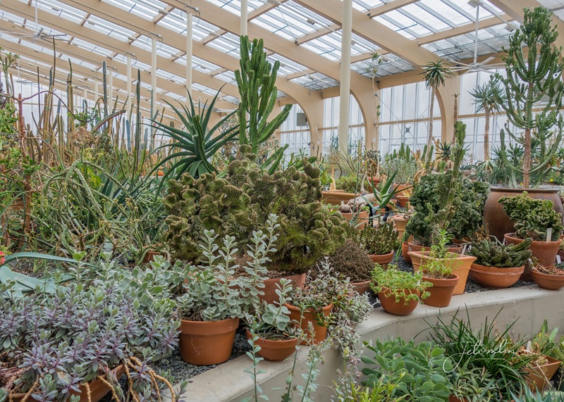
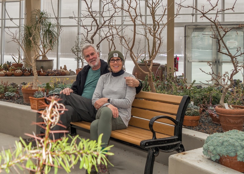
In the winter, there isn’t much to see outside, but the Conservatory was a perfect way to stay warm on a cold day.
The Conservatory
“This can be a prickly place”
Conservatory selfie
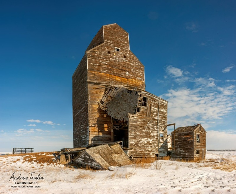
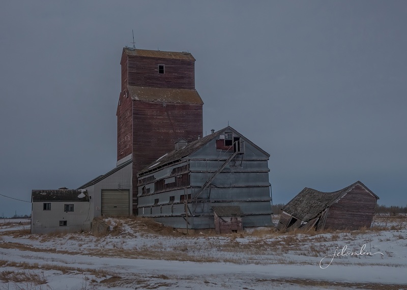
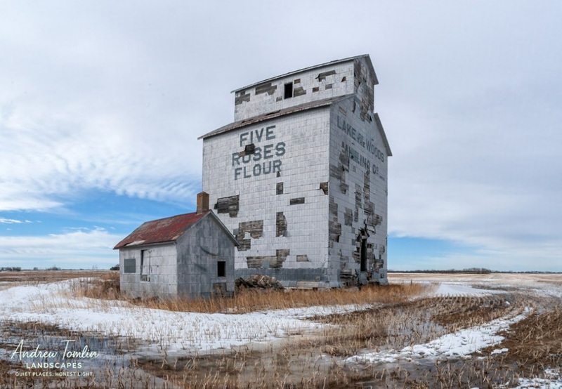
At their peak in the 1940’s, there were more than 5,500 wooden grain elevators or “prairie sentinels” across Manitoba.
selfie at Cameron – Manitoba’s oldest grain elevator still on its original site (built in 1902)
But as farms switched to steel silos, the wooden elevators became outdated and costly to maintain. Now, with more lost each year to demolition, fires, or natural disasters, these landmarks are quickly disappearing.
OberonTilstonThese two won’t be around for long (click on photos to enlarge)
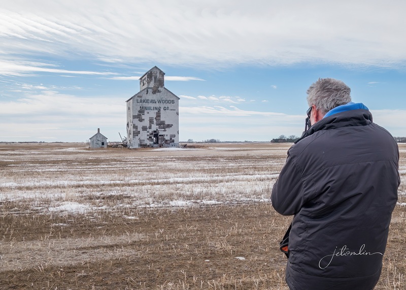
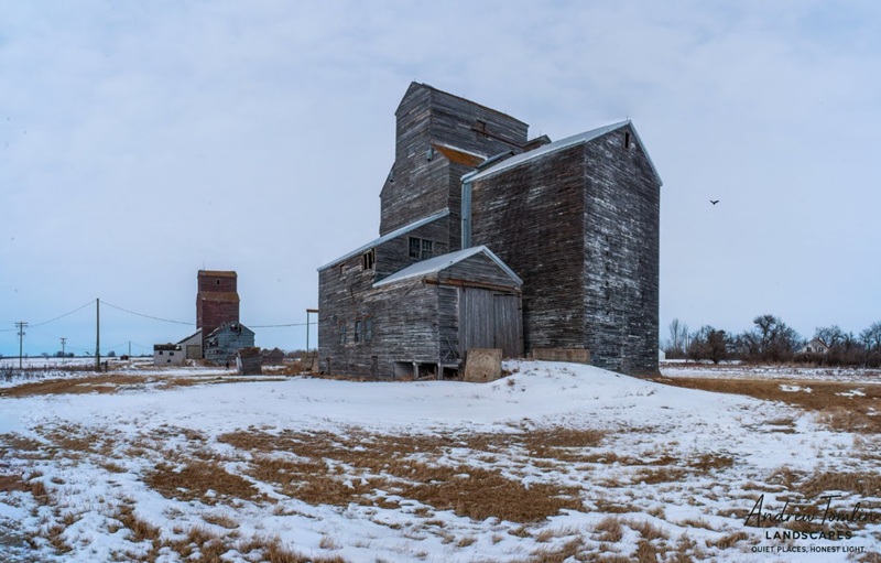
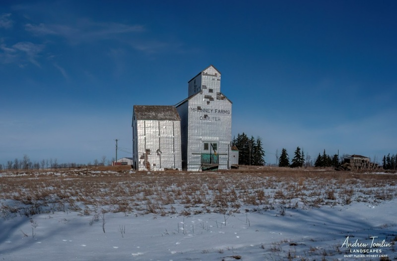
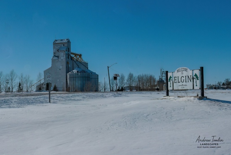
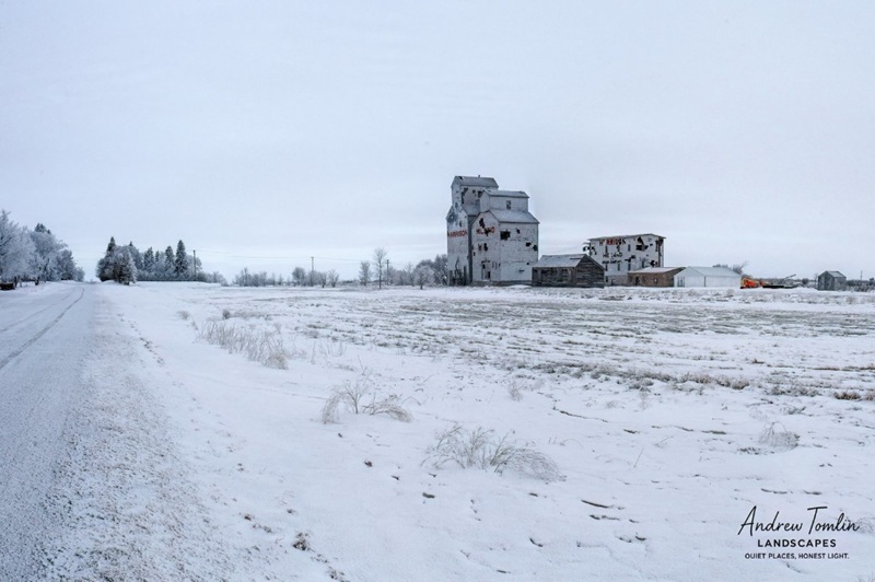
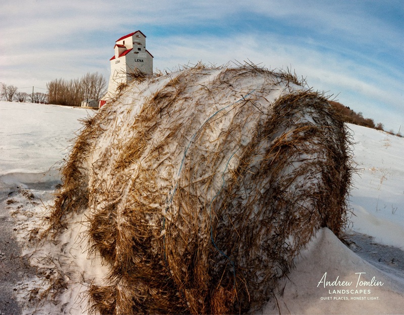
Across the province, only 80 classic wood elevators are still standing. Hoping to preserve some of this history before it is gone forever, we planned our wildlife safaris along routes where TG could capture a few of the old elevators that are still left.
TG at Cameron
Cameron
Tilston
Coulter
Oberon & Maddie
Elgin
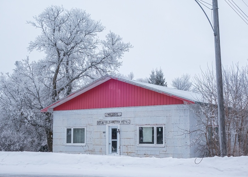
Holmfield
Lena
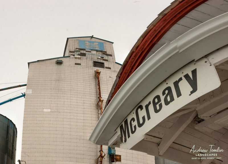
McCreary with vintage train station
We also stopped to photograph interesting landscapes and other structures while out exploring.
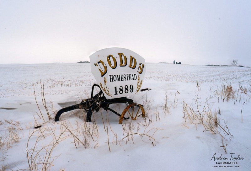
Dodd’s Homestead 1889
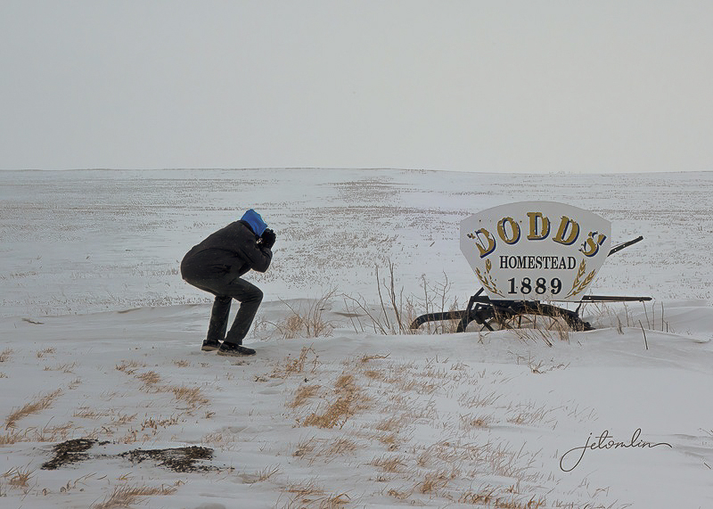
TG getting the shotHolmfield Hilton Hotellots of interesting signs, barns, and other structures to photograph (click on photo to enlarge)
March 13 turned out to be an extraordinary day. We didn’t have any specific plans – the snowstorm the prior evening had left many roads too edgy for our low-clearance VW Jetta.
It was blowing like a nor-easter the evening of March 12!
By mid-afternoon, the sun was shining, and TG suggested we pick up dinner from The Burning Bale. While driving, we saw a coyote by the side of the road and then two snowy owls in beautiful afternoon light. On the way back, we spotted two more snowys, bringing the total to four for the day!
male snowy owl
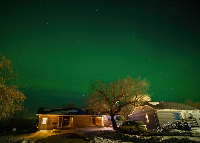
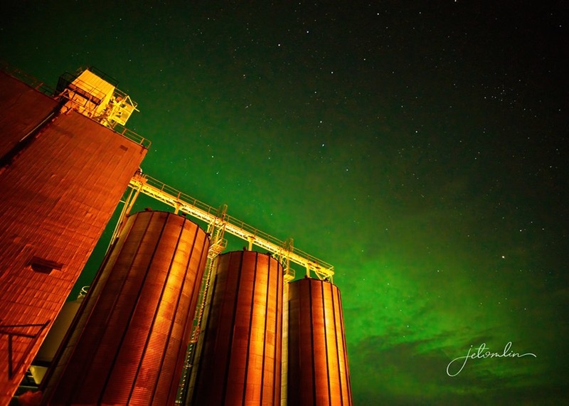
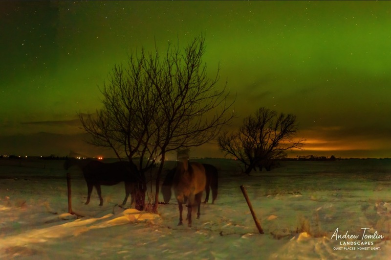
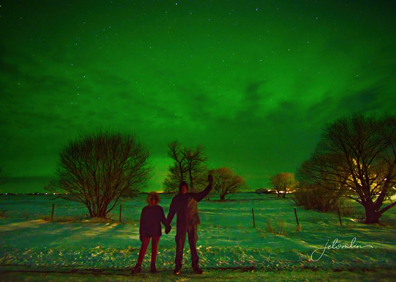
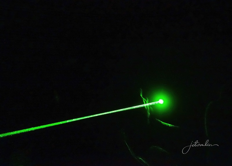
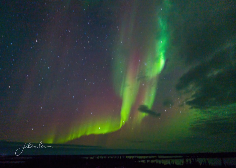
But the true magic happened later that night. A G2 storm bumped the KP index up to 6, and around 10 pm, we went outside to check the sky. The stars were bright, and the Northern Lights shimmered above us. Through our cameras, it glowed a brilliant emerald green. It was too cold to stay out for long, but we were grateful for this unexpected gift from Lady Aurora.
Country Corner Stay Airbnb
Aurora and Big Dipper over the Ninga grain elevator
Ninga horses under the Aurora
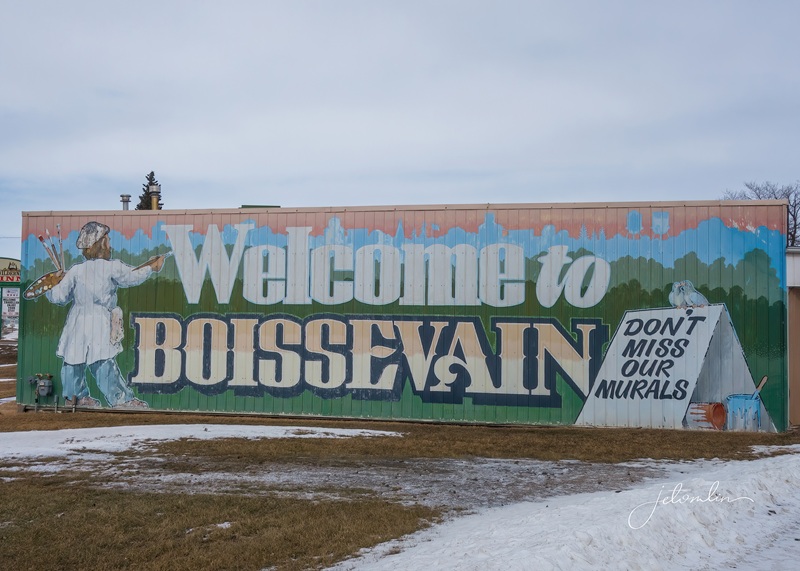
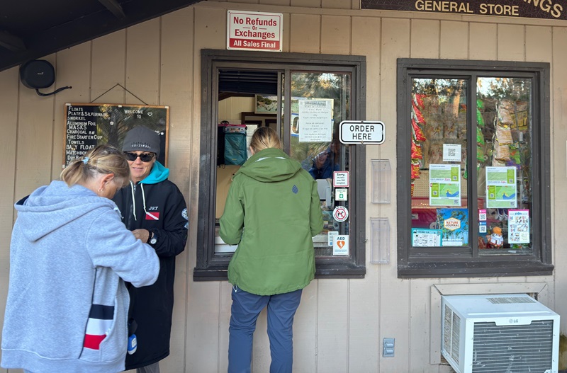
Ninga is about 14 miles from Boissevain (pronounced “boyz-eh-vane”) and was our closest option for gas and groceries.
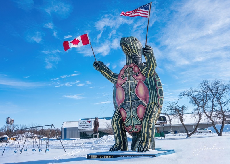
Tommy the Turtle, Boissevain
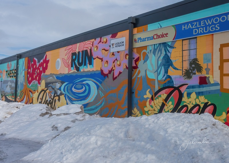
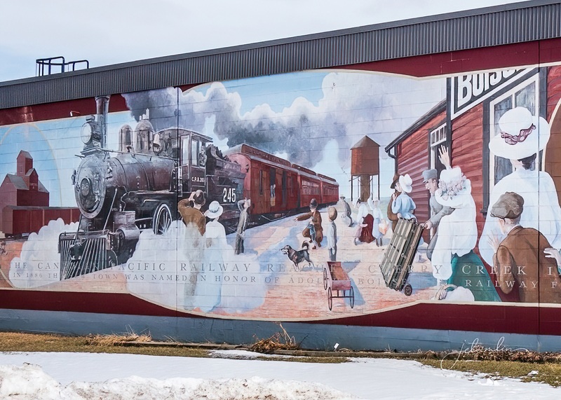
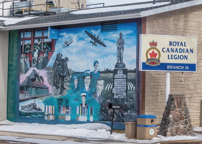
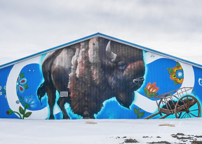
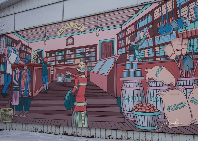
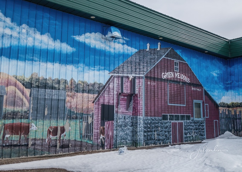
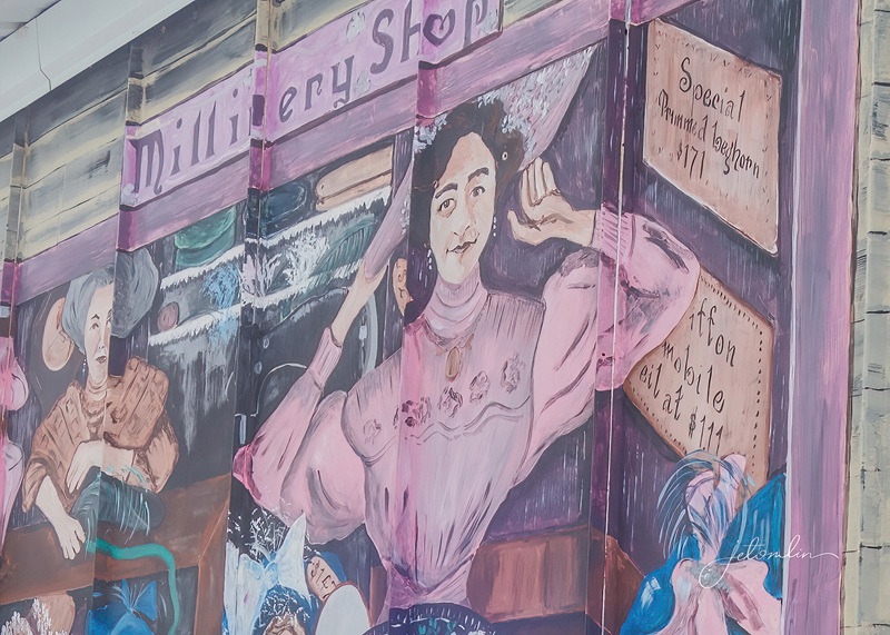
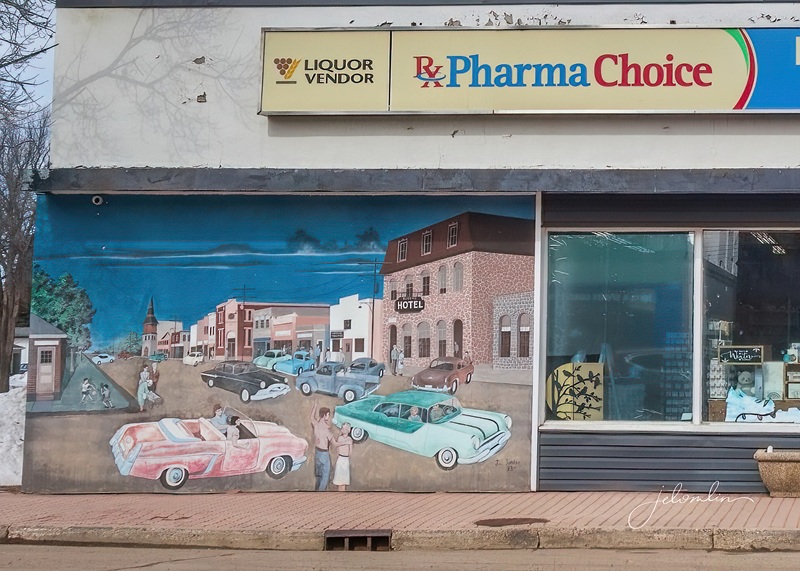
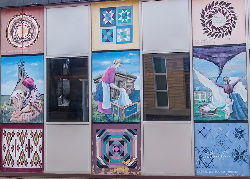
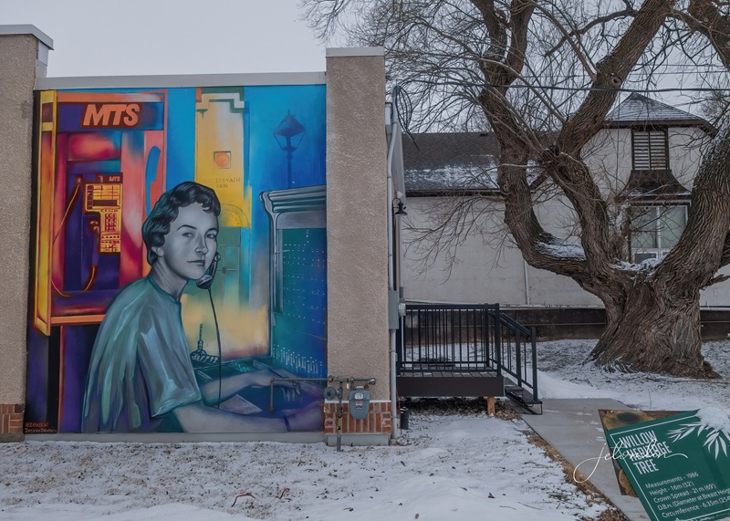
The Boissevain-Morton Arts Council (BMAC) was founded in 1990 to develop outdoor murals and promote tourism. More than 20 professional murals now tell the town’s story, several of which were visible each time we drove through.
Welcome to Boissevain – Don’t Miss Our Murals!
So, one day we walked around town to photograph them.
These Roots Run Deep
Romance of the Railroad
Royal Canadian Legion Branch #10
Travel Manitoba Visitors Center
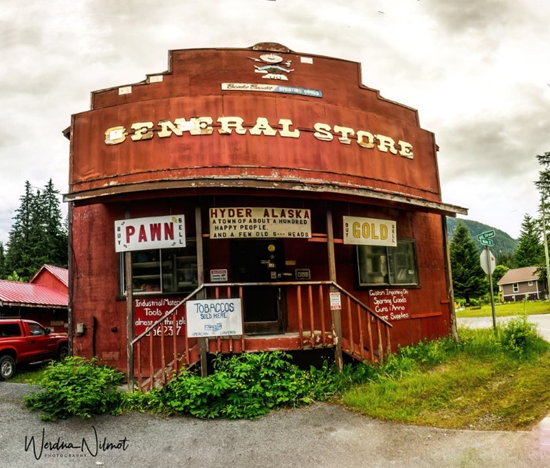
General Store
Green Meadows Farm
Travel Manitoba
Millinery Shop
Main Street Saturday Night
Ethnic Mosaic
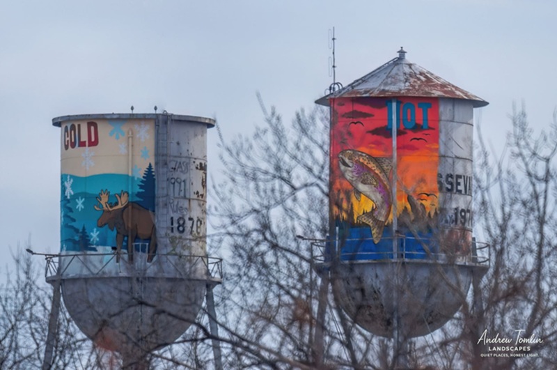
Water Towers
MTS Boissevain 1935
We met so many wonderful people during our visit—our gracious Airbnb hosts, Bethany, her mom Alma, and brother Justin were just the first. Richard recommended quiet roads for spotting moose and other wildlife. At The Burning Bale, Chef Germaine welcomed us with warmth and amazing food.
Chef Germaine, The Burning Bale Restaurant
Gord suggested Rt 245 for a scenic drive home.
30 seconds on scenic Rt 245 (sped up 2x)
And when we mentioned our passion for owls, many locals offered helpful information.
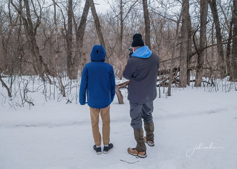
TG with a helpful fellow-birder
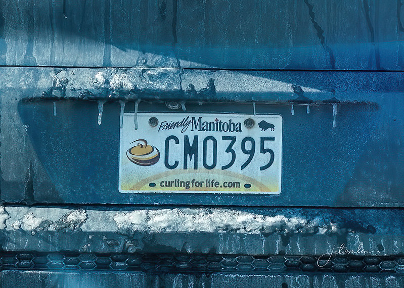
Manitoba’s license plate reads “Friendly Manitoba”—and we couldn’t agree more!
“Friendly Manitoba”
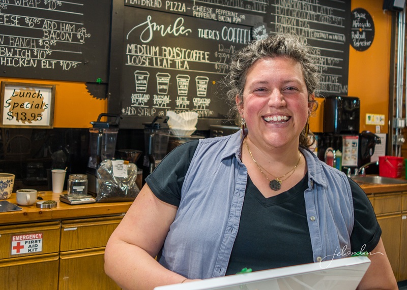
Sawmill Tea & Coffee Co
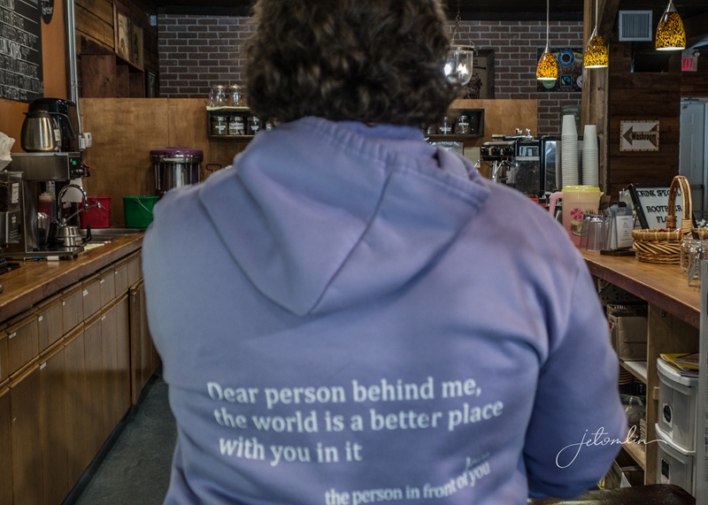
“Dear person behind me, the world is a better place with you in it”
With everything going on in the world right now, it’s important to take a break from the chaos once in a while. Manitoba’s wide-open spaces, abundant wildlife, and welcoming community helped us stay grounded and reminded us to look for peace, no matter what life brings.
Aurora over Ninga, March 13, 2026
To view all our photos from our month in Manitoba, click on the Flickr links below:
TG:
arrow through set or click on any photo to open a new tab in Flickr
JET:
arrow through set or click on any photo to open a new tab in Flickr
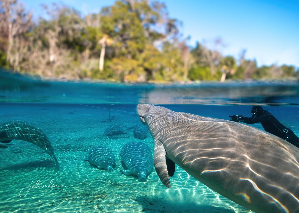
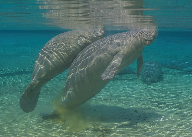
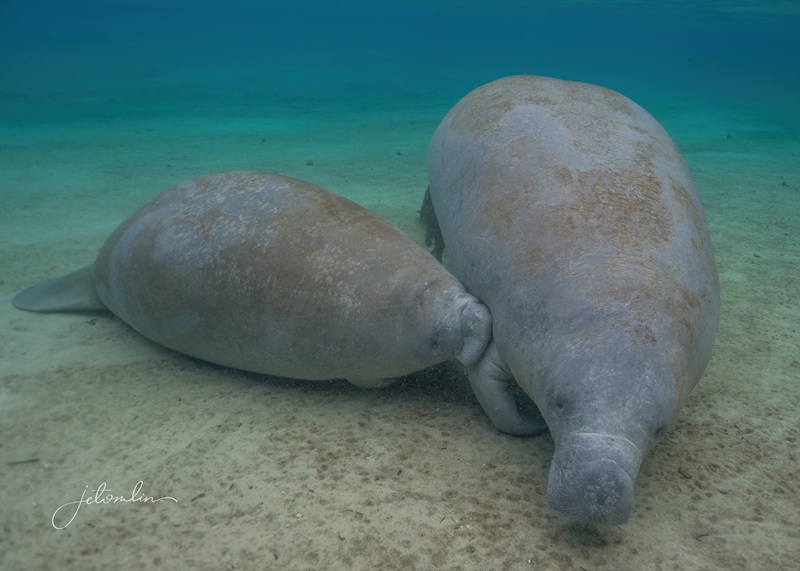
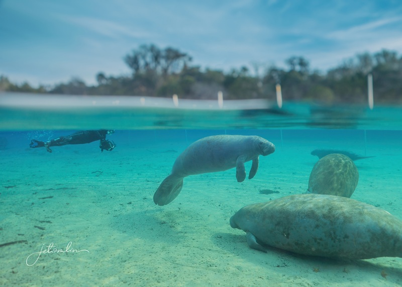
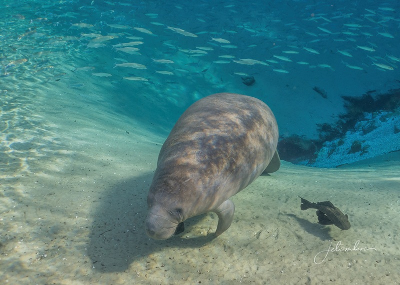
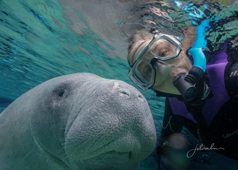
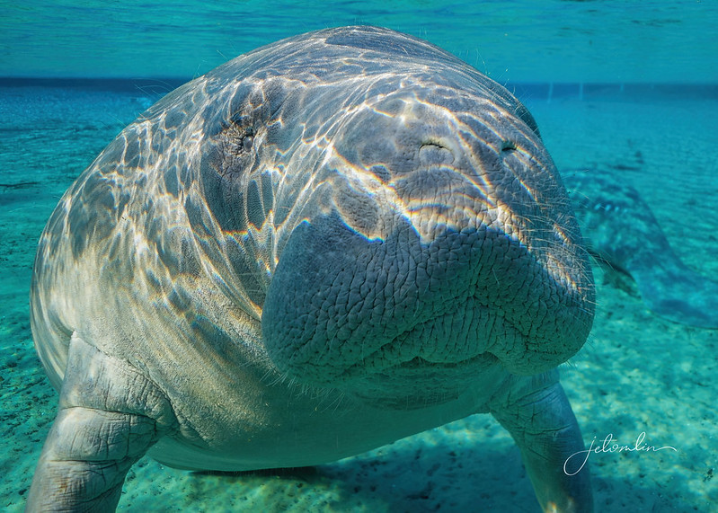
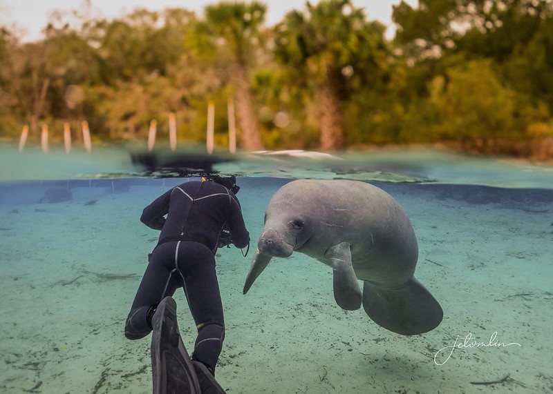
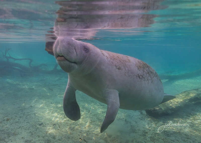
Some experiences in life never lose their charm, no matter how often you have them. For me, swimming with manatees is one of those things. For the past two decades, I have traveled to Central Florida every winter around my birthday to swim with these gentle giants. It doesn’t matter how many times I’ve done it; each encounter, when I come face-to-face with a sweet “floating potato,” fills me with joy.
February, 2016
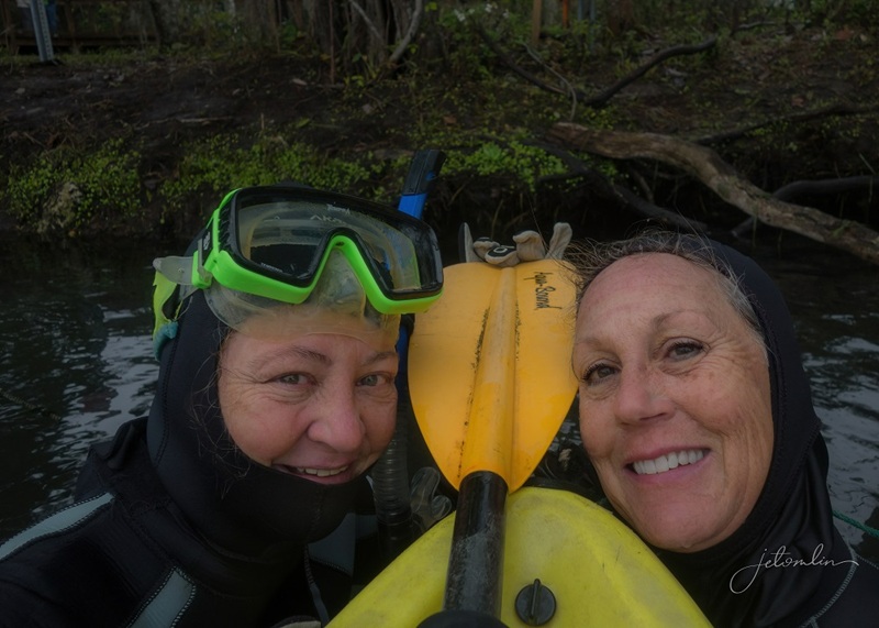
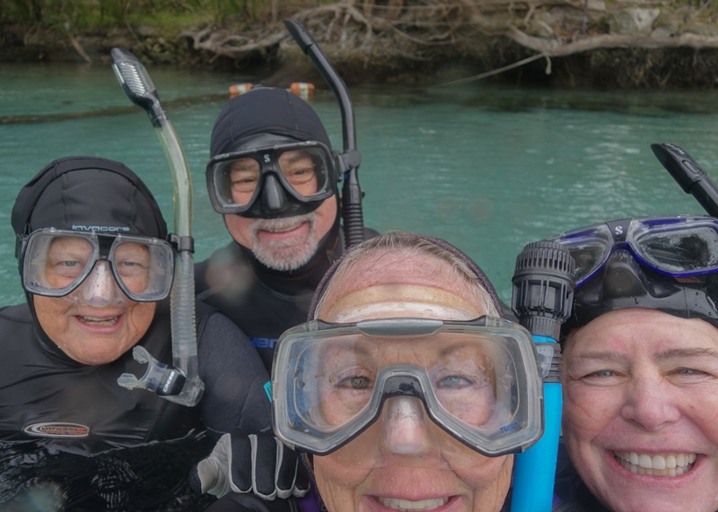
Since TG is not a fan of cold-water swimming, I’ve always invited a friend or two to join me on my yearly pilgrimage.
20182021
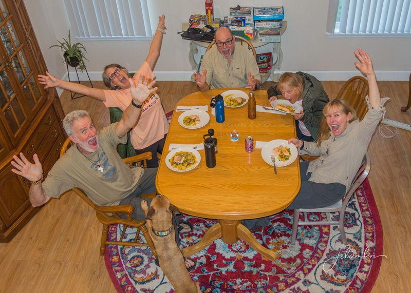
In 2025, two sets of friends joined me, and we had such a great time we decided then & there to meet up again in 2026. Plus, since we’ve moved so far away, getting “the band” back together once a year is as much a treat as the manatees!
January 2025
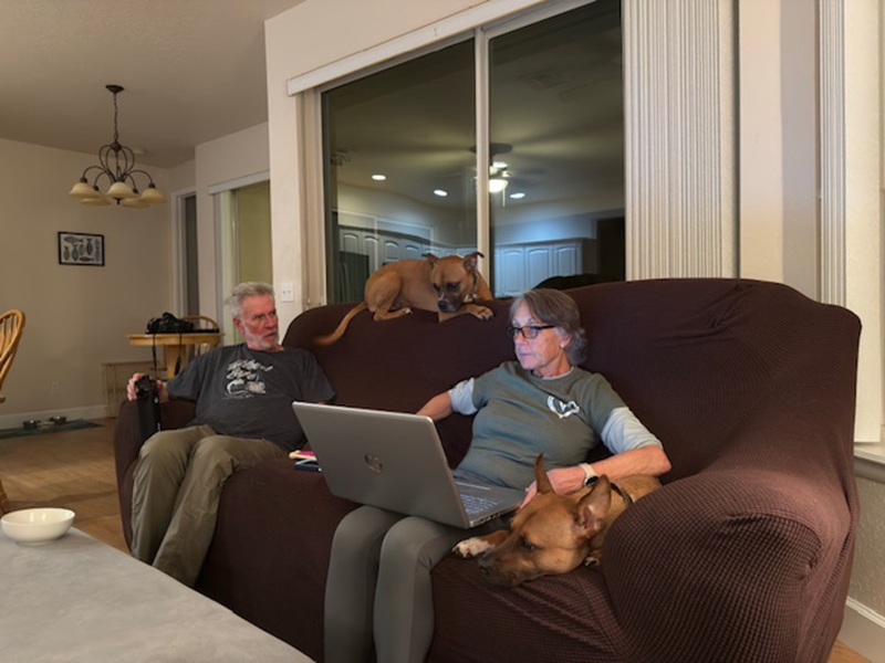
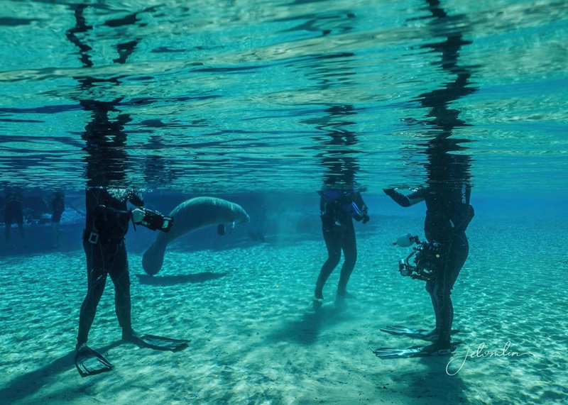
TG found a pet-friendly Airbnb conveniently located close to the springs and other natural areas. It had a “Big Chill” vibe, with plenty of space for the five of us (plus two pups), a large kitchen/common area, a fenced-in backyard overlooking a lake, and a spacious deck for drying our wet gear.
We arrived on Monday afternoon and, after settling in, enjoyed all the birds flitting through the trees across the canal.
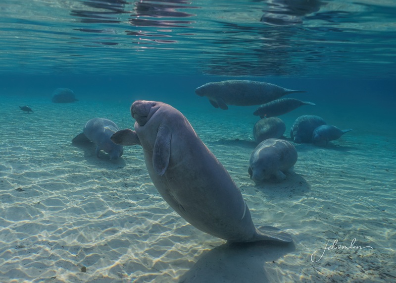
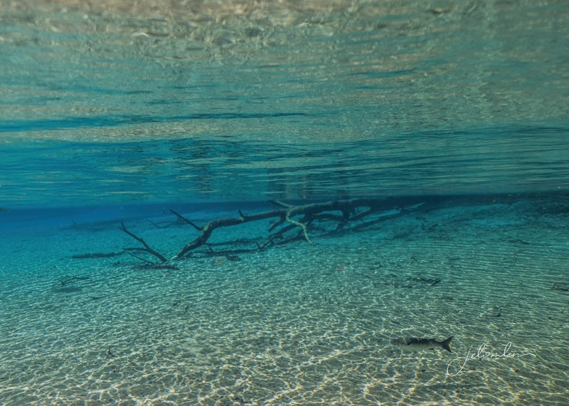
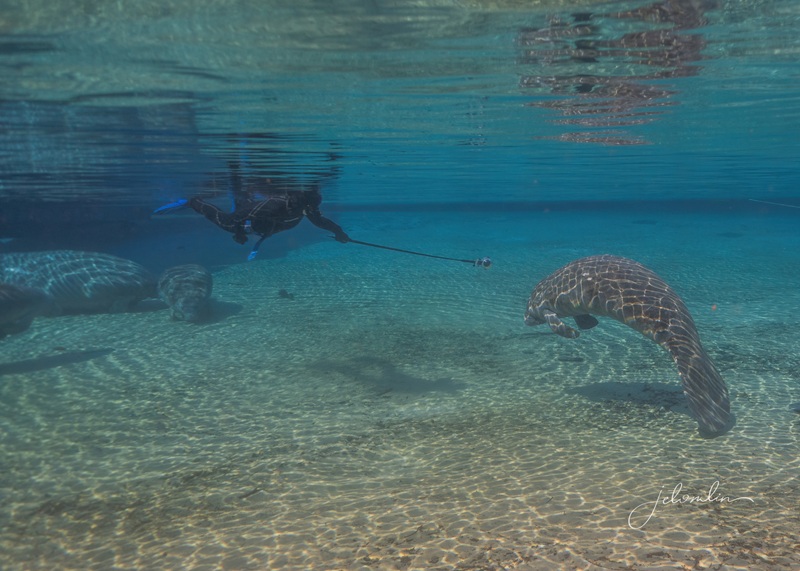
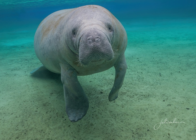
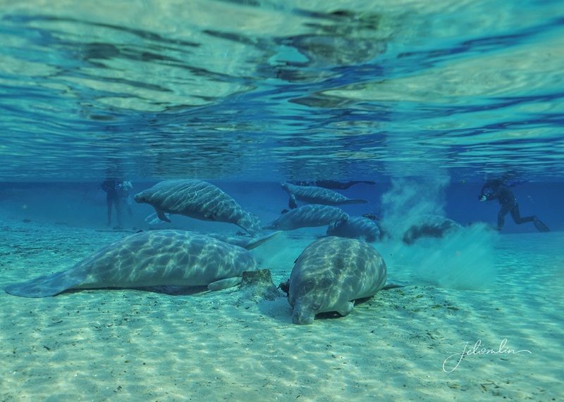
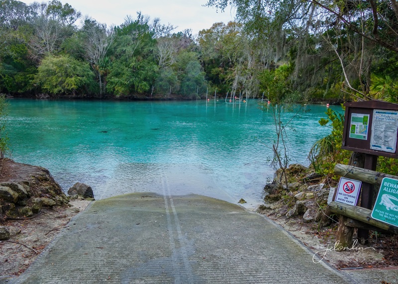
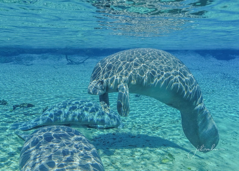
We prepared our gear for our first visit to the springs the next morning. The air temperature was in the 50s—a bit warm for manatees—but we found over 30 in the swim area and around the anchored boats.
January 6, 2026
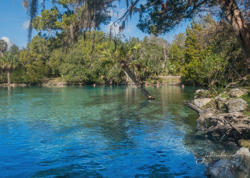
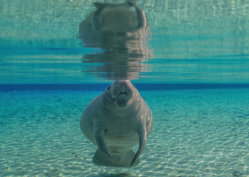
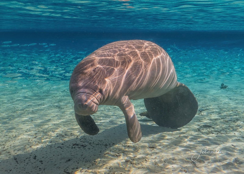
The water in the springs was crystal clear and a beautiful blue. It’s no wonder that on his first visit to a Florida spring in 1513, Ponce de León believed these waters had rejuvenating properties.
crystal clear, blue water
And although Florida’s natural springs aren’t literally Fountains of Youth, the National Park Service has noted that “being surrounded by trees, water, or open skies lowers cortisol levels and blood pressure within minutes. The natural world signals safety to the brain. Stress fades. Mood lifts. You remember how it feels to breathe deeply.”
the springs entrance
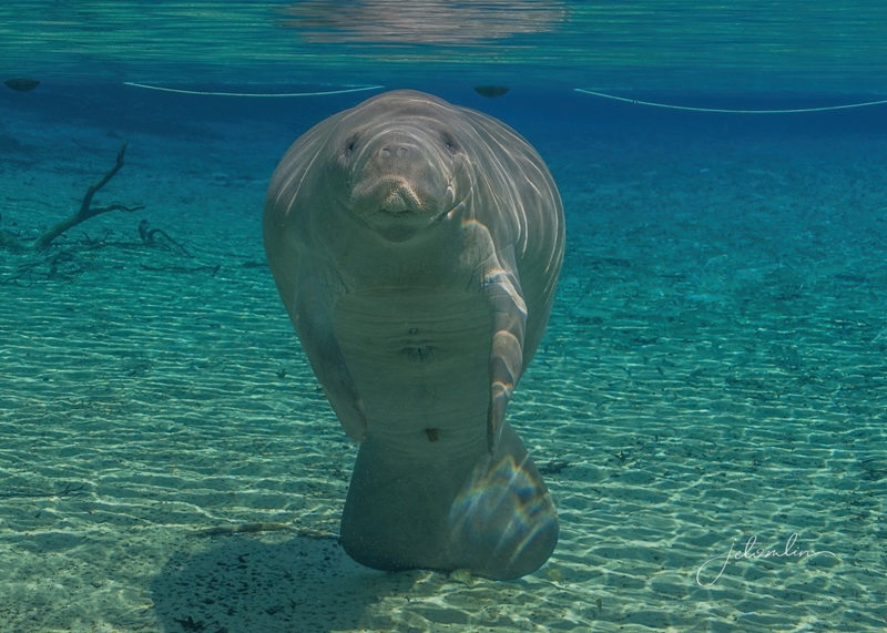
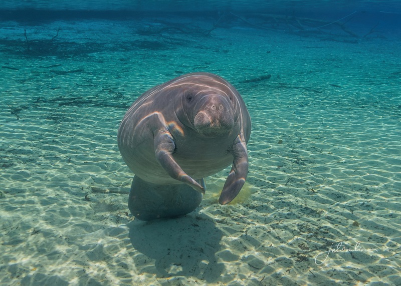
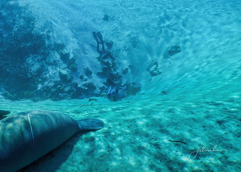
Our first manatee snorkel of 2026 was just as wonderful as it had been the last 20 times I had done this, and with bright sunshine and air temperatures near 80 degrees, we stayed in the water for over three hours before succumbing to the crisp 72-degree water.
click on image to view full size
Along with the manatees, we swam with multiple painted turtles
painted turtle
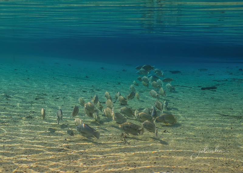
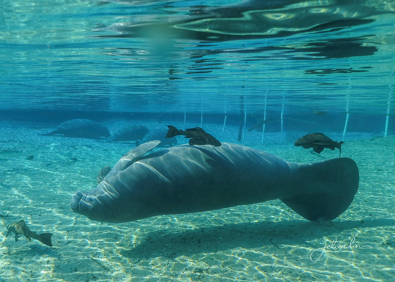
And huge schools of fish: mullets, tilapia, freshwater sunfish, and largemouth bass.
huge schools of fish!
While enjoying the manatees, we also found an alligator snapping turtle, which quickly disappeared into the mangrove roots in the shallows.
alligator snapping turtle (at 25% speed)
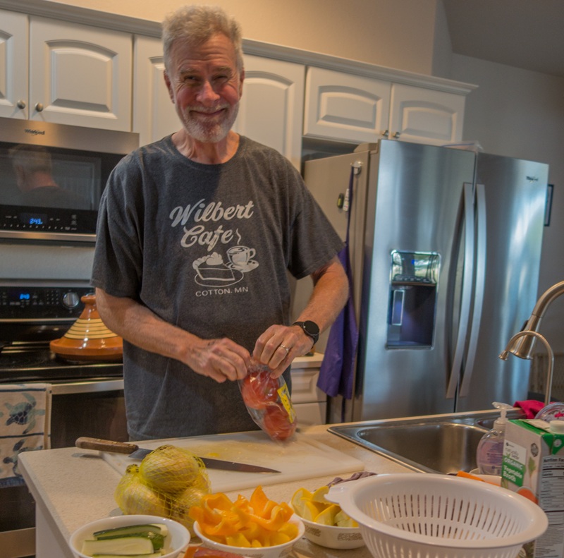
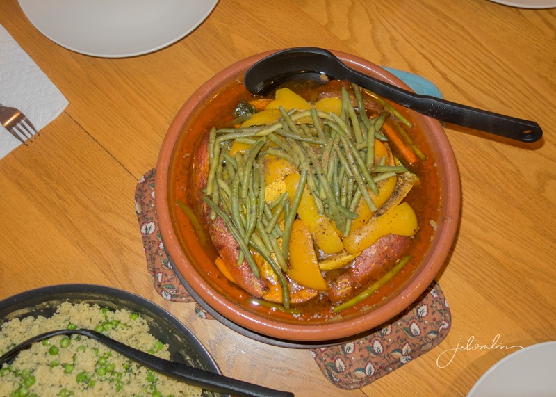
While we were having fun in the water, TG was back at the house, preparing dinner each evening. He loves to cook and got as much pleasure from us enjoying his meals as we did from eating them!
TG cooking!Moroccan tajinThe Band!click on image to view full size
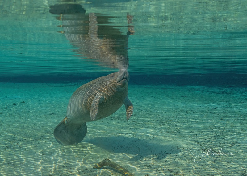
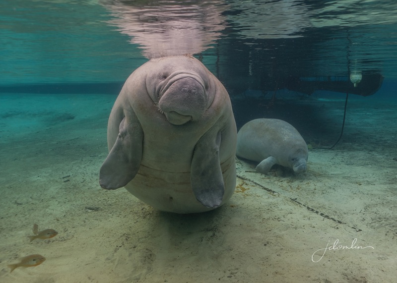
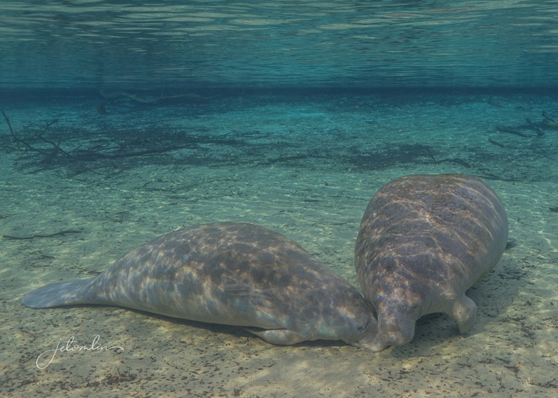
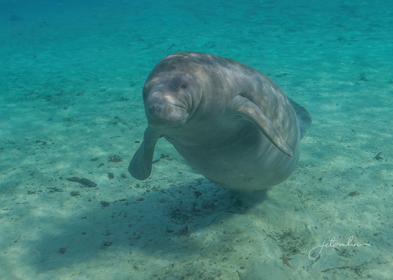
On Wednesday, we returned to the springs for Round 2. The air temperature was rising, and we saw fewer manatees than the previous day. Even so, there were close to 20, including a mother and her nursing calf.
January 7, 2026 – mother and nursing calf
Though it wasn’t as sunny as Tuesday, the light filtering through the crystal-blue water was perfect for photographing the manatees without a “dappling” effect.
click on photo to enlarge
manatee roll!
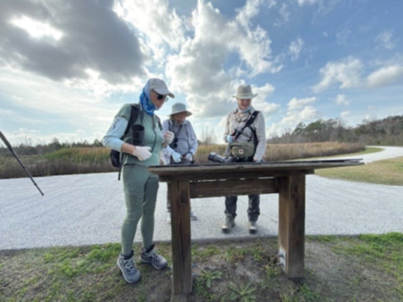
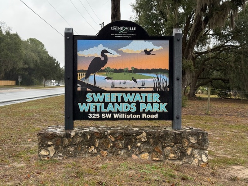
We took a break from the manatees on Thursday to visit two local nature areas: the La Chua Trail in Paynes Prairie State Park and Sweetwater Wetlands.
Sweetwater Wetlands (photo by John Casey)
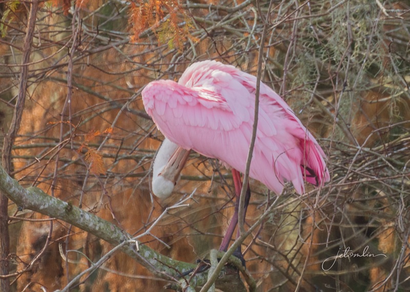
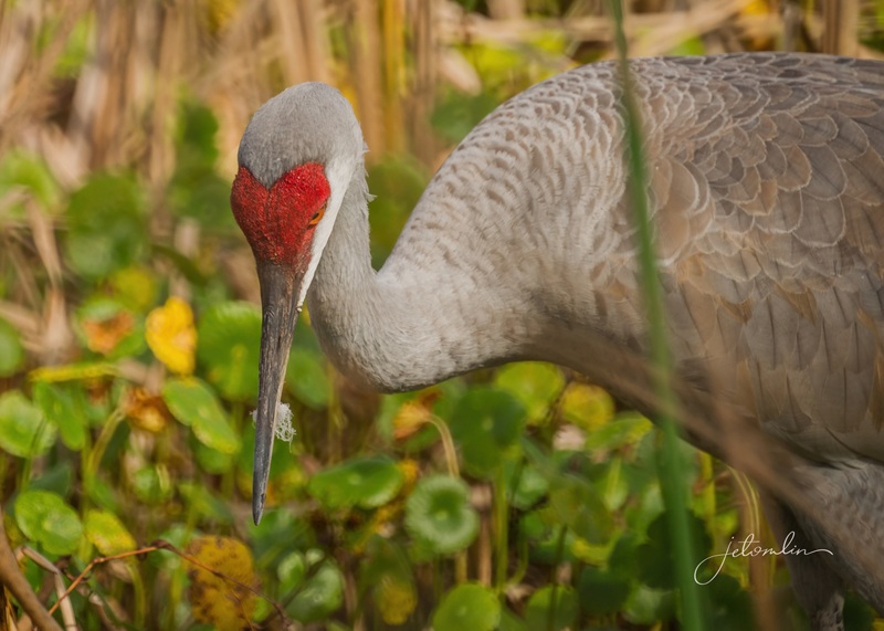
Highlights included more alligators than we could count, several species of sparrows, a roseate spoonbill, dozens of nesting great blue herons, and fearless sandhill cranes.
On Friday, we returned to the springs for Round 3, but there wasn’t a single manatee to be found. We swam all the way up the run to the lake to no avail.
January 9, 2026 – not a manatee to be found!
However, we did come across a 4-foot alligator sunning on a log, which was quite the experience—to be in the water, looking up at an alligator! It almost made up for the lack of manatees.
little gator sunning on a log
Knowing that it would be busy at the springs, we decided to spend the weekend topside. Saturday morning, we were up at the crack of dawn for a return trip to Sweetwater Wetlands.
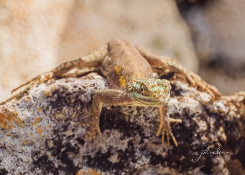
agama lizard at Sweetwater Wetlands
Later in the day, we went back to the La Chua trail at Paynes Prairie, with a stop at the Ecopassage Observation Boardwalk to hopefully see some bison. We were happy to find some reasonably close to the deck and got off a few good shots before we continued on.
bison at the Ecopassage Observation Boardwalk, Paynes Prairie
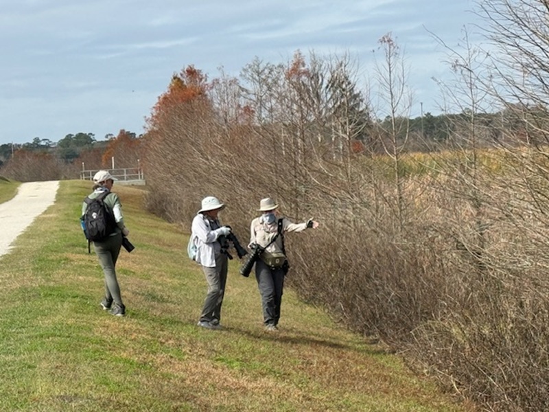
We arrived at La Chua at dusk to look for owls, and although we heard plenty of calls of both barred and great horned, it was nearly dark before we spied our first one. It was a great horned, so far away it was nothing more than a tiny dot high on a treetop.
owl patrol at La Chua, Paynes Prairie (photo by John Casey)
The setting sun painted the prairie a beautiful orange as we headed back to the car.
click on photo to enlarge
Sunday morning, we went back to Sweetwater for one last visit. We arrived even earlier than on Saturday – we were second in line for the 7 am gate opening. However, the morning fog never lifted, making for poor light and challenging photography.
sandhill cranes at Sweetwater Wetlands (photo by TG)
As we scouted for owls along a tree-lined path, we momentarily glimpsed a great horned owl before she disappeared behind the moss curtains.
great horned owl at Sweetwater Wetlands
Even so, it was a wonderful morning, and we were treated to multiple beautiful birds, including a marsh wren and a sora – two new birds for me!
sora
marsh wren
Around 9 am, it started to rain, and we hurried back to the parking lot.
around 9 am, it started to rain
We spent a quiet afternoon around the house and drove back to La Chua at sunset for one last chance to photograph an owl. We heard their distinctive hoot-hoot-hoot but were unable to locate them.
we heard multiple owls calling but were unable to locate them
sunset at the Airbnb
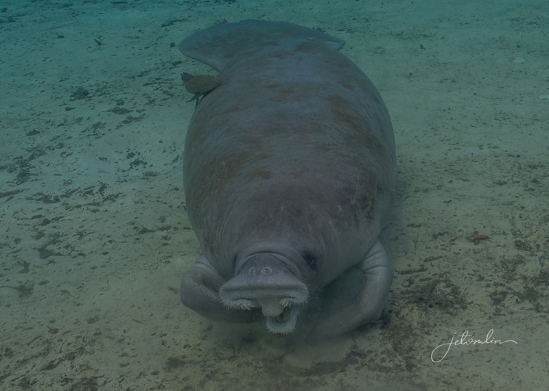
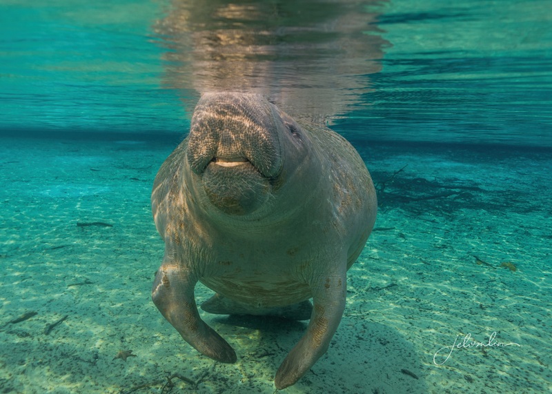
The following morning, we returned to the springs for Round 4. Air temperatures had dropped significantly overnight, and when we arrived at the park, the car’s thermometer read 42 degrees. I was certain we were in for a treat, and sure enough, we saw at least 20 manatees in and around the swim area.
January 12, 2026
We spent another three hours with them and only got out when our fingers got too cold and stiff to work the buttons on our cameras.
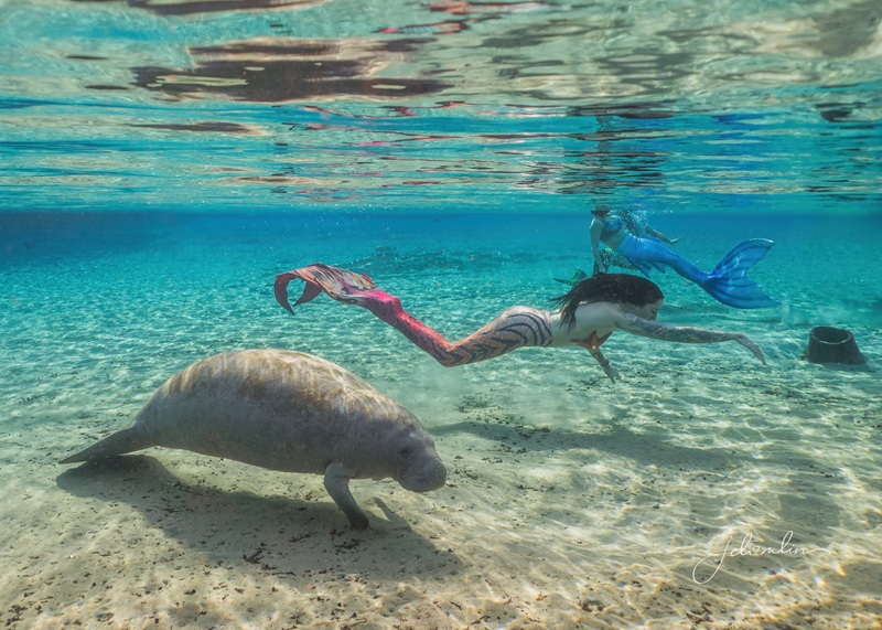
We also saw a bald eagle, an otter, multiple appearances of the alligator snapping turtle, and mermaids! The Florida Springs Mermaid Pod was there practicing, and it was fun to watch as they gracefully swam amongst the manatees.
mermaids!
After warming ourselves with a bowl of steaming hot soup, we spent the afternoon preparing to head home the following morning. We had four glorious swims at the springs, multiple birding opportunities, and hours filled with laughter, friendship, and Nature.
The Band, Sweetwater Wetlands, January 2026
What a mana-treat it was to spend the week with people so dear to my heart! As we drove home, I indeed felt my mood lift and my stress fade away.
January 12, 2026 – manatee at the springhead
To view all my manatee photos click here:
arrow through set or click on any photo to open a new tab in Flickr
To view all my topside nature photos click here:
arrow through set or click on any photo to open a new tab in Flickr
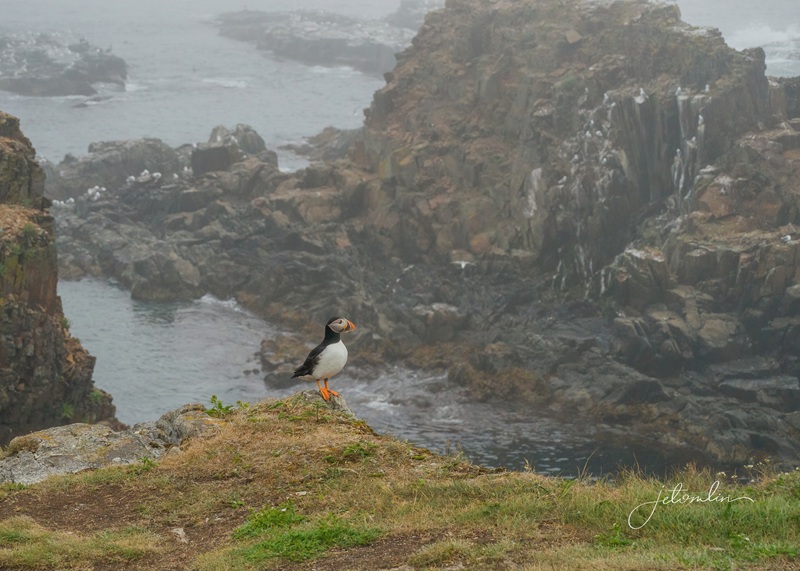
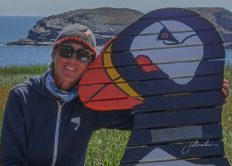
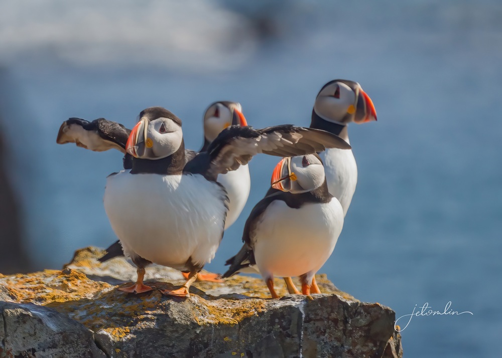
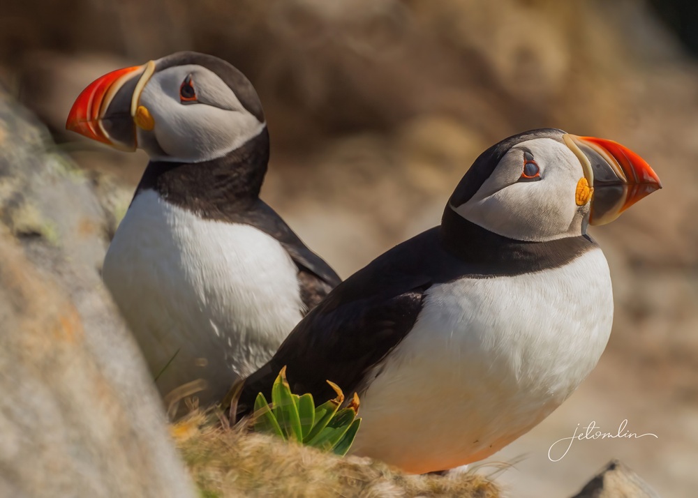
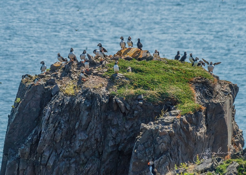
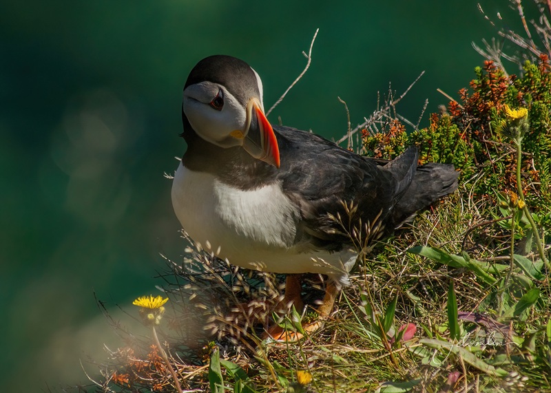
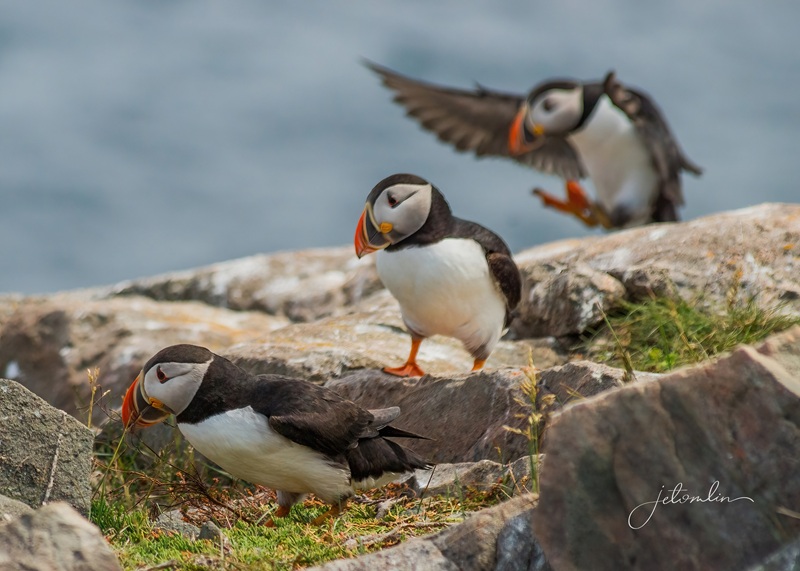
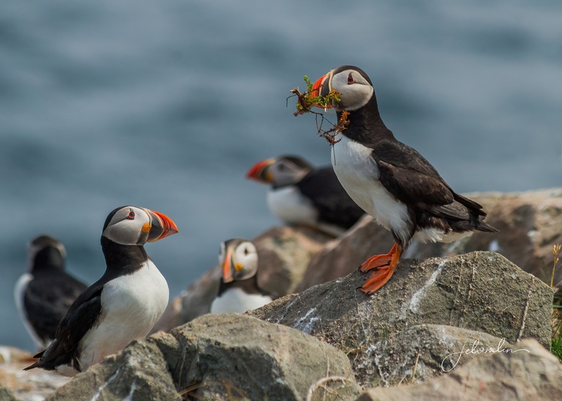
Puffins have always seemed nearly impossible creatures that look more like children’s toys than real birds. Their colorful beaks and triangular eyes stand out against sturdy black-and-white bodies, and their name perfectly captures their roly-poly look. As if that weren’t enough, their chicks are called “pufflings.”
Elliston puffin site, July 2025
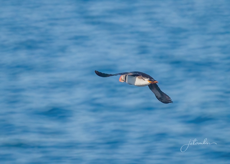
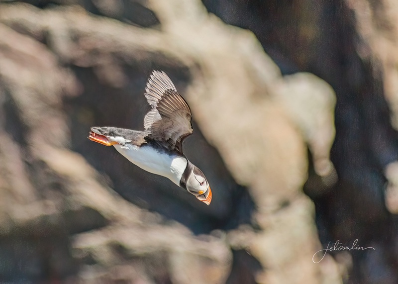
These pelagic birds are masters of the air, sea, and land,
Elliston puffin site, July 2025
Flying thousands of miles over the ocean,
Elliston puffin site, July 2025
Diving to catch fish (click on photos to enlarge),
Elliston puffin site, July 2025puffin with capelin
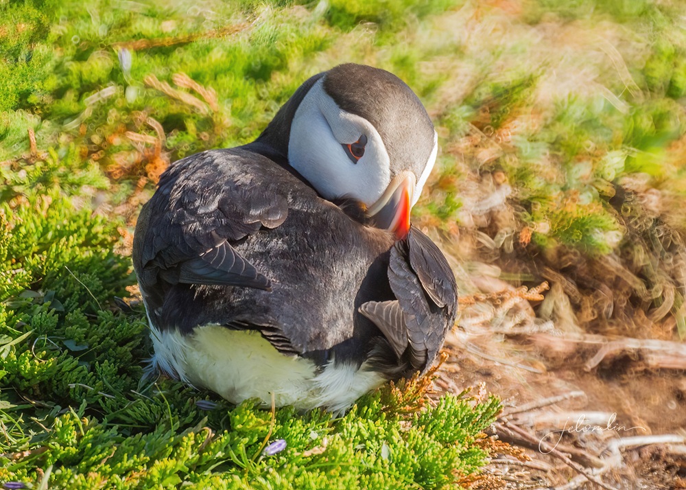
And burrowing to nest.
Spillars Cove, July 2025
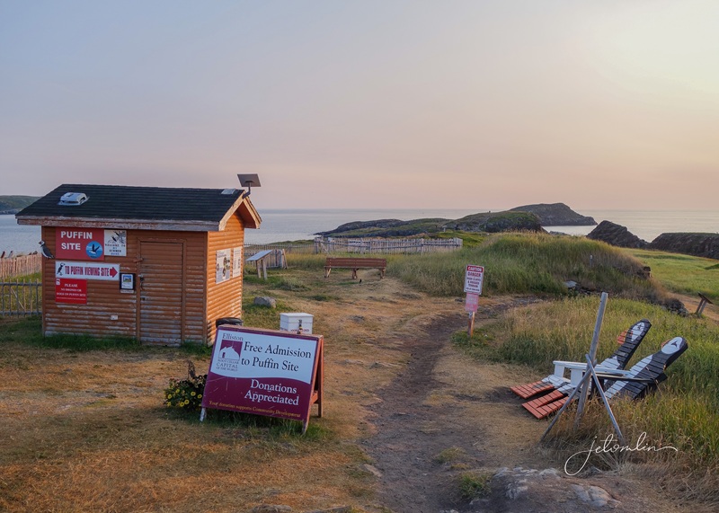
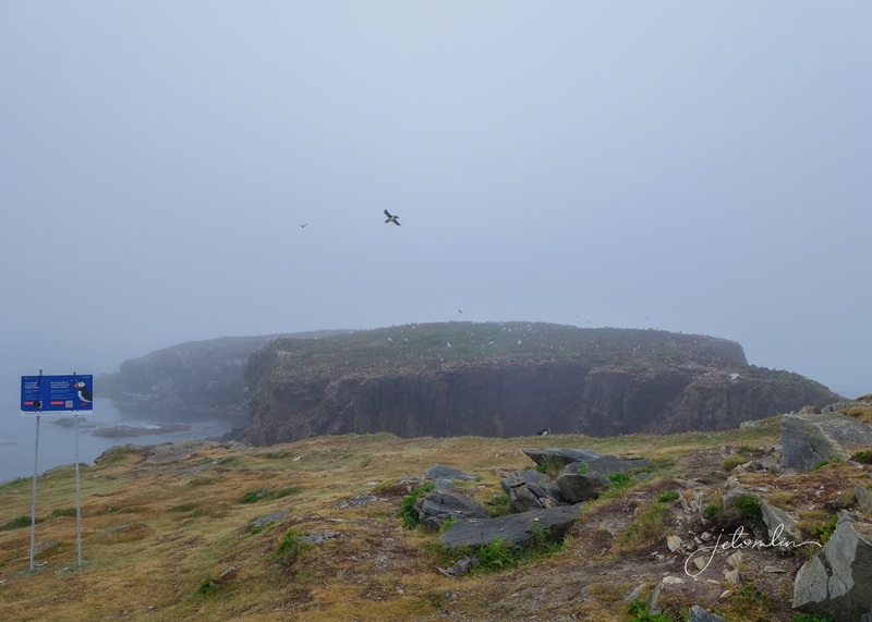
Despite the remote locations where puffins are typically found, I was determined to capture their beauty through my lens. The viewing site in Elliston, Newfoundland, is one of North America’s best places to observe puffins, especially from May to September when they breed on a rocky outcrop, allowing for close encounters.
Elliston puffin site, July 2025
Since the best times to photograph the puffins are early morning or late afternoon, I looked for other interesting ways to occupy my days. The surrounding area offers beautiful hikes and plenty of photo opportunities, so we booked a week at an Airbnb in Bonavista, just five miles from the Elliston site.
Johanna’s big red house BnB
Johanna’s spacious BnB featured a private bedroom and bath, as well as a shared kitchen, and was conveniently located near restaurants and the harbor. Her mi-casa-es-tu-casa hospitality instantly made me feel like family. And the location was a perfect base for exploring all that the Bonavista Peninsula had to offer.
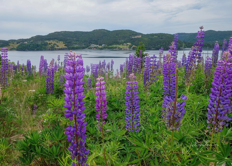
I flew WestJet’s direct morning flight from Orlando to St. John’s, picked up my rental car, and drove the 3 1/2 hours to Bonavista. The route was scenic and colorful — azure lakes nestled between lush green hills with bright yellow, pink, and purple flowers growing wild alongside the road.
lupines growing alongside the road
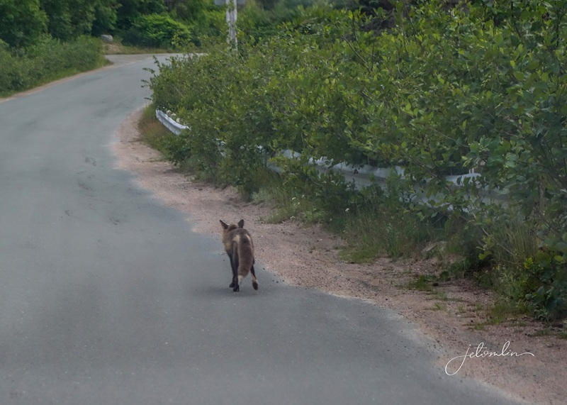
A red fox darted into the bushes as I drove by, and a bit further along, a second fox stayed long enough for me to snap a quick proof-of-life photo through the windshield as I zipped past.
a quick proof-of-life shot through the windshield!
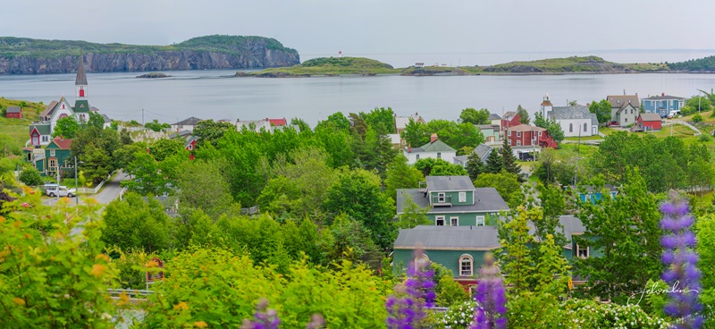
The coastline is filled with charming towns featuring brightly painted buildings that line blue harbors, where equally colorful boats bob in the waves.
Bonavista Harbor
My first day was overcast, and after visiting the puffins in the morning, I spent the afternoon exploring. The Puffin Craft Shop in Maberly offers a selection of handmade items and photographs. I had a wonderful conversation with the owner, Bernice, while choosing a knit cap – embellished with a puffin, of course. I immediately put it on and wore it for the rest of my trip. (Arrow through gallery set)
Puffin Craft Shop, Maberly
Pte. Puffin Pete
my new knit cap
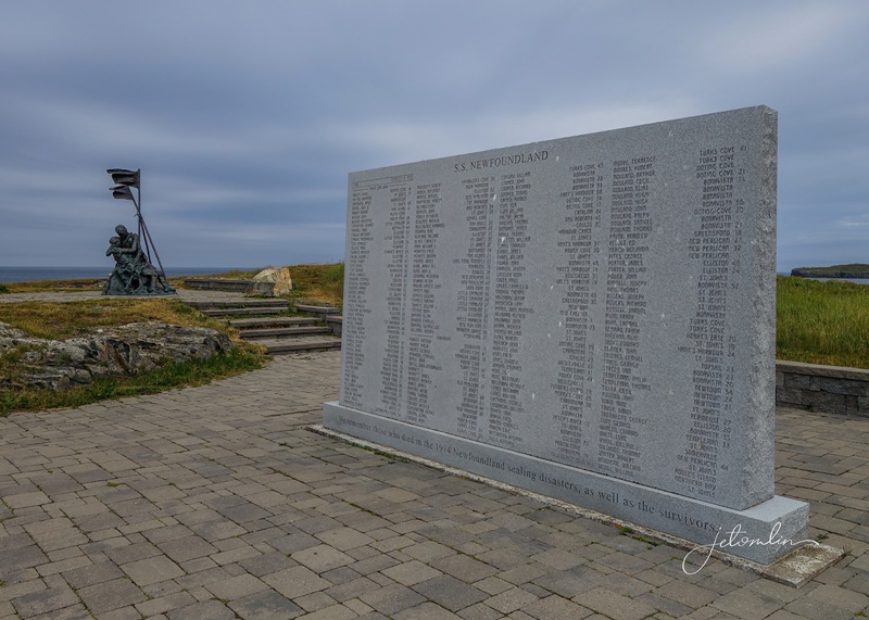
At one of my stops, I happened upon the Sealers Memorial, a powerful seaside statue and monument honoring those who died in the 1914 Newfoundland sealing disaster. (click on photos to enlarge)
Sealers MemorialSealers Memorial statue
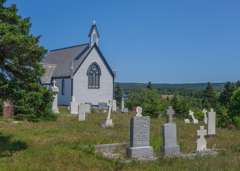
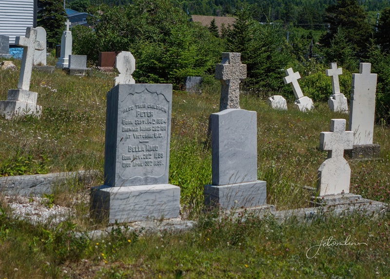
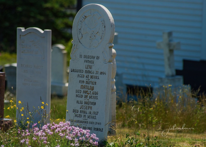
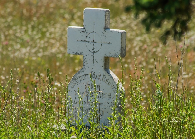
Every town has at least one cemetery with tombstones dating back to the 1800s. Many were overgrown, with ancient stone crosses tilted on their sides, and on the oldest, the writing had eroded from decades of wind and sea. (Arrow through gallery set)
Bonavista
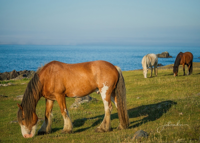
On a whim, I turned down Dungeon Road and came upon a herd of beautiful horses in the community pasture. I couldn’t help but snap a few photos as they grazed on the green hillsides against the blue ocean backdrop.
horses in Bonavista’s community pasture
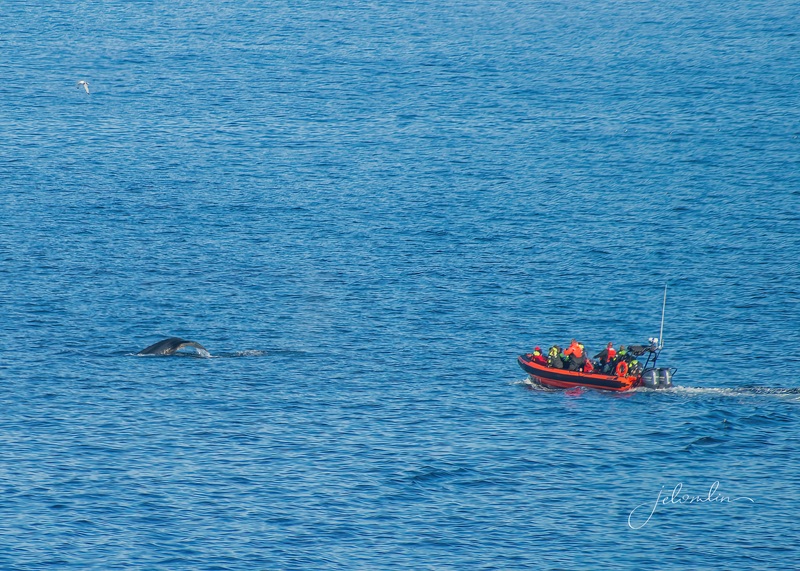
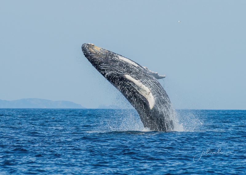
Later, I drove to Cape Bonavista and the lighthouse. From high up on the hill, I watched two humpback whales slowly meander in the bay below me as a bright orange tour boat followed behind. (click on photos to enlarge)
Bonavista Lighthousewhale with tour boat
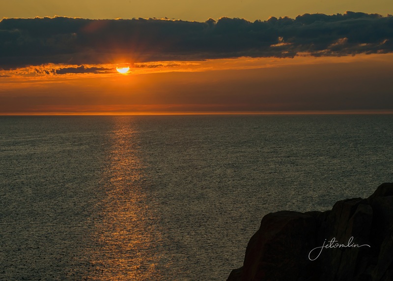
I returned to the lighthouse for the sunset. While I waited, whales entertained me, tails slapping as huge flocks of birds circled above.
setting up for the sunsetsunset over Cape Bonavista
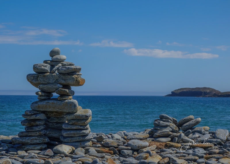
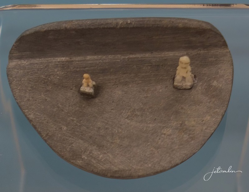
One morning, I stopped to photograph the inuksuks on Sandy Cove Beach. These traditional stone markers, which I first learned about during my visit to Churchill in November 2024, are a significant part of Indigenous culture. I was delighted to find them on a beach in Elliston, pointing the way to the puffin site!
inuksuk on Sandy Cove Beach with puffin site in the distance
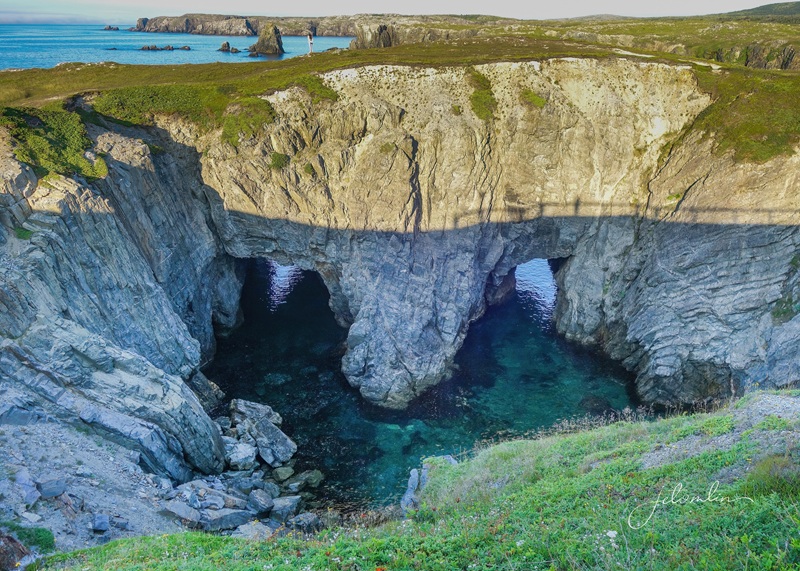
I returned to Dungeon Road and visited The Dungeon, a massive, heart-shaped crater with two separate openings to the sea. I enjoyed watching as the waves crashed in, the same waves that had carved out this breathtaking sea cave millions of years ago.
The Dungeon
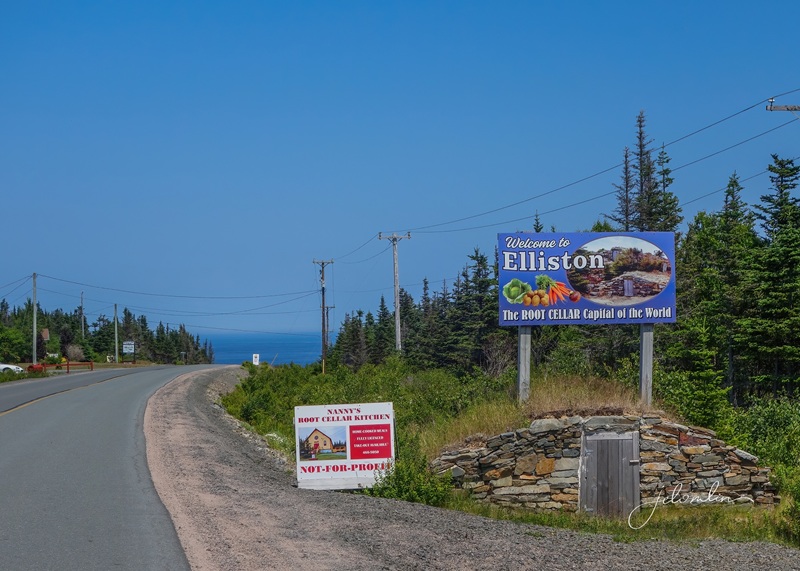
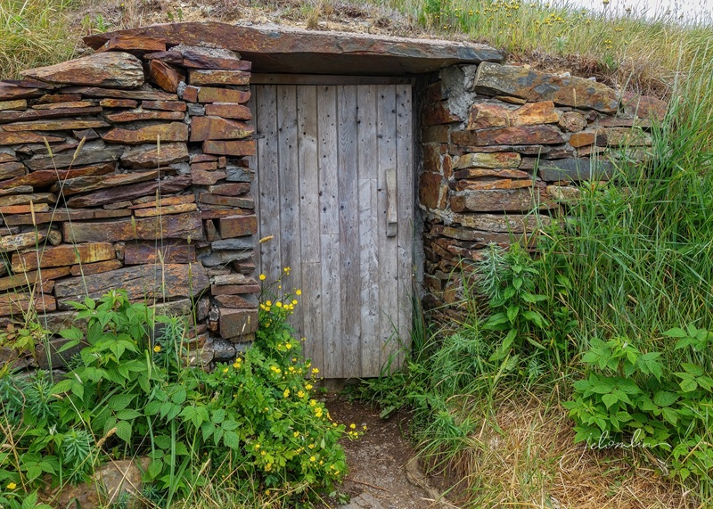
Besides being famous for its puffins, Elliston is also known as the Root Cellar Capitol of the World. So, of course, I had to snap a few obligatory root cellar pics! (Arrow through gallery set)
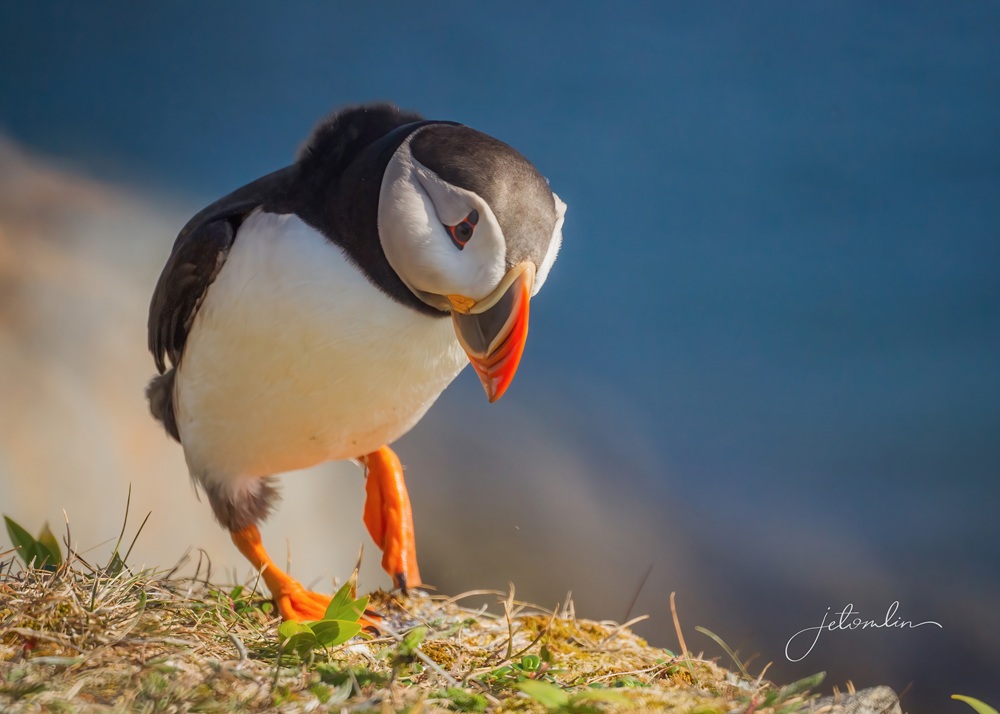
“That’s all fine and good, but what about the puffins?” you ask. The puffin viewing site is located at the end of a short hike along a rocky, uneven path. Until I was up and over the last hill, I had no idea what to expect. (click on photos to enlarge)
Elliston puffin siteElliston puffin site
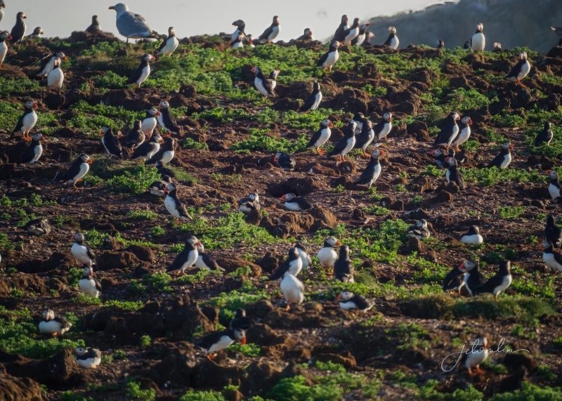
What I was given on my first foggy morning were more puffins than I could have hoped for! The rookery itself is located on an island offshore, at a reach of only the longest lens.
the offshore rookery, July 2025
However, there were hundreds of puffins on the mainland, so close that I had to back up to capture them with my 100-400mm!
hundreds of puffins on the mainland! (July 2025)
Although there were several photographers already milling around, there were more than enough puffins for everyone. I was in puffin heaven, enjoying their roly-poly, comical beauty.
puffin heaven! Elliston, July 2025
Wednesday morning dawned sunny and bright. I was back at the site by 6:45 and was greeted once again by hundreds of puffins on the mainland side. I had switched to my fixed 500mm lens this morning and needed to stay back even further to get my subjects in the frame! (click on photos to enlarge)
Elliston puffins, July 2025Elliston puffins, July 2025Elliston puffin, July 2025Elliston puffin, July 2025
Elliston puffins, July 2025
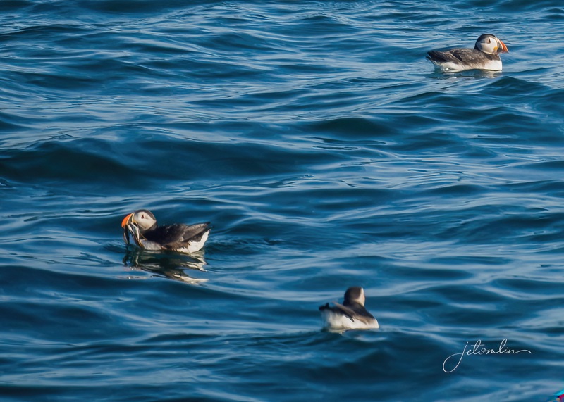
There were dozens of puffins floating in the bay, looking like miniature rubber duckies.
enjoy the beauty of the bay
I watched them for the longest time, even attempting a few shots of birds in flight – but photographing puffins in flight is like trying to capture a speeding bullet! So, I sat back and enjoyed the beauty surrounding me.
my little rock perch
As I watched from my little rock perch, two beautiful black guillemots landed no more than ten feet away.
black guillemot
Finally, the sun was high enough that I could move back to the east side of the mainland to shoot a few more close-ups, as close-up as my lens would allow.
Elliston puffin site, July 2025
A circus (yes, “circus” and “improbability” are both collective names for a group of puffins) had gathered on the cliffside several yards from me, and I was at a good vantage point with the sun at my back. It was indeed a circus as I tried to video a bit of their antics.
Elliston puffin site, July 2025
Suddenly, one brave puffin hopped up on the rocky ledge and waddled so close I had to put my camera down – I could not get her in my frame!
this puffin came too close for me to capture with my lens! Elliston, July 2025
After two morning sessions with the puffins, I had filled two 32GB memory cards. Although I was, for now, puff-full, I was smitten with these birds and could hardly wait to visit them again.
I was totally smitten with these birds!
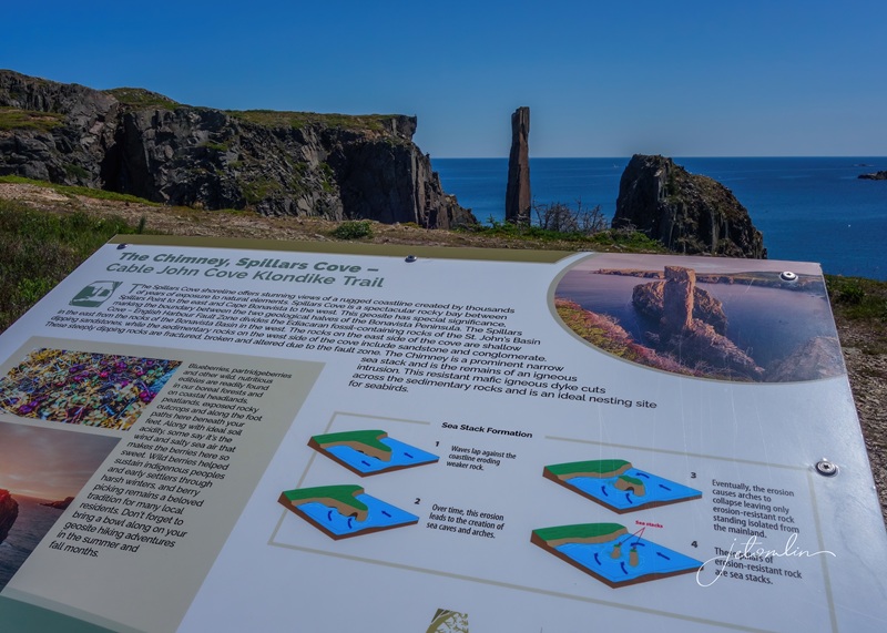
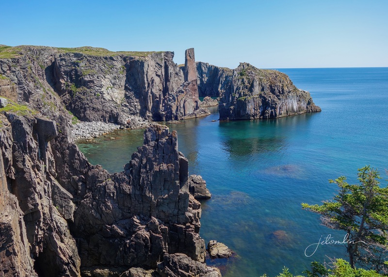
The Klondike Trail is an easy 3km out-and-back hike that runs from Spillars Cove to Elliston. The Spillars Cove trailhead begins at a famous rock formation called “The Chimney” and offers sweeping views of the cove, coastline, and a shorebird rookery. (click on photos to enlarge)
The ChimneySpillars Cove & Chimney
I chose to hike the trail to Elliston while the morning was still cool, as it promised to be a warm, sunny day. The trail led me inland, away from the rugged coastline, and I enjoyed the fresh, sweet air, as well as the many chirping birds, (click on photos to enlarge)
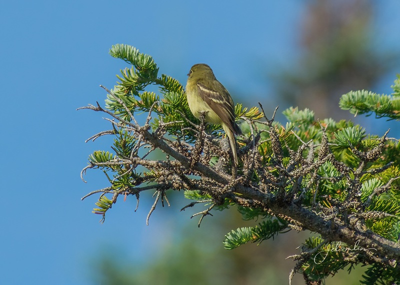
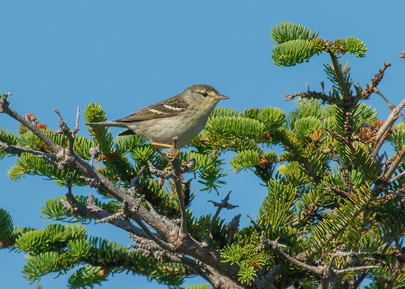
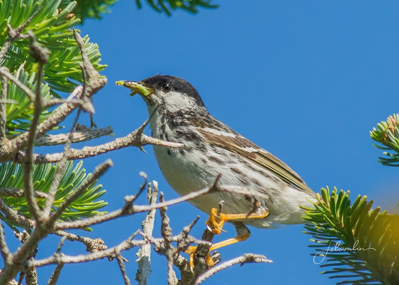
the route took me inlandyellow-bellied flycatcheryellow-browed warblerblackpoll warblerSavannah sparrow
And a snowshoe hare modeling her summer coat.
snowshoe hare
Upon my return, I followed a well-worn path of flattened grass down to the edge of the cliffs directly across from the rookery.
Spillars Cove, July 2025
There were hundreds of puffins flitting around the island and swimming in the cove.
Spillars Cove, July 2025
In 2017, we journeyed to Antarctica for our 35th wedding anniversary. I “penguined” for much of the time – I put down my camera and simply enjoyed the penguins and the beautiful scenery. This morning, I “puffined.” Unlike the sometimes-frenetic photographer activity at the Elliston site, I had Spillars Cove to myself.
this morning, I “puffined”
As I quietly watched, the puffins flew back and forth to burrows on the mainland, some even landing on a ledge directly beneath me.
as I quietly puffined, she landed on a ledge directly beneath me
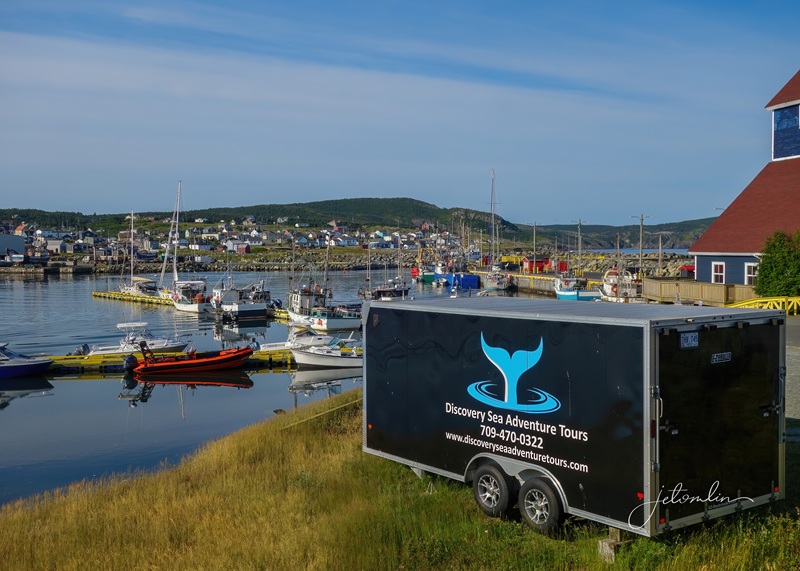
The world’s largest population of humpback whales returns to Newfoundland each year between May and September, and tour boats run daily trips to watch them frolic and feed near shore. I did not want to book a whale tour until I was certain I had all my puffin “money shots.” But after that spectacular first session on Tuesday morning, I booked a Friday tour with Discovery Sea Adventures.
Discovery Sea Adventure Tours, Bonavista
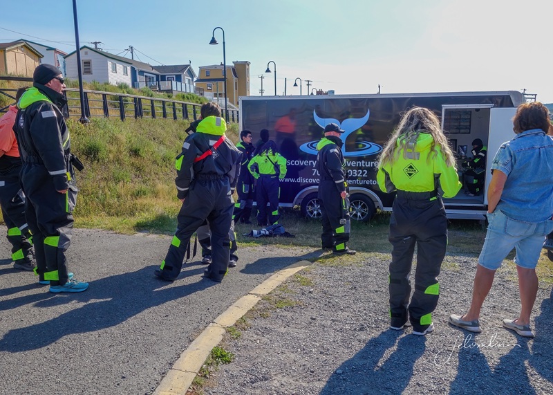
After everyone was dressed in a brightly colored survival suit, we boarded our zodiac and headed out to sea.
gearing up in our survival suits
Within minutes, Captain Bob spotted a minke whale. These whales are very shy, and it was just a quick glimpse before she disappeared beneath the waves. Next up, a pod of Atlantic white-sided dolphins, but at the same time, a mother and baby humpback breached in the distance.
minke whale
Leaving the dolphins behind, we raced to the whales, as there is never a guarantee of how long they might continue this behavior.
Mama jumped a few times, but the calf jumped over and over again. I missed a few breaches as I was distracted by more whales off in the distance, but in the end, everyone got their money shots. (click on photos to enlarge)
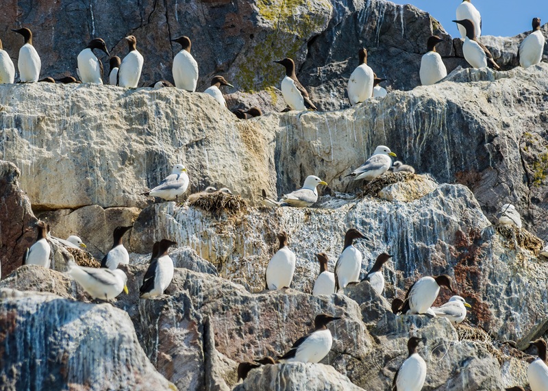
Finally, after more than an hour of continuous breaches, we left the whales. We headed to the seabird colony below the lighthouse, a bustling community of puffins, razorbills, and murres, among others.
the seabird colony below the lighthouse
Captain Bob wanted to find us more dolphins,
Captain Bob looking for dolphins
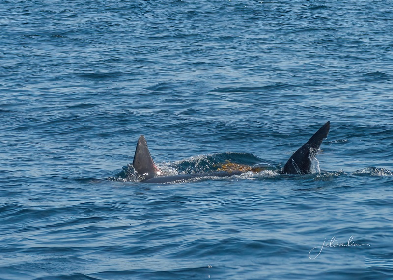
But we were diverted by three fin whales, the second-largest whale on the planet. These mighty whales rarely show their tails or breach, but they did show us their distinctive dorsal fins.
fin whale
Suddenly, Patti, a fellow passenger, cried, “What is that fin?!?” It turned out to be a porbeagle shark playing with a piece of kelp, adding even more excitement to an already fantastic day.
porbeagle shark playing with kelp
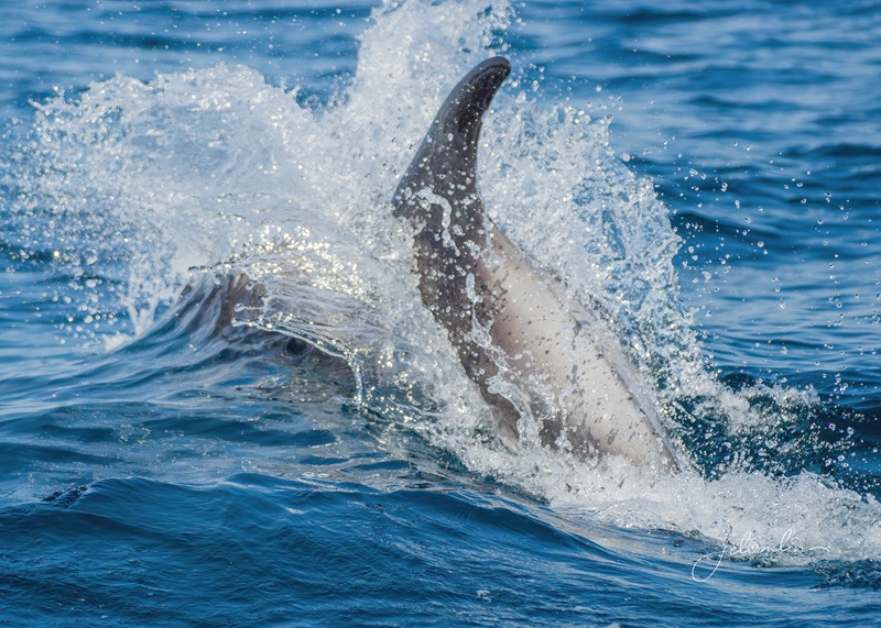
As we turned back towards Bonavista Harbor, we found our dolphins. They raced around the boat – almost too fast to photograph, but a thrill, nonetheless.
dolphins!
At the end of our adventure, Captain Bob instructed us to look up. A friend was flying a drone overhead and snapped a quick photo of our group – a special keepsake from our special day. (arrow through gallery set)
drone shot of our group
Dean & Patti & me seriously focused (photo by Dean)
what a day! (photo courtesy of fellow traveler)
Later that afternoon, I returned to Cape Bonavista to search for a fox family that lives in the grassy meadow below the lighthouse. After 90 minutes of fox-less waiting, I walked up to the rookery. I was delighted to find a large group of puffins on the mainland, happily going about their evening business while cameras clicked away. (Arrow through gallery set)
With the weekend upon me, I decided to explore more of the area. Johanna had given me a list of “must-sees,” and I planned routes that would cover most of them. As I drove along, I realized I was following part of the “Discovery Trail,” a 425km route that circles the Bonavista Peninsula.
I realized I was following part of the “Discovery Trail”
My first stop on Saturday was the charming town of Kings Cove and the Lighthouse Trail.
the charming town of Kings Cove
I chose the longer, 3.5km loop and was rewarded with a beautiful view from the lighthouse,
Kings Cove lighthouse
Another snowshoe hare,
the poor thing was trying to rub ticks off her nose
And a moose!
a moose
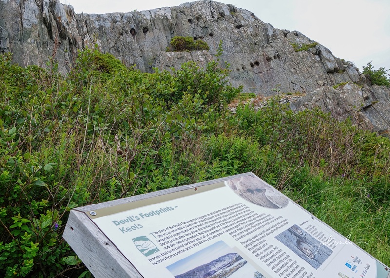
I had planned to stop at Maudie’s Tea Room in Keels for breakfast, but I was too early for their noon opening. I missed their sign on my way in and stumbled upon another interesting site: Devil’s Footprints.
Devil’s Footprints in Keels
While geological studies attribute these cloven, hoof-shaped indentations to natural causes, locals claim that the tracks were made by the Devil dancing over Keels. I found the local version a much better story!
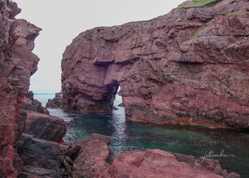
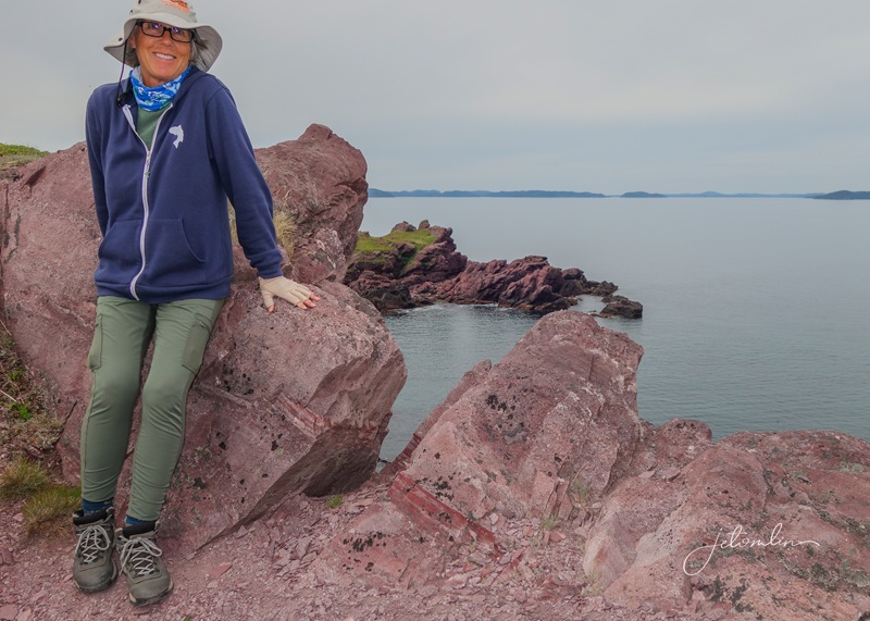
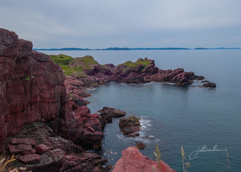
My journey then took me to Tickle Cove and the awe-inspiring Sea Arch, a magnificent rock formation.
Tickle Cove Sea Arch
I scrambled to the top of the hill above the arch and, lying on my stomach, gazed straight down at the sheer drop! (click on photos to enlarge)
I scrambled to the topa sheer drop straight down!
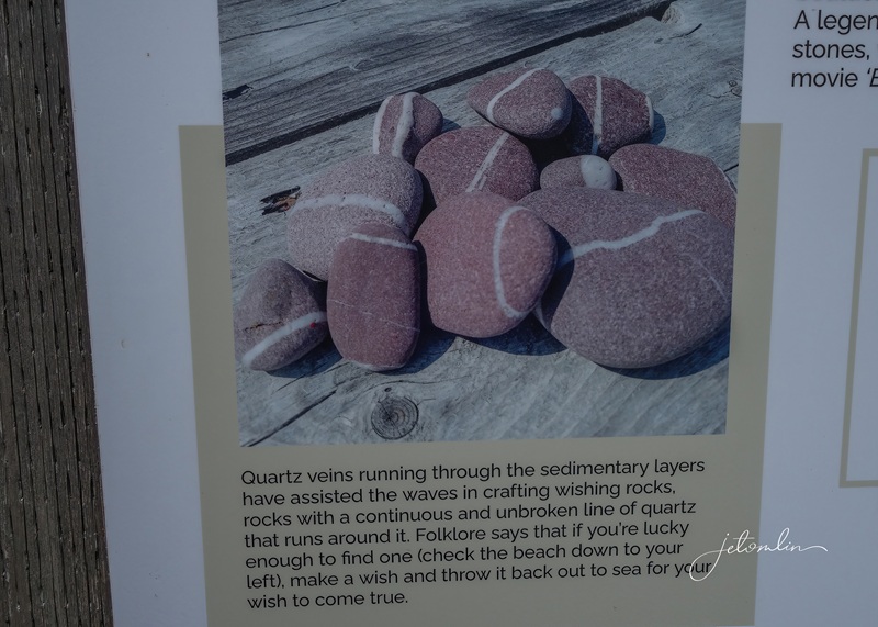
Below the Sea Arch was a small rocky beach filled with wishing stones – rocks with continuous lines of quartz running around them. Folklore says if you’re lucky enough to find one with unbroken lines and make a wish while throwing it into the ocean, your wish will come true.
the legend of the wishing stones
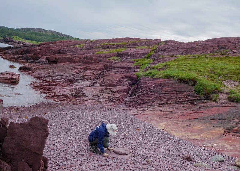
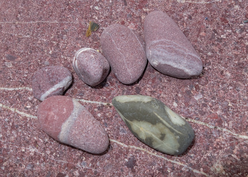
I spent an hour on the beach searching for a few stones that were just the right size to carry home. While I was there, I also threw one into the sea with a wish to return to Newfoundland someday. (click on photos to enlarge)
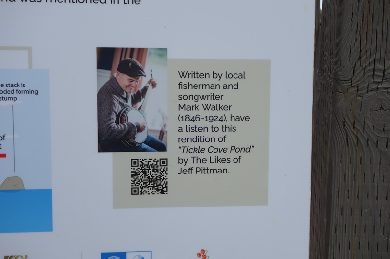
searching for my wishing stonesmy haullisten to Tickle Cove Pond by The Likes of Jeff Pittman
After a quick lunch in picturesque Trinity, I climbed the Gun Hill Trail for a panoramic view of the town.
the picturesque town of Trinity
And then, because I could not help myself, I returned to the Elliston puffin site. It was crowded this Saturday afternoon, and after snapping a few more photos of these captivating birds, I returned home to Bonavista. (Arrow through gallery set)
Sunday had me out the door before dawn, and I watched the sunrise over the ocean as I drove to Port Union and the Murphy’s Cove Trail.
sunrise over the ocean
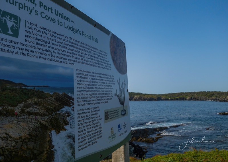
This 7.7km hike features multiple ocean views and an interesting fossil story.
Murphys Cove trail
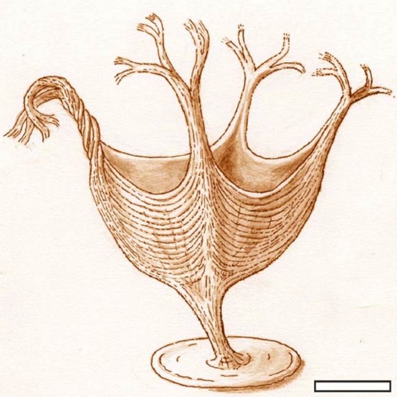
In 2008, scientists discovered the fossil of one of the world’s oldest living animals: a 560-million-year-old sea creature called a Haootia quadriformis. This ancient cousin to jellyfish is significant in understanding the origins of life. The fossil is on display in a museum in St. John’s, but it was fascinating to learn about it on this remote trail! (click on photos to enlarge)
the Haootia fossil site on the Murphy’s Cove Trailartist rendition of a Haootia
However, the most exciting part of my hike was the sudden appearance of a red fox darting across the path in front of me! I had given up on seeing another one on my trip, and this unexpected moment made my day.
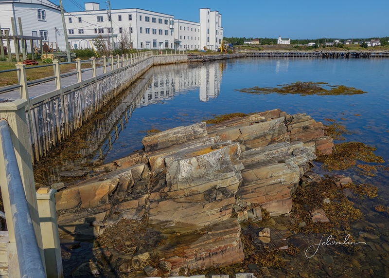
Port Union is North America’s first and, to this day, only union-built town. I checked out the historical Factory and Coaker Manor, and scrambled about on the rocks behind the Factory building, searching for (and failing to find) more fossils.
The Factory and Port Union fossil site
My next stop was the Skerwink Trail in Port Rexton. The Skerwink Trail is continually ranked in the top 35 trails in North America and Europe, and rightly so. As the founder of the trail, John Vivian, said, “This trail offers more scenery per linear foot than any other trail in Newfoundland.”
beautiful Skerwink Trail
I followed the 5.3km route up and down steep hills that hugged the rugged coastline, offering breathtaking views of the ocean that on this day was an impossible shade of blue.
the steep up & down trail followed the rugged coastline
After two somewhat strenuous back-to-back hikes, I was ready for lunch! I stopped at the famous “Oh My Cheeses” food truck in Port Rexton and splurged on “The Gull” – grilled brie with Newfoundland partridge berry jam on toasted bread. Yum!!
grilled brie & partridge berry jam from Oh My Cheeses in Port Rexton
On my way back to Bonavista, I swung by the Elliston puffin site one last time. The puffins were not putting on a show like they had earlier in the week. But Newfoundland had one final surprise in store: an iceberg!
an iceberg! (July 13, 2025)
I traveled to Newfoundland for the puffins and went home with so much more: whales, dolphins, foxes, a moose, countless stunning landscapes, rewarding hikes, delicious seafood, picturesque towns, spectacular sunrises and sunsets, and an iceberg – the final icing(berg) on the cake!
Bonavista Peninsula landscapes (with “Up She Rises” sung by Jason Ryan during my dinner at Skipper’s Restaurant)
And although I didn’t have the opportunity to get properly “screeched in” on this trip, in my heart, I am an honorary “Newfie.”
To view all my puffin photos arrow through the set or click to open a new tab in Flickr:
To view my whale and other Newfoundland photos arrow through the set or click to open a new tab in Flickr:
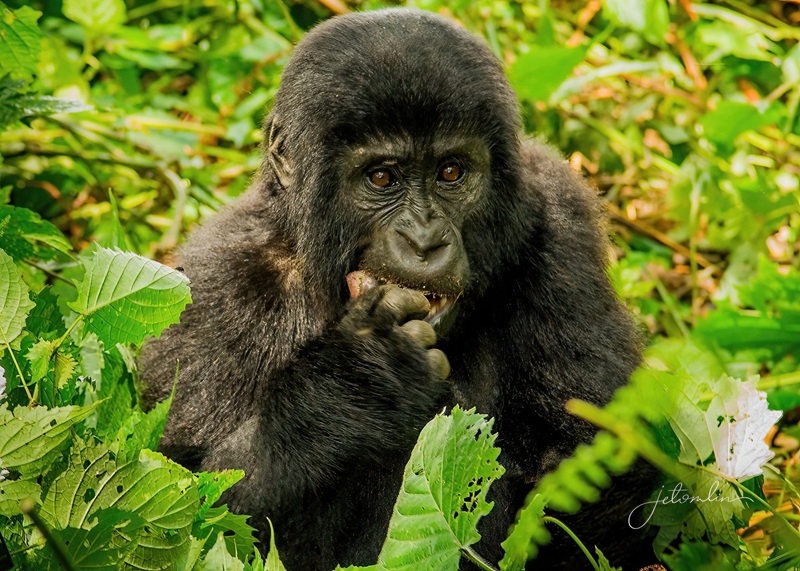
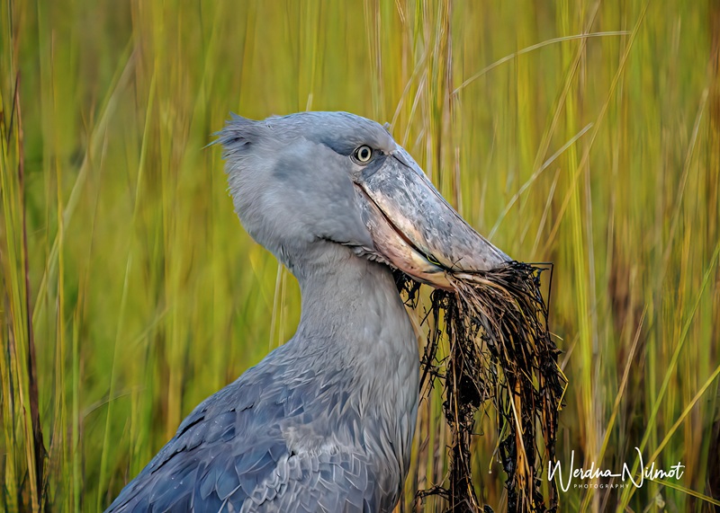
It has always been a dream of ours to photograph gorillas in the wild. They are continuously on the go, so seeing them can vary from a short hike to a grueling, hours-long trek through the jungle. We wanted to do this sooner rather than later, as we are not getting any younger.
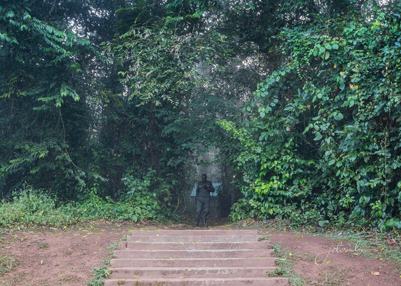
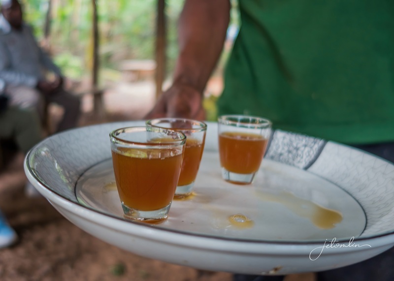
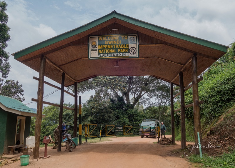
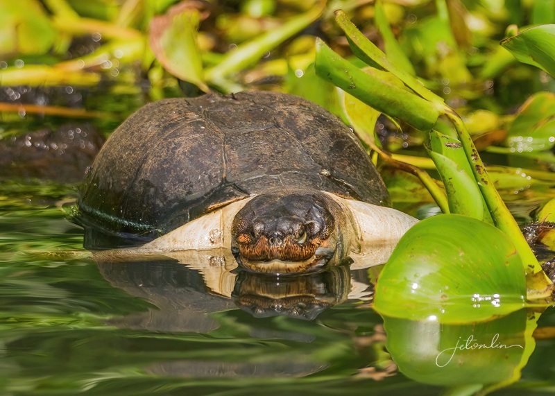
Bwindi Impenetrable Forest, Uganda, February 13, 2025
There are only a few places in the world that offer this experience: Uganda, Rwanda, and The Congo. Uganda presented the most affordable option, and our first step was to find a tour operator who could tailor an itinerary to our preferences. Along with gorillas, we also wanted to see chimpanzees, golden monkeys, and shoebill storks. These activities are regulated, requiring special permits, guides, and armed rangers.
waiting to board our KLM flight from Atlanta to Entebee (via Amsterdam)
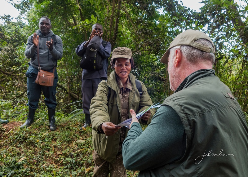
Gorillas are specially protected, with a limited number of trekkers permitted each day and a limited amount of time (one hour) once your assigned family is located. Mountain gorillas are critically endangered, and trekking plays a vital role in protecting them.
a limited number of trekkers are permitted each day (Bwindi Impenetrable Forest, Feb 2025)
The dollars we paid for our permits support anti-poaching, habitat preservation, and education programs.
the dollars we paid for our permits helps to support the Bwindi communities
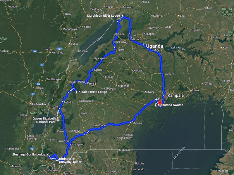
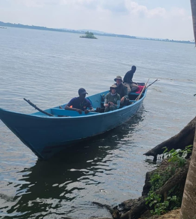
We researched extensively, read reviews, and compared prices. We found the right fit in Buyaga Safaris, a Ugandan company that was able to make our dream a reality. Our journey to see the gorillas would take us through other “must-see” destinations: Murchison Falls, the Victoria Nile, and Queen Elizabeth National Park.
our route
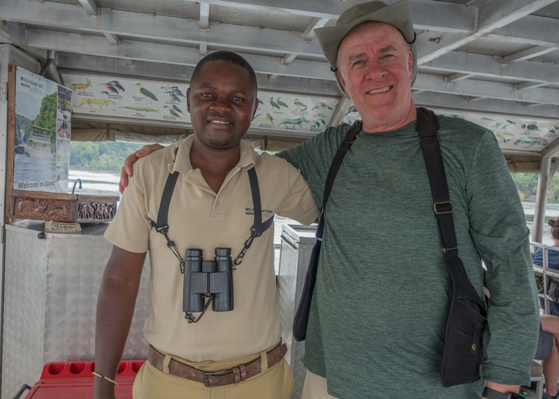
On Thursday, February 6, 2025, Eric, our driver/guide, met us promptly at 8am and we were on our way.
Eric, our driver/guide for the next two weeks
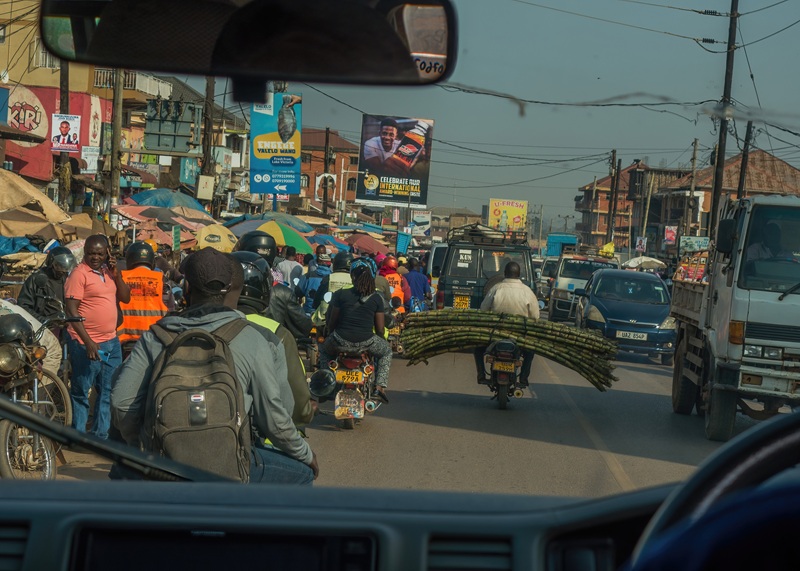
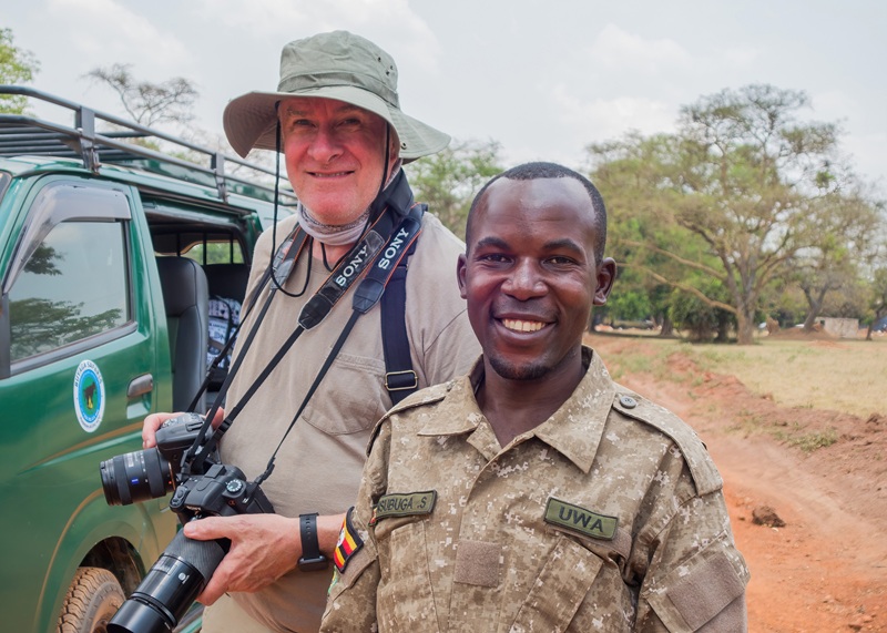
We navigated the choreographed ballet of near misses that is Kampala traffic and drove straight to the Ziwa Rhino Sanctuary.
Kampala traffic
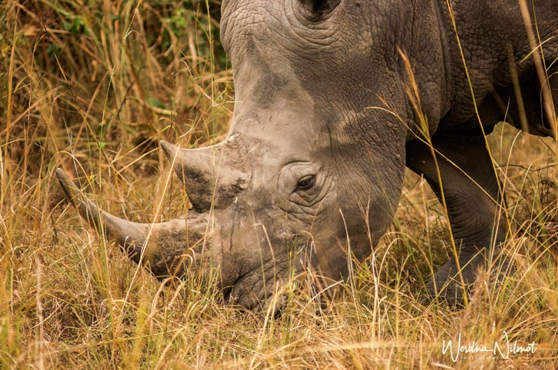
After being poached to extinction in Uganda, 27 square miles were set aside in 2002 to repopulate rhinos and one day re-introduce them into the wild.
white rhino in the Ziwa Rhino Sanctuary
Along with our ranger/guide, Sheriff, we tracked them on foot, finding 14 rhinos and approaching closer than I thought possible.
TG with our ranger/guide, Sheriff
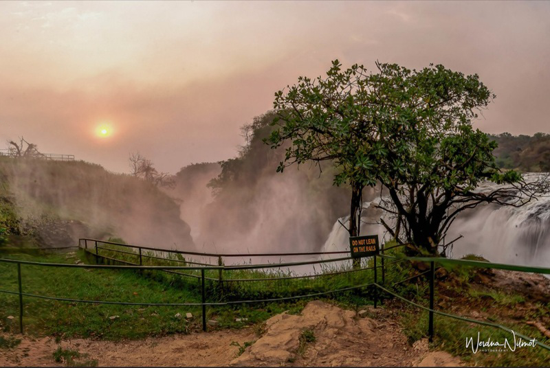
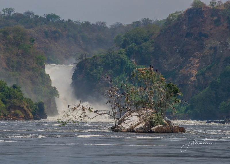
Then, we were off to Murchison National Park and the mighty Murchison Falls. The drive took most of the afternoon, and after visiting the top of the falls,
the top of Murchison Falls
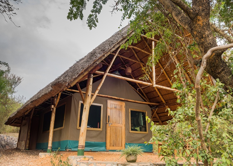
We checked into our home for the next two nights: the Murchison River Lodge. The lodge is “glamping” at its best: a sturdy canvas tent set on a bamboo deck with thatched roof covering the entire unit.
our glamping tent at Murchison River Lodge
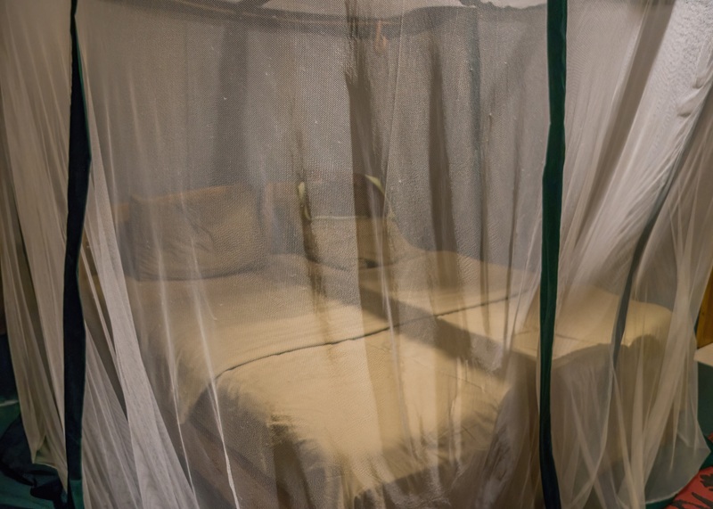
except at the highest elevations, mosquito nets were necessary
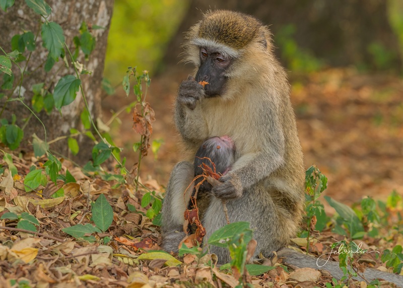
The attached bath was open air, and we were warned to keep the door shut to avoid monkeys sneaking into our bedroom during the night!
vervet monkeys
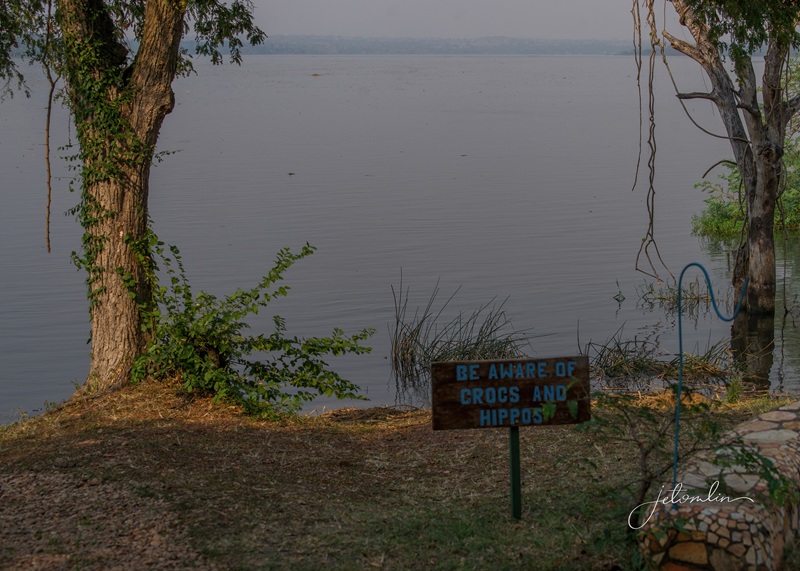
The common dining area overlooked the Victoria Nile, and after dark, the lodge provided escorts to and from our tent due to the threat of hippos coming up onto the paths.
the lodge provided escorts to & from our tent after dark
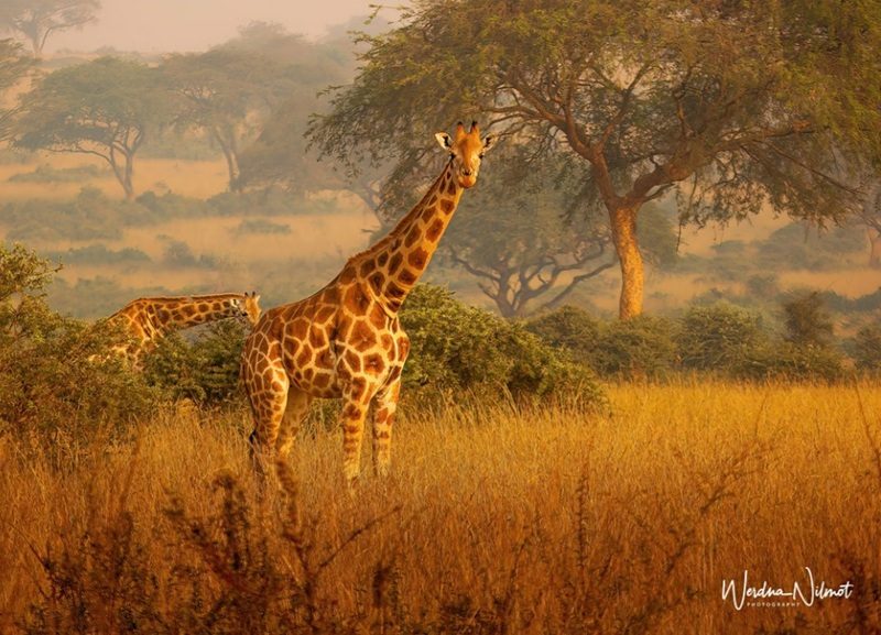
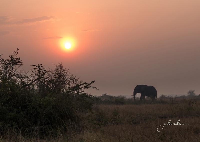
We were up early the following day for a game drive through the park. We saw lions, giraffes, the ever-present Ugandan kob, warthogs, buffalos, elephants, and dozens of beautiful birds.
giraffes in Murchison National Park
That afternoon, we took a cruise on the Nile. Shortly after we were seated, we talked with Herbert, the on-board naturalist, about all the birds we had seen on our drive that morning. We compared the photos in our cameras with his East African bird book, repeating the unfamiliar names.
Herbert and TG
After we were underway, Herbert instructed us to follow him. He had set up two chairs in what I can only describe as “VIP” seats. We had the best view on the boat!
our “VIP” seats!
We reached the bottom of the thundering falls, our turn-around point. It was a treat to see it from this perspective after our view from the top yesterday!
Murchison Falls
Goal #1 of 4: Kibale
The next morning, we journeyed to the Kibale National Forest. The drive took us all day, and we enjoyed the beautiful scenery along the way. Eric provided just the right mix of conversation and quiet, allowing us to enjoy what the road gave us.
on the way to Kibale
We checked into the Kibale Forest Lodge shortly before dinner. Our room was spacious and comfortable, and the manager, Dennison, a delight.
Kibale Forest Lodge manager, Dennison
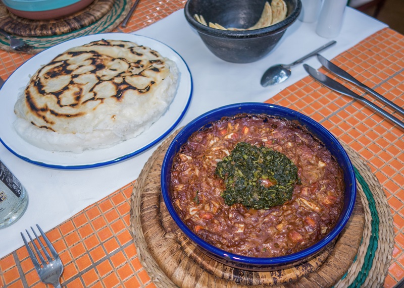
Uganda is rich in fresh produce, and we had no trouble finding delicious, nutritious vegetarian meals at every stop. Our meals at Kibale Forest Lodge were no exception.
Uganda is rich in produce
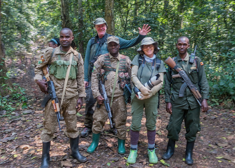
Early the next morning we gathered at the Kibale park headquarters for our chimpanzee trek.
the entrance to the forest
After the briefing, we were divided into groups of 8. We set off with our ranger/guide, Gordon, and two armed rangers, Russ and Nicholas.
our ranger/guide Gordon, along with rangers Nicholas and Russ
The Kibale Forest is known as the “Primate Capitol of the World,” home to 1,450 chimpanzees and on our walk, we also saw many beautiful butterflies and red-tailed monkeys. It took about 45 minutes to find our first chimpanzee, high in a tree.
our first chimp – high in a tree
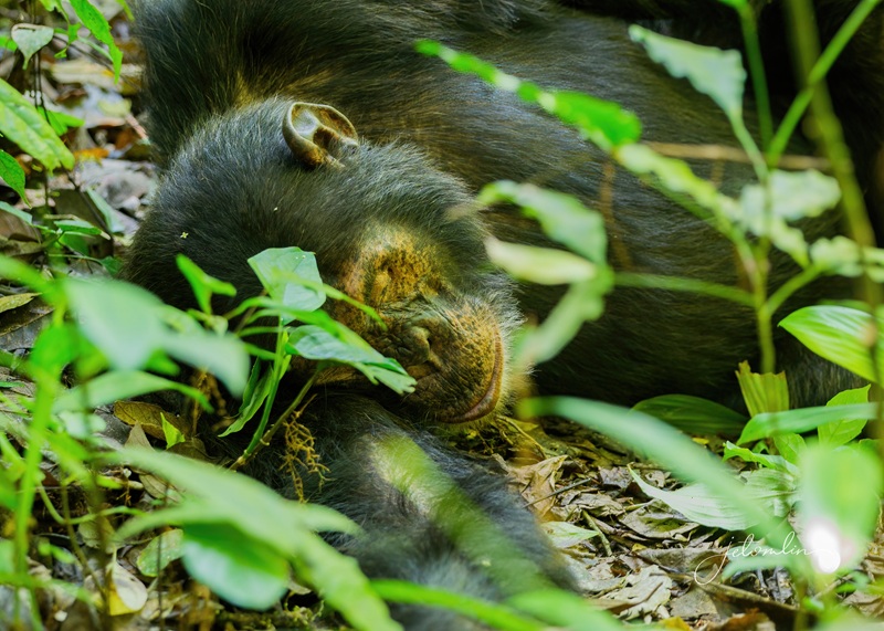
After taking several photos, he took off – and so did we! We dashed through the forest to keep up with the speedy chimp. Although the path was not steep, it was “off trail” and fast-paced. We found another chimp sleeping on the ground, allowing us to catch our breath.
this old guy was sleeping on the ground – paying no attention to us
In the end, we saw 25 different chimpanzees and heard the vocalizations of another 10.
turn up the volume to hear chimpanzees vocalizing in the Kibale National Forest
Gordon said it was “a good day.”
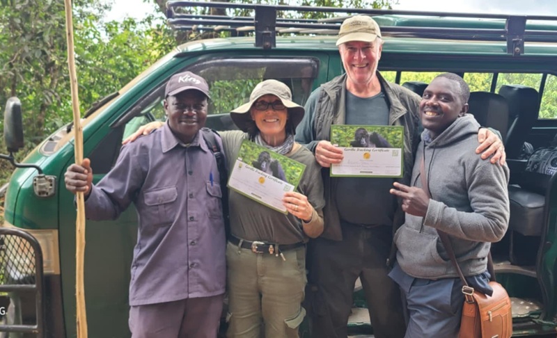
proudly displaying our trekking certificates with Gordon
But it didn’t end there. Immediately after lunch, we met our guide, Eddie, for a walk through the Bigodi Swamp. He asked us how much time we wanted to devote to the swamp, as he also had some “community experiences” planned. We agreed to walk for about two hours, spotting red-tailed monkeys,
red-tailed monkey
Black & white colobus, vervet, and rare, red colobus monkeys. Along the way, he also pointed out various plants used for traditional medicines, curing everything from headaches to baldness.
red colobus monkey
Eddie called us “Papa” and “Mama.” We didn’t mind—we were old enough to be his parents and it was far easier to remember than our names. Going forward, I told everyone we met to call us Papa and Mama. “You are my children of the world,“ I said.
Eddie
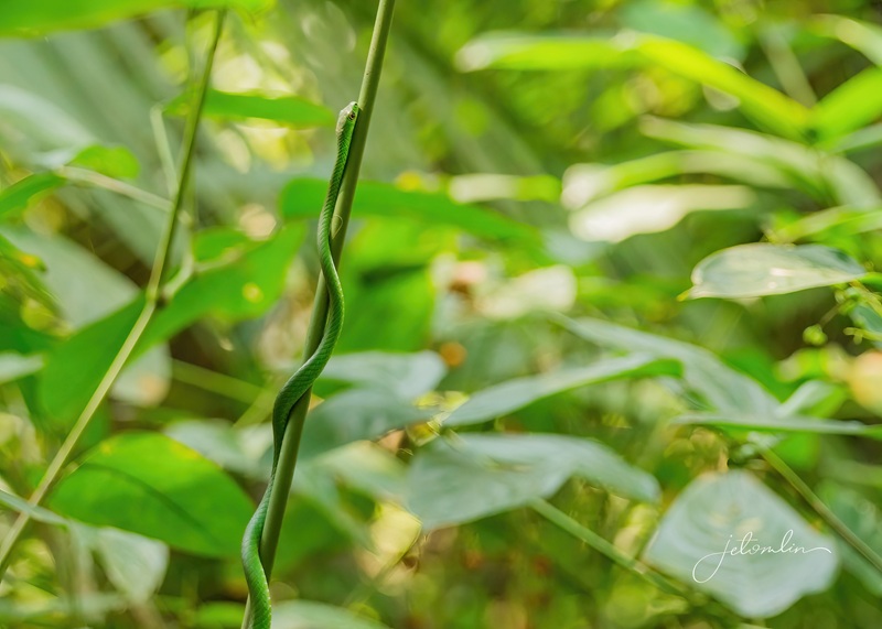
But the highlight of our walk was not the many primates we saw. Eddie asked how we felt about snakes. “We wouldn’t want one as a pet, but we love photographing them,” we replied. He backtracked a few steps and pointed out a slender green creature curling along a branch. We took a few photos and then hurried along. “A green viper,” he told us once we were safely on our way.
venomous green viper
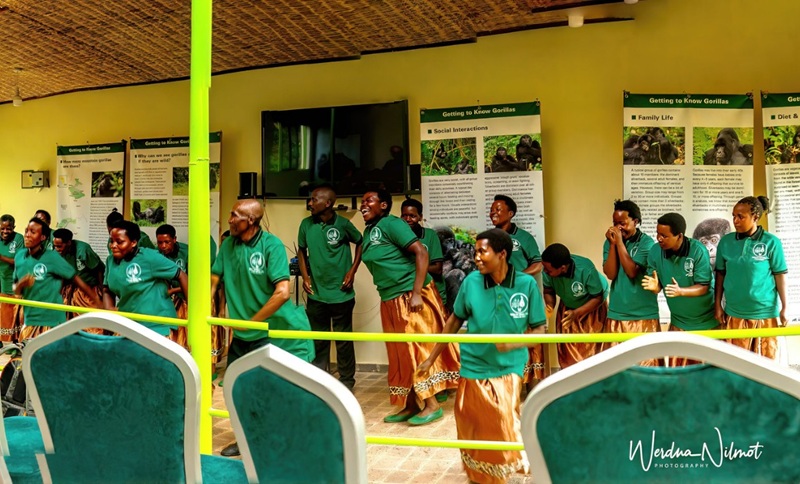
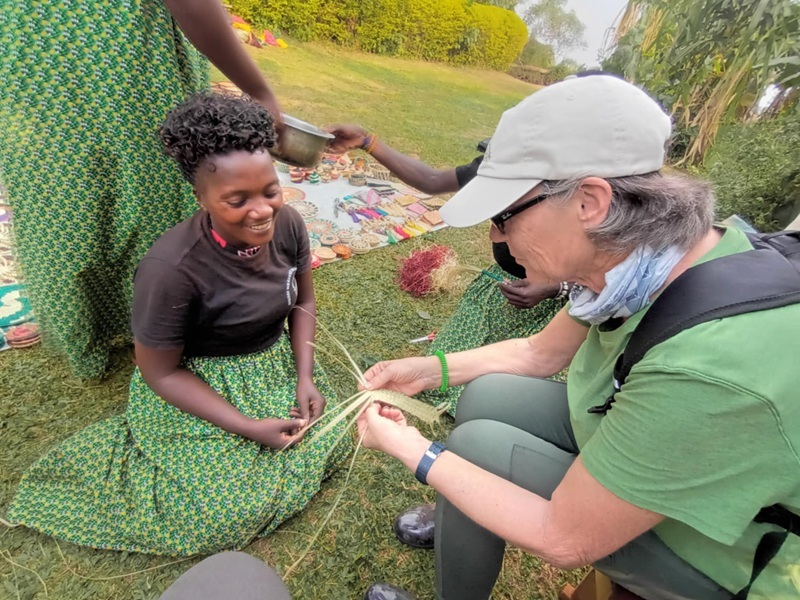
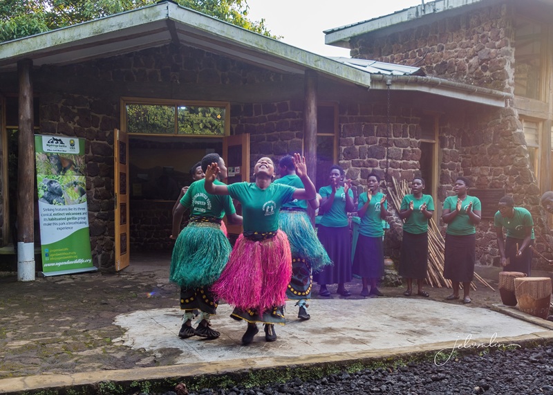
After our swamp walk, we visited the “Women Who Weave,” who entertained us with many songs and dances. And yes, I was encouraged to get up and dance with them!
dancing with the Women Who Weave
I also got to try my hand at weaving, and they showed us how they make their natural dyes.
attempting to weave
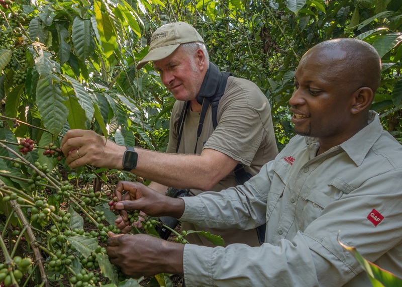
Then it was time for our “coffee experience.” Eddie explained how coffee is cultivated and harvested.
TG and Eddie harvesting red coffee beans
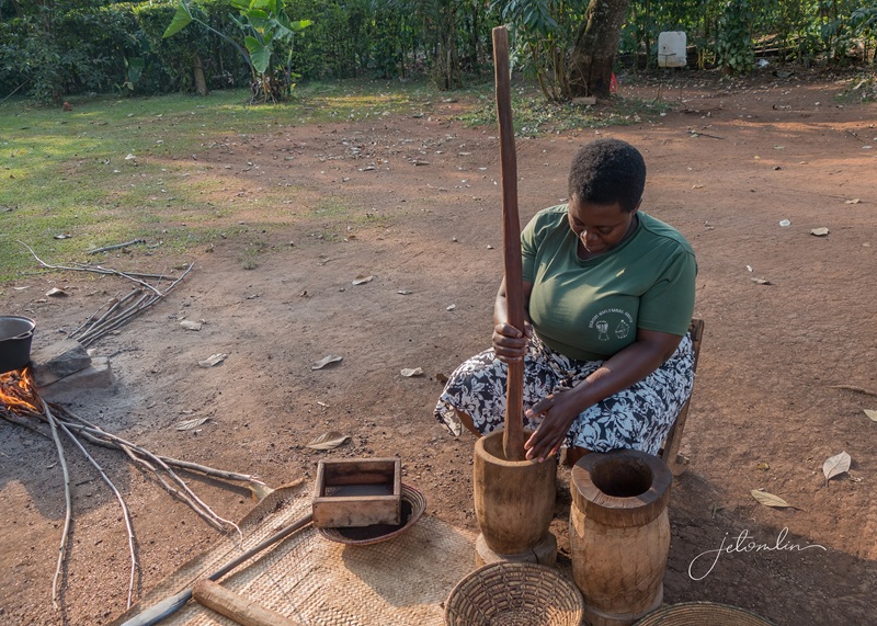
We watched as the bright red beans were roasted to a dark brown, pounded, sifted to remove the outer kernels, and sifted and pounded again until they were as fine as powdered sugar.
pounding the roasted beans into a fine powder
“Write something in the final product,” Eddie instructed me. After a moment’s thought, I spelled out the letters “L-O-V-E.”
“Of course, we love Mama and Papa – and Eric!”
And finally, we enjoyed the richest, most delicious cup of coffee we had ever tasted.
rich, delicious, and very strong coffee!
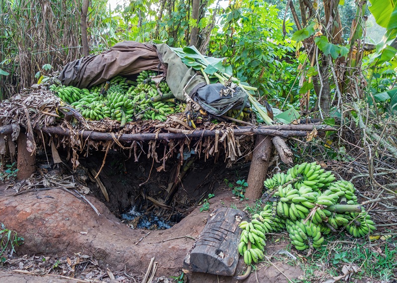
But there was one last surprise in store: a visit to “Rest in Banana.”
“Rest in Banana”
For the Banana Man, every day is banana day. He demonstrated how he makes banana juice, turns it into banana beer, and finally distills it into banana gin—40 and 60 proof! My “Putin Special,” he said.
he started with banana juice
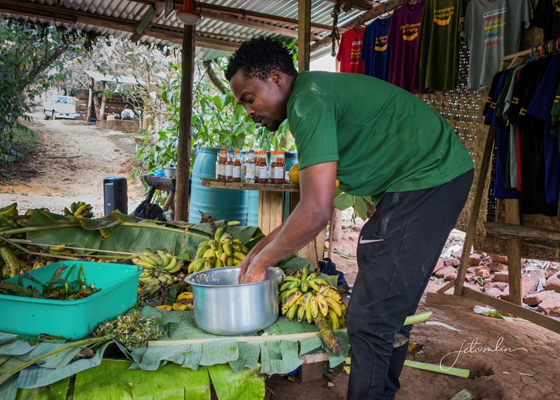
Each step of the way, we were given a tiny shot glass to taste.
sampling banana beer
It was now around 5 pm, and the Banana Man had been brewing—and sampling—his product all day!
“Every Day is Banana Day”
The next morning, we transferred to Queen Elizabeth National Park and our home for the next two nights. Elephant Hab turned out to be our favorite accommodation of the journey. Our spacious cottage had a big front porch,
our front porch
King bed, a separate changing room, and an en suite bath. The entire structure smelled of cedar. It was beautiful.
comfy king bed
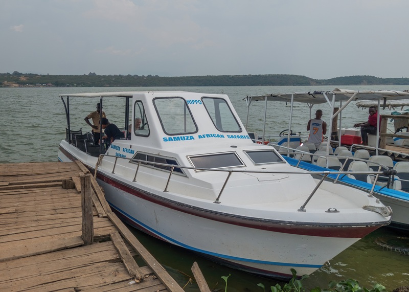
After we checked in, we went for a launch cruise along the Kazinga Channel.
Kazinga Channel launch cruise
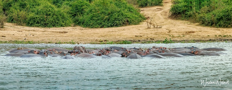
The hippos were so thick you could almost step across the river on their backs,
so many hippos you could almost step across the river on their backs!
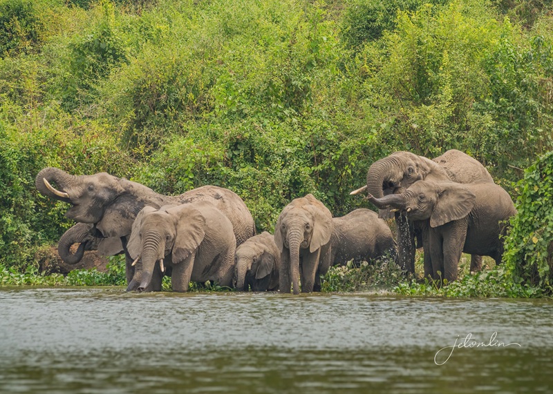
But the highlight was a huge herd of elephants who came down to the water’s edge.
a big herd of elephants entertained us at the water’s edge
We also spotted many monitor lizards, crocodiles, and countless colorful birds.
red-throated bee-eater
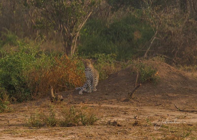
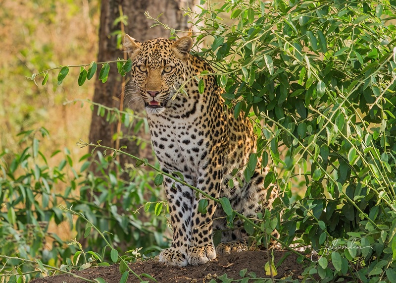
After the cruise, Eric asked if we would like to go on an impromptu game drive. “YES!” we enthusiastically replied. This turned out to be one of the most thrilling sightings of our trip. We drove the Channel Track at Queen, stopping to photograph two lions resting in a tree. We enjoyed all the warthogs and kobs that crossed the path.
Uganda kobs – the official animal of Uganda
A bit further along, something caught my eye, and I cried, “Stop! Back up! I think I saw a lion.” Eric quickly backed up, and sure enough, there was a cat sitting against a mound of dirt. TG looked through his 500mm lens. “That’s not a lion,” he said. “It’s a leopard!”
“that’s not a lion, it’s a leopard!”
The beautiful animal walked closer as we watched, finally lying about 20 meters from the van.
what a beautiful animal!
Eric quickly called his fellow guides, but it took almost twenty minutes for other vehicles to join us. In the meantime, we had the photo opp of our dreams.
the photo opp of our dreams!
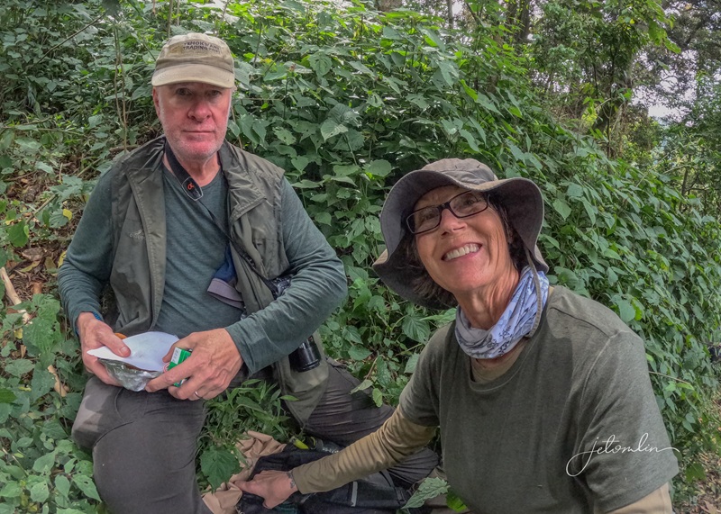
We were joined on this part of our journey by a lovely Czech couple: Martina and Ivan. We ate dinner together both nights and would later meet them again in Bwindi.
lunch with Ivan & Martina and their guide, Simpson
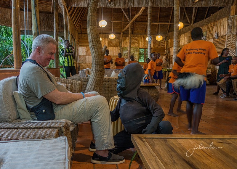
But while at Elephant Hab, we were treated to some special visitors. A group of children from a local orphanage gave us a pre-dinner song and dance performance. Most of their songs were energetic and joyful,
most of their songs were energetic and joyful
But one broke my heart: a song about AIDS and loss, a poignant reminder of the suffering in this part of the world and how truly blessed we are in the USA, even in the uncertain political times of 2025.
“Wake up in the morning, ask my mother where o where are you?”
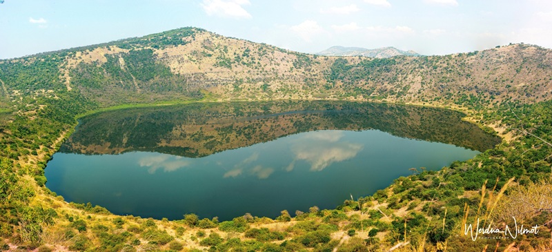
The following morning, Eric took us on a drive to the craters.
sunrise at Queen Elizabeth National Park
a crater lake in Queen Elizabeth National Park
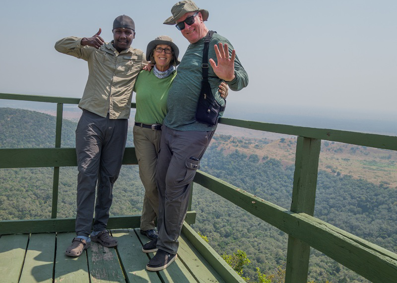
group selfie!
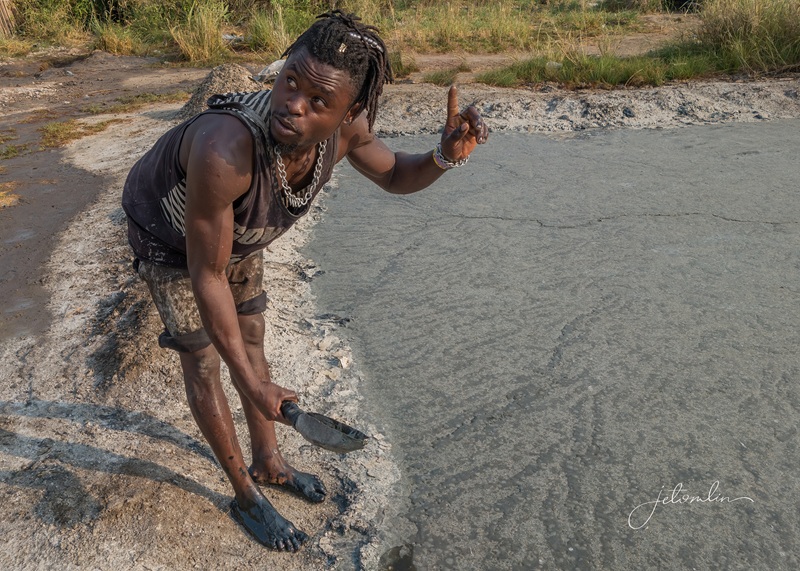
There are multiple craters in this section of the park, many of which are beautiful lakes, but some are used for harvesting salt.
a salt lake
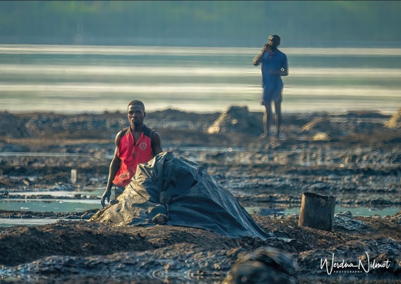
We stopped at a salt lake to watch the workers standing in the thick black mud, scooping up the water and tossing it onto the crusty surface.
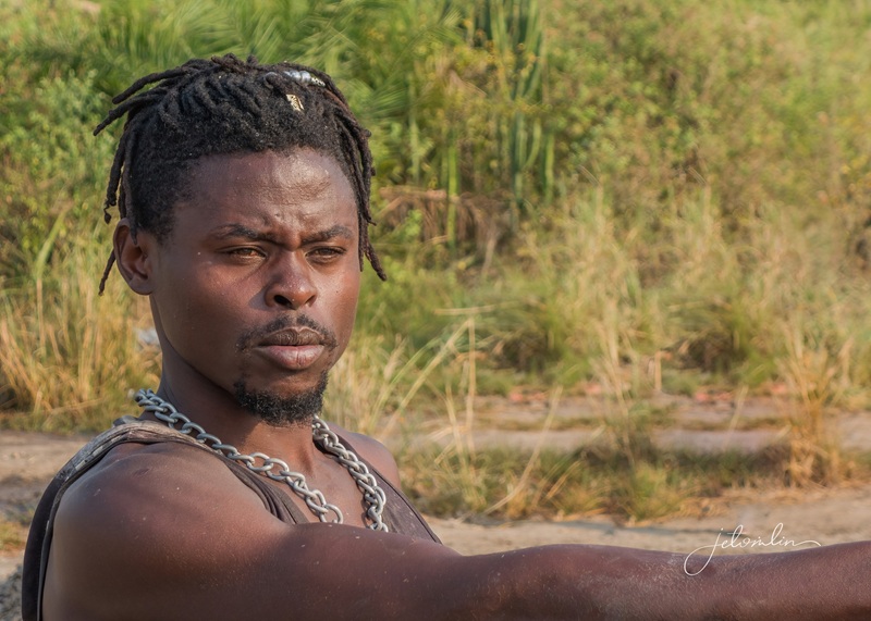
Eric asked a worker to demonstrate how he harvests the salt
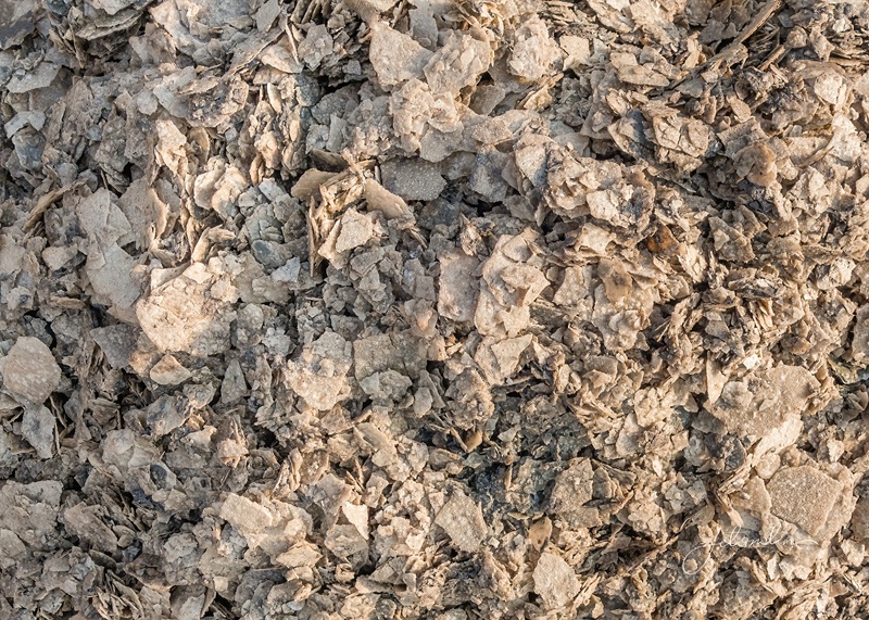
Once the crust is thick enough, it is gathered up and dried. The dirty gray piles were a world away from the pure-white crystals we find in the grocery stores at home!
a world away from the white crystals we buy at home!
The next day, we drove to the Ishasha sector in search of the famous tree-climbing lions.
Ishasha Sector: home of THE tree-climbing lions
However, due to a prescribed burn, the lions had moved away from any accessible location.
prescribed burn!
We did, however, see lions in trees in both Murchison and Queen. So even though we did not see THE tree-climbing lions, we did see lions in trees!
not “THE” tree-climbing lions, but a lion in a tree! (Queen Elizabeth National Park)
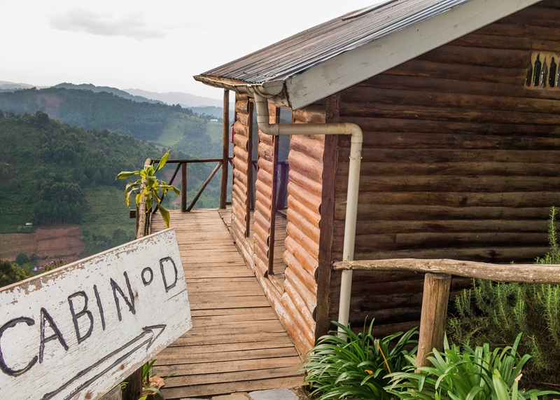
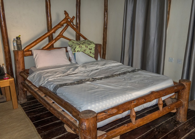
Late that afternoon we arrived at Bakiga Lodge in Bwindi, minutes from the entrance to the Impenetrable Forest. Our room was basic but comfortable and clean,
our cabin
basic but comfortable and clean room
And the view from our balcony was worth a million dollars. We went to bed early, anticipating what the next two days would bring.
view from Bakiga Lodge
Goal #2 of 4: The Impenetrable Forest
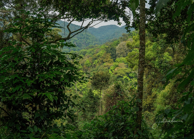
The Bwindi Impenetrable Forest is a World Heritage Site, one of the most biologically diverse areas on earth.
Welcome to the Bwindi Impenetrable National Park
It is home to roughly half of the world’s mountain gorilla population: approximately 600 gorillas live in this rich, dense rainforest.
the Bwindi Impenetrable Forest
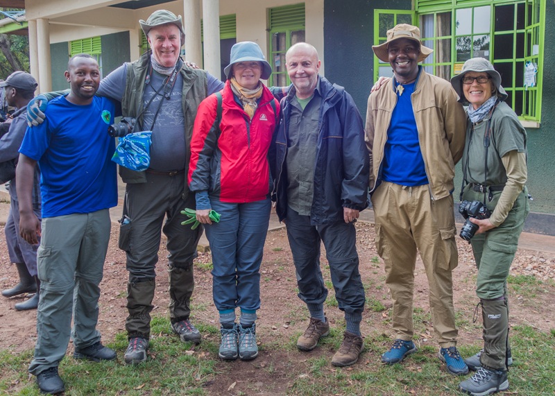
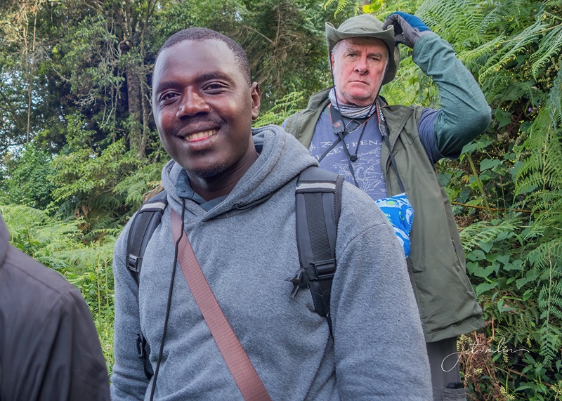
Eric drove us to the park headquarters for the briefing about our day’s activities. Then we were divided into groups of eight and assigned a gorilla family.
pre-trek good-bye to Ivan & Martina and Simpson
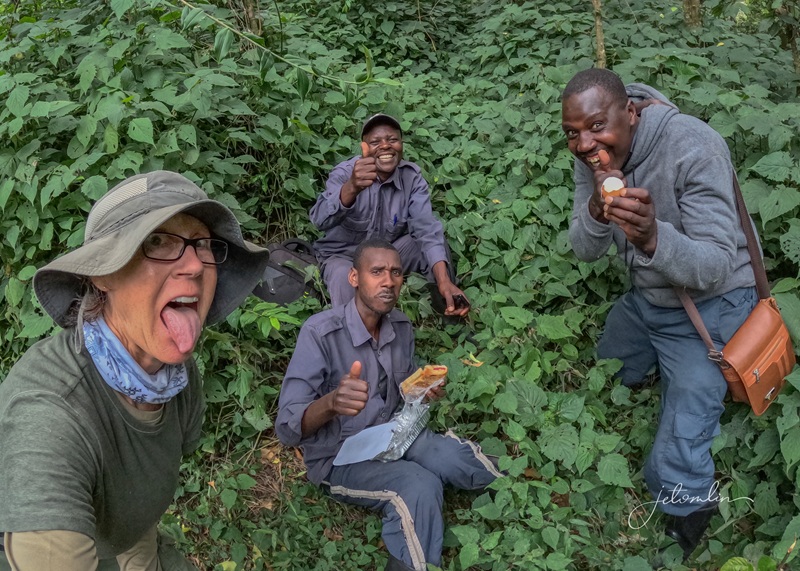
This was also when we hired our porters: strong young men and women who carried our backpacks and lent a helping push or pull when needed. Nestor was adorable, and I loved him so much that I asked for him again the next day.
Nestor and me
TG hired Silas, and we also hired him the following day.
Silas and TG
Today, we were assigned the Mukiza gorilla family.
Ben waiting for us at the Mukiza Group sign
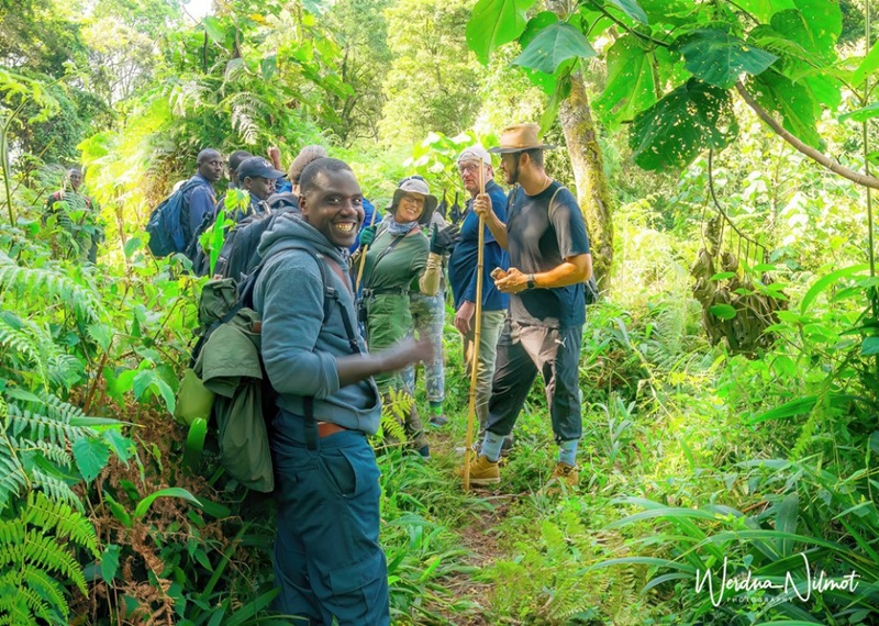
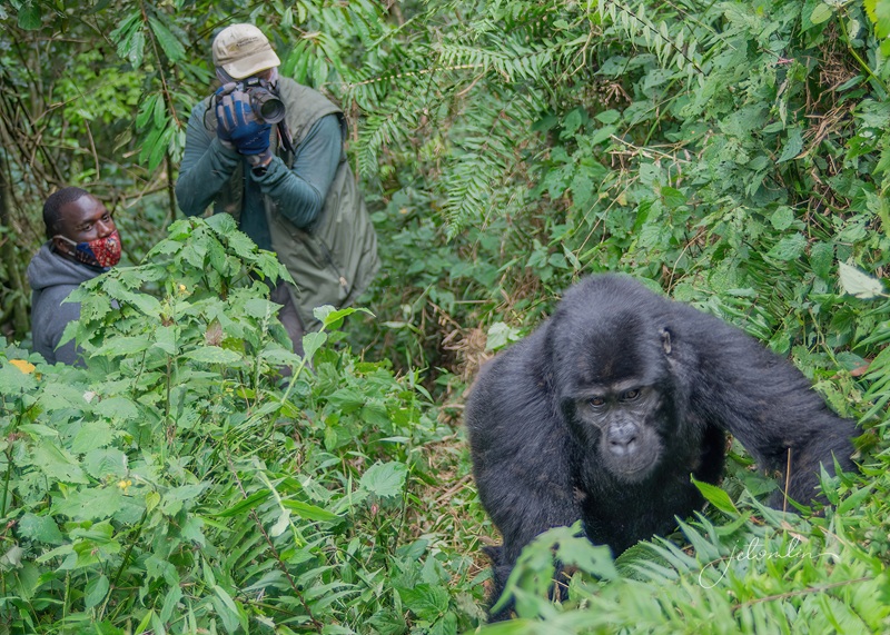
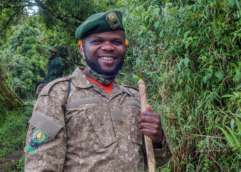
Our ranger/guide, Ben, along with armed rangers Felix, Roland, and George, led us up and down the steep jungle terrain for almost two hours, stopping many times to hack their way through the thick foliage, before we found our family.
steep jungle terrain!
I thought it was the most physically challenging thing I had ever done, including my 13 full, 26.2-mile marathons.
taking a much-needed energy break!
The hour we spent with them went by quickly as we struggled to find good photo opportunities through the many branches and bushes obstructing our view.
we struggled to find good photo ops
Elevation in the Impenetrable Forest reaches 7500ft. The altitude, combined with the required masks and the adrenaline rush, made it difficult to breathe.
masks are required once you are near the gorillas
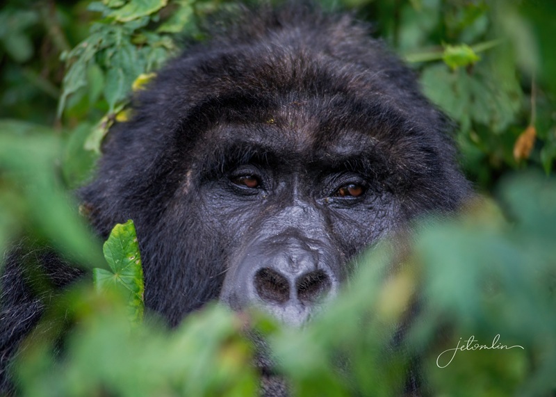
But to stare into their intelligent eyes took my breath away. It was life-changing, and on that day, what was wild turned to wonder.
Wild turned to Wonder
It took another two hours to return to headquarters, where Eric waited to take us home to the lodge. Too tired to do anything that afternoon, we opted for showers and a nap before dinner. We were doing this all over again tomorrow!
trekking certificates Day 1
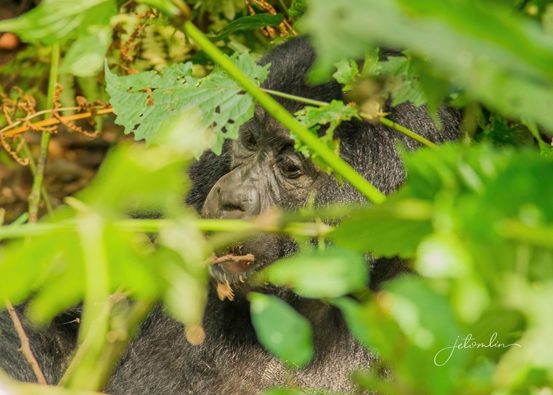
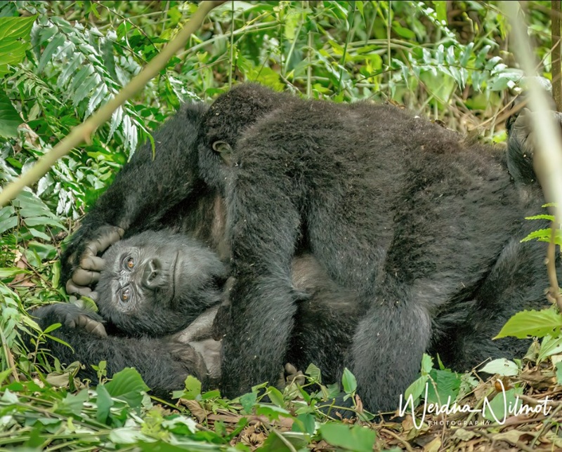
After our briefing the next morning, we were assigned to ranger/guide Allen and two of the guards from yesterday, Roland and George. Today we were to visit the Bitukura family. They are the oldest habituated gorilla family in Bwindi, comprised of three silverbacks, two blackbacks, multiple juveniles, and babies.
one of the Bitukura family’s three silverbacks
We drove up and up to the top of the mountain and then began our hike down – straight down – a steep, slippery 30-degree-angle hillside. It wasn’t easy to breathe between the altitude and exertion, and Silas and Nestor earned their keep on this day. But after about an hour of slip-sliding, we reached the family.
our porters earned their keep today!
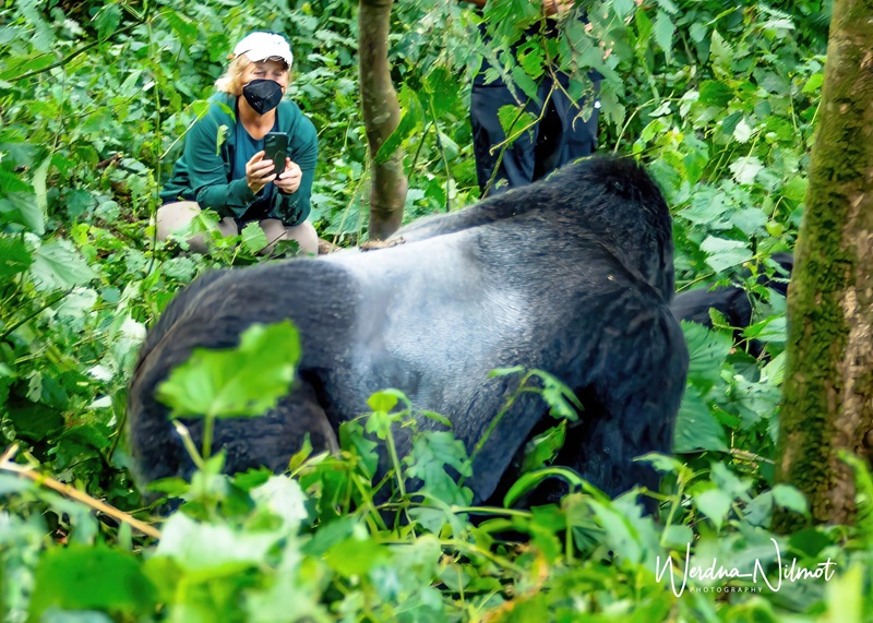
And then things turned to magic. Standing on narrow paths with thick vines to keep us from tumbling over the cliffside, the gorillas walked right by us – one even slapped TG on his backside as he ambled by.
this gorilla slapped TG’s backside as he ambled by!
As I watched, a baby climbed up on his mother’s chest and began to nurse. She looked at me as if to say, “I’m Mama, and this is my baby.” I put my camera down and stared back into her eyes. “I’m Mama, too,” I silently whispered. It was a moment I will never forget. Considering we share 97.4% of our DNA, it’s no wonder the line between Mama and me became blurred.
“I’m Mama, and this is my baby”
Today’s trek was shorter but even more challenging than the day before. What went straight down had to go straight up, and it seemed to take forever to scramble back up the steep hillside.
Well done, TG!
But in the end, it was only three hours from start to finish, and before we knew it, we were back in the van with Eric, heading towards the Mgahinga National Park.
Nestor, me, TG, and Silas
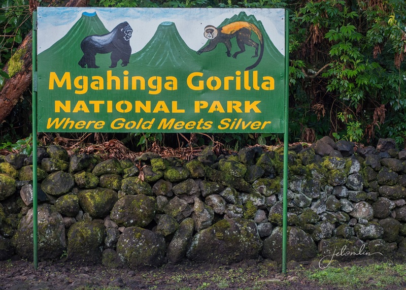
Goal #3 of 4: Mgahinga
Our home for tonight was a guesthouse: Amajambere Community Camp. It was simple but clean and just steps from the national park entrance.
Mgahinga National Park entrance
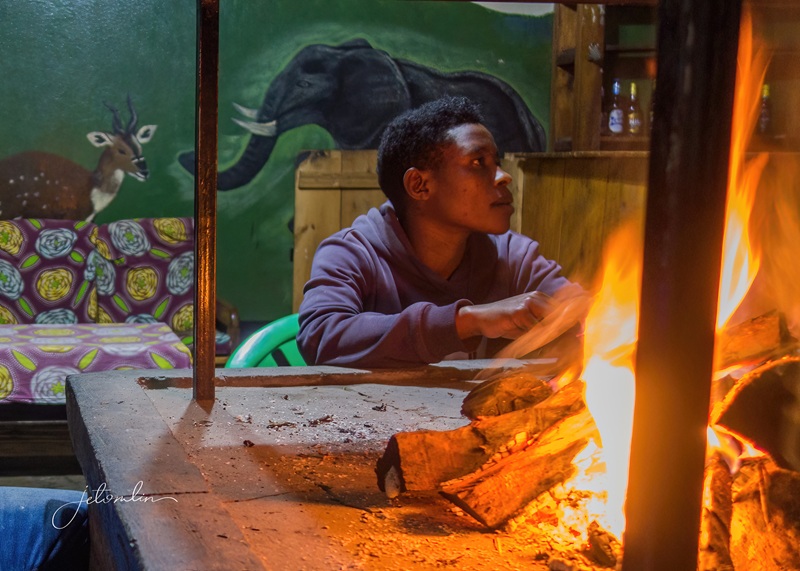
The area is high in the mountains, and the night air was so cold that our hostess, Clemensia, gave us hot water bottles to warm our bed.
we huddled with Clemensia around the warm fire until it was time for bed
these hot water bottles kept our bed warm all night!
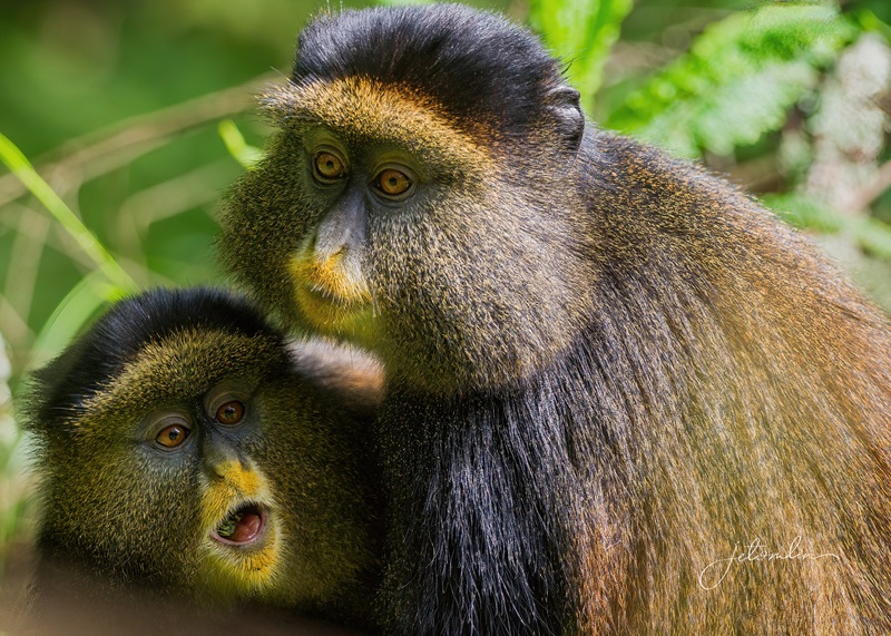
We gathered at the park headquarters early the following day for a briefing and our golden monkey trek.
community groups welcomed us with songs and dance at every stop
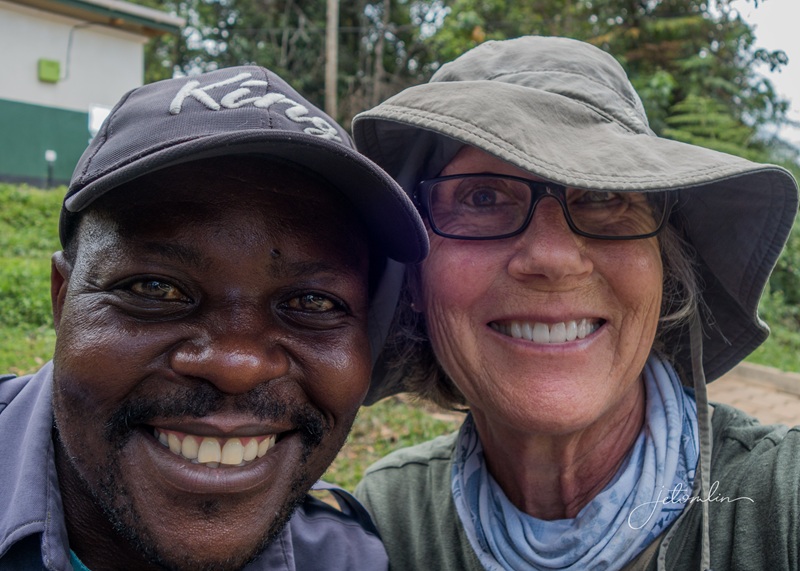
Our ranger/guide this morning was Miel. I said, “That’s honey in Spanish!” He laughed and said, “Yes! You can call me Honey.”
Honey!
The up & down hike was not particularly difficult, but after two back-to-back arduous gorilla treks, my quads did not take long to scream. I was happy that within an hour, the rangers got word that the monkeys had been located.
golden monkeys
Despite heavy rains the night before, the day turned to glorious sunshine, lighting up the monkey’s fur so they were golden!
golden monkeys playing
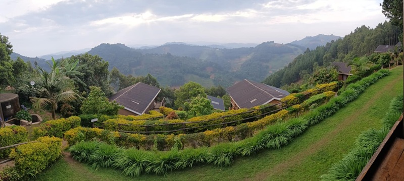
We were back at headquarters by noon and on our way to Lake Bunyoni for an evening of relaxation at Birdnest Resort. This beautiful hotel sits directly on the lake, and after three days of strenuous trekking, we were grateful for the hot shower and comfortable bed.
view of Lake Bunyoni from our room at Birdsnest
our spacious, comfy room at Birdsnest
Goal #4 of 4: Mabamba Swamp
Eric wanted to hit the road early the next morning. We had an 8-plus hour drive ahead of us and we were on our way by 6:30am.
we were on our way before sunrise
Eric stopped at a shop specializing in local honey so that I could take a jar home,
a honey shop
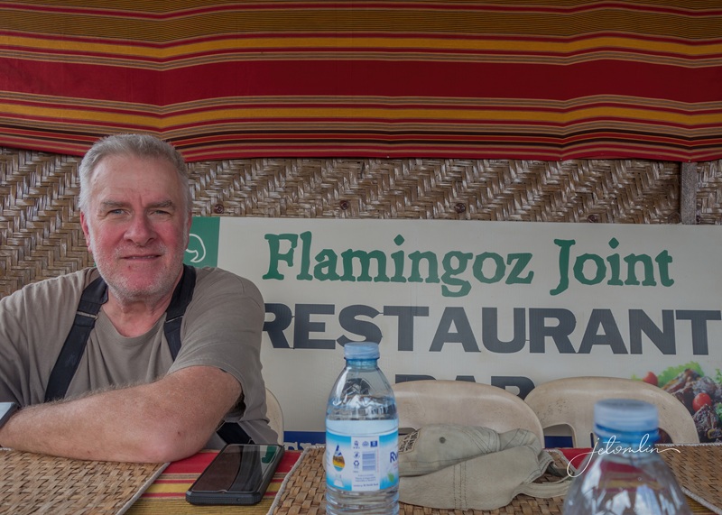
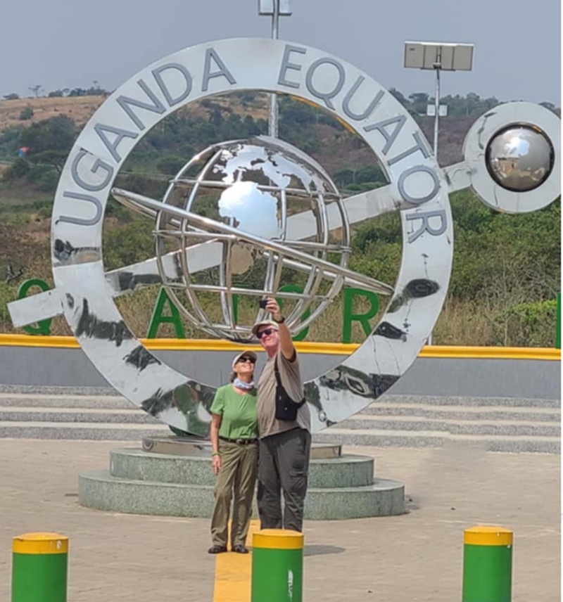
And then an Equator lunch break at “Flamingoz Joint.”
egg & cheese rolex at Flamingoz Joint on the Equator
obligatory Equator shot
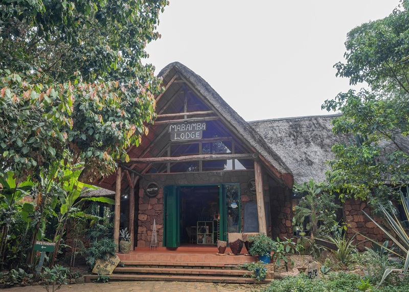
Mabamba Lodge sits on Lake Victoria, surrounded by lush gardens and beautiful birds, including multiple hamerkops.
Mabamba Lodge
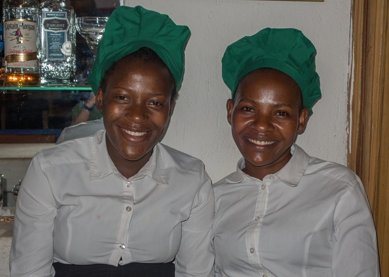
Five sweet young ladies manage the lodge: Joan, Juliet, Jo-Ann, Josephine, and Jane.
Joan and Juliet
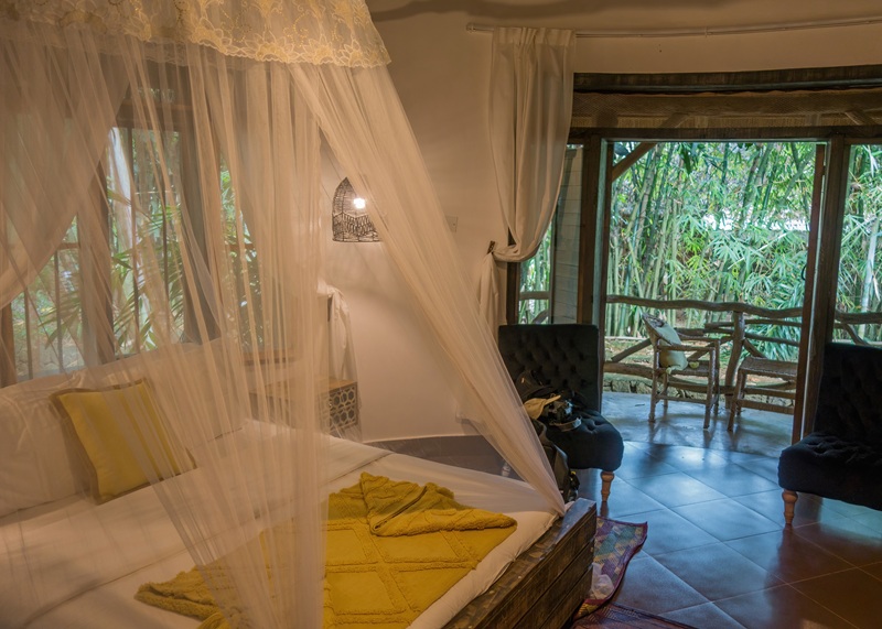
The private cottages are equipped with king beds, en suite baths,
our room at Mabamba Lodge
And outdoor showers.
an outdoor shower!
And the food!! Every meal we enjoyed in Uganda was delicious, but Chef Sara outdid the rest. The presentation—and taste—was 5-star-worthy cuisine.
traditional Ugandan stewed vegetables with ugali (cooked corn meal)
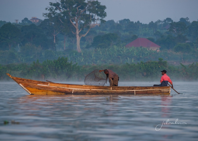
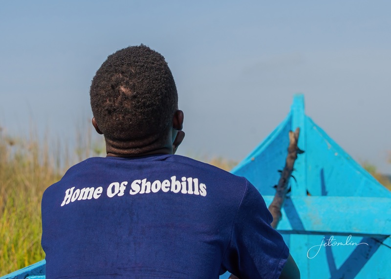
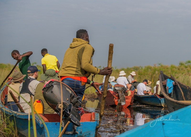
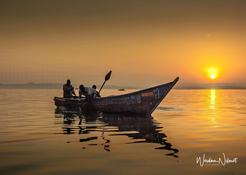
We were instructed to meet at 7am sharp to search for the elusive shoebill storks, and soon we were motoring across Lake Victoria on our way to the swamp.
Jonathan and our boat to the swamp
The lake was busy with fishermen on this early morning, catching lungfish, tilapia, and other fishes.
the lake was busy with fishermen on this early morning
We passed many beautiful birds along the shoreline, while pied kingfishers dove into the water around us, spearing their breakfast.
a pied kingfisher diving for his breakfast
Jonathan pointed out a spotted-necked otter (too quick for a photo) and an African mud turtle.
African mud turtle
But our guide (also named Eric) wanted to get to the swamp before the other boats made the crossing from Entebbe. Mabamba Lodge is the only accommodation close to the swamp – other tour boats take an hour or more just to cross the lake before reaching the entrance.
Mabamba Lodge is the only accommodation close to the swamp
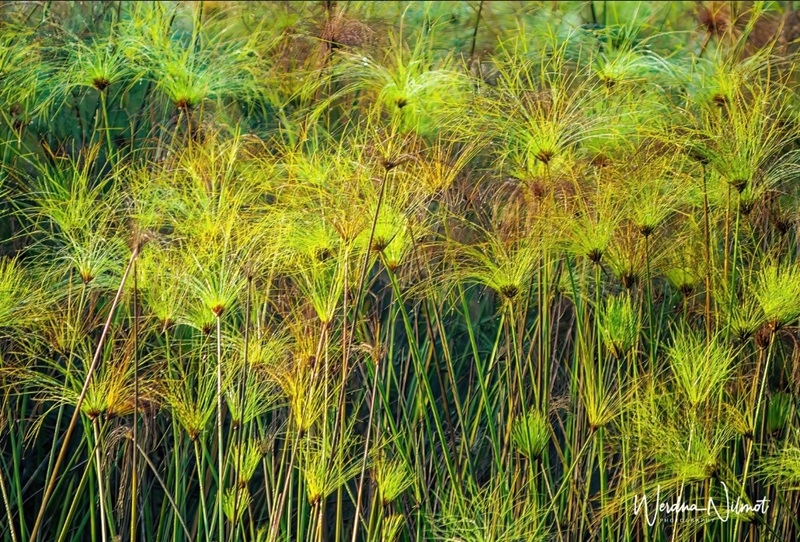
As Jonathan turned our boat towards the swamp, the tall grasses and papyrus gradually closed in around us, the waterway growing increasingly narrow as we made our way deeper into the lush green.
making our way through the tall grass and papyrus
Finally, it was an impassable mess of sludge, and Eric said, “Now we push.” TG and I looked at each other as Jonathan and Eric grabbed long wooden poles and pushed the boat through the muck.
Mabamba Swamp
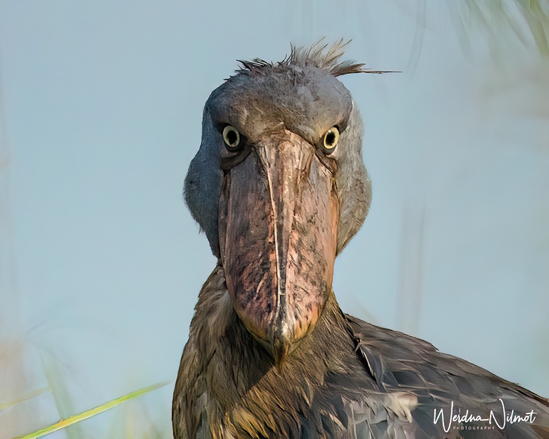
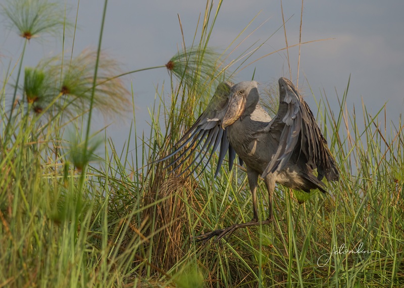
We inched along for what seemed like forever when suddenly Eric whispered, “Are you ready for the shoebill?”
“Are you ready for the shoebill?”
And there he was – standing tall and magnificent directly before us. We both gasped at the size and majesty of the bird – so beautiful, mysterious, and prehistoric-looking!
shoebill stork
After taking multiple photos in such a clear, unobstructed spot, he grabbed a big clump of weeds in his mouth and flew up to a nearby ridge.
he grabbed a big clump of weeds
Eric told us there was a nest with a baby! Although it was too tucked in to see much more than the fluttering of its little wings, it was still a thrill.
papa flies to a nearby ridge
Just then, the female flew in, signaling the changing of the guard. The male flew off, and we were given another hour with Mama.
mama flies in, signaling the changing of the guard
Several more boats had arrived by then, and we knew it was time to go.
time to go!
As we made our way back out of the sludge, we saw yet another shoebill standing alone in the tall grass.
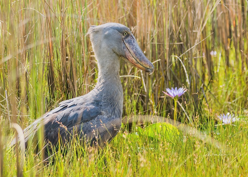
another shoebill, standing alone in the tall grass
Eric said there are an estimated 10-15 shoebills in the entire swamp and that morning we saw four.
what a great day!
The next day, we went back to the swamp, but the majestic birds did not give us the same photo opps.
another beautiful sunrise on day two
We were truly blessed with the sightings we had the previous day. Even so, we saw another four: the mama and the fluttering of little baby wings, and two more flying high overhead.
mama hiding in the tall grass
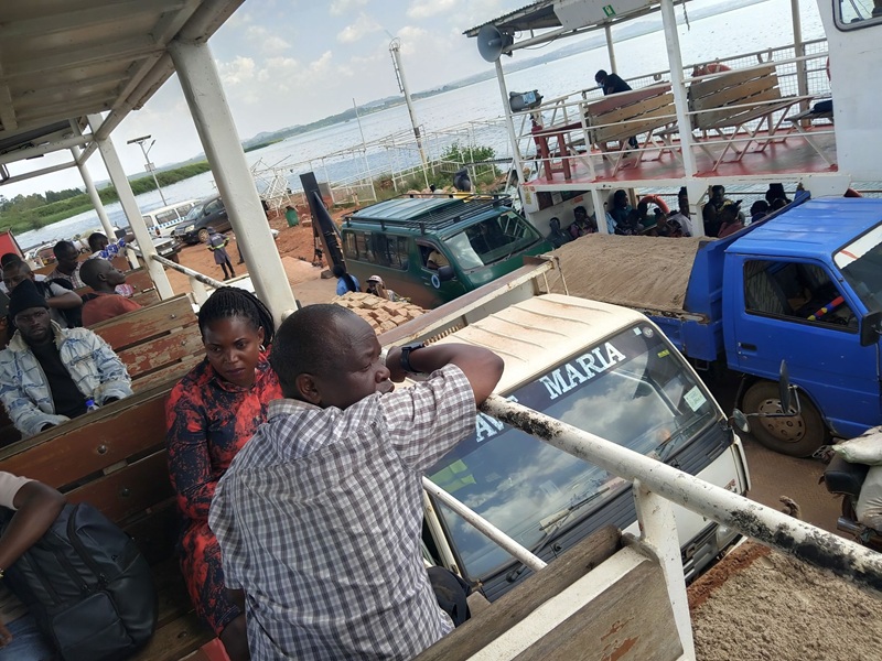
After a late breakfast, we were on our way to Entebbe and the end of our journey. We took the car ferry across Lake Victoria,
the car ferry to Entebbe
And Eric dropped us off at Aivilo’s Guest House late that afternoon. It was the perfect place to relax, re-organize our bags, and wind down before beginning our long journey home.
relaxing before our long journey home
I cannot say enough about Eric. He was an excellent driver; even on the sketchiest mountain roads, we always felt safe in his capable hands.
some of the roads were pretty sketchy!
His easy-going, “it will work out” nature kept us from getting stressed about the few minor hiccups we had along the way. He was a joy to travel with.
Thank you, Eric!
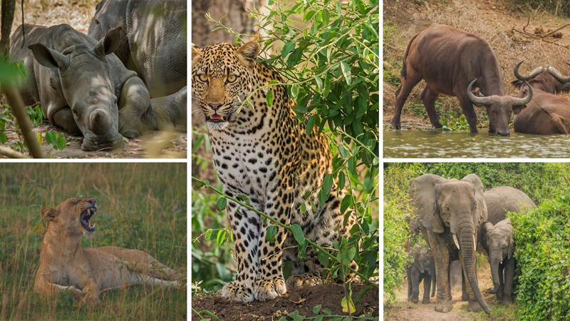
And Peter’s itinerary was just the right balance of adventure and relaxation. We accomplished our four goals and so much more – we even managed to tick off the Big Five, something we had not expected!
the Big Five!
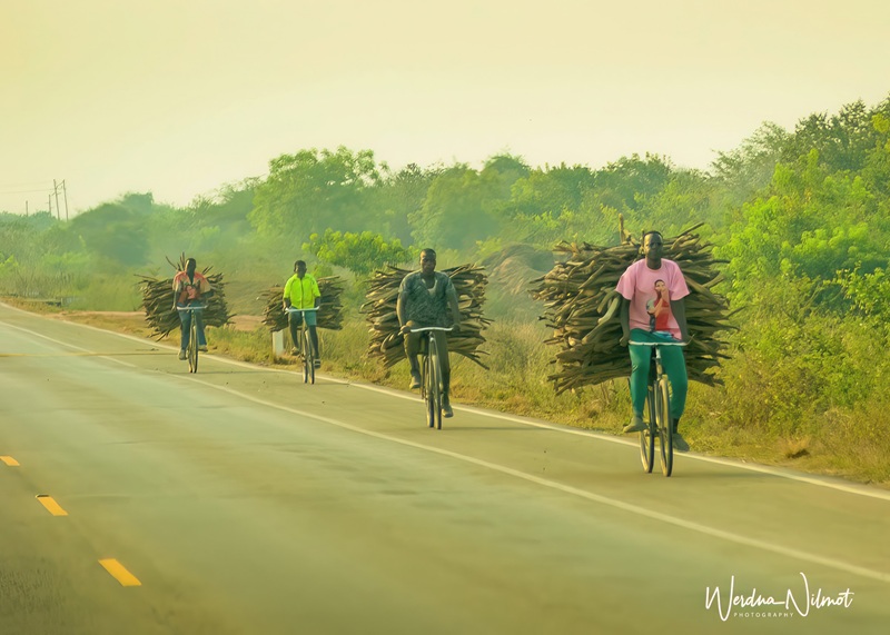
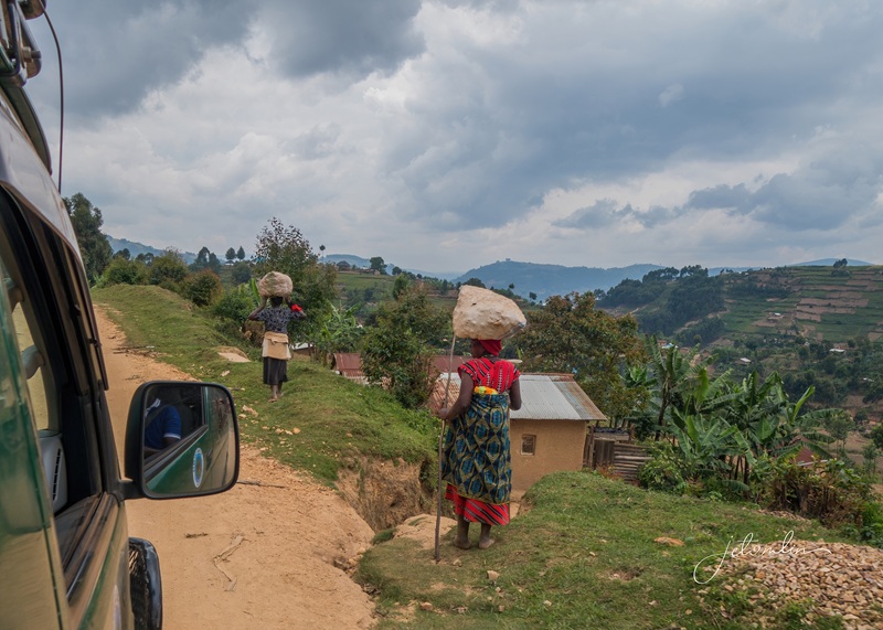
We traveled over 800 miles, passing through multiple agricultural areas: acres of banana trees, mountains of pineapples,
so much produce!
Terraced green hillsides, mats of coffee beans drying in the sun, and huge piles of onions that filled the air with their savory scent.
terraced green hillsides
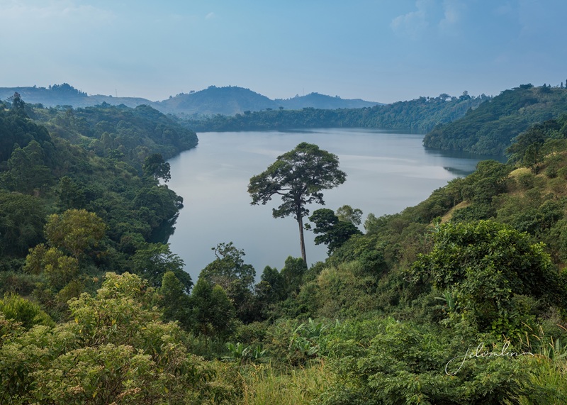
Uganda truly is the “Pearl of Africa,” full of gorgeous landscapes,
gorgeous landscapes
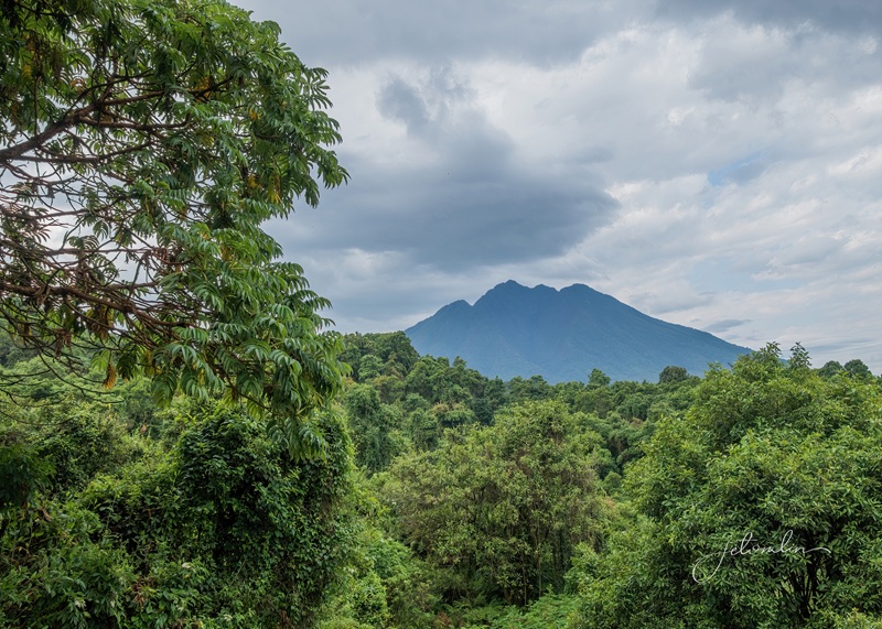
Beautiful mountains,
beautiful mountains and volcanoes
Incredible wildlife, colorful birds,
grey-headed kingfisher
And the friendliest smiles you’ll ever see.
the team at Elephant Hab
Thank you, Peter, Eric, and Buyaga Safaris for a trip beyond our wildest dreams. We hope to see you again someday.
“It’s Easy to Say Welcome, But Difficult to Say Good-Bye”
To see all of our photos from Uganda, click on the links below.
TG: Click on any photo to open a new tab in Flickr or hover to arrow through the set
JET: Click on any photo to open a new tab in Flickr or hover to arrow through the set.
Manatees congregate in the springs in Central Florida every winter when the ocean temps drop. And for the past two decades, I have traveled to the area around my January birthday to swim with them.
my annual birthday swim with the manatees, January 2025
This year, we booked an Airbnb in Fort McCoy and invited a friend to join us. “Kerr Camp” ended up being a perfect choice. It was clean, comfy, and cozy, with plenty of room to spread out and a big backyard for Oscar and Maddie.
I also invited another SoFL couple to join us at the springs – friends I had not seen since we moved from Okeechobee in 2023. And much to my delight, they agreed! Hooray – the band was getting back together!
Okeechobee, FL March 2023
We met at the park when it opened at 8 a.m. It was a bright, cold morning with air temps in the 30s, and we knew the constant 72-degree water would feel warm!
a cold, 30-degree morning at check-in!
As we made our way to the entry point, I could already see several round, gray blobs in the crystal-clear water, a sure sign that manatees were present.
the entrance to the swim area
I counted at least 25-30 in the swim area close to the spring. Although plenty of other people were enjoying the chilly morning with us, there were more than enough manatees for everyone!
plenty of manatees for everyone!
Most of the manatees in the swim area were curious and friendly, and welcomed all the attention. I even had the joy of receiving a few affectionate nose-bonks,
I’m about to get nose-bonked!
And John found a “girlfriend” who seemed smitten with him and would not leave him alone!
John and his girlfriend
At one point, I swam to the opposite shoreline and spotted an alligator snapping turtle, the largest freshwater turtle in North America!
alligator snapping turtle
After taking a few shots, we returned to enjoying the manatees.
John getting a shot of the snapping turtle
Armored catfish surrounded the manatees. Many appeared to be cleaners, eating the algae off the manatee’s backs and around their eyes. But now and then, one would give a quick roll or shudder to shake off the pesky fish.
rolling to shake off the pesky catfish
The park has established a roped-off zone to help fragile sea grass grow, and manatees wanting peace and quiet were resting in that “no swim” area.
PVC pipes mark the protected sea grass area
Despite the fun, we eventually got cold enough to call it quits. We agreed to meet that evening for dinner at a local pizza restaurant and then go to bed early—we had another full day of manatees to look forward to tomorrow!
making plans to meet for pizza
The next morning was just as cold, but the sun shone brightly, making it feel a bit warmer.
mist rising off the spring on this chilly morning!
When we first entered the water, we spotted a mama with a tiny newborn baby, but they did not stick around long enough for more than a quick proof of life shot. We did, however, see at least two more moms nursing their young.
mama and nursing baby
The sunshine was so bright it created diamond patterns on the manatees, making them beautiful to see but difficult to photograph.
the bright sunshine created diamond patterns on the manatees
There were even more in the spring than the day before, and we spent almost five hours enjoying their company.
swimmers free diving down into the spring
Not a big fan of cold water or wetsuits, TG opted for a lunch meet up with some South Florida friends we hadn’t seen since our move.
TG opted to meet up with friends for lunch at Alligator Joe’s in Ocklawaha
That afternoon we walked to Kerr Lake,
Kerr Lake
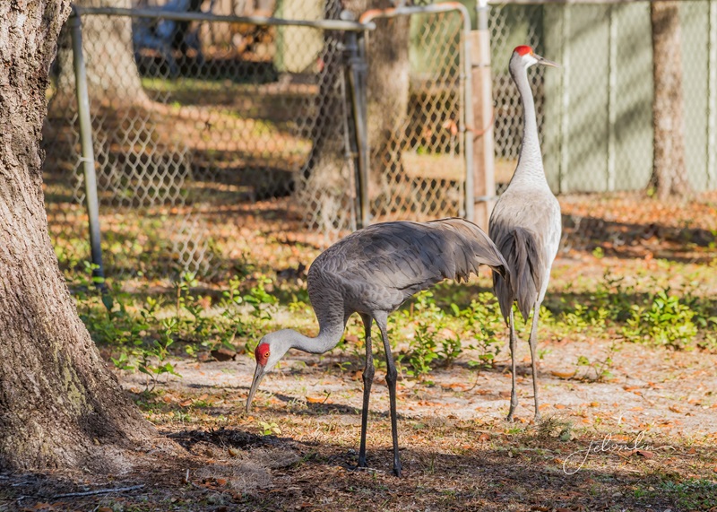
Enjoying all the neighborhood sandhill cranes along the way.
neighborhood sandhill cranes
After another quiet evening at the Airbnb, it was time to pack up and head home.
a quiet evening at home
What a fun trip we had – made even more so by the good friends who joined us!
thanks for a manatee-splendid early birthday!
As we packed up the car, I couldn’t help but feel grateful for the opportunity to reconnect with dear friends and with my beloved manatees. It was a birthday trip I will always cherish.
manatees in the spring
To see all the photos from my two days, click here:
hover on photo to arrow through the set or click to open a new tab in Flickr
I have celebrated my January birthday swimming with the manatees in Crystal River, FL, for decades. This year, due to an international trip that nearly coincided with my usual dates, we moved the trip back to mid-December. But as we got closer to the week, AccuWeather predicted unseasonably warm temperatures, which is not ideal for finding manatees in Florida’s springs, so we moved the dates again.
Crystal River, FL (January 2024)
That left us with two open weeks over Christmas and New Year’s. We visited the Wheeler National Wildlife Refuge for one overnight in December 2023 and have always wanted to return. It was established in 1938 as a wintering area for ducks, geese, and other migratory birds and attracts thousands of sandhill cranes and endangered whooping cranes.
sandhill & whooping cranes, Wheeler NWR, December 2023
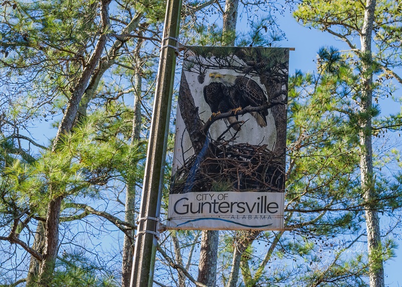
TG found a last-minute Airbnb in Scottsboro, a small town outside of Guntersville, about an hour’s drive from Wheeler, and booked nine nights over the holidays.
“Fisherman’s Cove” Airbnb in Scottsboro
The charming town of Guntersville is appropriately called “Alabama’s Lake City,” as there is water, water everywhere! With over 69,000 acres of shoreline, you don’t have to travel far to view the Tennessee River or Lake Guntersville. The area is home to dozens of parks and natural areas, and we planned to explore as much as possible during our stay.
water, water everywhere!
We arrived on Christmas Eve and spent the afternoon getting settled. Although basic, the Airbnb was just right for us, with a covered carport, comfy king-size bed, and a large backyard for Oscar and Maddie to explore.
O & M found the yard very interesting!
We were up early Christmas morning for our traditional breakfast at Waffle House.
our traditional Christmas breakfast at Waffle House
Then we checked out an owl listing on E-bird (no luck) before heading to the Lake Guntersville walking trail. This beautiful pathway hugs the lake for miles, offering multiple views of waterbirds and colorful songbirds.
cedar waxwing on the Lake Guntersville walking trail
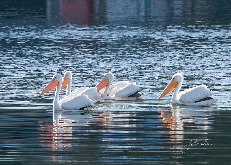
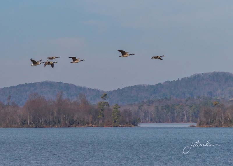
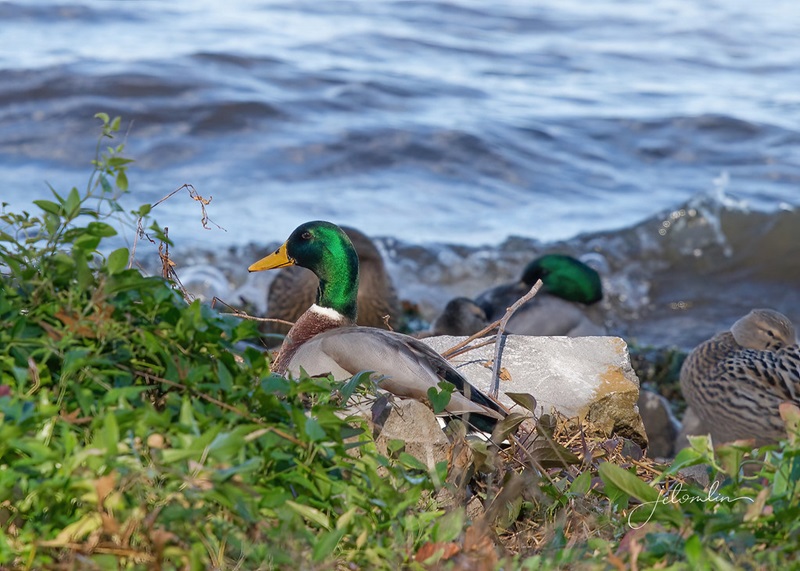
A classic Christmas carol has that lovely line, “Let heaven and nature sing,” and it truly felt like that on this beautiful morning! We were greeted by flocks of graceful white pelicans, Canada geese, thousands of American coots, gem-colored mallards, and a stunning goldeneye.
white pelicans on Christmas morning
Canada geese flying over Lake Guntersville
gem-colored mallards
As we walked along the path, we encountered several people who saw our cameras and asked if we had spotted any eagles.
“Have you spotted any eagles?!?”
This area is popular for eagle-watching, and while we quickly found their large nest, it took us a few more visits to actually see them perched high in a tree.
it took us a few visits, but we were finally able to see both eagles
Thursday morning, we awoke to drizzly rain. We drove to Wheeler NWR, but the overcast skies offered little promise for photos.
Wheeler NWR, December 2024
We tried another location, the Goldsmith Schiffman Wildlife Sanctuary in Huntsville, but turned back when the trail became too wet and muddy to continue.
Goldsmith Schiffman Wildlife Sanctuary
Unfortunately, the forecast for next few days looked just as bleak: cloudy with rain. But we have never been ones to sit around due to inclement weather, and we found plenty of things to keep ourselves occupied.
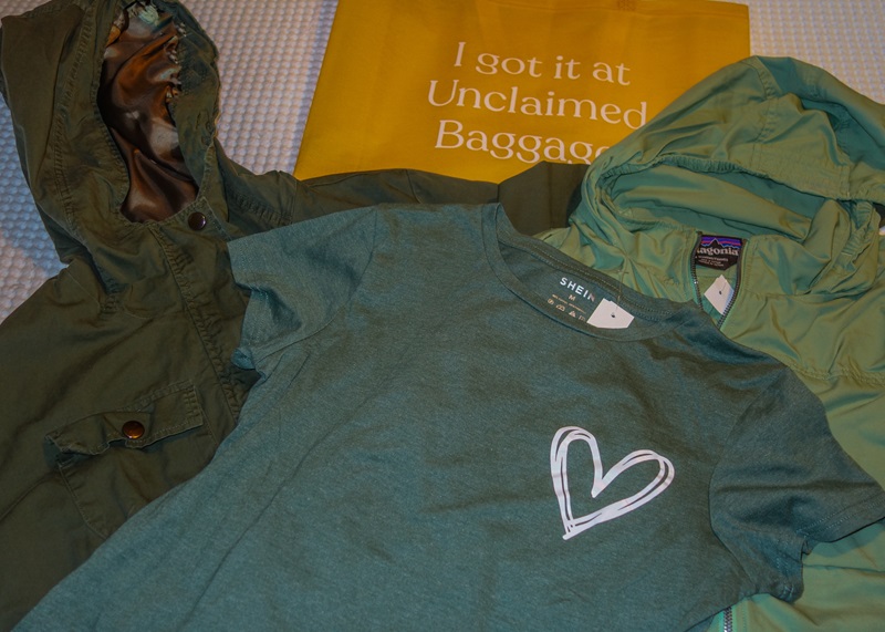
We visited the Unclaimed Baggage store, which has purchasing agreements with airlines and transportation companies for items deemed “orphaned.” I picked up a mint-condition $350 Patagonia jacket for $30! TG was tempted by a sweet $5K Hermès jacket priced at only $300, but unfortunately (or luckily?), the sleeves were a tad short, so we left it for another bargain hunter to find.
my Unclaimed Baggage haul
We had lunch at Julia’s, a Mexican restaurant in downtown Guntersville, full of beautiful artwork.
lunch at Julia’s Mexican restaurant
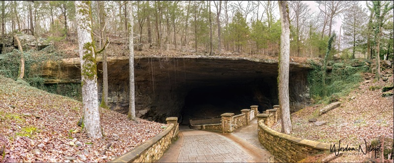
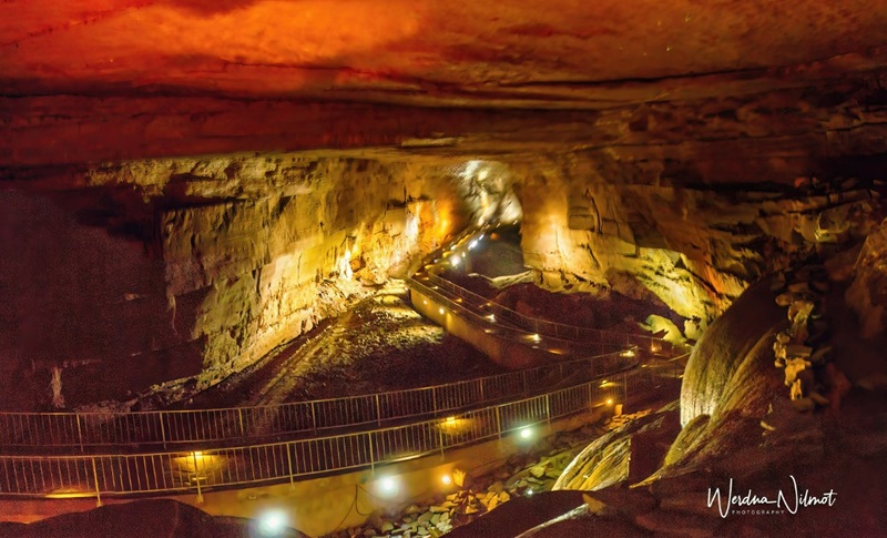
And on Saturday, we visited the breathtaking Cathedral Caverns, a state park just a 20-minute drive from our Airbnb. The entrance is massive and is reputed to be the largest commercial cave entrance in the world.
the massive entrance to the Cathedral Caverns
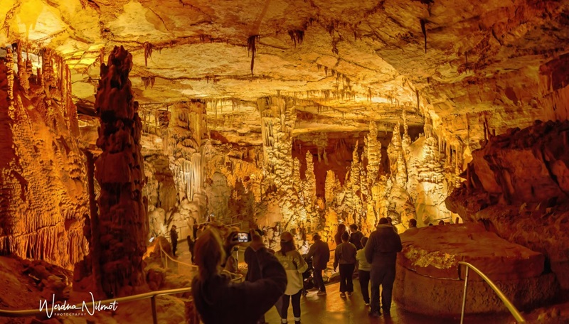
Opened in 1950, the cavern was named for its cathedral-like appearance. While it’s difficult to determine the exact age of the stalactites and stalagmites, radiometric dating techniques indicate that some are at least 190,000 years old.
the Cathedral Cavern
Once inside, our cheerful guide, Grace, led us on a fascinating journey past some of the most beautiful formations Mother Nature has created. Highlights included a “caveman” perched atop a flowstone wall, a “frozen waterfall,” and an improbable stalagmite that is 27 feet tall and only 3 inches wide.
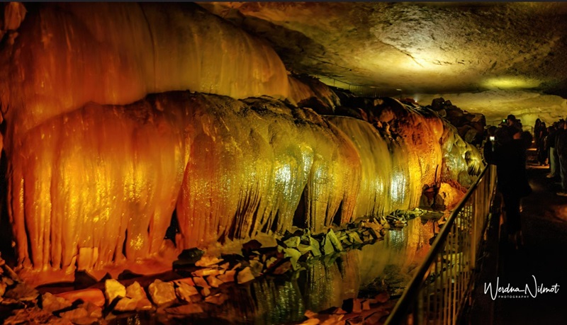
frozen waterfall
About 3/4 of a mile into our walk, we were instructed to turn off every bit of light so that we could experience Total Darkness. We were almost 1,000 feet underground, and the pitch-blackness was so thick that you could practically reach out and touch it!
Grace’s laser pointer in Total Darkness!
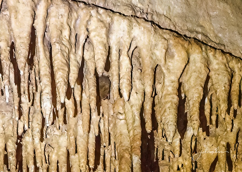
The tour follows an out-and-back paved pathway. On our way out, Grace indulged my request to search for the tiny Eastern pipistrelle bats that inhabit the cavern.
the out-and-back paved walkway through the caverns
They are some of the smallest bats in North America, weighing less than a quarter of an ounce. They looked like tiny dots on the cavern walls, and I was only able to capture a proof-of-life shot.
proof-of-life shot of a tiny Eastern pipistrelle bat
But sensing my keen interest, Grace gave me some intel. Sauta Cave, located in Scottsboro, is a summer roosting site for gray bats. One of nature’s most spectacular events occurs every evening in June, July, and August, when at dusk 200,000-400,000 bats leave the cave to begin their nightly foraging.
As if we needed another reason to return to this area next summer! 🦇🦇😍
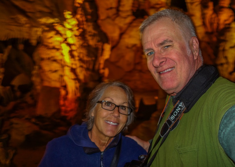
Cathedral Caverns selfie
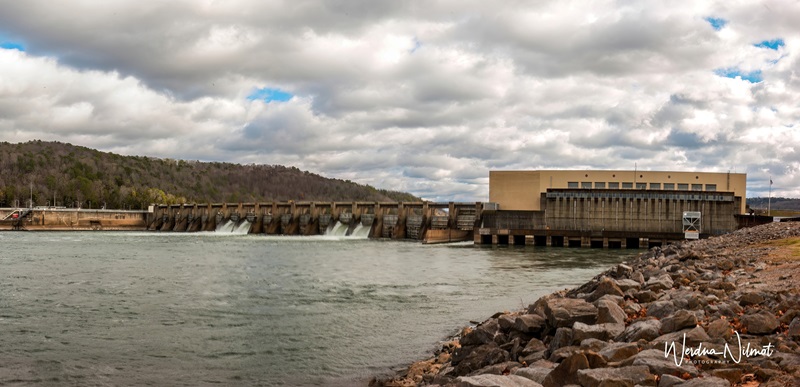
We visited Guntersville Dam, which was designed by the Army Corps of Engineers and completed in 1939.
Guntersville Dam from the south side
Guntersville Dam from the north side
The dam was built primarily for flood control, but it also serves several additional purposes: navigation on the Tennessee River, hydroelectric power generation, providing water to the city of Guntersville, and recreational activities such as fishing and birdwatching.
fishing at the dam
The north and south areas of the dam are recognized as E-bird “hotspots,” with nearly 200 species reported on almost 300 checklists.
northern flicker at Guntersville Dam
On Monday, the clouds finally cleared, revealing bright blue skies and warm sunshine.
sunrise, 12-30-24
We decided to go back to the Wheeler National Wildlife Refuge to capture some better photos of the sandhill cranes.
sandhill cranes at Wheeler NWR, 12-30-24
It seemed like everyone was taking advantage of the beautiful weather, reminding us why we have such a “love-hate” relationship with this refuge. While the cranes are certainly lovely, the limited viewing areas are often crowded with photographers, all vying for the same shot!
limited viewing area
On New Year’s Eve, I visited the Hays Nature Preserve, which features over ten miles of trails along the Flint River and is an important part of the Alabama Birding Trail. For the first hour, I shared the path with flocks of cedar waxwings, robins, other migratory birds, and multiple hawks.
red-shouldered hawk at Hays Nature Preserve
I crossed paths with a young man carrying a long lens. Kevin was looking for owls, so I asked if I could join him. We scoured his “known locations” for over an hour, but luck was not on our side. As we returned to our cars, I casually asked if he had spotted any owls recently. His response, “Oh no, this is my first time here since last summer,” added a touch of irony to my owl-less adventure.
But the next morning, I took O & M out before dawn and heard the unmistakable hoot of a great horned owl in the trees at the back of the property. I quickly grabbed my phone and played the call. Although I was unable to spot the owl, we shared a delightful “conversation” as he hooted in response to my calls. What a wonderful end to our stay in Guntersville and a wonderful start to the new year.
there is a great horned owl somewhere in those trees!
You can view all of our photos from our holiday week in Guntersville here:
TG:
hover on photo to arrow through the set or click to open a new tab in Flickr
JET:
hover on photo to arrow through the set or click to open a new tab in Flickr
2024 was our first full year in our new home in Southern Alabama, and what a year it was! We moved to “Casa-Bama” in the summer of 2023 to lower our cost of living and enable us to continue to travel as much as possible.
If you’ve been following our blog, you’re familiar with our adventures over this past year. As we begin 2025—a year that promises change and uncertainties—we hope you find solace, happiness, and love in every moment. And be sure to stay tuned for the exciting travels we have planned for the coming months!
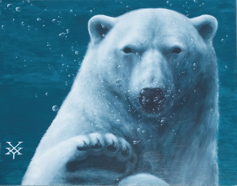
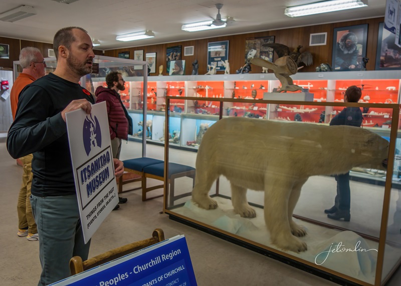
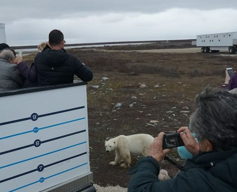
My fascination with polar bears began decades ago at Lincoln Park Zoo in Chicago. I was watching at the underwater viewing window when a bear swam by. I placed my hand on the thick glass, and he put his massive paw against mine. Mere inches separated me from this mighty creature, and I knew then that someday I would see these magnificent animals in the wild.
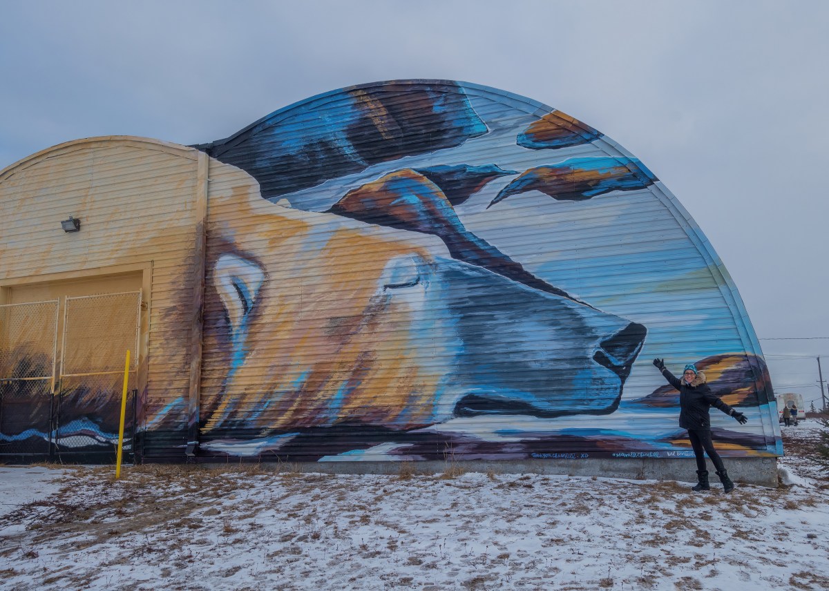
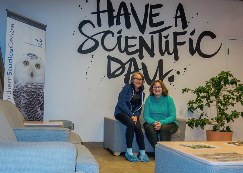
mural at the Iceberg Inn, Churchill, Manitoba
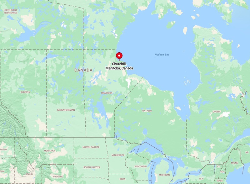
The years passed and other adventures took priority over polar bears. But as I grew older, I felt an increasing sense of urgency that if I did not make the trip soon, I would lose whatever opportunity I might have. After thorough research, I settled on the Lords of the Arctic learning vacation at the Churchill Northern Studies Centre in Churchill, Manitoba.
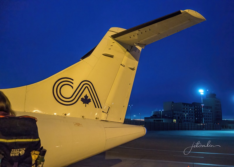
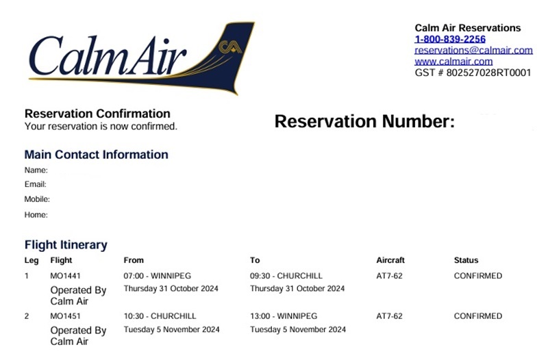
7am Calm Air flight from Winnipeg to Churchill 10-31-24
Day One: Arrival & Orientation
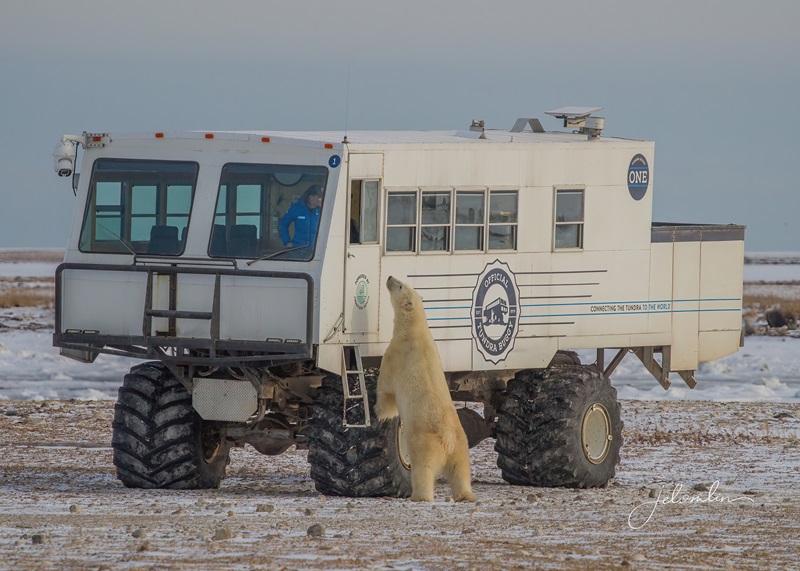
Faith is at the airport to meet us, and we are efficiently loaded onto the CNSC bus. We stop in town to pick up a few more folks and are on our way to the Centre, located about fourteen miles from Churchill. The landscape is covered with a light dusting of snow, and the road winds its way along Hudson Bay, looking very cold and gray this morning. I scan both sides of the tundra, looking for signs of wildlife, but at 50 mph it is challenging to spy anything.
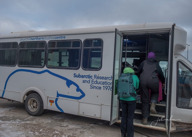
boarding the CNSC bus
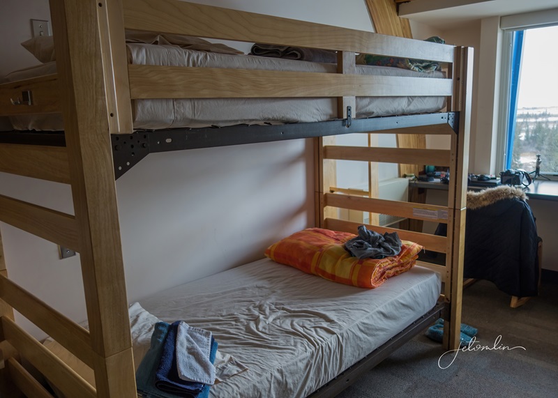
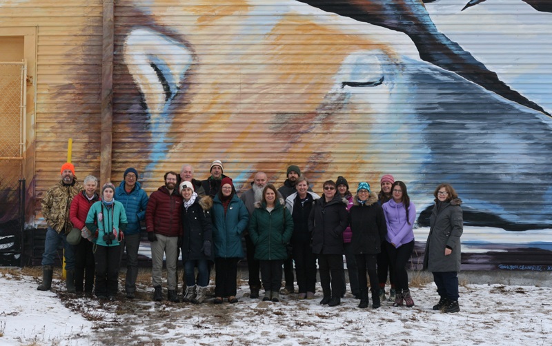
We gather in one of the many meeting rooms for our Welcome orientation and room assignments. This week we are a small group: just eighteen of us have traveled from across Canada, the US, and the UK. I am delighted to find that we are only two in a room built to accommodate four.
my home for the week
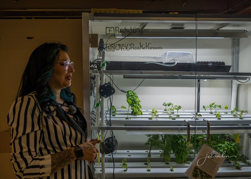
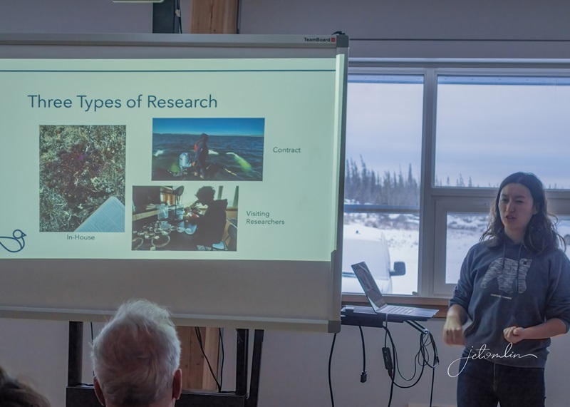
After a quick lunch, Ashley gives us a tour of the building. The CNSC is an independent non-profit that conducts multiple in-house and outside research projects. One of their projects is Rocket Greens, where they grow leafy green vegetables and herbs for much of the town of Churchill, including some of the hotels.
Ashley at the Rocket Greens demo case
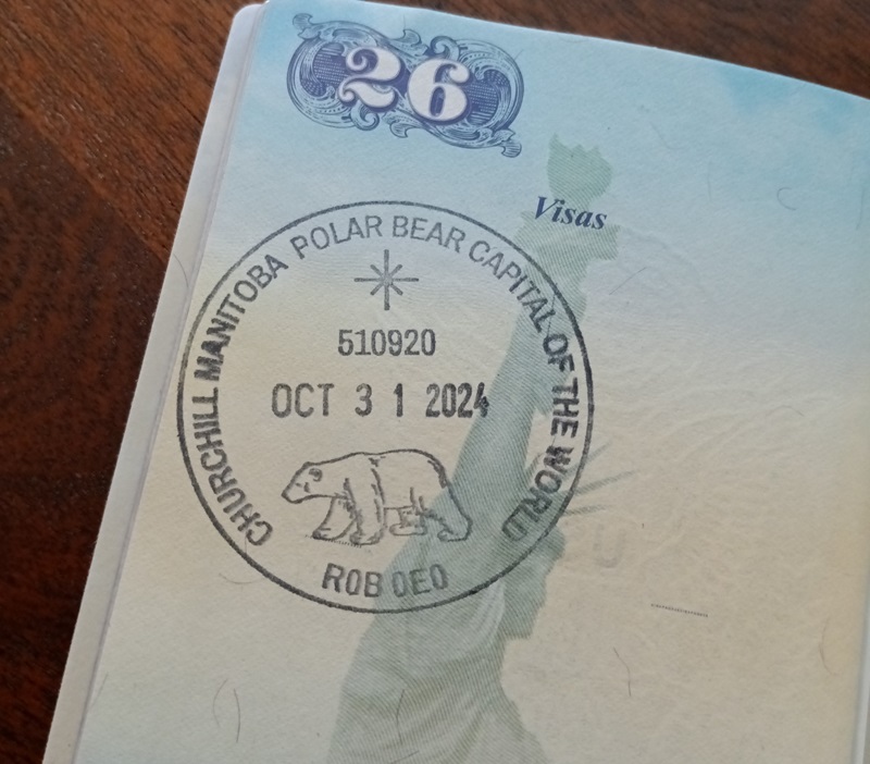
Once the building tour has concluded, we board the bus for a supply run in town. I do not need anything, but I do not want to pass up the chance to see wildlife on the tundra. After we board, Faith has a surprise: there will be a stop at the post office to stamp our passports!
a stop at the post office for a passport stamp!
As we drive around the small town of Churchill, I see multiple murals – the result of the “Sea Walls” art project in 2017. After we return to the Centre, we watch an hour-long documentary about how this beautiful project came to be: “Know I’m Here.” You can watch the full video on Vimeo at the link below:
With no time to catch our breath, we move from the A/V room to supper and the evening lectures. The first is by a visiting scientist, Sjoerd Vos. He explains his “Whiskers Project”- a way to ID individual polar bears by the pattern of their whiskers, enabling scientists to track changes in the bears over time. We can participate in his research by providing photos – and he gives us the specs of exactly what he needs.
Sjoerd Vos explains his Whiskers Project
Next, head scientist and our group leader, Doug Clark, presents “Polar Bears 101” – a comprehensive overview of the state of polar bears in the Hudson Bay area. Diminishing sea ice (due to climate change) has lowered the reproductive rate: little ones have a much harder time surviving due to the shortened hunting season for the moms. But if they can reach adulthood, they will survive. This is good news, as I once feared that polar bears might go extinct in my lifetime.
Doug Clark presenting Polar Bears 101
Doug wraps up his lecture a little after 8pm. We retire to our rooms, and my roommate, Michele, and I talk until almost 10pm. She is from outside of Calgary and is traveling this week with her two grown sons.
Michele and me
Day Two: A Very Beary Day
Today, we board a tundra buggy at 8am for an all-day drive through the Churchill Wildlife Management Area. The first buggy (Buggy One) was a modified garbage truck built by a local hunter who simply wanted a place to sleep while out on the tundra. A PBS crew asked to tag along to get closer to polar bears, and so an industry was born.
Buggy One
Currently there are around 15 buggies – not all in working order, nor all for tours. They are modified school buses that sit perched on giant tires with windows over ten feet from the ground. Each buggy is equipped with an RV-style toilet and a back viewing deck.
Our driver is Max Burke, a second-generation buggy driver who drove his first buggy at the age of five. We love his passion for the bears and other wildlife. He is a wealth of information about the land, the history of this area, and the culture of the community.
Max at the wheel
The terrain is rough – “pothole” does not even begin to describe the huge bumps and deep crevasses the buggy traverses as we lumber along. But we are all bright-eyed with anticipation for what this day will bring.
“pothole” doesn’t even come close to describing this!
We spot our first polar bear within minutes: a single male slowly walking across the ice. At the same location, we spy a mother and two cubs, far in the distance. It is more than I ever dreamed of – four bears within the first hour! I am filled with emotion, and I fight back tears of joy.
a lone male walking across the ice
And then things get crazy: Max barely restarts the buggy at each stop before we spy another bear. We scurry from one side to the other, from the big front windows to the back viewing deck, taking shot after shot. It is impossible to convey the size of these animals: massive, huge, enormous, colossal all seem inadequate. They move their powerful bodies without a sound, gracefully walking along the tundra and ice.
mother and year-old cub
A mother and year-old cub stroll towards the buggy stopped ahead of us. We watch as they sit below the back viewing deck, giving those folks the photo opp of a lifetime.
the photo opp of a lifetime!
And then, much to our surprise and delight, she turns towards us! She brings her son to our buggy for the same opportunity – even going as far as to walk underneath the back viewing deck to look up at us through the grated metal floor. We are beyond thrilled.
much to our surprise and delight, they turn towards us!
At one of our stops, a flock of two dozen ptarmigans fly across the road and land in the willows directly beside us. A polar bear to the right of us, ptarmigans to the left: where do we point our cameras?!?
ptarmigan – check out those furry feet!
Later, we spy a white-rumped sandpiper, looking like an out-of-place Florida shorebird. Snow buntings fly back and forth across the road. And when it is too dark to photograph, a cross fox runs ahead of us. By the time Max turns towards home, our count for the day is twenty-five unique bears. He says it is the most bears in one day he has ever seen in his life – using words like “sick” and “insane.” Later, Doug tells me that it is the most bears he has seen in a single day in over three years of Lords of the Arctic learning vacations. It was indeed epic!
what an epic day!
We return to the Centre in time for dinner and Doug’s evening lecture. He briefly overviews tomorrow’s activities and then talks about his remote-camera project. His team has set up remote cameras in four locations throughout the area, monitoring polar bear activity without human interference. Their findings closely parallel what scientists have found using more traditional tag and collar methods. This means legitimate scientific data can be gathered with non-invasive techniques, which is better for the bears and safer for the communities that live in the sub-Arctic.
It has been a wonderful day. Our adrenaline ran nonstop for the nine hours we were on the buggy, and everyone is exhausted. Lights out comes early, and I sleep soundly.
lights out!
Day Three: Churchill Captures A Piece of My Heart
Another busy day begins with a lecture by Lara Grevstad, the CNSC Research Coordinator. She explains that this area is comprised of three unique bio-habitats, which draw scientists and researchers from all over the world. Part of the Centre’s mission is to supply accommodations, lab space, and supplies such as microscopes and other equipment for visiting scientists. However, the CNSC also conducts its own research projects and assists with outside contract work.
Lara Grevstad, CNSC Research Coordinator
After Lara’s talk we are assigned our helicopter time and given a safety briefing. I wait about an hour for my turn, but the time passes quickly, and soon I am up in the air, in the front seat next to our pilot, Jennifer.
pilot Jennifer & me (Nancy in the back)
I tell her we saw 25 bears on our buggy tour yesterday and she replies she just saw 22 on her last flight. I scan the ground below me, looking for puffy yellow dots against the white ice and snow. Before long, we begin to count. There is one, there is another, and there are nine lying along that ridge! We lose count around 20.
polar bear from the helicopter
We see a big red splotch in the snow and a bear walking towards it. Jennifer tells us it is a seal kill. Minutes later, we see another big splotch with two bears actively feeding. And then a third, this time with one bear. It is a National Geographic moment, and I am relieved we are too high up to see much gore.
I’m glad we are too high up to see much gore
As we head back to the Centre Jennifer asks if we would like to see the Ithaca. Yes! We reply. The Ithaca is an abandoned cargo ship that sits in Hudson Bay, rusted and forlorn. On a fateful day in 1959, loaded with electrical generators and plywood, its rudder broke in an 80-mile-an-hour gale, and it ran aground. The company paid local townspeople to help offload the cargo, then permitted them to salvage whatever they could from the wreck.
the Ithaca
To view all the photos from my helicopter ride click here:
hover on photo to arrow through the set or click on any photo to open a new tab in Flickr
After a quick lunch, we are out the door again. First, we take a driving tour of the rocket launch site that sits abandoned on CNSC property. The site was built in 1957 to study the effects of the aurora on long-distance communications. It was used sporadically after that but was largely deserted by 1985.
the abandoned rocket launch site on CNSC property
Next, we are on our way to Wapusk Adventures for an afternoon of dog sledding. On our drive, we spy three foxes – too far away for my little RX100 camera, but still a thrill. Once at Wapusk, we gather in the warm building for an introduction by “Big Dog” Dave Daley and his team of 43 dogs.
“Big Dog” Dave Daley
He passionately talks about his family of dogs and Indigenous-based tourism. In 2004, he founded the Hudson Bay Quest, a qualifier for the Iditarod. He explains that today we will be running the “Idita-mile,” and we are given fur hats and mittens to wear while on the sleds. I choose a pair of beaver mittens Dave has worn on over 1500 miles of dog races.
Dave & me with his beaver mittens
Liz sits in the front of the sled while I am in the back, standing position. I am also responsible for stepping on the brake pad, a thick plastic sheet with studs pointing down into the snow. Emma, our driver, tells me to jump off the runners and onto the pad when instructed to do so. And then we are off!
photo by Daniel Raiti Photography
What fun it is, and the mile flies by all too quickly.
Wapusk Adventures dog sledding
Back at the Centre, it is time for a quick supper, and then a few of us board the bus for another trip into town.
There is a local artist’s market at the Complex, and we are eager to go shopping. I stop at a booth selling Hudson Bay sea glass. Sandra Cook is at a nearby table. She is the mother of Max, our tundra buggy driver from Friday, and I am happy to chat with her about our extraordinary day. I purchase three greeting cards.
the Complex community bulletin board
As soon as we return to the Center, we join Doug in the classroom for this evening’s lecture. Tonight, he tells us the story of The Three Bears. In addition to polar bears, the Hudson Bay area is home to black bears and an increasing population of grizzlies. All three species have been captured on his remote cameras. It is a fascinating talk, and we sit spellbound, hanging on to every word.
grizzly bear caught on Doug’s remote camera (photo courtesy of CNSC FB page)
Somewhere between the helicopter ride and the dog sledding, my paradigm shifted today. I have fallen in love with this unique corner of the planet, and I share my enthusiasm with the vendors at the market. Their eyes glow with pride for their hometown.
Day Four: Back on the Buggy
We are up early for another full day on the tundra buggy. This morning Captain Sean is our guide. He is a good driver, and we see four bears within short order. But unlike all our close encounters on Friday, most of these sightings are quite far away, and it is difficult to capture good photos.
Captain Sean navigating a huge pothole
We come upon a group of three bears sleeping on the rocks along the shoreline. What was predicted to be an overcast day with freezing rain has turned into blue sky and sunshine. The lighting is beautiful, and we linger, hoping for some movement. Just as Sean starts the engine, one of the bears wakes up and gives us a few “centerfold-worthy” poses.
centerfold!
Sean suggests we head towards the Tundra Buggy Lodge – a string of buggies that host guests out on the tundra for multiple nights. We have barely started in that direction when he makes a sharp turn and races the opposite way. He has spotted two sparing males!
sparring males!
We stay for over an hour, watching as the two bears tumble around, then stand to box, then nap. We lose count of the number of times they repeat this behavior. The only sound is the clicking of cameras.
we lose count of the number of times they repeat this behavior
After most of the action is over, a buggy full of students pulls up. The bears lift their heads, and as if to agree to one more performance, they stagger to their feet and spar once again.
While watching the boxers, we are also keeping an eye on a bear coming towards us from far off in the distance. A tiny moving dot eventually takes the shape of one of the largest and most beautiful bears we have seen yet.
Big Boy!
But wait! Another bear is hiding behind the giant tires of Buggy #12. Four bears!
a fourth bear is watching the action from behind the giant tires of Buggy #12
Big Boy lies on the ice, eyeing the two boxers now resting on a ridge across the road. He moves towards them. In slow motion, we watch as the two smaller bears get up to flank him. What is going to happen?? Will we witness a three-way fight?!? After some sniffing and circling, Big Boy ambles away and the two lie back down. The drama is over. I do not know whether to be relieved or disappointed.
What is going to happen?!?
In addition to the buggies used for tours, there is a maintenance vehicle and “Honey Buggy,” the sanitation truck for the lodges that stay out on the tundra. “Honey” is racing across the ice near where Big Boy has chosen to lie. He is startled and runs fast across the ice and into the willows. Doug estimates Big Boy at 20 years old and around 1000 pounds. This is unusual behavior for a bear of this age and size. By now, he should be accustomed to vehicles. A possible explanation is that he has recently arrived in this area from further south and is not yet used to humans.
Captain Sean turns towards the buggy dock and home. After a slow start, we were given 19 unique bear sightings, some quite close, in the most beautiful light we could have hoped for. But the tundra has one more surprise for us. With the dock in sight, we see a sub-adult lurking around the edges of the property. Jim, the bear guard, is on high alert as the bear approaches. He fires off a few warning crackers, and the bear runs off. We are instructed to board the bus without delay.
To see all my photos from our two days on the tundra buggy click here:
hover on photo to arrow through the set or click on any photo to open a new tab in Flickr
After dinner, Doug talks about the politics of bear management. A 1973 international agreement between the five sub-Arctic countries home to polar bears established strict guidelines—a remarkable collaboration that has lasted for decades. However, as global warming increases and governments change, combined with more Indigenous awareness and input, polar bear management has become increasingly complicated.
Putin with polar bear (internet photo from Doug’s slide show)
Each night, we check the forecast and the sky overhead. It has been overcast all week, and tonight is no different. It is not likely we will see Lady Aurora dance this week. I try not to be disappointed as I came for polar bears and have been given more sightings than I could have imagined. But I continue to hope …
the view from my dorm room – overcast skies every night!
Day Five: Pink & Green Icing on the Cake
Today is our last full day and the “On-the-Town” tour. We load the bus early to photograph the many murals we have seen around Churchill. Bear safety is taken very seriously, and all week, we have been instructed to move quickly from bus to building and never venture outside except on the Centre’s second-story observation deck. Whenever we return after dark, Faith does a slow loop around the parking lot, scanning for bears before letting us off the bus and straight into the building.
Our first stop is the Churchill WMA sign, followed by the “Golf Balls,” an abandoned radar station once part of the rocket program. Doug feels uneasy, and rightly so. A bear is moving towards us from the tree line. Our photo opportunity is cut short, and we see firsthand why bear safety is so important.
our Golf Balls photo opp cut short!
Next is the polar bear jail. The town of Churchill has created a program to protect its citizens, visitors, and the bears. Armed guards regularly patrol the roads and try to haze any bear that wanders into town. If that doesn’t work, the bear is captured and taken to a holding facility, where it is kept until the ice freezes enough to release it far from the community.
polar bear jail
We have fun taking photos of each other inside the bear trap.
me inside a bear trap (photo by fellow traveler, Amber)
Our next stop is Miss Piggy, an old plane wreck. We are not fully unloaded when another bear is spotted approaching us. Although he appears far away, we have learned that polar bears can run up to 30mph. We quickly pile back into the bus and make our way to town.
Miss Piggy
After a brief stop at the Complex, we drive to Cape Merry, the fur-trading post for the Hudson Bay Company and a national historic site. Our guide, Fia, gives us a fascinating tour,
Fia, our National Parks guide at Cape Merry
While armed guards stand vigilant.
armed guards keep watch for polar bears
We continue with our mural tour and stop for lunch at the Tundra Inn. After lunch, we visit the Itsanitaq Museum, home to a beautiful collection of Indigenous art.
Itsanitaq Museum
One of the most fascinating pieces is a set of miniatures carved from human teeth!
tiny figures carved from human teeth!
We head to the Churchill Visitors Center for a presentation on York Factory, a Hudson Bay Company fur trading post on the southwestern shore of Hudson Bay. Our guide, Eric, is entertaining, and the time passes quickly.
me modeling a late 1700’s felt coat & hat – worthless in Churchill winters (photo by fellow traveler, Nancy)
To see all my photos from our Around the Town tour, dog sledding, and the rocket launch site, click here:
hover on photo to arrow through the set or click on any photo to open a new tab in Flickr
We have about 45 minutes to shop on our own before heading back to the Centre for dinner. Our evening presentation is by Georgina Berg – a Cree survivor of the trek from York Factory. It is a fascinating but heartbreaking story. She talks about taking only what they could fit in a small canoe, leaving behind their dogs, their sleds, and most of their belongings. Because her father was Scottish, they were not given Treaty land and were forced to move to Churchill with almost nothing. The Indigenous children were sent to boarding schools and were not permitted to travel home during the school year. She talks about the darkness in her cousins and the challenges they still face today.
Georgina Berg
She concludes by saying it is not good to end an evening on such a sad note and invites us to participate in a smudging ceremony. One at a time, she stands in front of us as we lift the smoke up over our heads, our eyes, ears, mouth, hearts, and bodies to remove negativity and replace it with good thoughts. It is a sacred moment.
Back in the classroom, Ashley and Doug present each of us with a Certificate of Completion and we toast our wonderful week.
Cheers to all for a fantastic learning experience!
Around midnight, the skies clear, and Lady Aurora comes out to dance. We crowd onto the viewing deck, oohing and aahing as the sky turns brilliant shades of green, pink, and red. Everyone is awake, including the high school students we have shared the building and meals with this week. What a joy it is to feel the enthusiasm of these kids experiencing the magic along with us. I could not have asked for a better end to our week.
November 5, 2024 (around 2am)
To see all my photos from that magical night:
hover on photo to arrow through the set or click on any photo to open a new tab in Flickr
Day Six: Homeward Bound
We awake to snow. Our time in Churchill is over and it’s almost easy to say goodbye with the weather so blustery. We head to the airport and, from there, go our separate ways. This trip has exceeded all my expectations; I came for the polar bears and am going home with 67 unique sightings. I had hoped for northern lights, and the Lady obliged.
A Few Final Thoughts
I cannot say enough good about the CNSC. The individual cost of the activities packed into our five days was worth far more than the tuition they charged. Add to that the educational lectures, the Lords of the Arctic learning vacation is the best value of any Churchill polar bear package you can find. The dorm rooms, although basic, are clean and comfortable and the meals kept us fueled for our activity-filled days. The staff is professional and friendly. They did their best to accommodate every special request we threw at them: the post office for a passport stamp, the visit to the local artist’s market, and (my request) fresh bear tracks where I could safely take a “bare hand/bear paw” photo.
bare hand/bear paw
On my final leg home, the short flight from Atlanta to Pensacola, I sat next to a gentleman who was fascinated with my week in Churchill. I found myself confidently discussing diminishing sea ice, declining reproductive rates, and the global politics of polar bear management. Along with the fun and beautiful photo opportunities, I learned a lot!
Churchill Visitors Center
It was truly the trip of a lifetime, made even more special by the great group of people with whom I shared the week.
our group 10/31-11/5/24 (photo by Faith Carnegie)
a final close encounter with a polar bear!
“If you think adventure is dangerous, try routine, it’s lethal” ~ Paul Coelho
To view all of my photos from Churchill, see the Flickr link below:
I was born in Tokyo, Japan, and flew to the US for the first time when I was six months old. By the time I reached 21, I had seen more of the world than many people do in a lifetime.
my first very own passport, issued in 1973 (back in those days, young children were listed with their mother)
After TG and I tied the knot, we continued to travel and have experienced a lifetime of adventures together.
Tikal, Guatemala 1989
Before COVID-19 shut the world down in 2020, we had planned several bucket list destinations. After countries opened again, we took one international trip, an experience we were not eager to repeat any time soon. In the meantime, we discovered the joys of road trips with our two pups, and as of this writing, we have traveled with Oscar and Maddie to 29 states and four Canadian provinces.
Hyder, Alaska, June 2024
But one dream remained close to my heart: to see polar bears in the wild. The thought of being in the presence of these majestic creatures filled me with an overwhelming sense of awe. The journey to reach them is not easy, as they are not accessible by car, and the cost of airfare and the remote location make it a significant investment. Since TG did not share my passion, we decided I would take this trip solo while he stayed home with the pups.
The most practical place to see polar bears is in Churchill, Manitoba. Peak bear season is from mid-October to early November when the bears tend to be most active, gathering on the shores of Hudson Bay and waiting for the ice to freeze before setting out to hunt seals. So, it’s a short season with limited options for accommodations and tour companies.
the most practical place to see polar bears is in Churchill, Manitoba
After thorough research, we settled on the Churchill Northern Studies Centre. Their six-day/five-night “learning vacations” cover everything: accommodations, meals, and the opportunity to see polar bears up close. In addition to bear sightings and other wildlife encounters, they include a helicopter tour of Hudson Bay and an afternoon of dog sledding.
Churchill Northern Studies Centre Welcome Package
The prospect of learning from experts each evening, which appealed to the “science geek” in me, was a bonus. And the group setting—sleeping dormitory-style with shared meals—was perfect for a solo traveler like me.
Expert instructors, 2024!
You can find more information about this trip, as well as their other learning vacations here:
The facility is located inside the Churchill Wildlife Management Area, 14 miles from town. Curious polar bears and other wildlife will sometimes approach the building,
photo courtesy of CNSC Instagram
And there was a chance I might even see the Northern Lights during my stay.
the Centre has a webcam where you can watch the aurora live! (screen grab from 10-10-24)
We booked the Oct 31-Nov 5, 2024 “Lords of the Arctic” dates and roundtrip airfare from Atlanta to Churchill, with an overnight in Winnipeg at the front and back of the trip. All I had left to do was pack my suitcase!
All set to fly to Churchill
So, zip up your warmest jacket, grab your sense of adventure, and join me on a thrilling journey into the Arctic wilderness, where polar bears reign as lords!
Coming Next: MyLords of the Arctic learning vacation
The drive from Stewart, B.C., to Excel, Alabama, takes at least eight days and seven nights. This is too far to attempt straight through – too many back-to-back nights in hotels would not suit us or the pups. So, after our first three nights, including a quick drive through Jasper and Banff, we stopped in Ochre River, Manitoba, for four nights.
our route over 2+ months!
Ochre River, a quaint town with a population of about 1000, is strategically located just 20 minutes from the north entrance to Riding Mountain National Park, one of two national parks in Manitoba. We chose to stay at Lois’s Airbnb, a charming old farmhouse on the outskirts of town that offered a peaceful retreat and a convenient base for our adventures.
Riding Mountain National Park consistently makes the Top Ten list of things to do in Manitoba, and it’s easy to see why – the sheer beauty of the over 1,100 square miles makes it a perfect destination for nature lovers. Plus, it’s three overnights from Casa-Bama, making it a convenient place to stop for R&R while on road trips. This brief “layover” was a chance to check it out for future visits, either as a stand-alone destination or as a place to catch our breath on longer trips.
Hwy 10 looking north
Most of Riding Mountain’s visitors are there to hike, bike, or horseback ride on the 250 miles of trails. But since our visit was so short, and at the end of a two-month road trip, we chose to drive along the scenic roads.
we chose to drive the scenic roads
The Visitor’s Center, all the shops, and most campsites (hence most people) are in the park’s southern end, in Wasagaming. Once we were north of the hustle and bustle, the park was quieter, with more wildlife activity.
Riding Mountain National Park Visitor’s Center
On our first morning, we drove into Dauphin, about 20 minutes away, to stock up on the few groceries we would need for our stay. That afternoon, we checked out Riding Mountain. A considerable amount of rain had fallen in the past few weeks, and the unpaved roads were muddy. We drove the Lake Audy Road to the bison enclosure, splashing through puddles and potholes the 15 miles each way. We did not see much on the drive, and by the time we were back on 10 – the main road that runs through the center of the park – our poor car was covered in mud!
Opting for paved roads for the rest of our stay, we headed to Wasagaming and saw several deer.
white-tailed deer near Wasagaming townsite
We stopped at the Visitors Center, and as we started our journey back north, we were graced by the sight of a beautiful cinnamon morph black bear. After experiencing the chaos of Yellowstone bear jams, it was refreshing to witness such a calm encounter. She was happily grazing along the side of the road, unfazed by the few cars that had stopped to watch her. No one blocked traffic, and no one got out of their vehicle. It was a serene moment, a stark contrast to the frenetic energy of Yellowstone.
cinnamon morph black bear
Thrilled with such a magnificent sighting on our first visit to the park, we headed home, our hearts racing with excitement, to plan the remainder of our stay.
We were at the park by 6:50 the following day, and within two hours, we saw four black bears—one a cinnamon morph—and several deer.
black bear
white-tailed deer
Multiple cars drove by as we watched alongside the road, but no one stopped. We once again marveled at how “chill” Riding Mountain wildlife sightings were compared to the frenzy of Yellowstone.
cinnamon morph black bear
However, the recent rains had made the mosquitoes relentless. The moment we lowered the windows, they swarmed the car. Merely an annoyance to me, TG was instantly covered in painful bites, making photography almost insufferable. Pack your insect repellent if you plan a trip to Riding Mountain in July!
We went back for a late afternoon drive through the park. During this visit, we spied three more bears, all in the park’s northern half. In our limited experience, we had already concluded that there were two types of bear sightings: if the bear was on the move, running across the road, there was no point in stopping. That bear wanted nothing to do with us.
this bear wanted nothing to do with us!
But if she were going about the business of grazing, paying us no attention, we could stop for photos and sooner or later get the “full face” shot we hoped for.
full face black bear
We stopped at a quiet spot for a picnic supper and watched a pine marten run across the road. Our bear count was up to eight for our three visits, and although we did not see another on this trip, we were thrilled with the sightings we had and the photos we took.
If I’ve piqued your interest in Riding Mountain and you would like to plan a trip, here is an excellent article by Road Trip Manitoba. It covers everything from the park’s history to places to stay to the best hiking trails.
The last stop on our “Westward Ho II” road trip was Stewart, B.C., about a four-and-a-half-hour drive north of Prince Rupert. This tiny community is located just across the border from Hyder, Alaska and offered several opportunities: a chance to visit our northernmost state, a chance to drive the Salmon Glacier Road, and a chance to check out the Fish Creek Wildlife Observation Site.
the junction at Highway 16 and 37
We were a little early in the season for bears at Fish Creek, so this would be a short recon mission—only three full days. But since we were already within a few hours’ drive, it would allow us to decide if we wanted to plan an extended visit in the future.
a little early for the bears at Fish Creek
Despite the overcast sky and on/off rain, the drive from Prince Rupert to Stewart was one of the prettiest we had ever seen. For the first part of the journey, the road follows the Skeena River— the scale of which is massive! The towering snow-capped mountains form a dramatic backdrop to the lush green hills and broad, fast-running river.
the Skeena River along Highway 16
Heading towards Stewart on Highway 37A, we passed Bear Glacier—a destination for many travelers. Ice once filled the pass, but in the 1940s, the glacier began to retreat, and Strohn Lake was formed in the exposed basin. In the last two decades, the glacier’s annual retreat rate has nearly doubled compared to the previous half-century, making it an important area to study and protect.
Bear Glacier and Strohn Lake
Stewart is a quaint little town with a few shops, restaurants, and hotels and a population of around 500.
“Stewart B.C. welcomes you!”
We chose to stay at “The Cabin,” an Airbnb with quirky African-inspired décor and a funky layout that took a bit of getting used to. However, once you’re settled, it is more than adequate. The stand-alone building, with kitchenette, sitting area, comfy king bed, and very hot shower, provided a cozy and comfortable stay.
On Tuesday, we were out the door by 6 am. We stopped at the Alaskan border (such as it is) for a few photos before continuing to Fish Creek.
no border crossing to enter Alaska – just a sign
The Fish Creek Wildlife Observation Site offers the unique opportunity to witness grizzlies and black bears in action. From July to September, these majestic creatures can be seen fishing for the coho, chum, and pink salmon that spawn in the creek.
Fish Creek Wildlife Observation Site
The salmon run also attracts bald eagles, wolves, and other wildlife. On our visit, we were greeted by a mama merganser duck and her adorable fluffy babies,
mama merganser and ducklings
And a family of beavers busy building a lodge.
busy beaver!
It was a clear day, so we continued from Fish Creek to the Salmon Glacier. This is the world’s largest road-accessible glacier, and the road winds through rugged and spectacular scenery as it passes along its eastern edge.
the view from Salmon Glacier Road
Numerous mining companies operate in the surrounding mountains, making the Stewart/Hyder area a significant gold district in this part of North America.
one of many mining operations
About halfway up the mountain, we came to a sign warning of avalanches. There was a lot of information to decipher, and as I stood there assessing the risks—and our tolerance—a young couple from Vancouver also stopped. The young man said, “We’re going up! You gotta risk it to get the biscuit!”
“You gotta risk it to get the biscuit!”
So, we threw caution to the wind and carefully followed behind them.
“Stay to the left … just not too far to the left”
We could not drive to the summit as snow still blocked the road.
June 25, 2024 – one mile from the summit the road was still blocked with snow
But we did get within a mile of the top, and the view was incredible!
Salmon Glacier
glacier close-up
The Salmon Glacier is the fifth largest in Canada and a remnant of the last great age of glaciers.
listen to the sound of waterfalls and chirping birds as you marvel at the glacier
The road crosses the Canada-U.S. boundary, so upon returning to Stewart, we stopped at Checkpoint Charlie-I-mean-Canada Border Services. The story goes that Stewart once had a Russian mayor who was not the easiest to get along with, hence the “Eastern Sektor” signage (installed by the residents of Hyder).
Checkpoint Charlie
But with passports in hand, it was an easy process, and we spent most of the time chatting with the agent about the beauty of the surrounding mountains.
beautiful Fish Creek
We were up early again on Wednesday and drove 37A to the Meziadin Junction to look for bears. It was a beautiful drive, and the reflection of the Bear Glacier in Strohn Lake was too irresistible to pass without stopping to take a few photos.
we had to stop and take some photos!
Bear Glacier
We then continued to Fish Creek. There were no beavers this morning, so we dallied around Hyder, Alaska. Hyder has the look and vibe of what Key West must have been like in the early days: a small community full of aging hippies and non-conformists.
“a town of about 100 happy people and a few s—heads”
Many of the people we spoke with had lived there for decades but every winter escape the cold and snow for warmer temperatures.
Jim has lived here for decades
We also had the pleasure of meeting a young couple from Switzerland, Sara and Gian, who were on an adventure of a lifetime. They had quit their jobs, sold all their belongings, and were on their way to Alaska to drive south on the Pan-American Highway to Ushuaia, Argentina—about 30,000 miles! We wished them safe travels, and they gave us a sticker for our car, a memento that will always remind us of their adventurous spirit.
“May all your trails be crooked, winding, lonesome, dangerous, leading to the most amazing view, where something strange and more beautiful and more full of wonder than your deepest dreams waits for you.” – Edward Abbey
On Thursday, we slept in, caught up on photos, and then drove to Hyder for Fish & Chips 2 Go. Jim catches all the fish, and Dianna cooks it that day—you can’t ask for anything fresher and tastier!
Dianna and TG at Fish & Chips 2 Go
It was delicious, and we enjoyed conversing with Jim while sitting at the picnic table and soaking in the view.
Alaska Premier Seafood and Fish & Chips 2 Go
After lunch we went to Fish Creek and chatted with Flint, a forest service employee, who shared a wealth of information about bears and other wildlife.
Audubon’s warbler pair at Fish Creek Wildlife Observation site
On our way back to Stewart, we stopped in at Hyder Hides, another quirky little shop. While Jerry and Katie mainly sell taxidermy, they also offer a variety of souvenirs. They shared that bears often visit their backyard and Jerry took us to see the skunk grass growing at the back of their property. As we made our way through the tall grass, I gave TG a look that said, “this may not end well.”
Although we did not spot any bears on that sunny afternoon, the possibility was real as Jerry snapped our photo in front of an authentic bear trap!
“Trapped in Hyder, Alaska”
We traveled to Stewart with three goals:
(1) Visit Alaska, including bring Oscar and Maddie to their 29th state
Welcome to your 29th state, Oscar and Maddie!
(2) Drive the Salmon Glacier Road
selfie at Salmon Glacier
(3) Check out the Fish Creek Wildlife Observation site for a possible future visit
when the salmon are running the creek is full of bears!
We accomplished all that and more! We saw gorgeous scenery around every curve of the road,
Salmon Glacier
Watched a family of busy beavers building a lodge, photographed beautiful birds, and saw bears.
beaver at Fish Creek
Yes, we did see bears, although they were half-hidden on the side of the road or crossing too fast for photos. However, we managed to shoot a short video of one brief encounter.
bear running across the road (slow-motion at half real time)
We loved our time in Stewart and look forward to planning for bear season at Fish Creek next year. So, stay tuned for more On the Road with Tall Guy & JET!
grizzly bear outside of Banff, Alberta
To see all the photos from our time in Stewart and Beyond, click below:
TG:
hover on photo to arrow through the set or click on any photo to open a new tab in Flickr
JET:
hover on photo to arrow through the set or click on any photo to open a new tab in Flickr