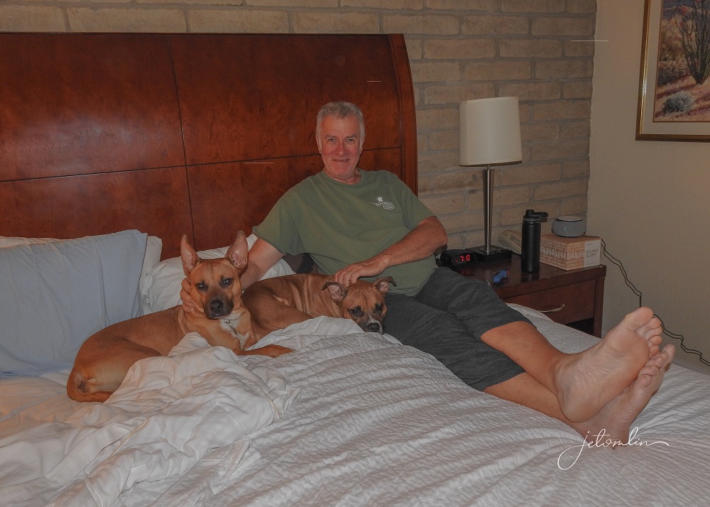
In October 2021, we embarked on our most ambitious road trip to date: a 7,700-mile journey to New Mexico where we planned to catch the winter bird migration in the Bosque del Apache as well as visit other interesting spots out west. All-in-all we would be gone for 28 days.

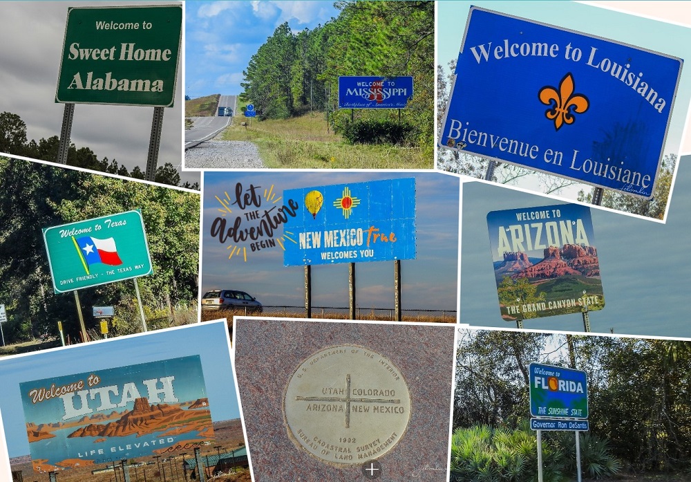
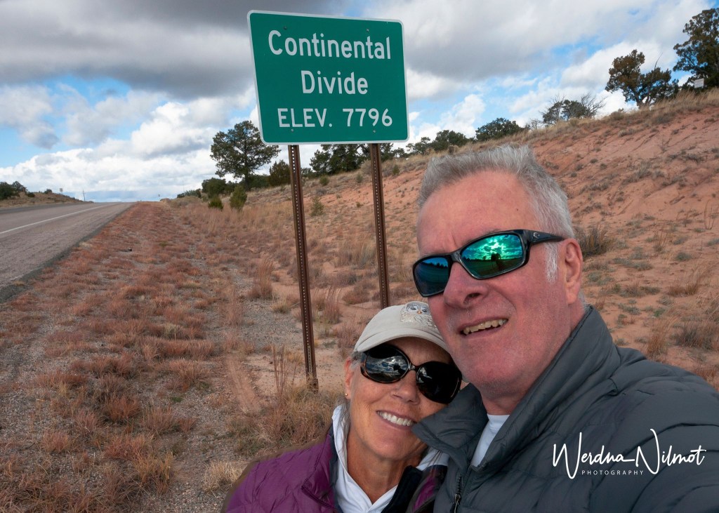
During our month-long trip, we would travel through nine states across three time zones, over multiple mountains and rivers, and cross the Continental Divide four times.
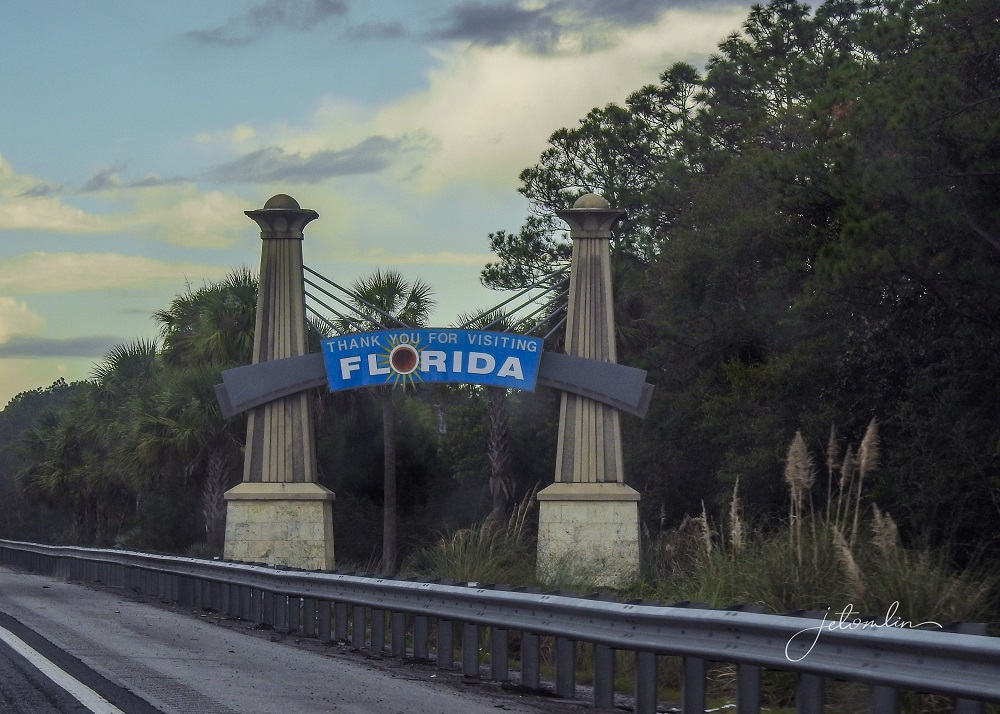
We loaded up the pups and pulled out of our driveway at 6am, driving through Florida’s panhandle,
Then Alabama, and spending our first night in Jackson, Mississippi.
The next morning, we crossed the Mississippi River into Louisiana before entering Texas.

We had programmed Siri to avoid tolls and thus far she kept us on interstates with not a whole lot to see.
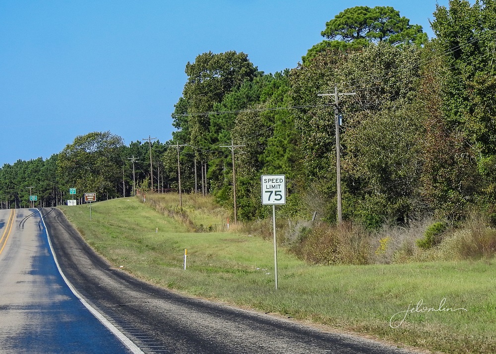
However, once we arrived in Texas, she took us on country roads which proved much more interesting.
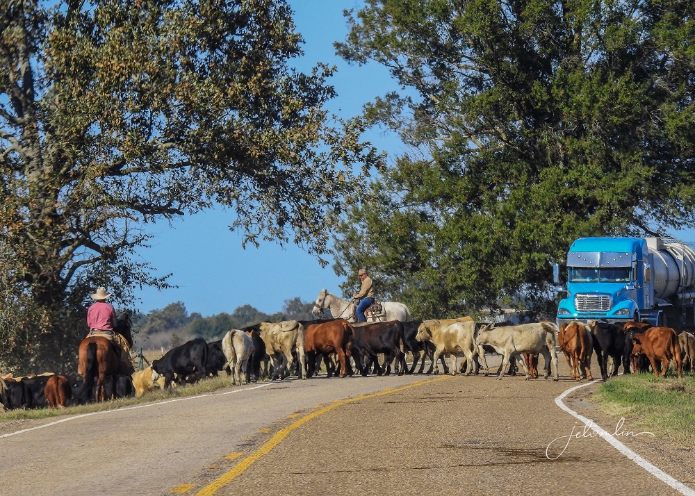
With no traffic and a 75-mph speed limit, we did not lose any time as we continued on our way.
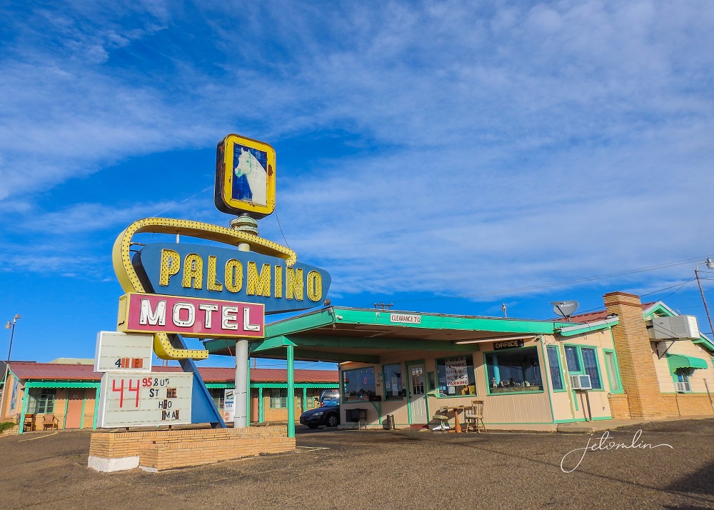
We stopped the second night in Amarillo, Texas.
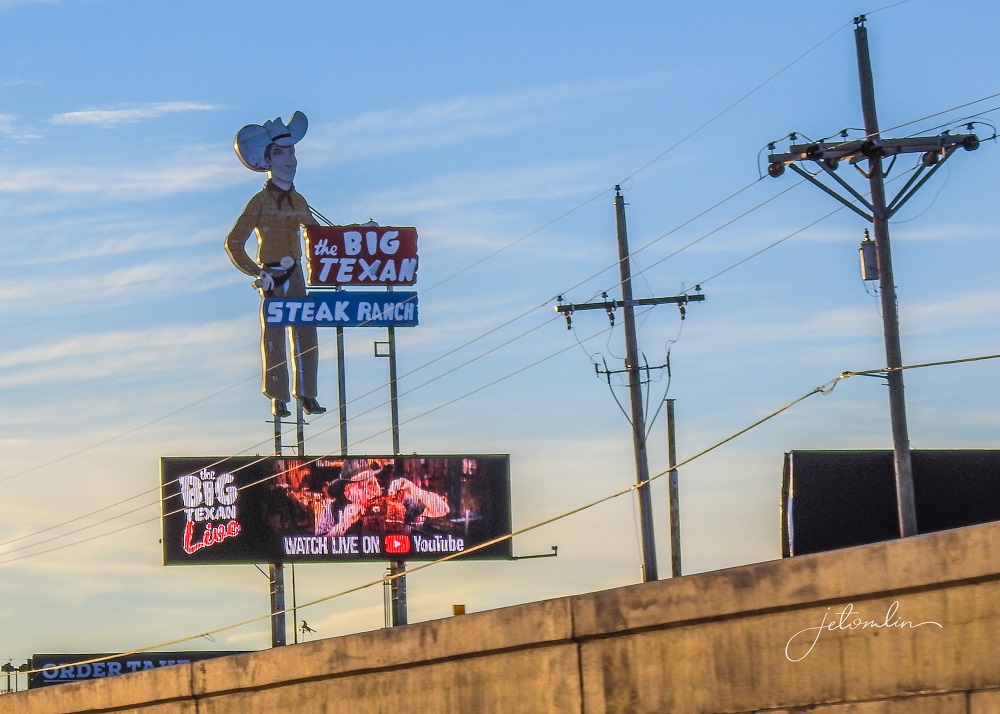
We had planned to push hard the first two days and we did: putting in back-to-back 13-hour drives. By the time we reached Hyatt Place Amarillo, we were ready to slow down a bit.
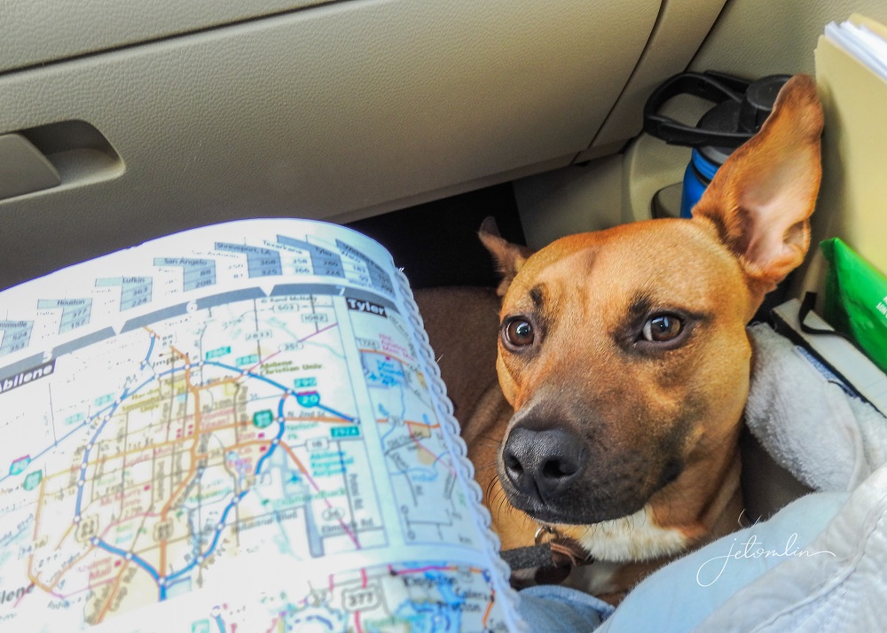
We had six more hours to get to our Air BNB in Lemitar, New Mexico and wanted to mosey with multiple stops along the way.
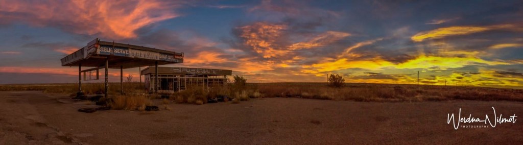
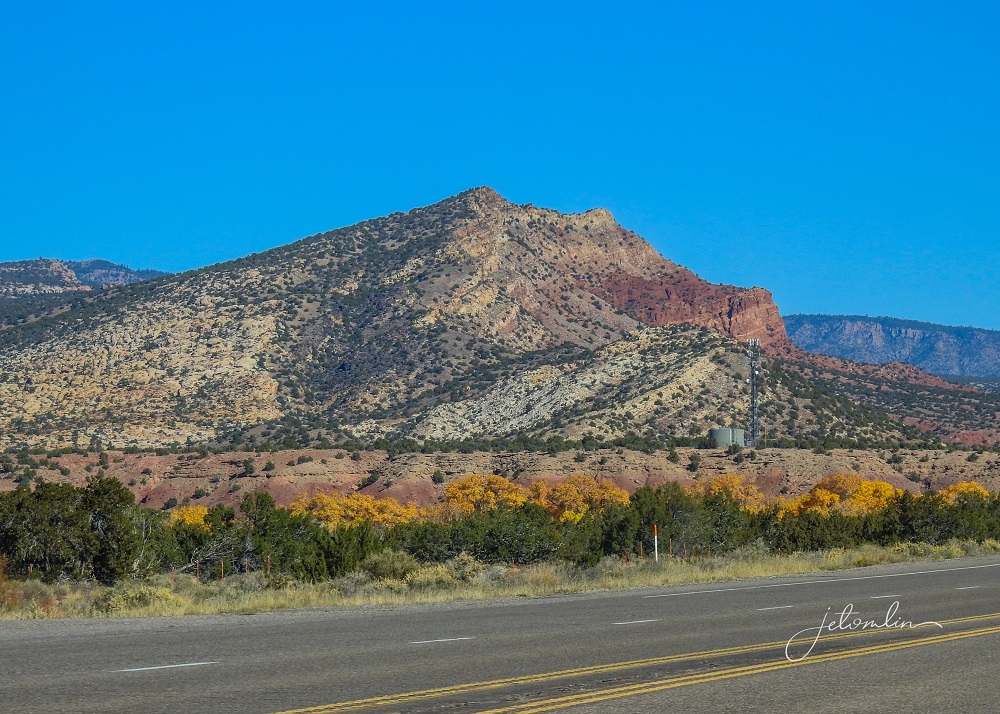
First up: Glenrio. This town was abandoned once the interstate replaced Route 66, but its ghosts remain.
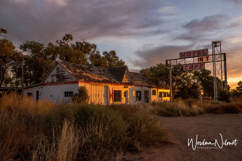
Glenrio straddles TX/NM and the gas station sits just east of the border, proudly claiming to be “the last stop for gas in Texas.”

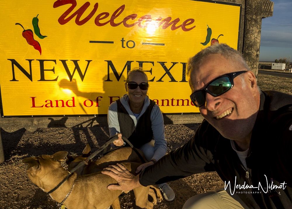
Once we crossed into New Mexico …
We headed for Tucumcari, another town on the old Route 66. This town has worked hard to preserve the nostalgia of that by-gone era, and we had fun capturing images of the vintage buildings.


You can see more of our photos from Glenrio and Tucumcari here (click on photo then use the arrow to go through the images):

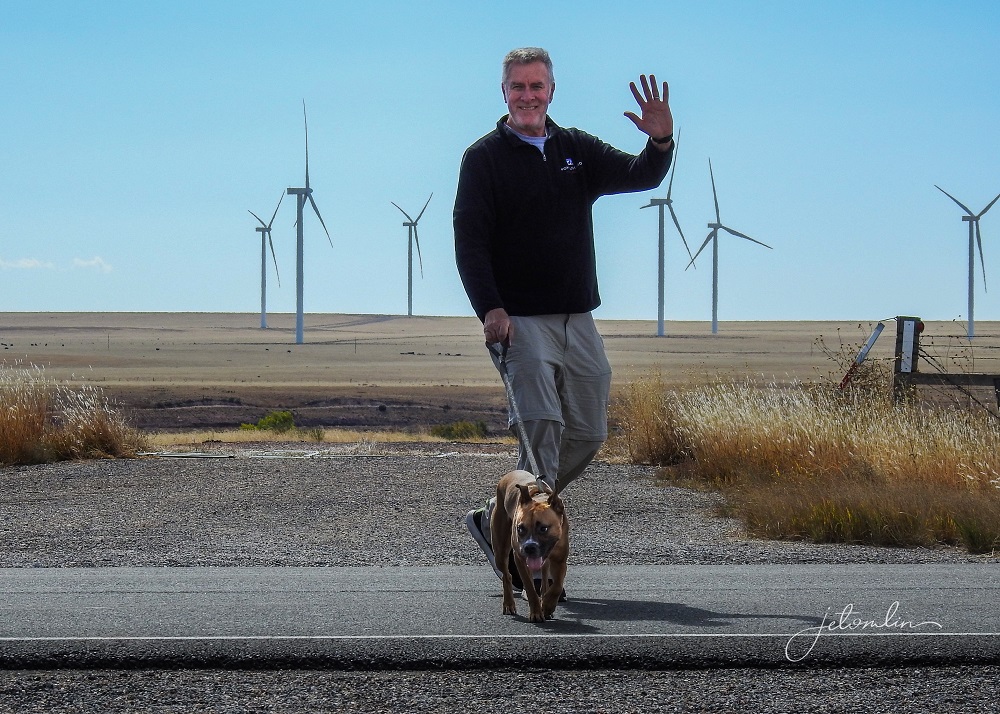
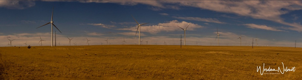
We had a four-hour drive ahead of us and we wanted to arrive in enough time to get unpacked and make a grocery run. So after Tucumcari, we headed southwest.

We took the time to marvel at the huge wind farms,
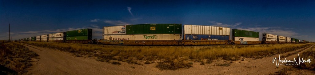
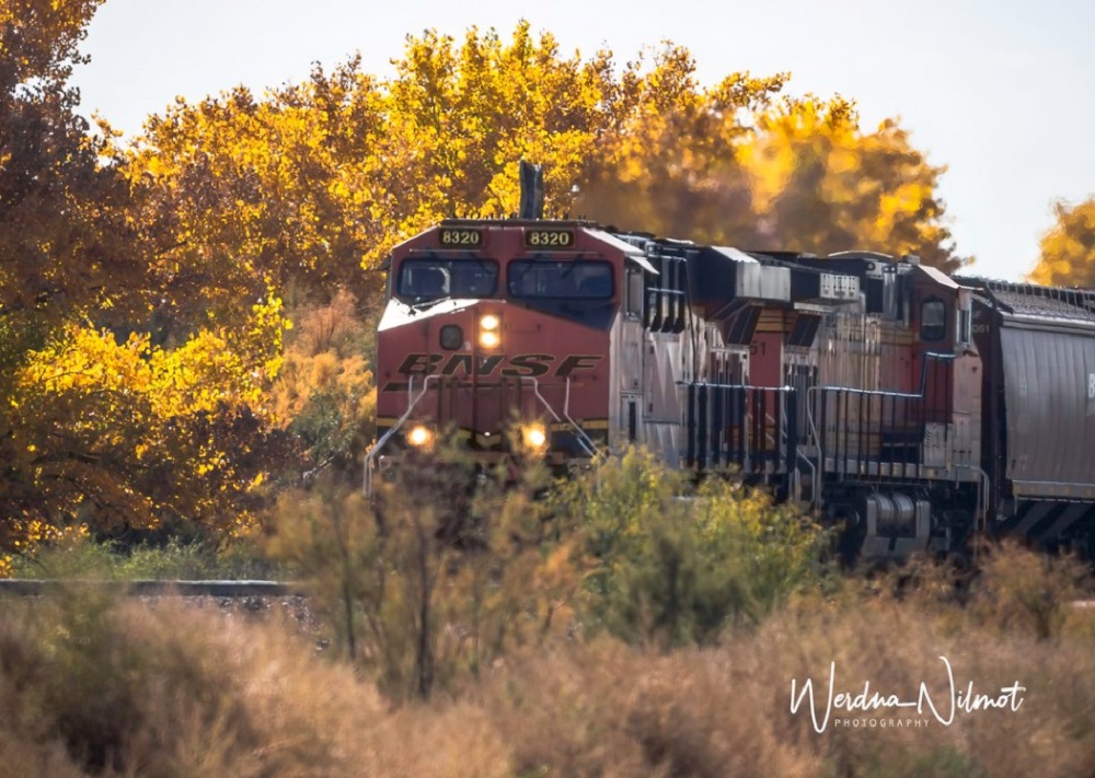
And the mile-long freight trains, loaded with stacks of containers.

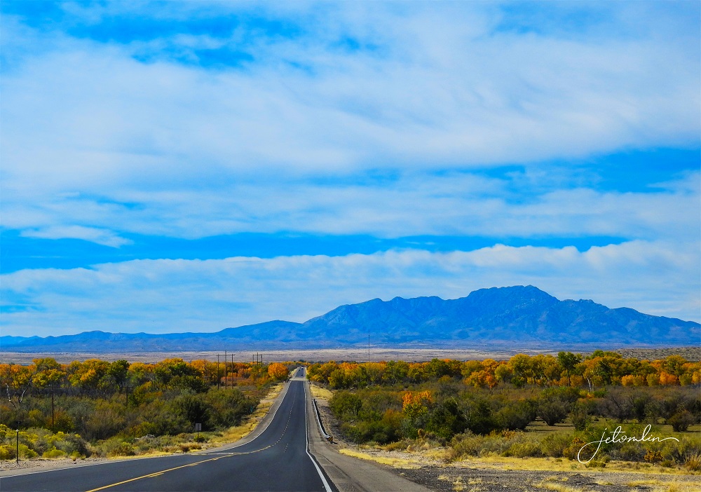
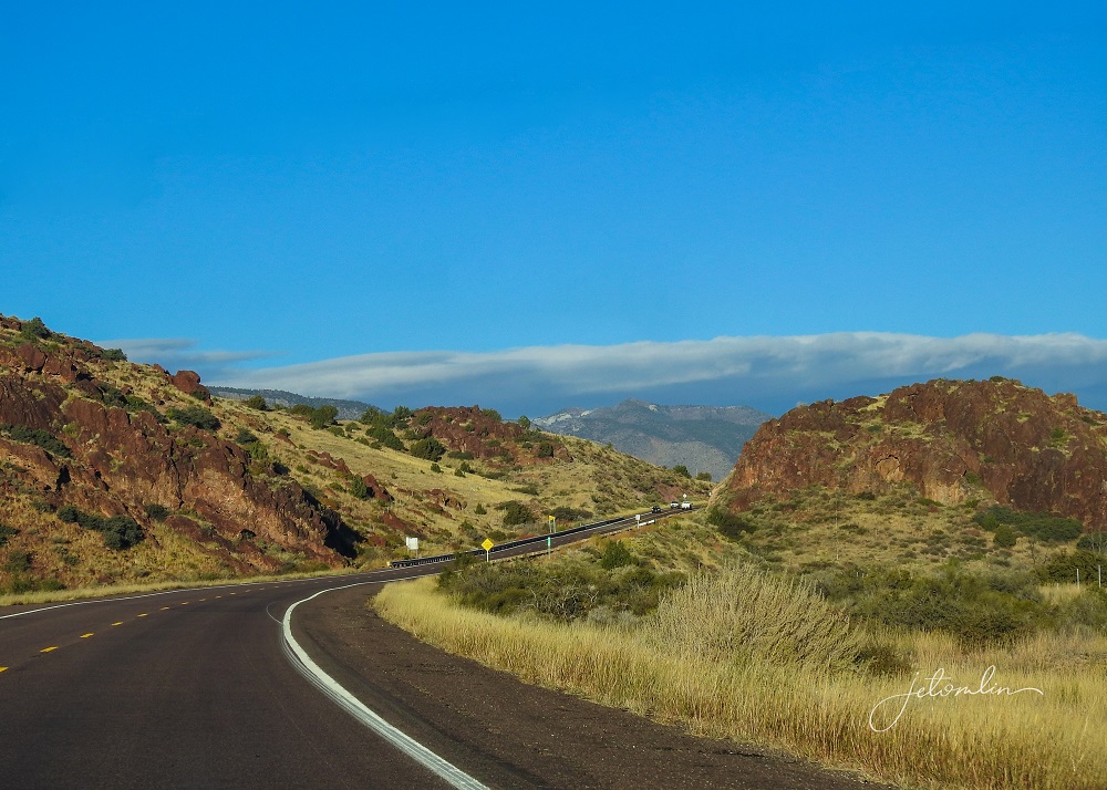
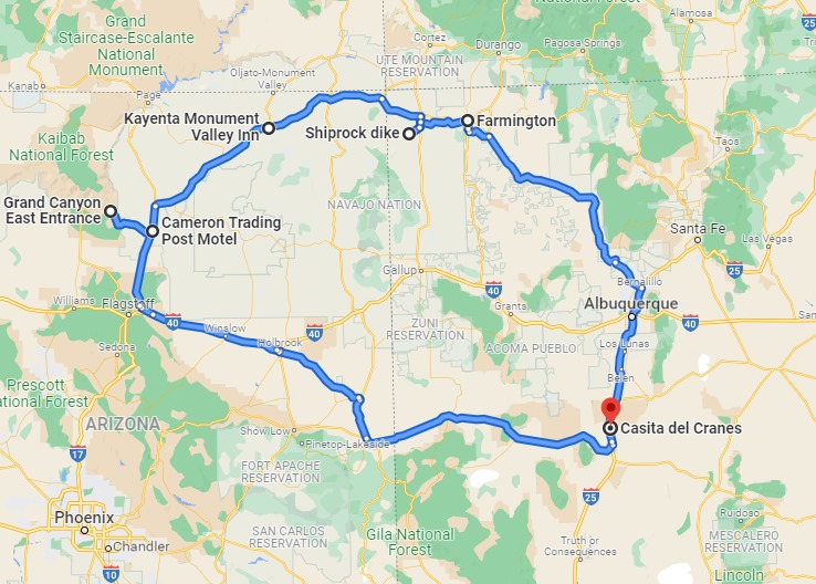
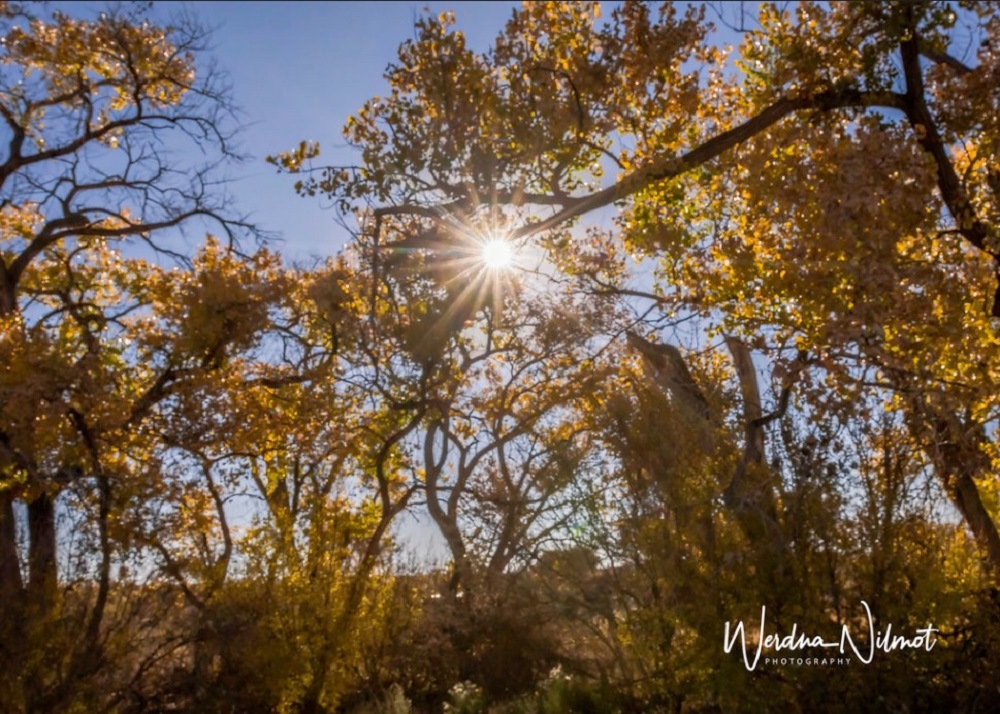
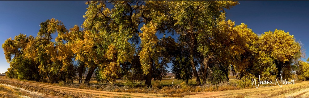
The topography of New Mexico is beautiful. Living in flat Florida, we had forgotten how much we love the mountains.

The cottonwood trees were in full bloom, a brilliant gold against the blue sky and reddish-brown mountains.
Casita Del Cranes makes for a comfortable and affordable home-away-from-home with plenty of privacy. It has a big living/dining/kitchen area, one bedroom with a queen bed, and a small bath with hot shower. We had room to spread out as well as set up Oscar and Maddie’s kennel.
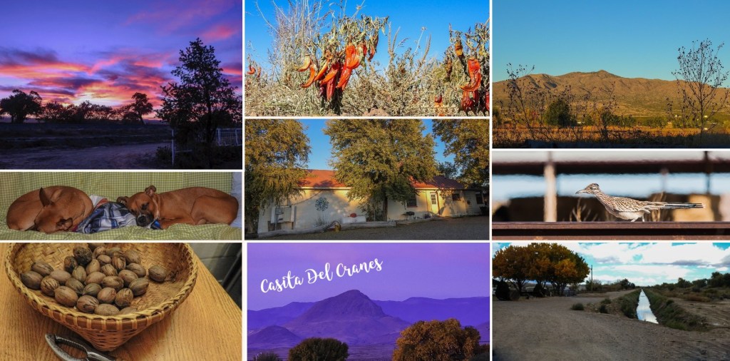
It sits on a quiet road – other than the occasional passing car the only sounds are the freight trains that rumble past, something we found charming.
It is located about a 15-minute drive from the town of Socorro, with a large, well-stocked Walmart. And only 45 minutes from the Bosque del Apache where we would be spending most of our time.
Home – Bosque del Apache – U.S. Fish and Wildlife Service (fws.gov)
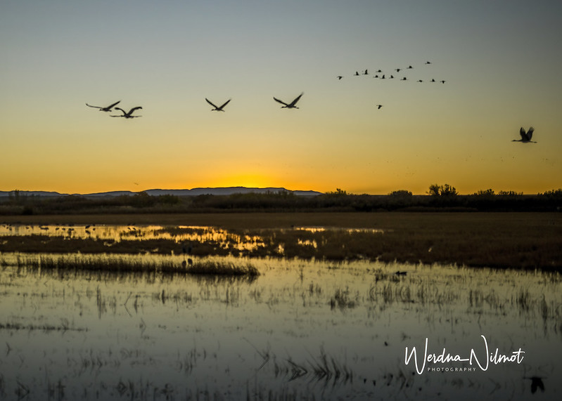
We spent our first 2 ½ days checking out the Bosque at both sunrise
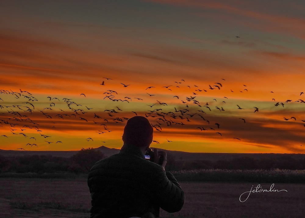

And sunset.
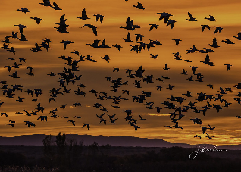
The birds had not yet arrived in the 1000’s we expected but we planned to be in this area until mid-November when the migration would be in full swing.
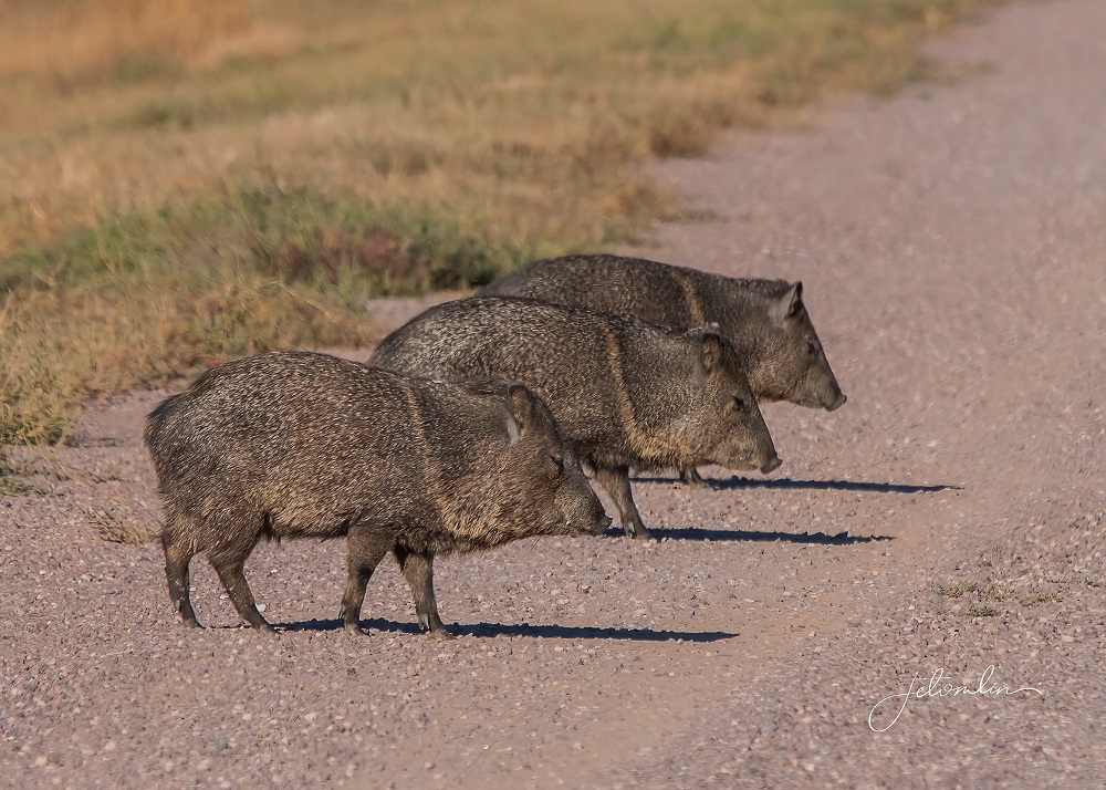
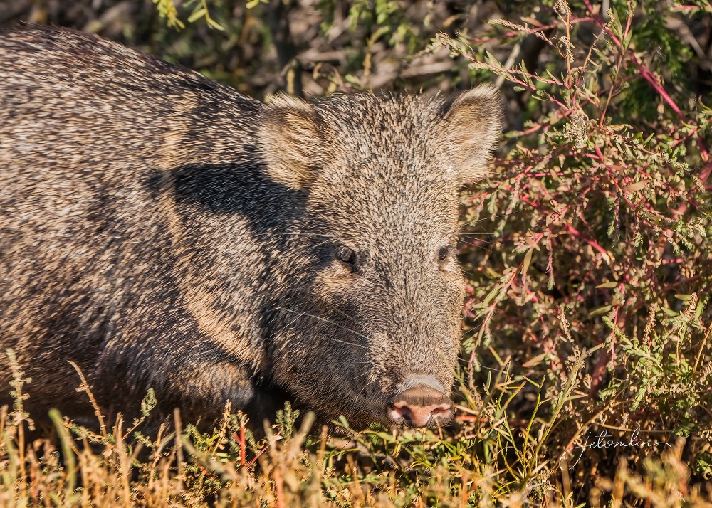
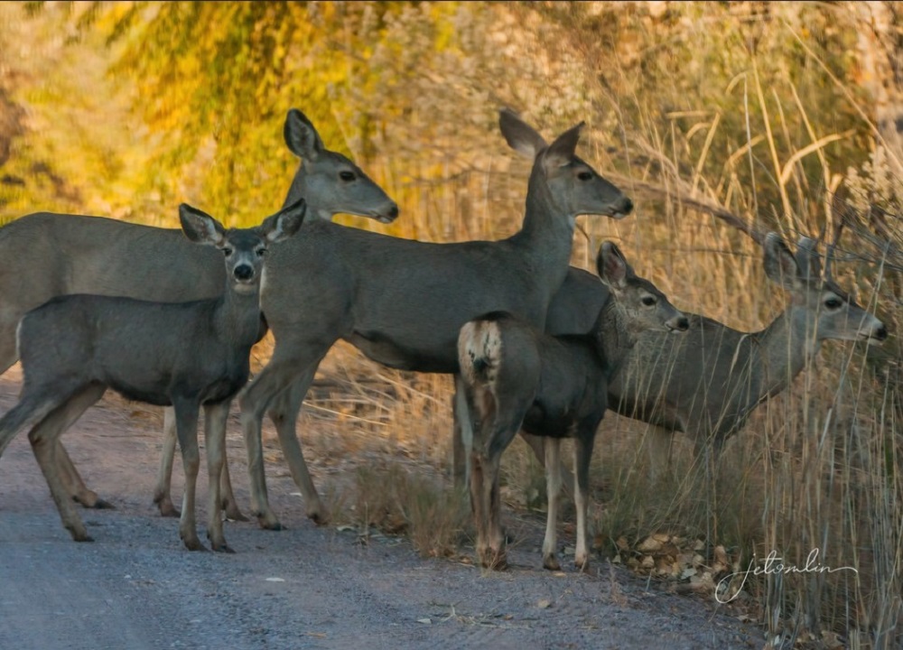
We did manage to spy a coyote sneaking across a field at sunrise, a small bobcat, several mule deer, and a group of javelinas crossing the road ahead of us!
We took a break from the Bosque on Tuesday and drove out to the Very Large Array. The drive through the mountains was breathtaking.
The VLA is a group of huge radio antennas that complement giant, single-dish telescopes for the National Radio Astronomy Observatory. In a nutshell, it creates a telescope many miles across. It is difficult to grasp its massive scale, but we were able to see the large, white dishes from more than 20 miles away.

These huge antennas are on tracks and are repositioned throughout the year – sometimes bunched close together and other times spread far apart.
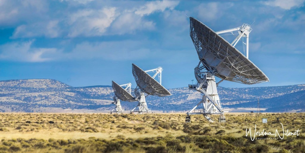
You can check the VLA website for exactly where they will be at any given time and plan your visit accordingly.
VLA Configurations – National Radio Astronomy Observatory (nrao.edu)
You can see more of our photos from the VLA here (click on photo then use the arrow to go through the images):
We continued west over the mountains and, in the process, crossed the Continental Divide.
The following day we drove south to White Sands National Park. This was a 2 ½ hour drive and we wanted to arrive for the early morning light. On our way, we crossed the Rio Grande.
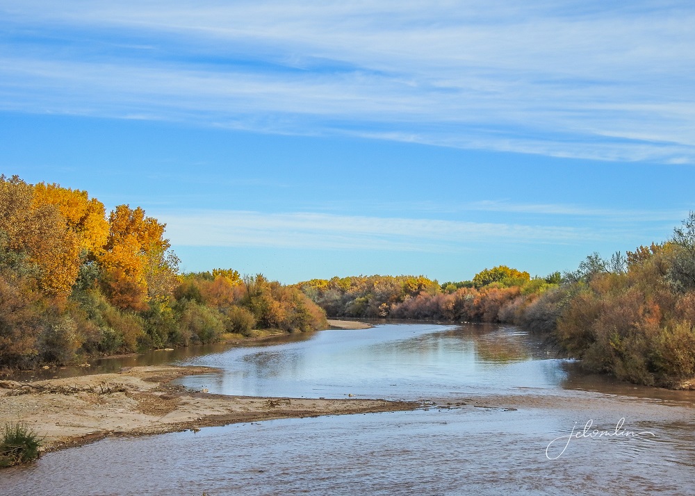
After traveling through the entire state of New Mexico, this grand river becomes the US/Mexico border once it reaches Texas.
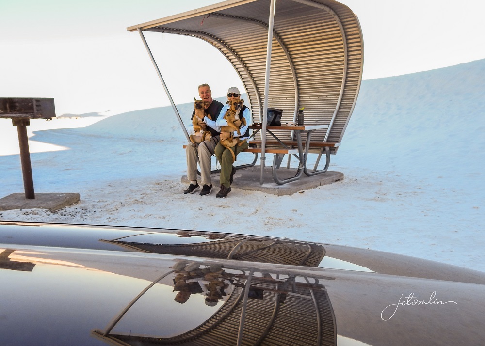
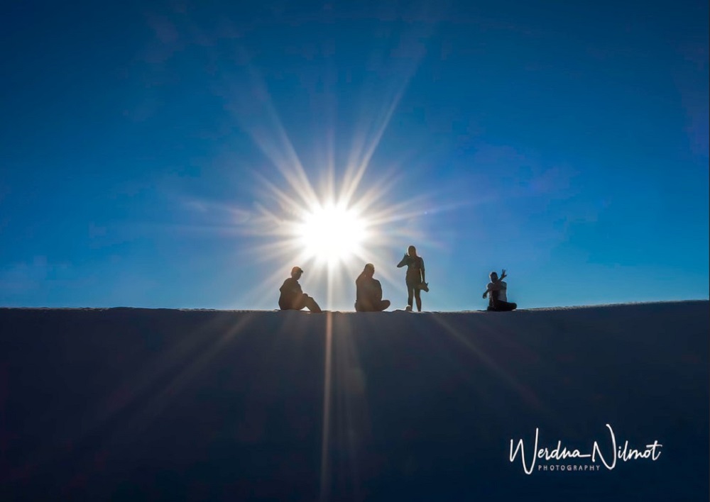
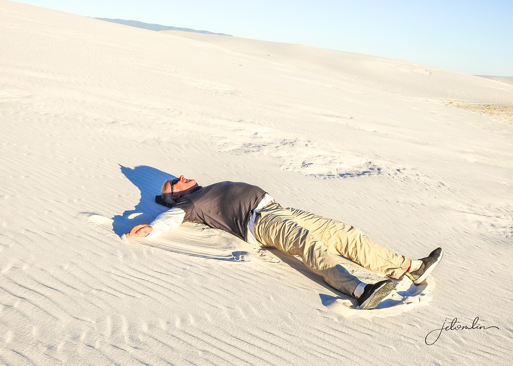
By the time we arrived at White Sands National Park it had turned into another sunny, cloudless day and the stunning white sand looked like huge snowdrifts. Driving through the dunes in the early morning quiet, without a single car in sight, was otherworldly.
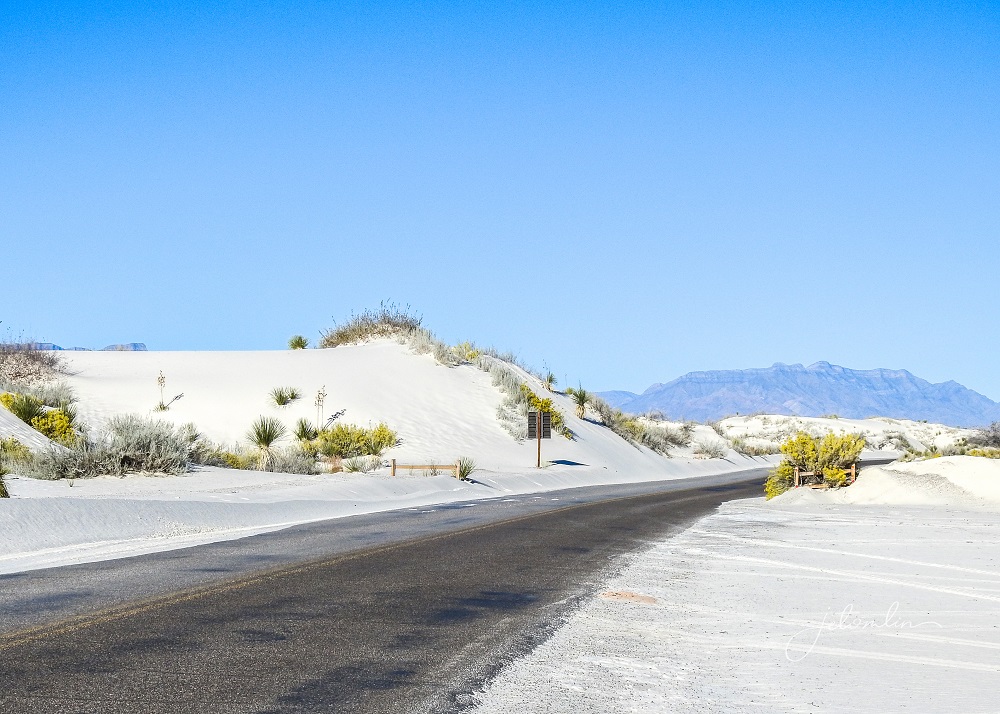
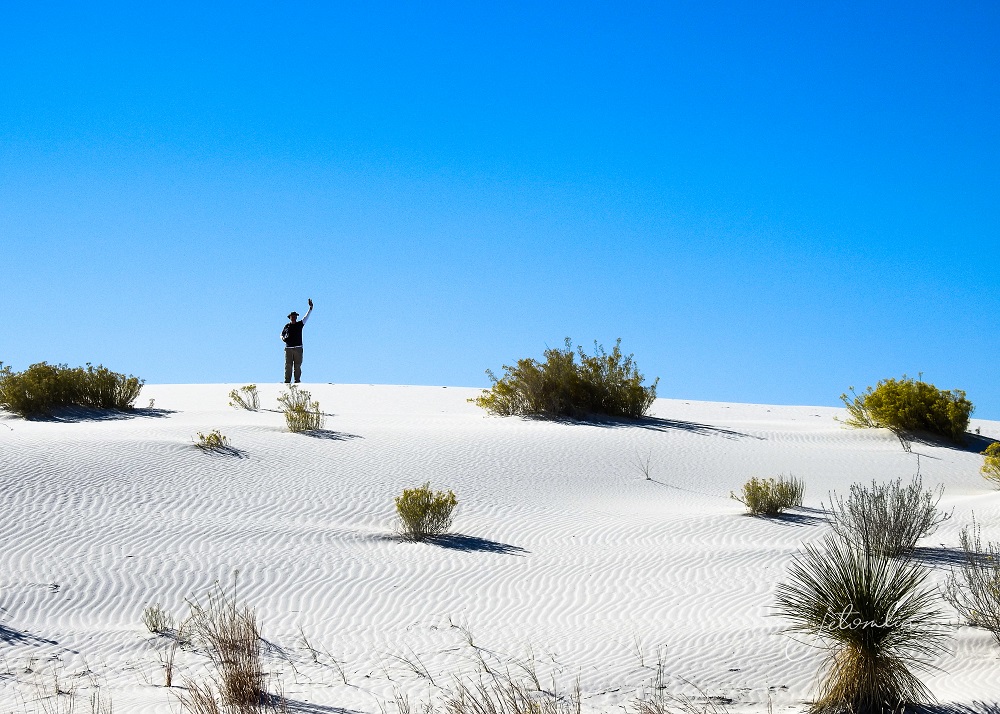
The sand looked hot to touch (like our Florida beaches), so before we let the pups out of the car I ran a handful through my fingers. It was soft as powered sugar and almost cold! Air temps that day were in the mid-50’s.

We decided to stick around for sunset, so we took a mid-day break to check out McGinn’s Pistachio Land,

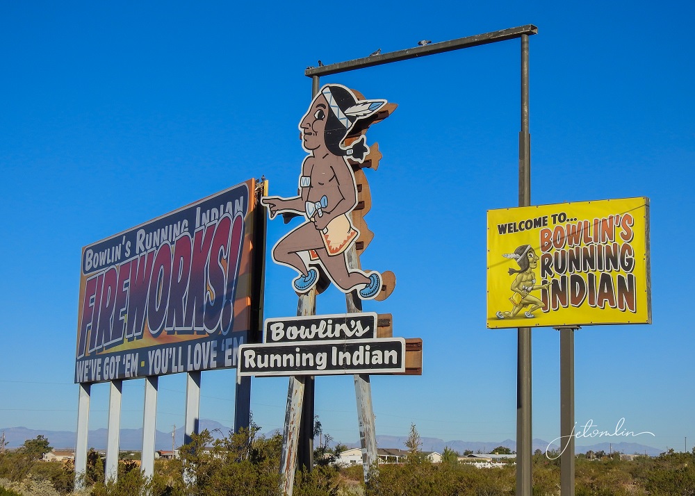
Bowlin’s Running Indian Trading Post for refrigerator magnets,
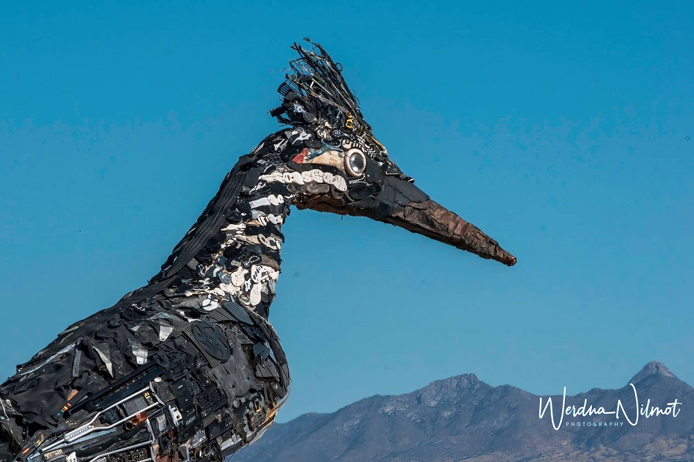
And the famous recycled roadrunner sculpture overlooking the town of Las Cruces.
We arrived back at White Sands around 4 pm and enjoyed a picnic dinner while we waited for the sun to set.
Without a cloud in the sky, the sunset was not as dramatic as it might have been, but we were nonetheless awed by the ethereal beauty of the park.
By the time we pulled into our driveway at Casita Del Cranes, it was after 9pm – 15 hours in the car with Oscar and Maddie! All of us slept well that night!
You can see more of our photos from White Sands here (click on photo then use the arrow to go through the images):
And so ended our first week in New Mexico.
Week Two started with another day of brilliant blue sky and plenty of bright sunshine. We chose to stay home – working on photos and getting ready for our upcoming “embedded road trip.”
In addition to our time in Lemitar, we had made reservations to stay in Farmington for three nights, Monument Valley for one night, and the Grand Canyon for another two.
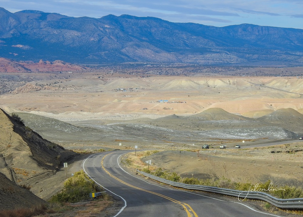
We drove north and west from Albuquerque through the Valles Caldera Mountains, and at over 7,000 feet we could feel our ears popping!
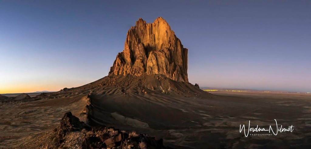
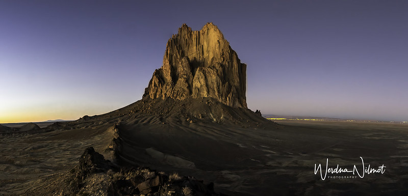
Before checking into our Air BNB in Farmington we first drove to our destination for later that evening: Shiprock.
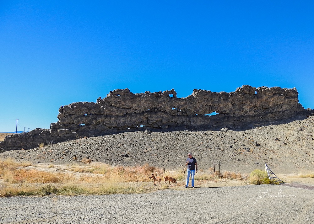
Like the VLA, it is impossible to show the massive scale of this natural rock formation. It sits in the middle of Navajo Nation land, and you can see it from 30+ miles away. It felt like we drove forever before arriving at our rendezvous spot!

Shiprock (Navajo: Tsé Bitʼaʼí or “rock with wings”) rises 1,600 feet above the plain and is considered a sacred site. As such, you are not permitted to drive close to the monolith without a Navajo guide. We booked our tours with Navajo Tours USA.

We settled into Fairview Hide-Away in Farmington, our home for the next three nights.

And were back at Shiprock by 6pm.
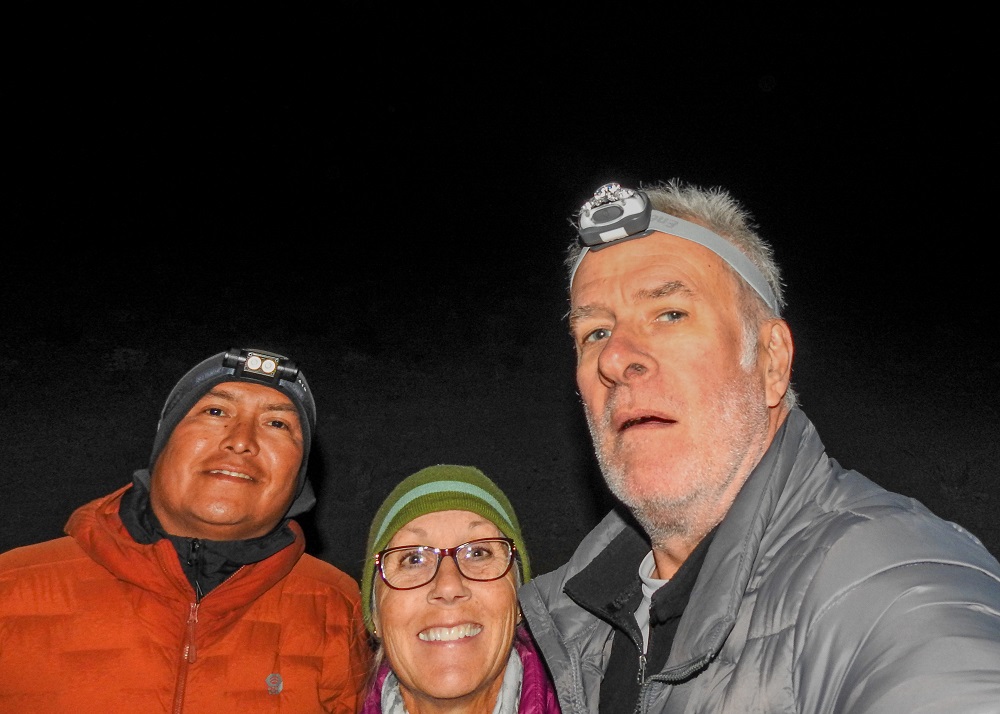
Our guide, Kialo, arrived shortly after, and together we caravanned to the end of the road. Kialo assured us that our VW Jetta could make it “no problem” but it quickly turned into the bumpiest, most nerve-wracking non-road TG had ever driven!
We parked at the base of the monolith and then proceeded to scramble up the side of a sheer cliff to get to our first photo spot. Kialo bounded up like he had been doing this his whole life (he has) while I inched along behind him, not daring to look down and clinging to the rock wall for dear life. A tumble would, at the very least, result in severe injury, and we took our time going up.
But we were rewarded with an incredible bird’s eye view of the monolith, the last of the sunset turning it bright orange.
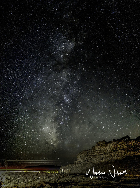
What goes up must come down, so we inched our way back in the inky blackness and on to our next spot for Milky Way shots. TG set up for a stack,
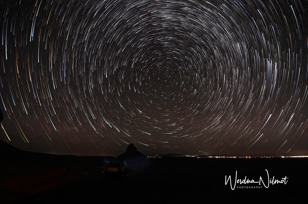
While I walked back and forth shooting the Milky Way from various angles.
The moonless sky was clear, and the stars were out in such numbers it was difficult to spot individual constellations. The Milky Way was a brilliant, vertical arch that stretched far over our heads into the sky above us.
It was truly a night to remember.
You can see more photos from Shiprock here (click on photo then use the arrow to go through the images):
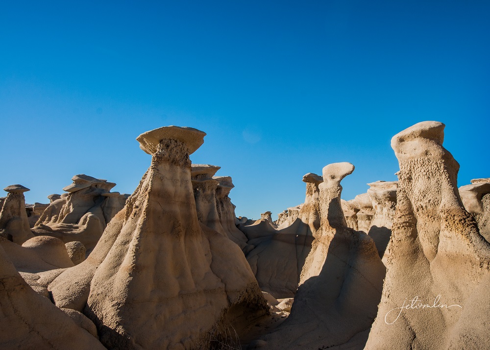
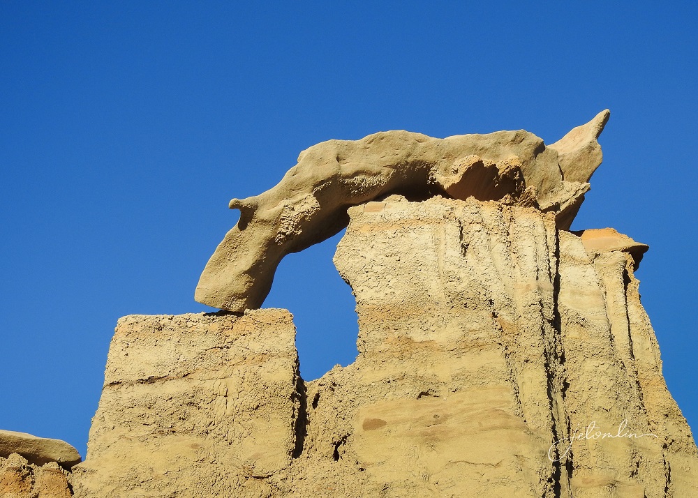
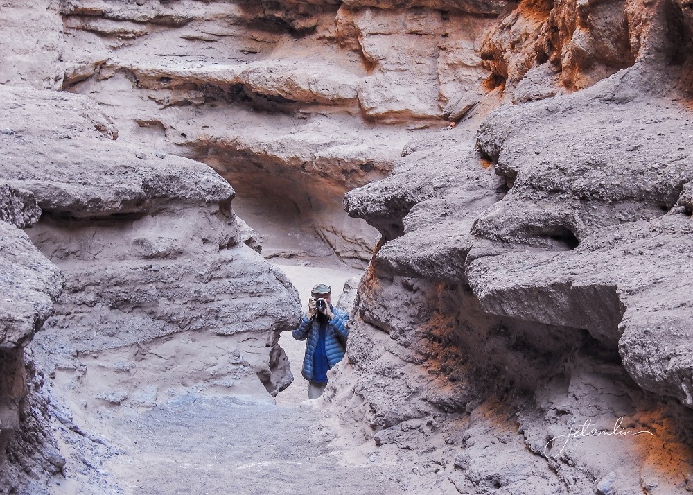
On Saturday we had arranged for two day-hikes into the Bisti (rhymes with “Misty”). The Bisti/De-Na-Zin Wilderness is a rolling landscape of badlands that offers some of the most unusual scenery found in the area.
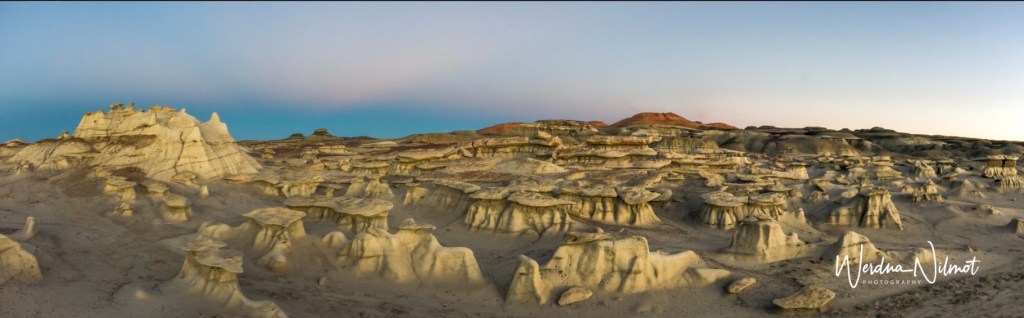
Time and nature have etched a fantasy world of strange rock formations made of interbedded sandstone, shale, mudstone, coal, and silt.
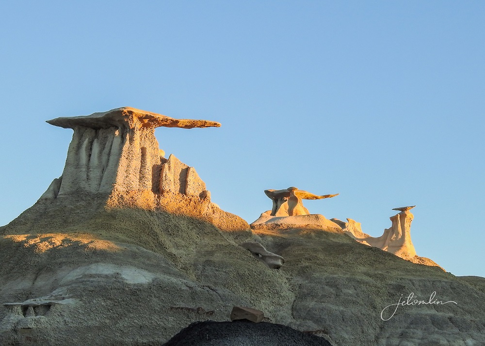
These hoodoos are in the shapes of pinnacles, spires, capped mushrooms, and other unusual forms.
We met our guide, Gilbert, at the north section rendezvous spot at 7am.
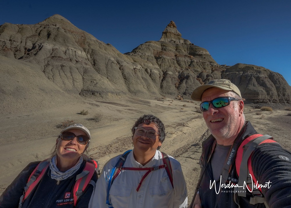
We learned a lot about the Bisti and Navajo culture as he pointed out the various formations.

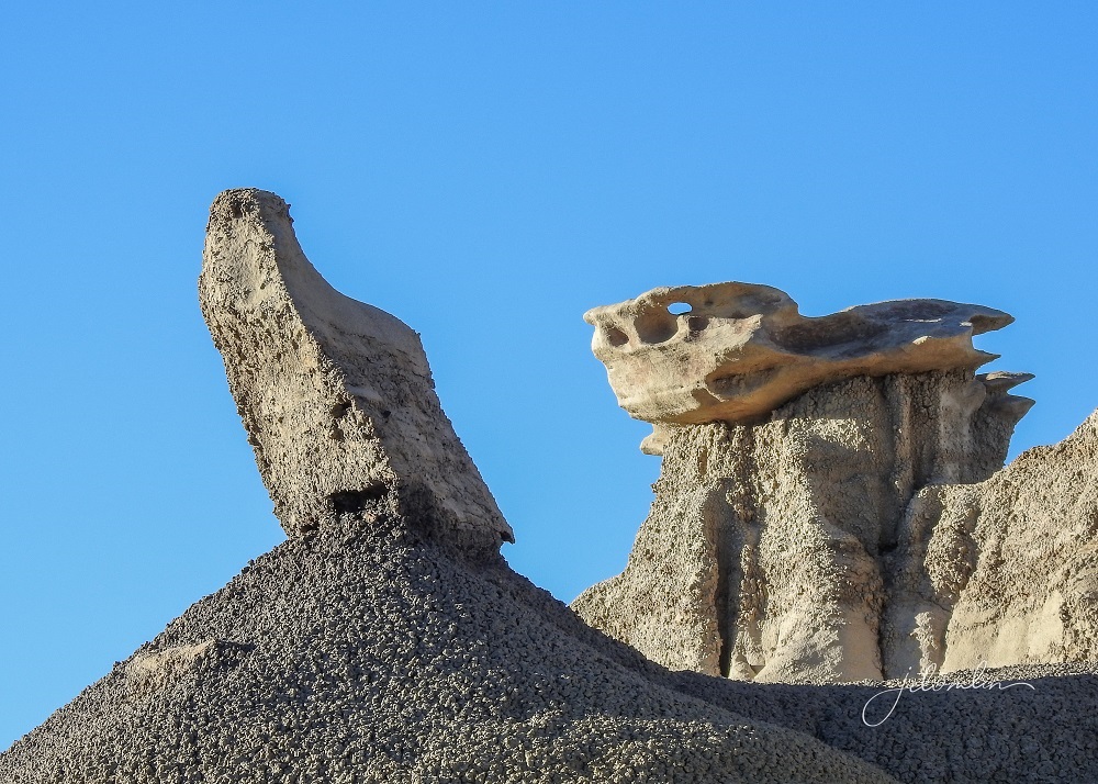
We also played “What do you see?”
I named this formation “Thirsty Dog.”
TG said, “I see a camel!”

We ended our first hike around 11am and had just enough time to drive home for a quick lunch and spell Oscar and Maddie. The total distance that morning was around four miles.
We were back at the south section parking lot by 3pm and hiked to several well-known spots including the Petrified Logs,
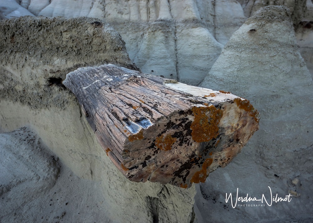
And the famous Egg Hatchery.

We finished our afternoon hike at just over 5 miles and were so tired we could barely make it home. But it was another memorable day.

You can see more photos from the Bisti here (click on photo then use the arrow to go through the images):

The next morning, we caught up on photos and took advantage of Fairview Hide-Away’s washer & dryer – an amenity we appreciated being one month on the road!

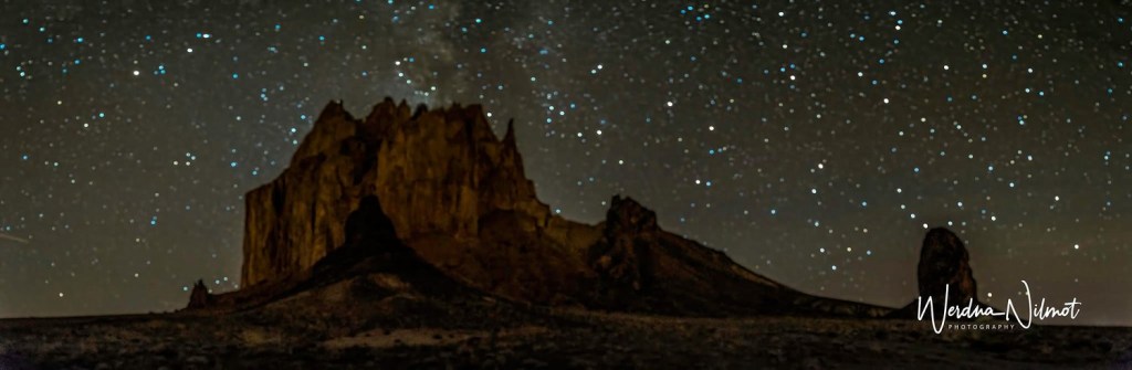
Later that afternoon we drove back out to Shiprock for one more shot at the night sky and a star stack. Because we were on our own, we stayed in the parking lot. But even so, it made for a special night as the headlights from passing cars illuminated the dike while we took our shots.
On Monday, we said goodbye to Farmington and headed west.
It is difficult to take in the vastness of the southwestern United States. It goes on forever and coming up over a rise you can see for 50 or more miles. It is beautiful and it is spellbinding.
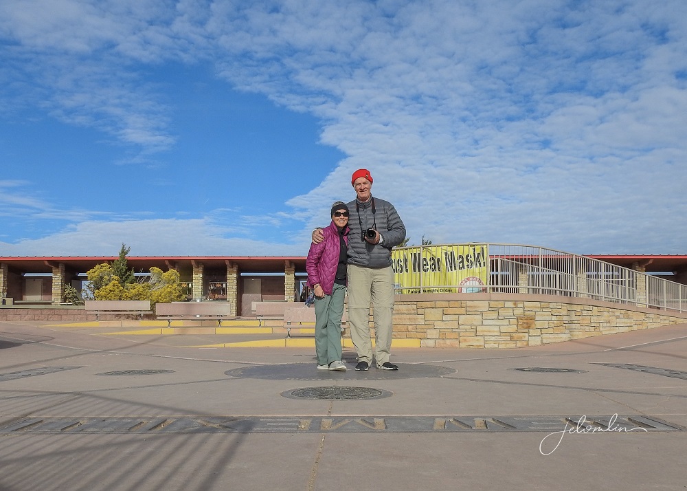
A quick detour took us to Four Corners.
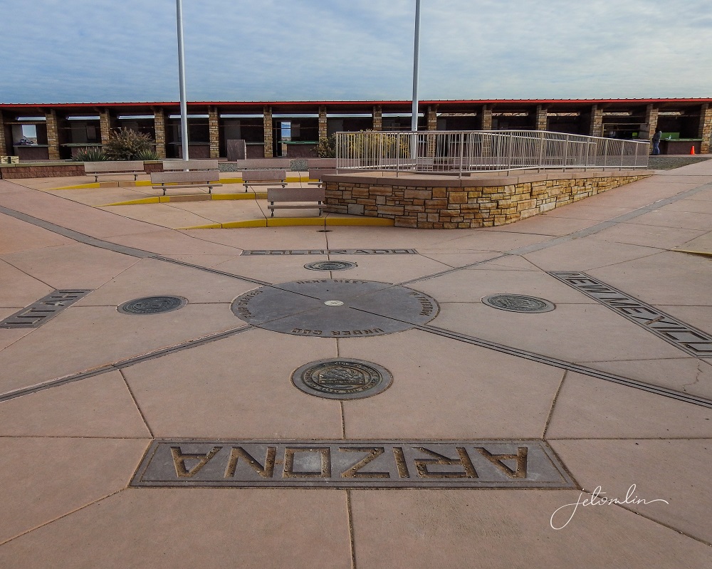
And of course we had to take a selfie standing in the four states: New Mexico, Arizona, Utah, and Colorado!
We ended the day at Monument Valley. We checked into our room at the Kayenta Valley Inn,
And then drove the twenty-five miles to the monument entrance. Here is TG’s description of our experience:
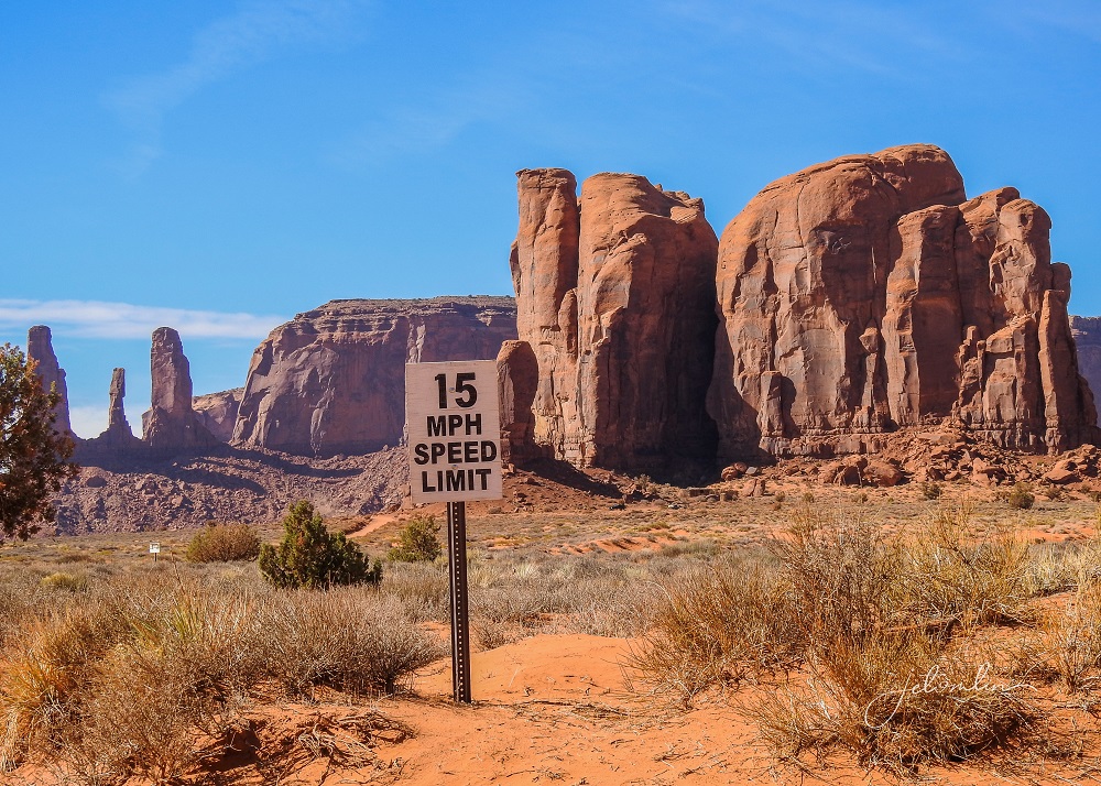
We visited Monument Valley near Kayenta, AZ yesterday. I must say that despite the monuments themselves being extraordinary in size and beauty, it was a letdown. It was the most controlled, yet uncontrolled, experience I have ever encountered.

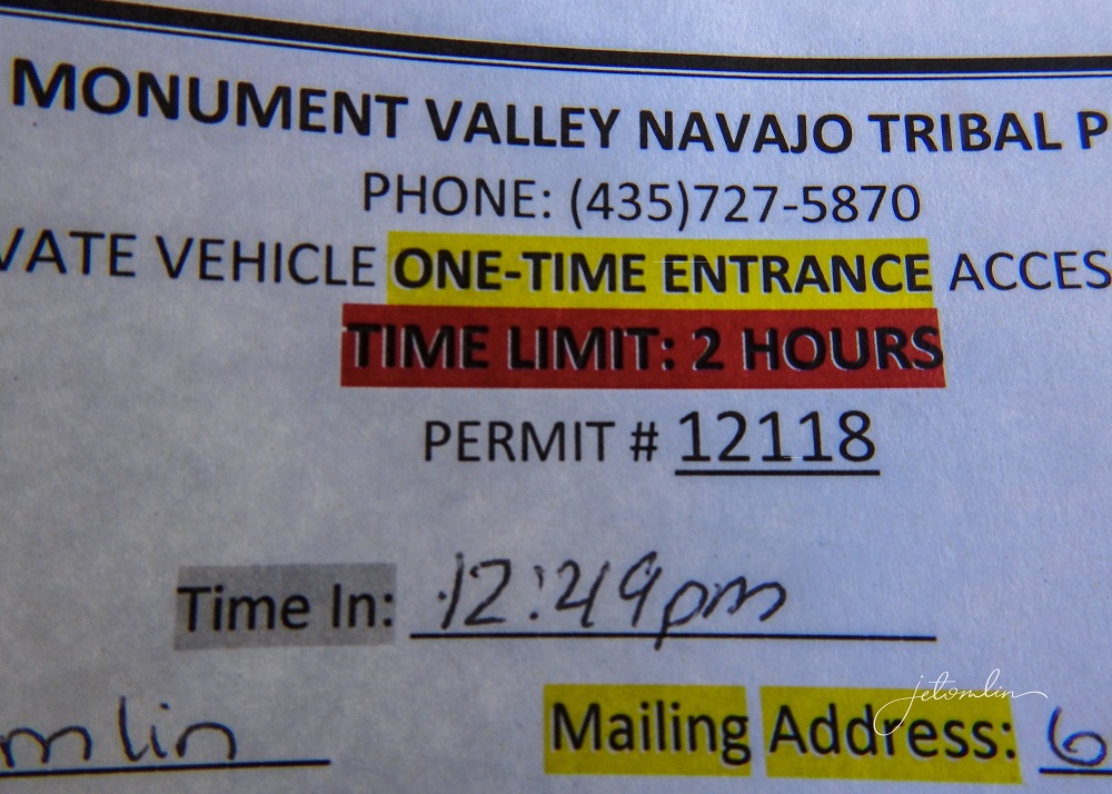
For $20, you are issued a permit allowing a timed, 2-hour drive on a marked road that really should not allow any vehicles with moderate to low clearance…
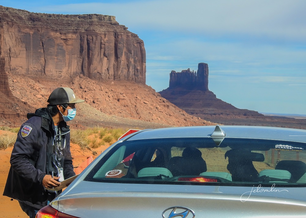
There were many spots that we had to cover at less than 5 MPH and a couple of very steep hills with loose gravel on the way out that we almost could not climb.
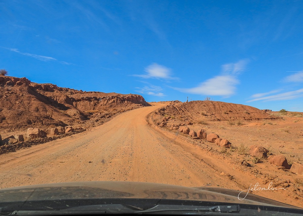
Additionally, there is no policing of the drivers once in the park, although there are plenty of rules. Many drivers went well above the 15 MPH limit, kicking up dust, not looking where they were going, driving the wrong way, and stopping in the middle of the road. What we had looked forward to quickly turned into a “let’s get out of here ASAP” moment.
You can see more photos from Monument Valley here (click on photo then use the arrow to go through the images):

Our original plan was to go back the following morning for a sunrise drive but based on the previous afternoon experience we nixed that idea and continued west.
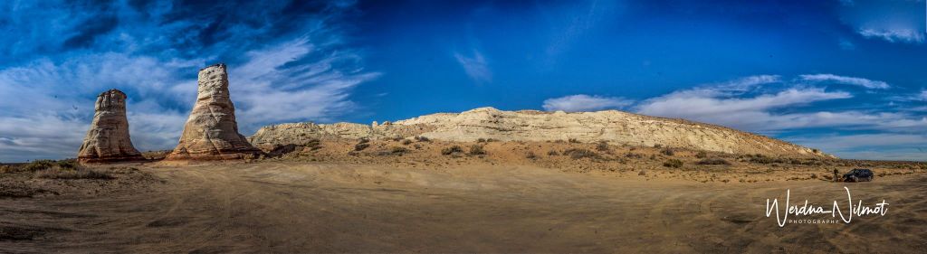
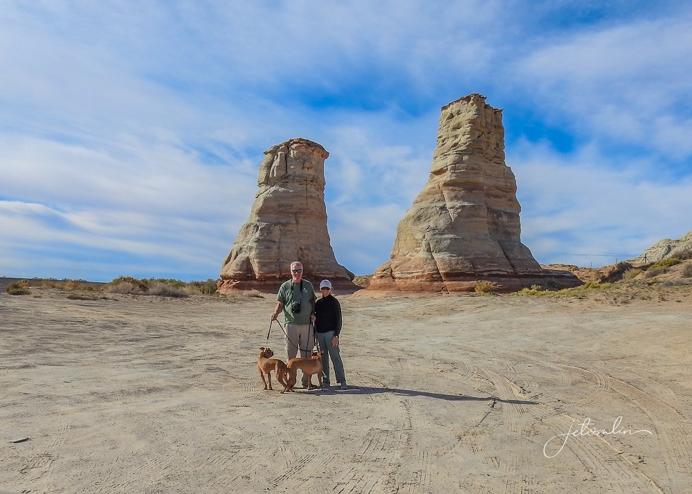
Alongside Route 160 there is an interesting rock formation called “Elephant’s Feet” where we stopped to take a few photos and stretch our legs.
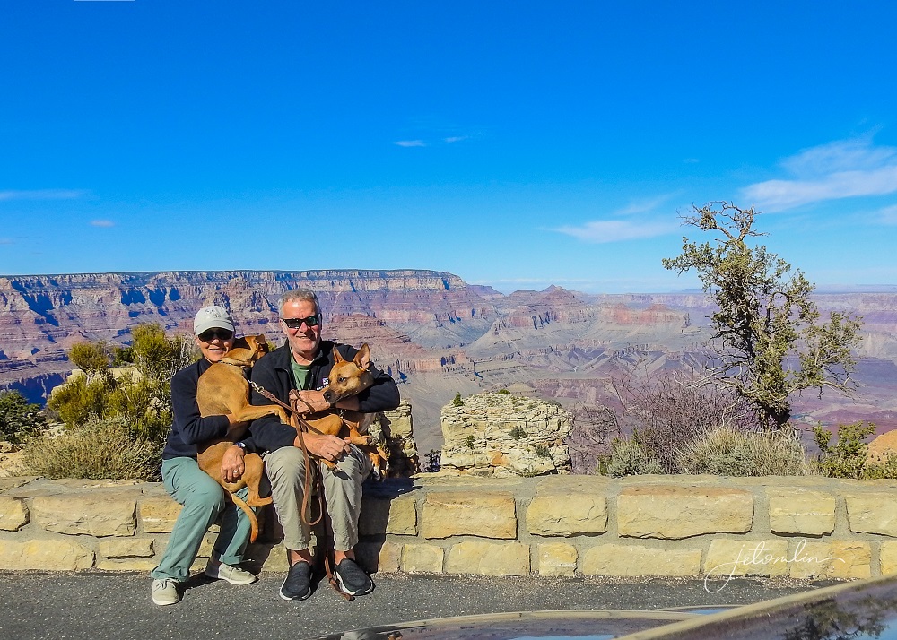
We arrived in Cameron around noon – far too early for our 4pm check-in. So, we headed straight to the Grand Canyon National Park, located about a 30-minute drive west of town.
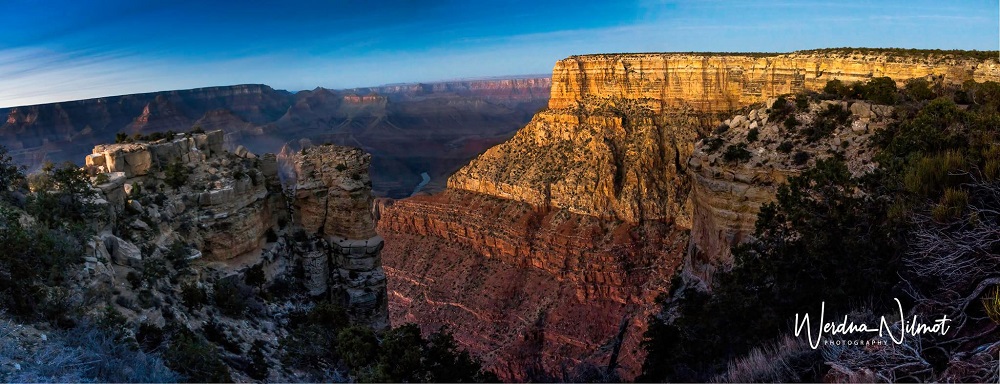
The Grand Canyon was on both of our “Bucket Lists” and our first views did not disappoint.
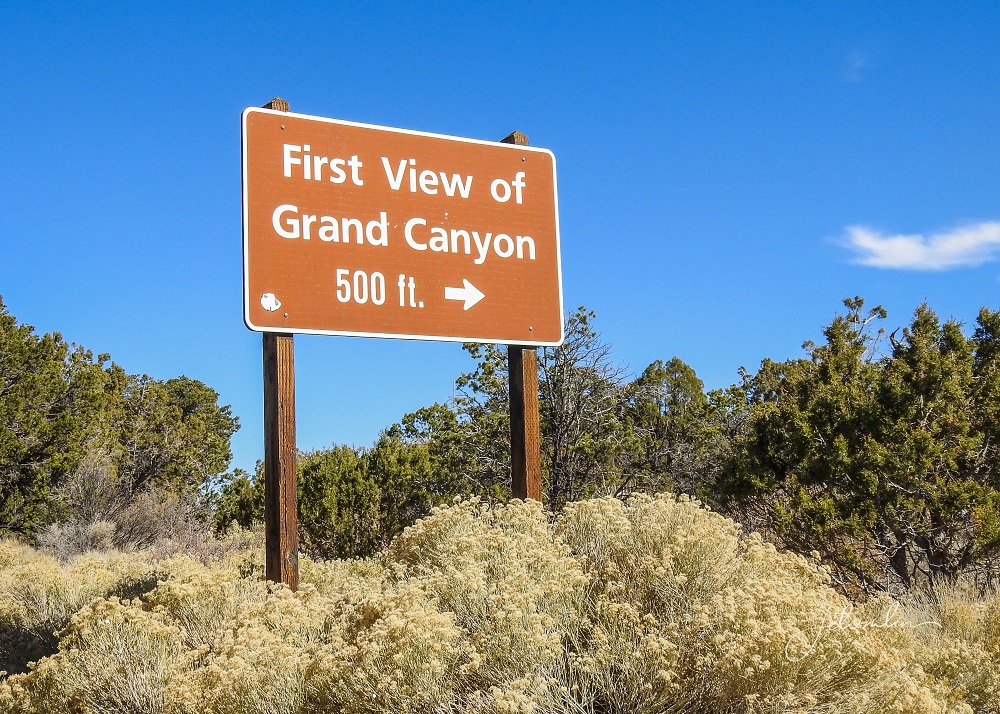
It truly is one of the Seven Wonders of the World and I found myself in tears, overwhelmed by its awesome beauty.
Since we had all the following day, this afternoon was a scouting mission to get the lay of the land.
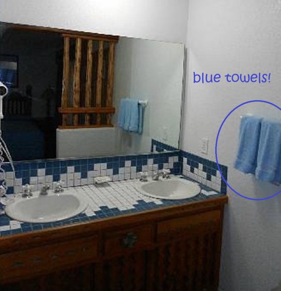
Back in town, we checked into the historic Cameron Trading Post, our home for the next two nights.
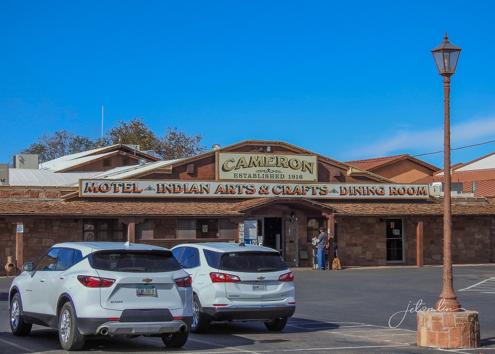
This charming hotel has gorgeous views, private entries, and well-laid-out rooms. It also has the prettiest, softest baby-blue towels!
We had plenty of space to spread out our laptops and camera gear.
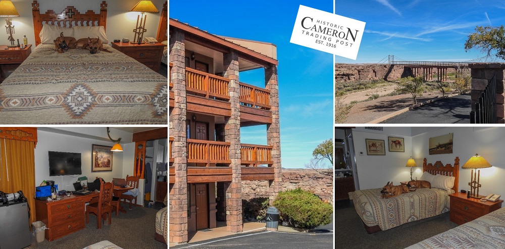
The restaurant serves both American and traditional Navajo food, with convenient curbside pick-up.

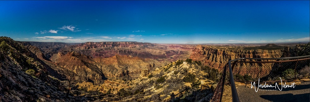
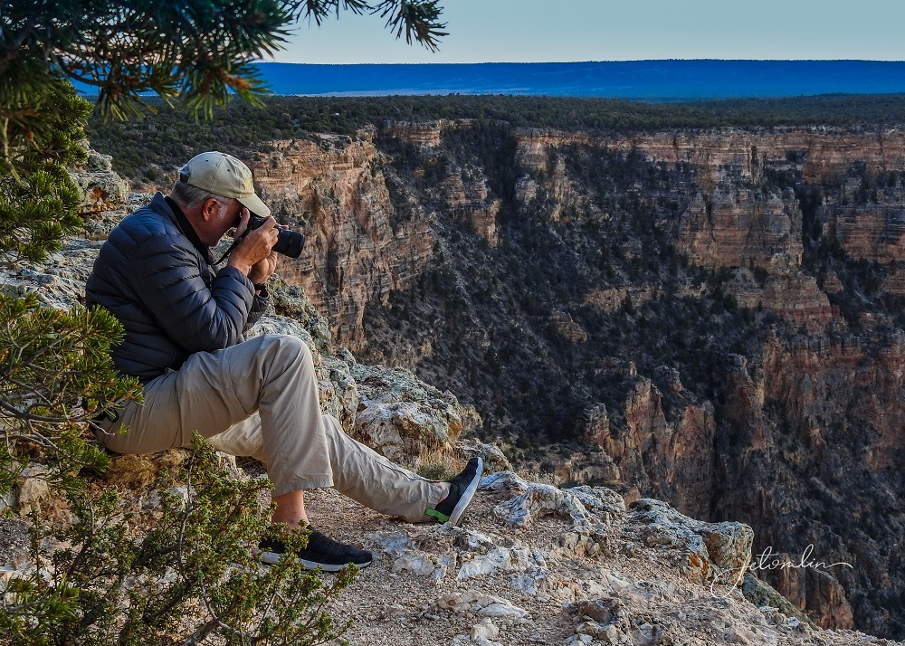
We realized that we were woefully unprepared for photographing the vast expanse of the Grand Canyon with its layers of light, shadow, and colors. TG spent some time researching “how-to” techniques for the next morning’s sunrise.
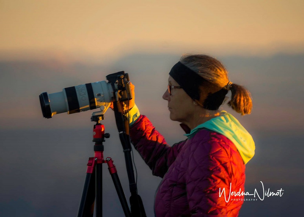
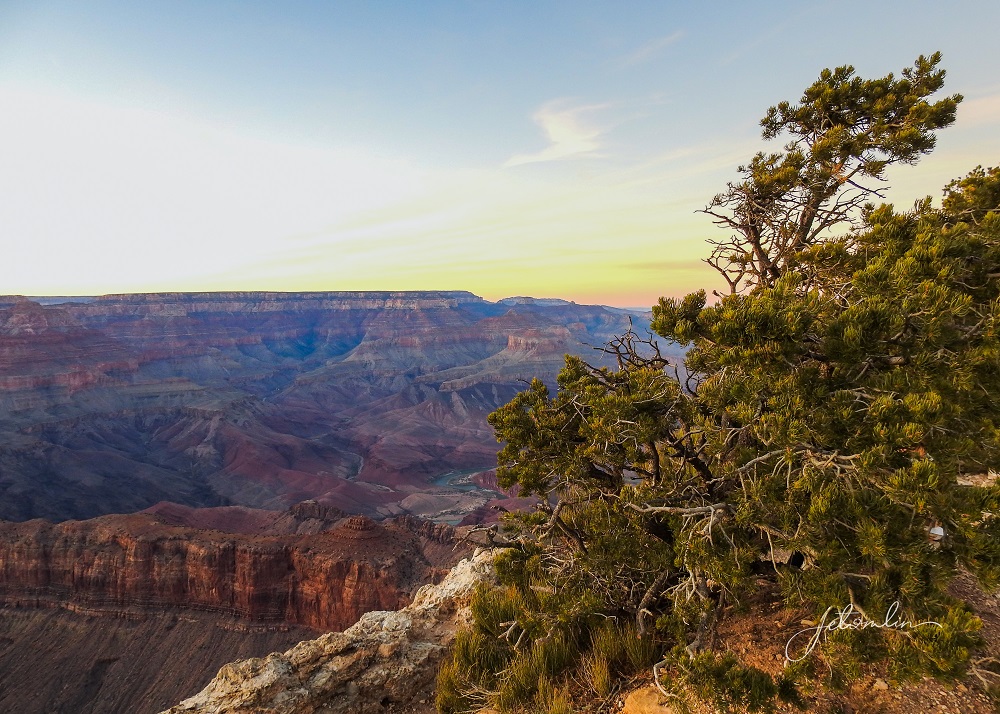
We were back at Lipan Point well before dawn and watched the sun slowly bring the layers of color alive as it rose above the horizon. Once again, a lump formed in my throat as I took in the beauty of it all.

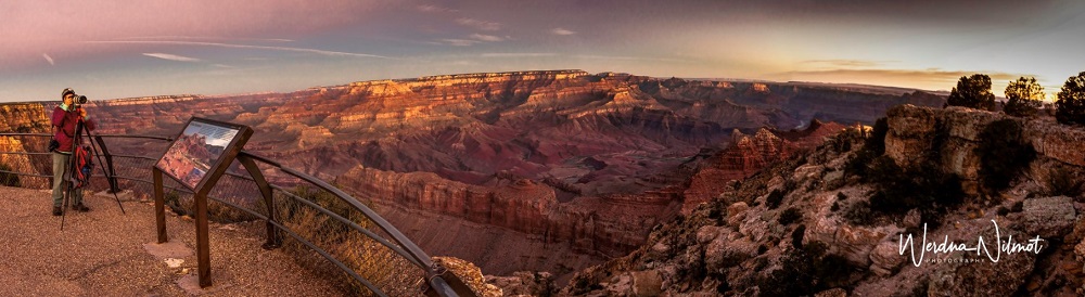
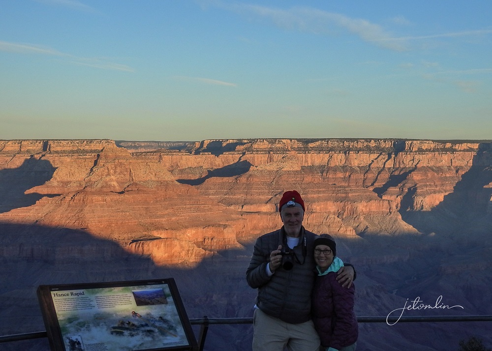
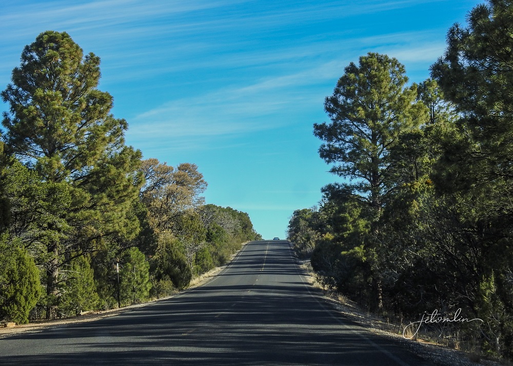
November is a great month to visit the Grand Canyon. It is less crowded – for our sunrise session, we were one of a small handful of people. And although the morning started out quite cool, it warmed up quickly during the day. We were fortunate to have blue skies and bright sunshine for both days.
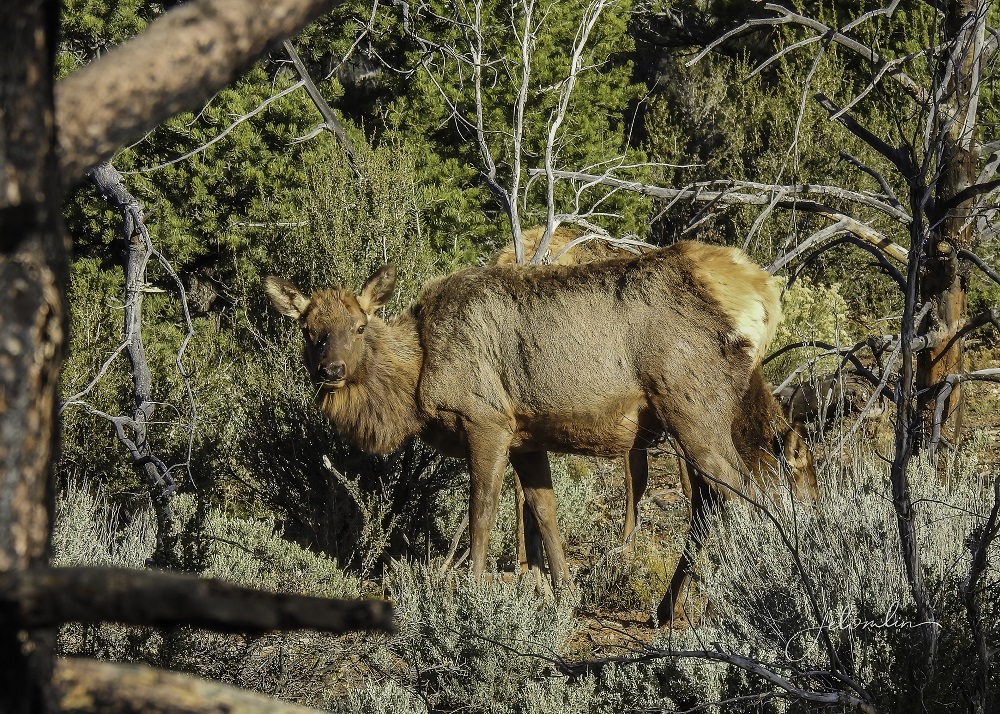
The roads are free of cars,
And we were able to stop and snap photos of the elk that grazed in the woods on either side.
We even took turns hiking a bit of the Grandview Trail.
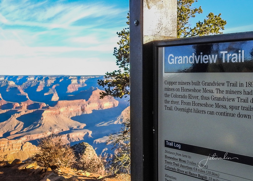
With O & M waiting patiently in the car neither of us wanted to be gone for too long, so a trek to the bottom was not an option for this trip.
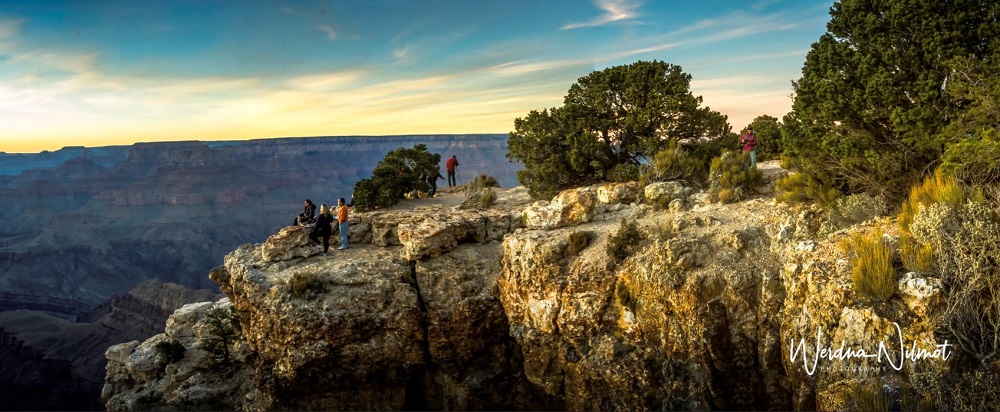
That afternoon we went back to Lipan Point for the sunset.
Many people had the same idea and the best vantage points were crowded with photographers, picnickers, and folks simply taking in the view.
We took a few photos,
And then moved on to Moran Point, a quieter location to wait for nightfall.
You can see more photos from the Grand Canyon here (click on photo then use the arrow to go through the images):

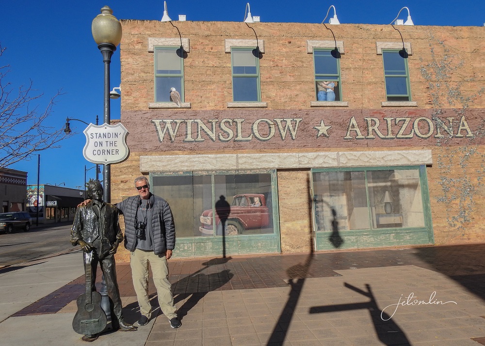
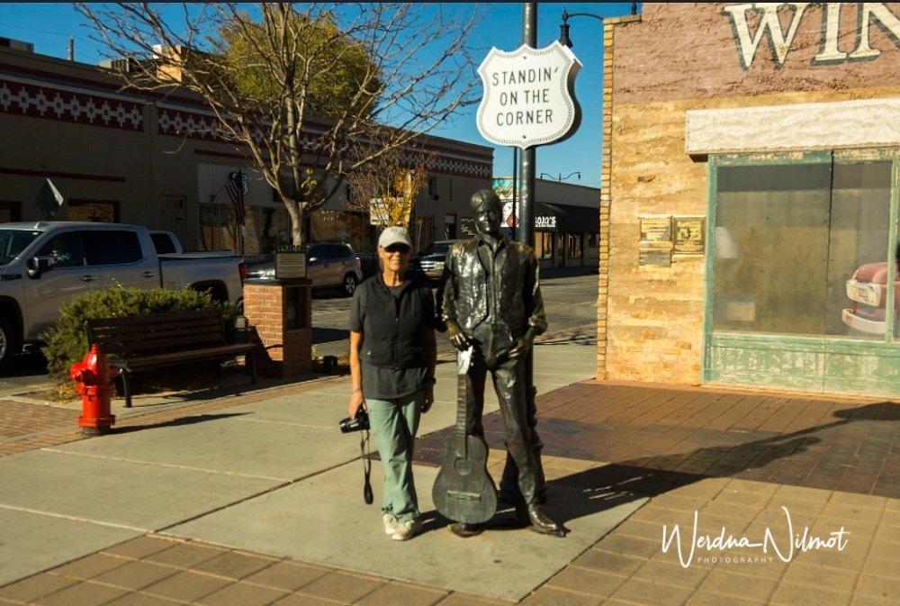
Thursday morning it was time to pack up the car and head back to Casita Del Cranes for the remainder of our trip. We plotted a route south and east, through Winslow, Arizona.

And yes, Eagles Fans, we did stand on the corner.
Driving for hours requires regular pit stops – for both us and the dogs. I do not normally write about these, but the truck stop in Twin Arrows deserves special mention.
Set in the middle of the Arizona desert, the doggie area was a large section of Astroturf, akin to a putting green. Oscar and Maddie found this unacceptable and used the surrounding bushes instead.

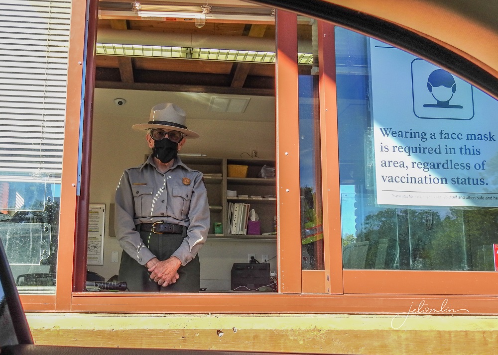
And before you were allowed to enter the building, your temperature was taken. The Navajo Nation was hit hard with Covid, and they are doing everything they can to keep it at bay.
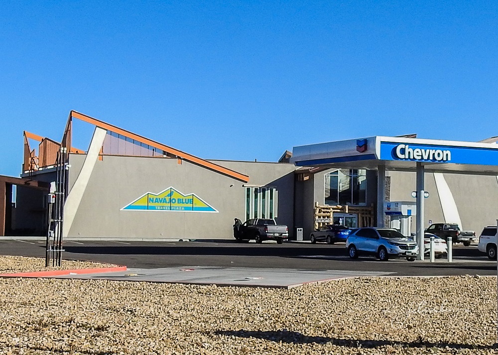
They also sold Navajo Blue piñon coffee, which might be some of the best coffee around!
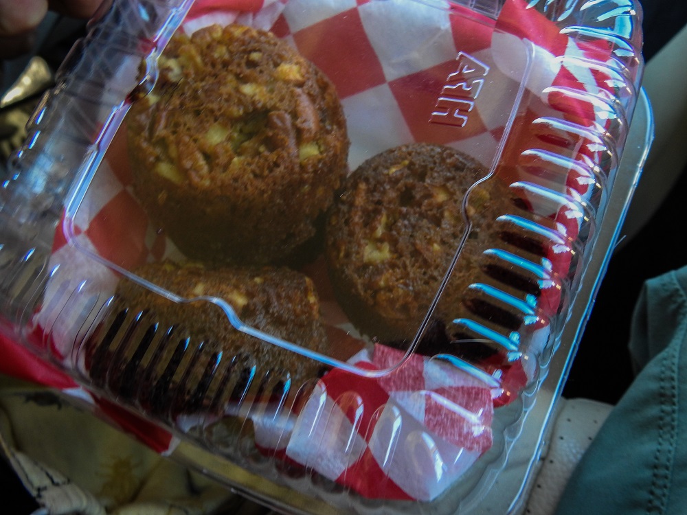
Route 60 goes straight east through a fun little spot called Pie Town, where we stopped for (you guessed it) pie.

The homemade options this day were traditional apple and pecan pie muffins.
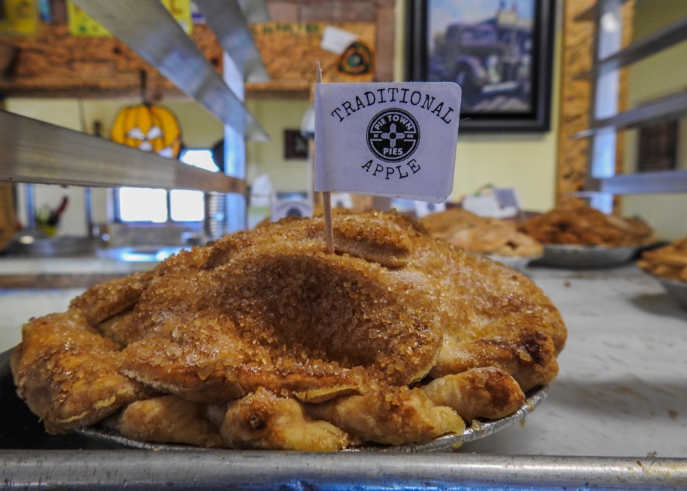
Pecan pie muffins!?! They tasted even more delicious than they sound, and my hips are grateful there isn’t a Pie Town back home!
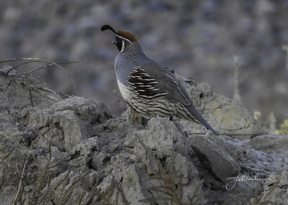
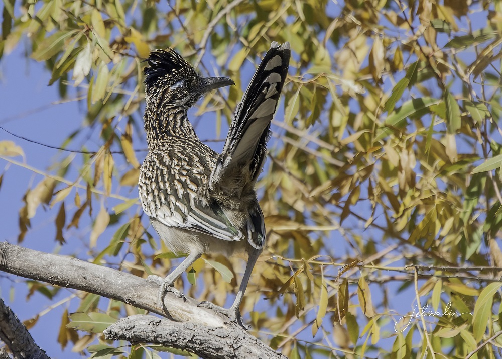
We arrived at Casita Del Cranes late that afternoon, happy to be back at our home-away-from-home. While TG fixed dinner, I took a walk down the dirt road in front of the house to look for roadrunners.
I was happy with this sighting of a Gambel’s quail, a new-to-me bird!
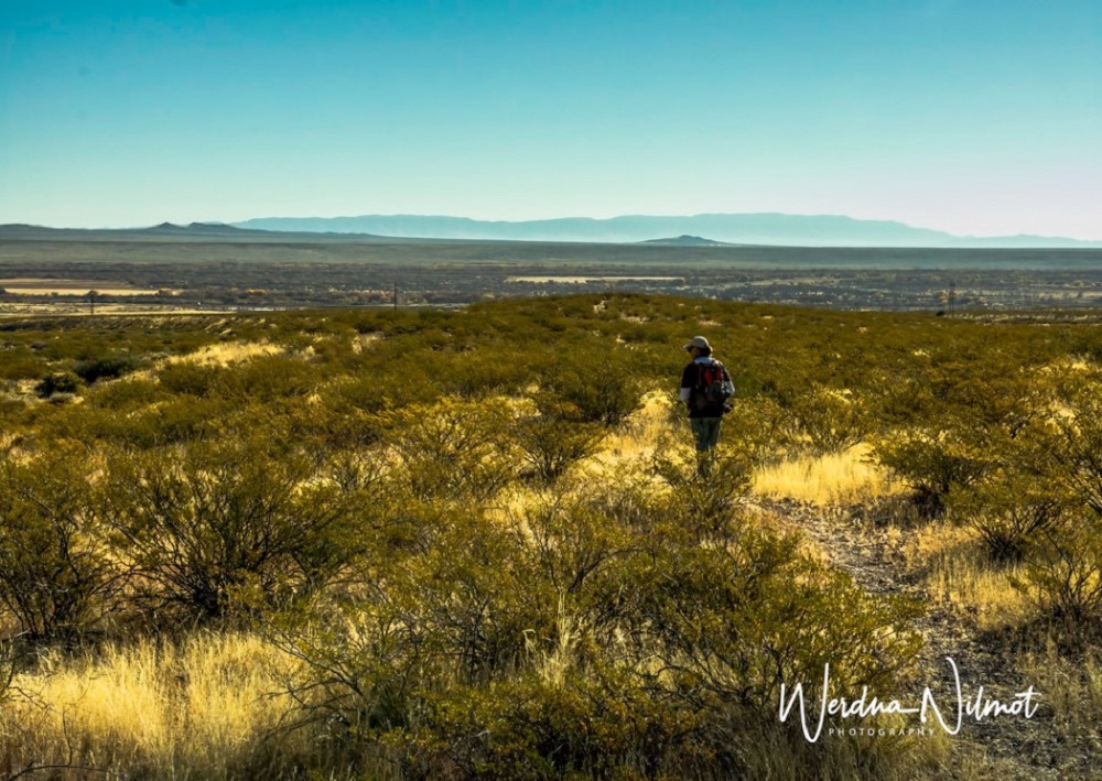
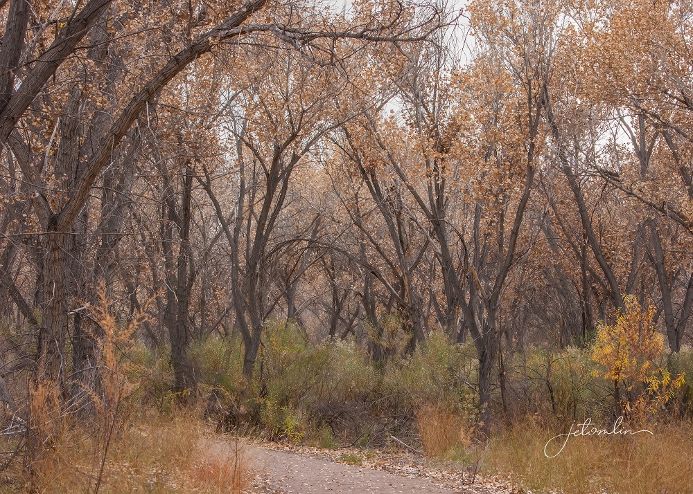
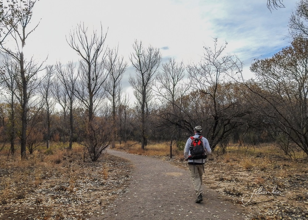
Week Three began with a visit to the Socorro Nature Area, a beautiful little preserve about three miles from Casita.
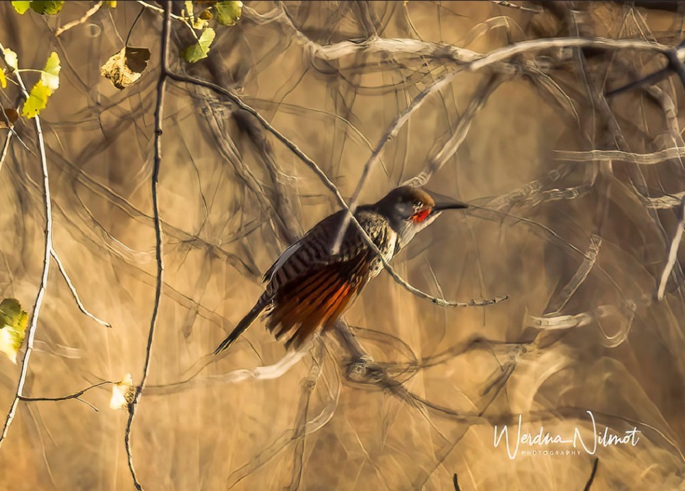
Most of the birds were TTB’s (tiny twitchy birds) that required much patience to photograph.
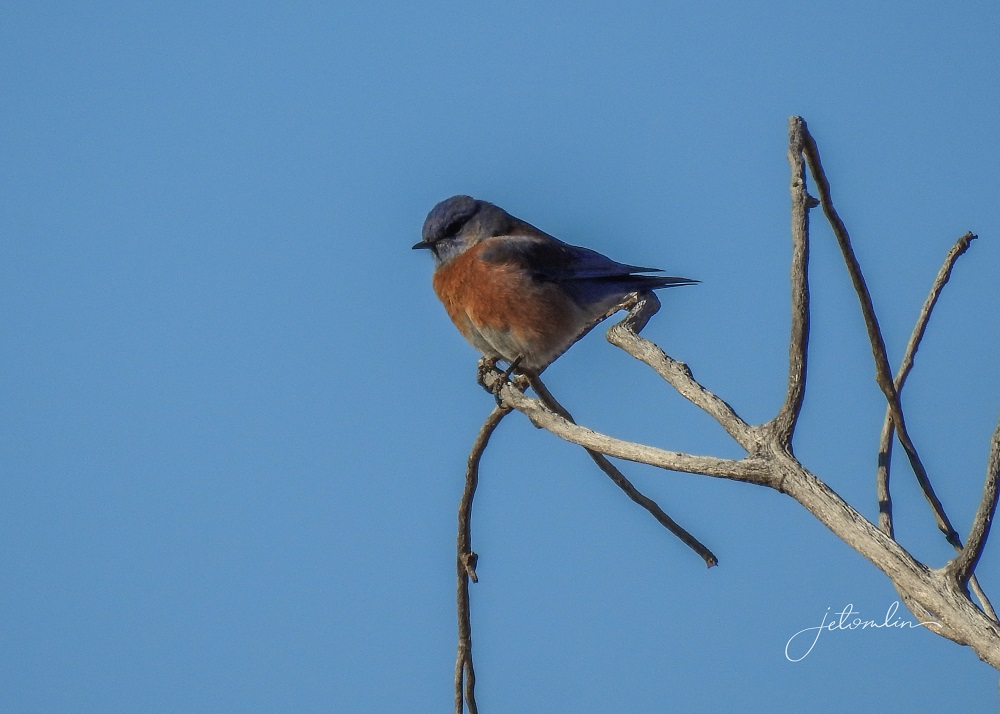
TG was able to capture some beautiful landscapes,
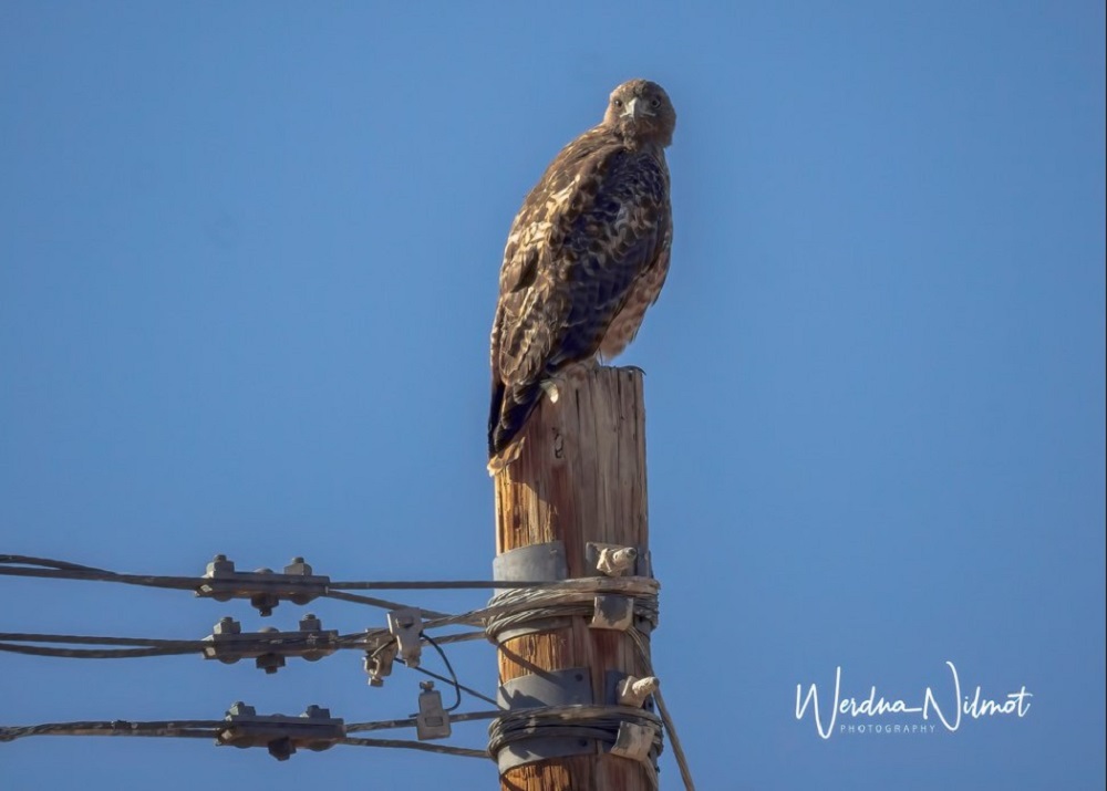
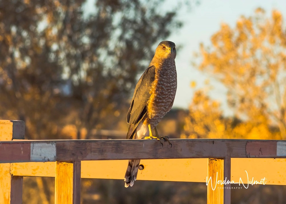
On our drive home, we spied a red-tailed hawk
and (much to my delight) beep-beep! a roadrunner!
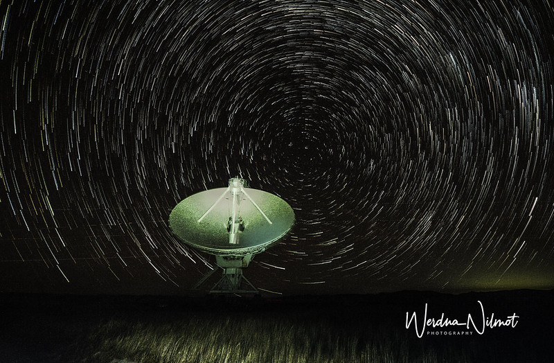
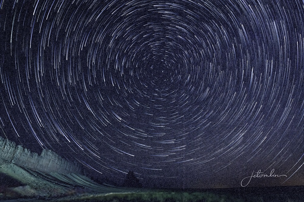
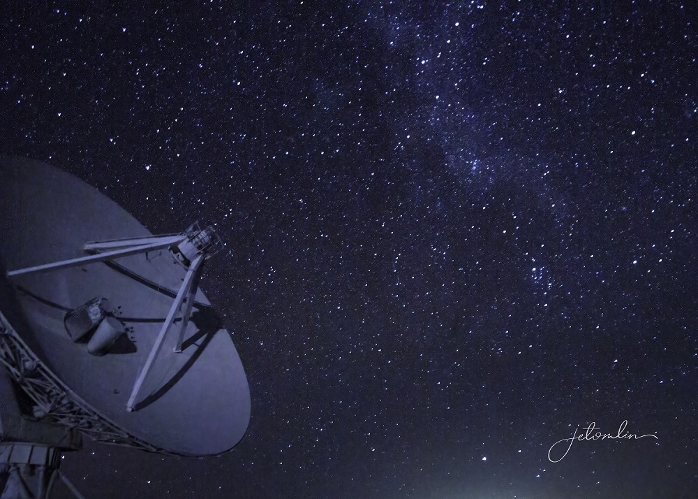
The VLA is a designated ClearDarkSky site, and the forecast that evening was for clear and dark skies with excellent “seeing.” When away from lights, the night skies in New Mexico are unlike anything we have seen. The Milky Way is incredibly bright and visible, much more so than in Florida. We wanted to try for a star stack with one of the VLA’s massive white dishes in the foreground.

We arrived at the VLA around 7:30pm and the stars were already out in full. We parked in the darkness close to one of the giant antennas and set up for a star stack. It takes about an hour to shoot the 100-200 images needed for a stack. As we waited, we looked for various constellations and watched as stars and satellites shot across the sky while the screeching cries of hunting owls filled the air around us.
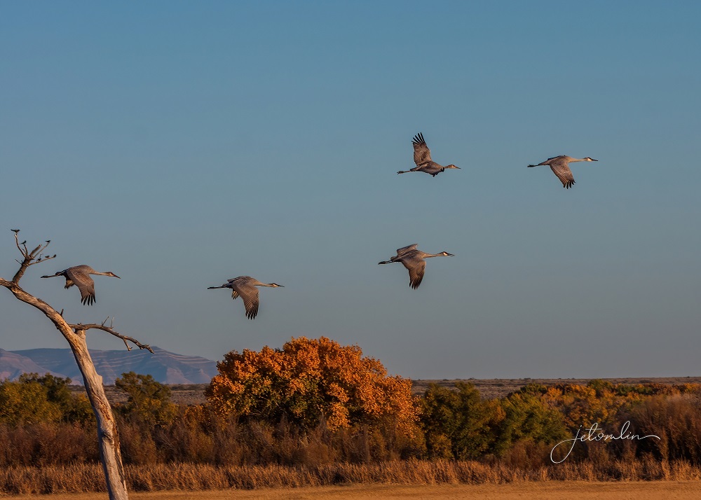
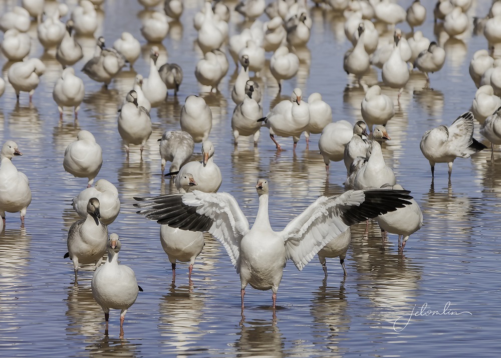
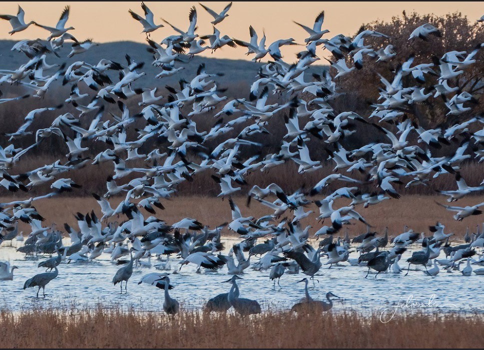
By now the birds had arrived in the Bosque del Apache in the thousands we were hoping for, so we spent the last six days of our trip close to home.
We alternated between hikes:
Seven miles of the Chupadera Trail where we climbed up to 1800 ft.
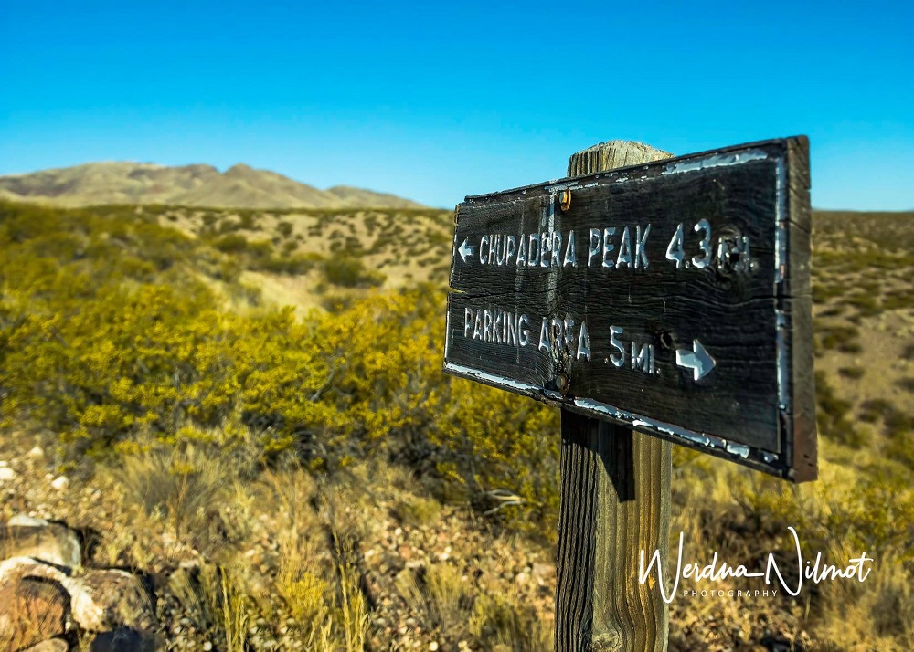
The full trail is 9 1/2 miles, but we turned around at a dry riverbed crossing. The drop down was at least five feet, and we knew the scramble back up would be a challenge!
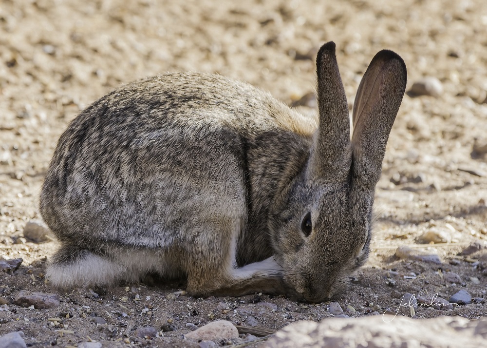
We spied a few desert cottontails
And a group of Gambel’s quail.

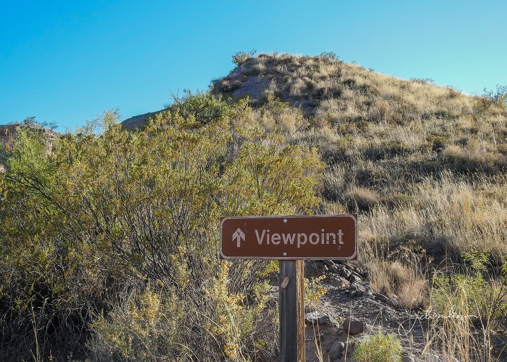
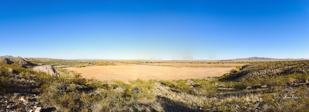
The Marsh Overlook Trail, which has a short but beautiful climb up to a panoramic view of the Bosque,
And the Rio Viejo Trail.
Just as we started down the trail, a couple with a friendly golden retriever was headed to their car. They told us there was a family of javelinas near the back of the loop and TG whispered “not anymore.”
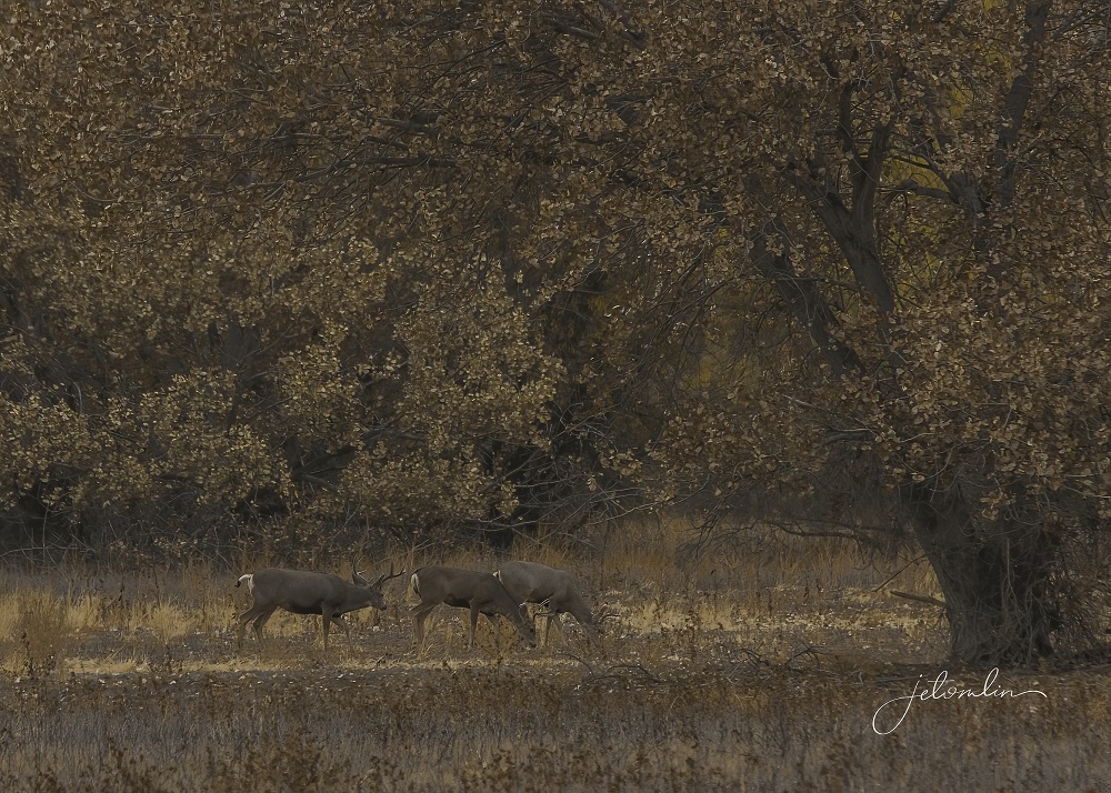
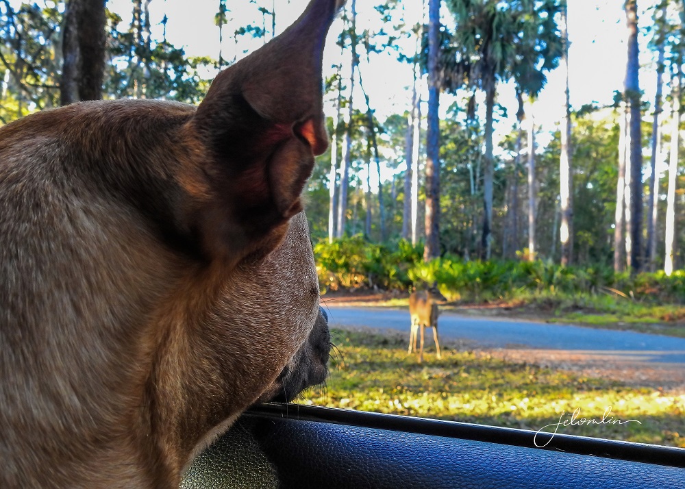
It was still a beautiful walk through the woods and we did manage to spy a group of mule deer.
We drove the “Loop Tour” roads around the refuge multiple times, where we enjoyed encounters with various wildlife such as javelinas,
More mule deer,
A fleeting glimpse of a coyote, a bobcat,

And many beautiful birds.
You can see more photos from our Loop Tour drives and hikes here (click on photo then use the arrow to go through the images):

And we spent each sunrise at the “Flight Deck.”
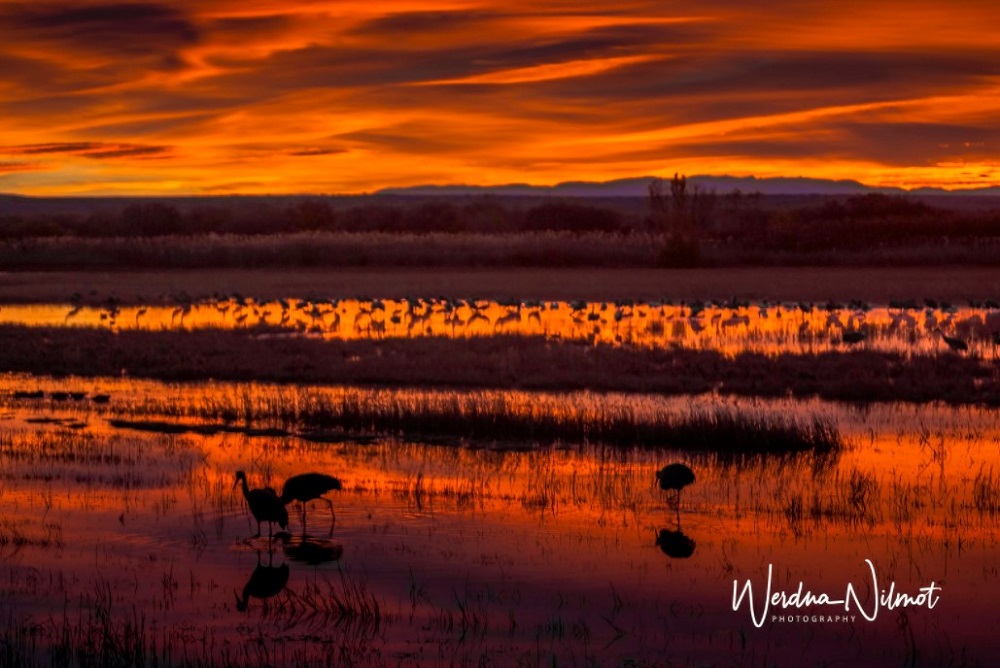
The Flight Deck is a wooden boardwalk that stretches out over the marsh and in the mornings is THE place to watch the birds flying in, out, and overhead.
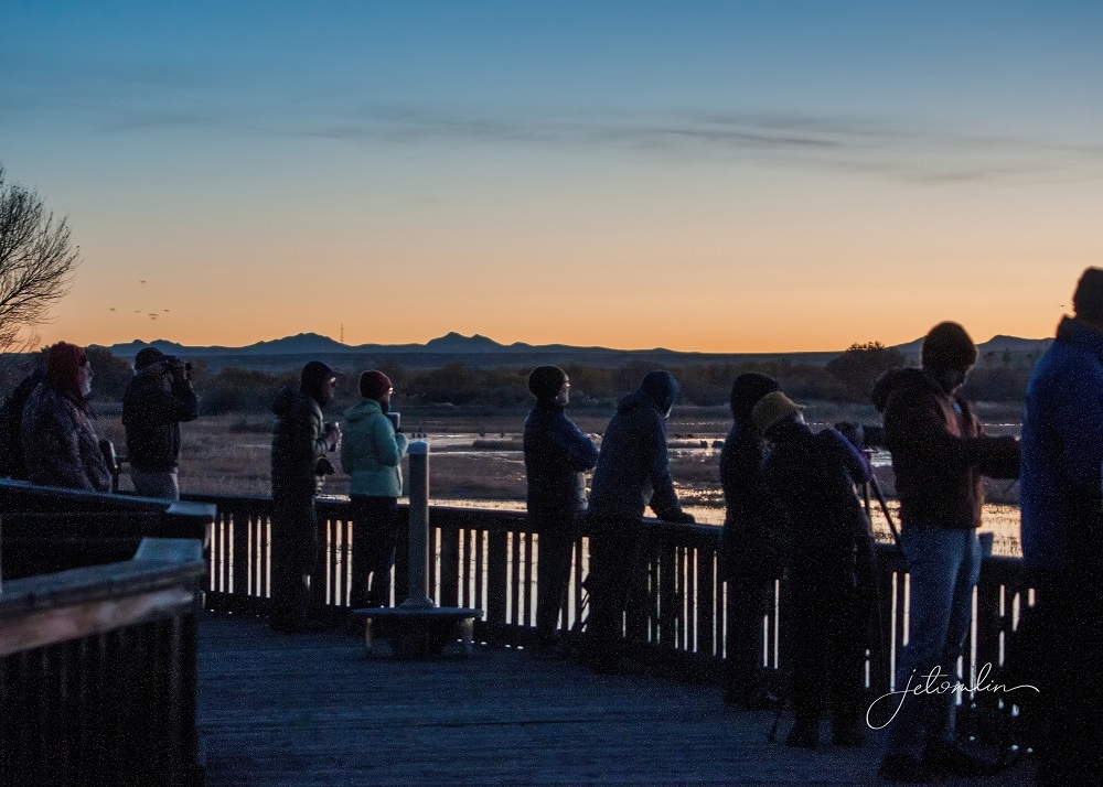
We arrived each morning before dawn to secure a prime spot. Two dozen or more photogs, each armed with a big-lens camera, vie for the same choice positions at the north and south ends of the deck.
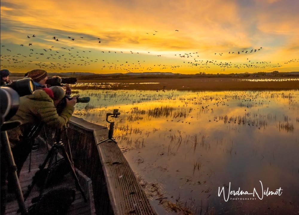
The noise from the birds is quite loud as small groups go through sporadic launches and then settle back down into the flock.

But suddenly, as if on cue, the noise swells to an almost deafening crescendo as they take off and fill the sky.

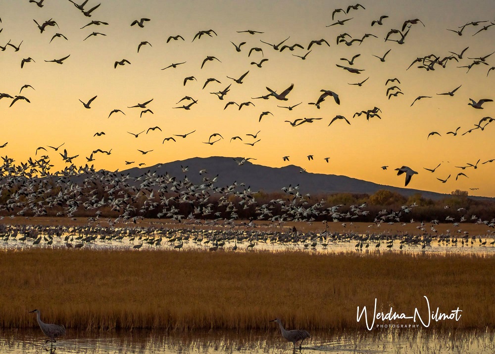
It is unlike anything we have ever witnessed.
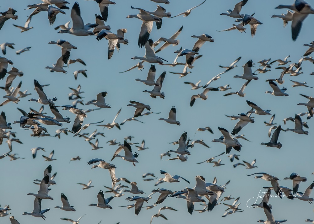
It is spectacular.
You can see more photos from sunrise at the Flight Deck here (click on photo then use the arrow to go through the images):
Every day on our way to and from the Bosque we passed the Owl Bar and Cafe. This landmark restaurant has been in business for 76 years and boasts “the world’s best burgers and steaks.” I absolutely love owls, so of course we had to stop in. Being vegetarians we opted for the breakfast burritos — which were also delicious!

One afternoon our host, Steve, drove us out to San Lorenzo Canyon, located about six miles from the Casita. This picturesque canyon is in the middle of the desert and is only accessible in high-clearance or 4-wheel drive vehicles.
Even in Steve’s big truck, it was a bumpy ride! But worth it to climb among the narrow cliffs, arches, hoodoos …
And angular rock formations.

You can see more photos from San Lorenzo Canyon here (click on photo then use the arrow to go through the images):

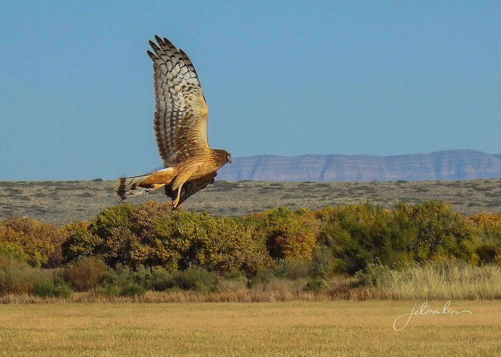
On our last afternoon, Pam joined us for one final Loop Tour drive. On our way out we spied a beautiful female northern harrier, posing perfectly in the golden light. Since this is one of TG’s favorite birds, it seemed only right that she be the one to bid us farewell.
Later that evening, Pam and Steve invited us for prickly pear margaritas. Over our three weeks at Casita, we had occasionally heard the hoot of a great horned owl in the pecan tree outside our front door. One night at 3am I went outside with a flashlight and found him sitting at the top of the tree, just out of range of my light and certainly out of range of a camera.
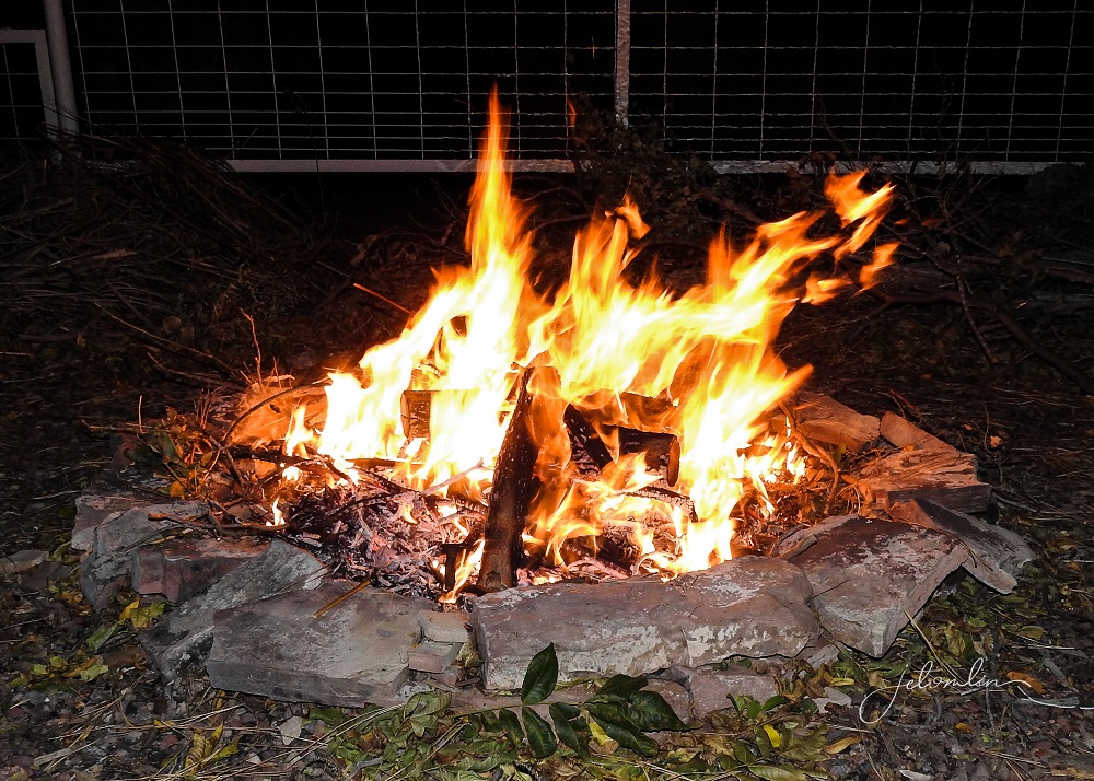
We sat under the pecan tree, calling for the owl. No owl was seen (or heard) but we enjoyed friendly conversation, a warm fire, and stars twinkling overhead.
It was a fitting end to our time at Casita del Cranes.
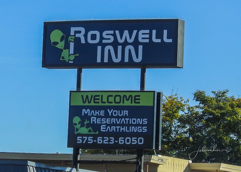
My sister lives west of Dallas and we wanted to spend a weekend with her before continuing home to Florida. But it is a nine-hour drive from Lemitar, so we broke up the trip by booking one night at the LaQuinta in Roswell.
We drove east through the lava fields and the spectacular Capitan Mountains.
The town of Roswell was somewhat of a disappointment. It sits in the middle of a vast wasteland, surrounded for miles in all directions by nothing but rolling yellow hills. It is easy to imagine a UFO touching down somewhere in all that nothingness.

But the kitschy part of town is only about three blocks on Main Street, with lots of tacky souvenir shops,
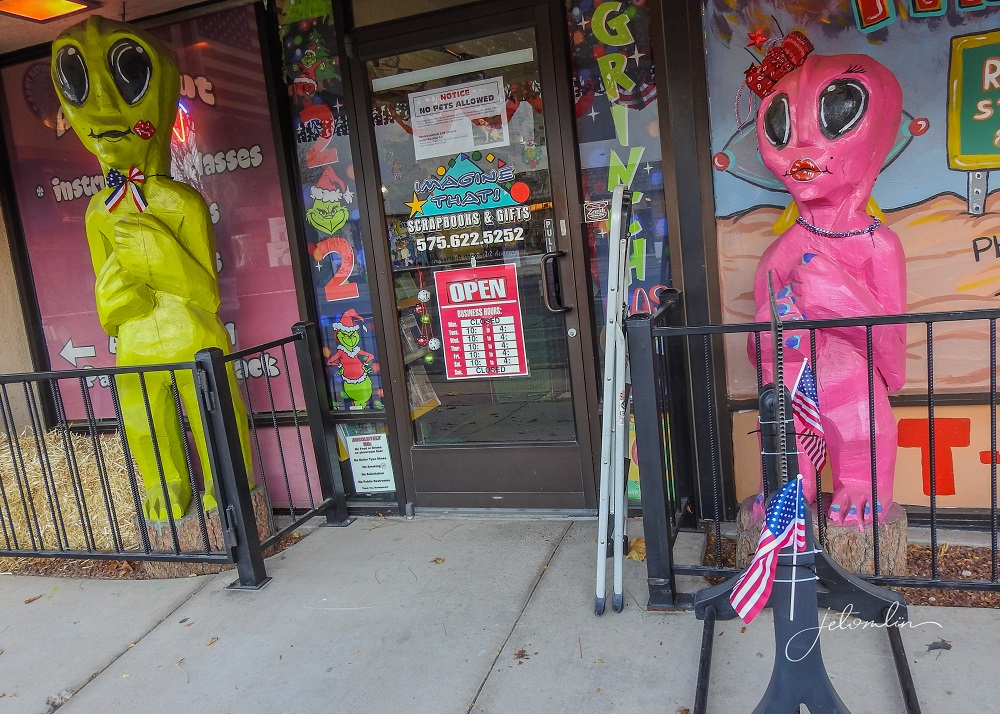
Themed restaurants,
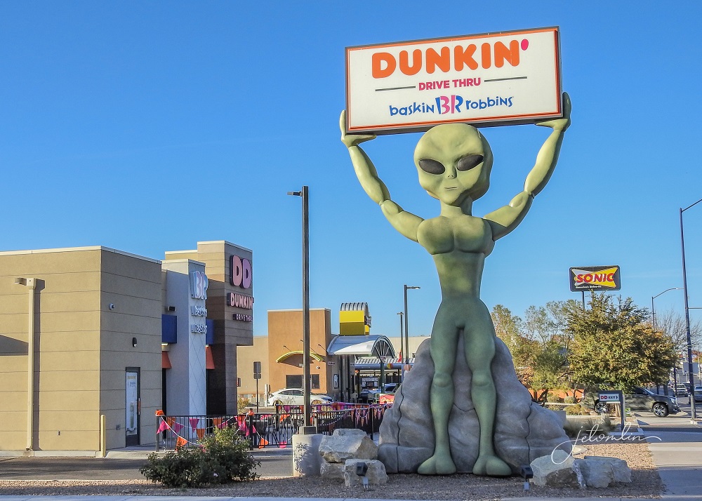
And the UFO museum.
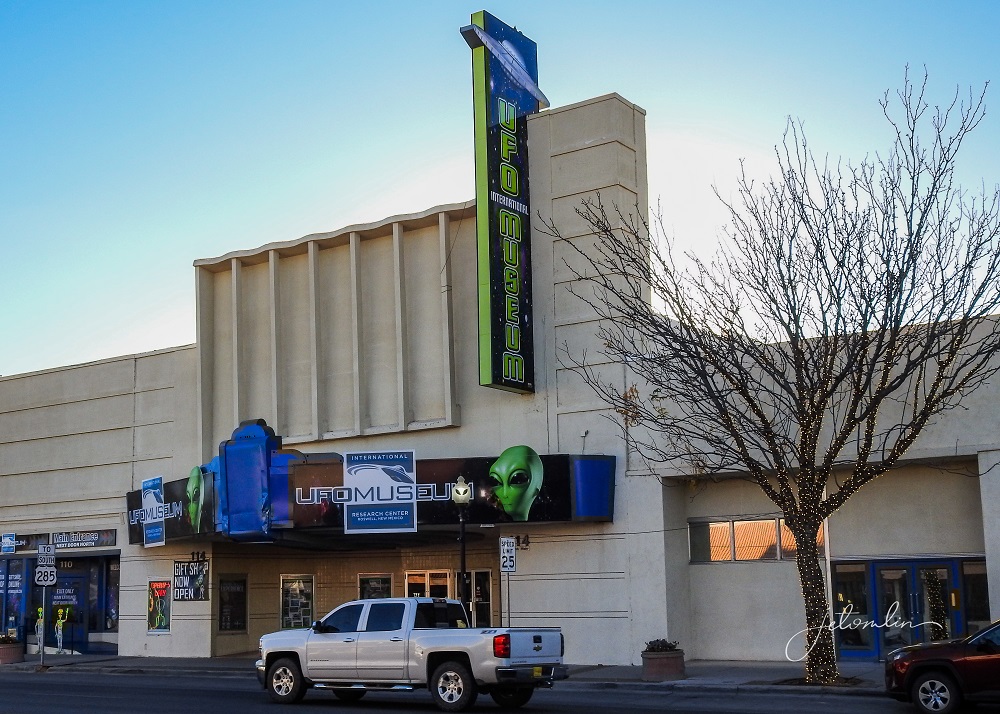
The rest of the town is kind of blah, without a whole lot of personality.
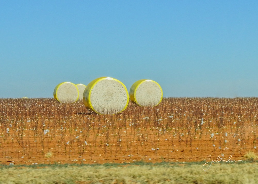
Once you cross the New Mexico/Texas border you come upon hundreds of miles of cotton fields. Many had huge bales bundled up in colorful yellow or pink wrappers.
The landscape changes dramatically as you near the Dallas area – it turns into rolling hills with lots of green trees. We spent a too-short, but delightful visit with J & D in their beautiful home.

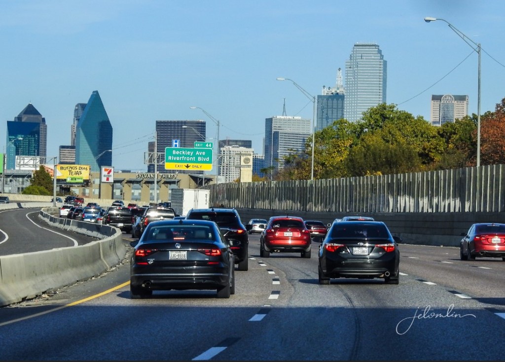
We wanted to get a head start on DFW traffic, so we left on Sunday afternoon rather than waiting until Monday morning.
We were glad we did, as even on Sunday the traffic was intense for us country folks!
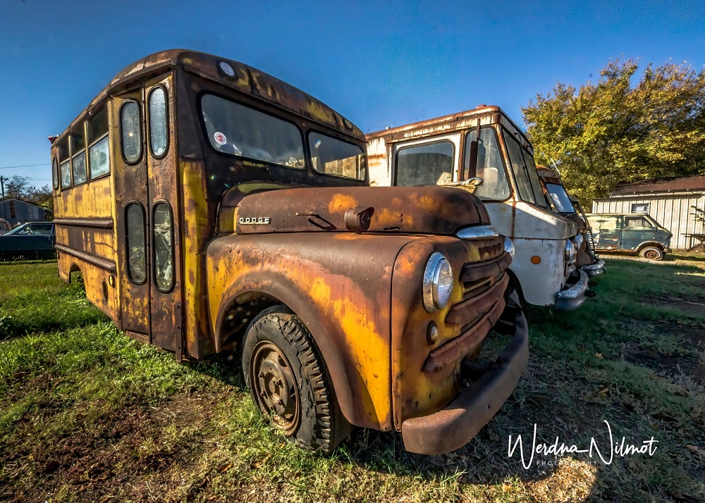
At the start of our journey, we had passed through the interesting town of Bogata, TX, and promised ourselves we would take time for photos on our way back east.
There are several old garages filled with classic cars and trucks. Many private homes also have vintage cars sitting on their lawns.

Multiple Google searches did not turn up any explanation for all the cool old cars, but it was fun to see and photograph them!
Driving as many hours as we did, we came up with fun games to pass the time. One was “if you could live anywhere based solely on the name, where would it be?” “Baton Rouge” is a fun name to say, as is “Sheboygan.” But then we passed a sign for:
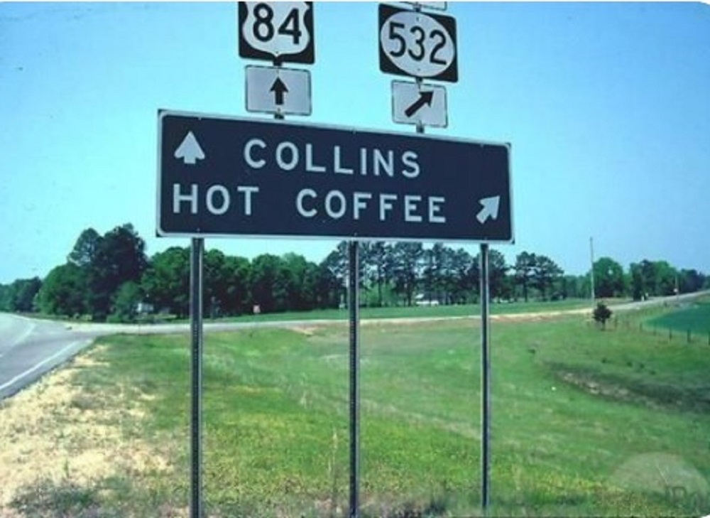
???? HOT COFFEE?!? Seriously, it’s a real town in Mississippi, and on our next trip we will have to check it out!
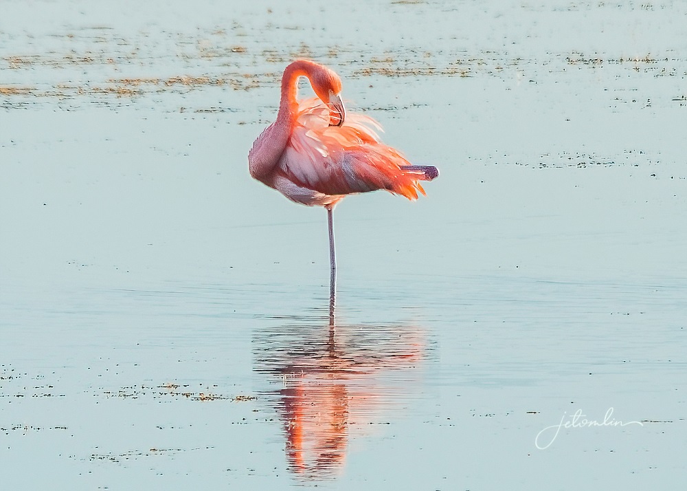
We spent our last night in Tallahassee. We had a six-hour drive home to Okeechobee and only 30 minutes to St. Marks Wildlife Refuge. There had been multiple sightings of a flamingo at the refuge, and we wanted to see it for ourselves.
So, we detoured south to St. Marks early the following morning and were not disappointed. The flamingo was there, looking ever-so-elegant in the early morning light.
We also saw three bald eagles,

Some white-tailed deer,
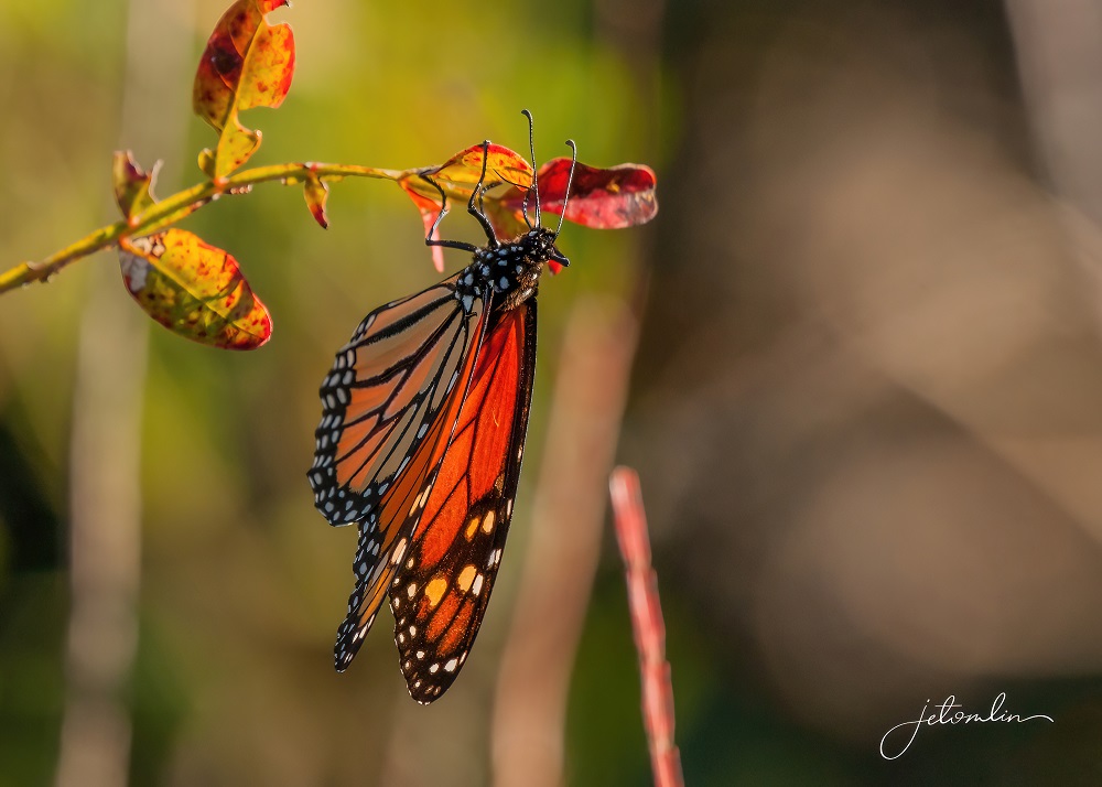
And were pleasantly surprised to find a few monarch butterflies still fluttering about.
You can see more photos from St. Marks here (click on photo then use the arrow to go through the images):

We were heading home by 9:30am and pulled into our driveway mid-afternoon. It was an amazing trip and of the 17-odd things we wanted to see/photograph we got all but one: a rattlesnake. But it WAS winter after all!

We also learned a lot about how to streamline for our next big adventure. TG and jet (and Oscar & Maddie) are indeed back “On the Road” again!
In conclusion, here are TG’s thoughts on our trip:
This was the longest road trip in distance and duration, and was a test run of sorts for some even longer journeys we have in mind…
Some Pros: JET is the best human road buddy…..we did not kill each other despite being together 24/7 for 28 days straight, much of it in the confines of a 2012 VW Jetta wagon.
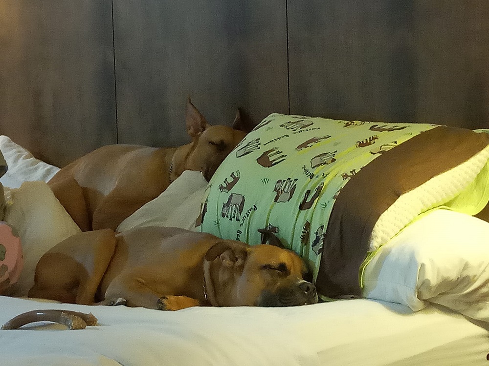
Oscar & Maddie are the best non-human road buddies, period.
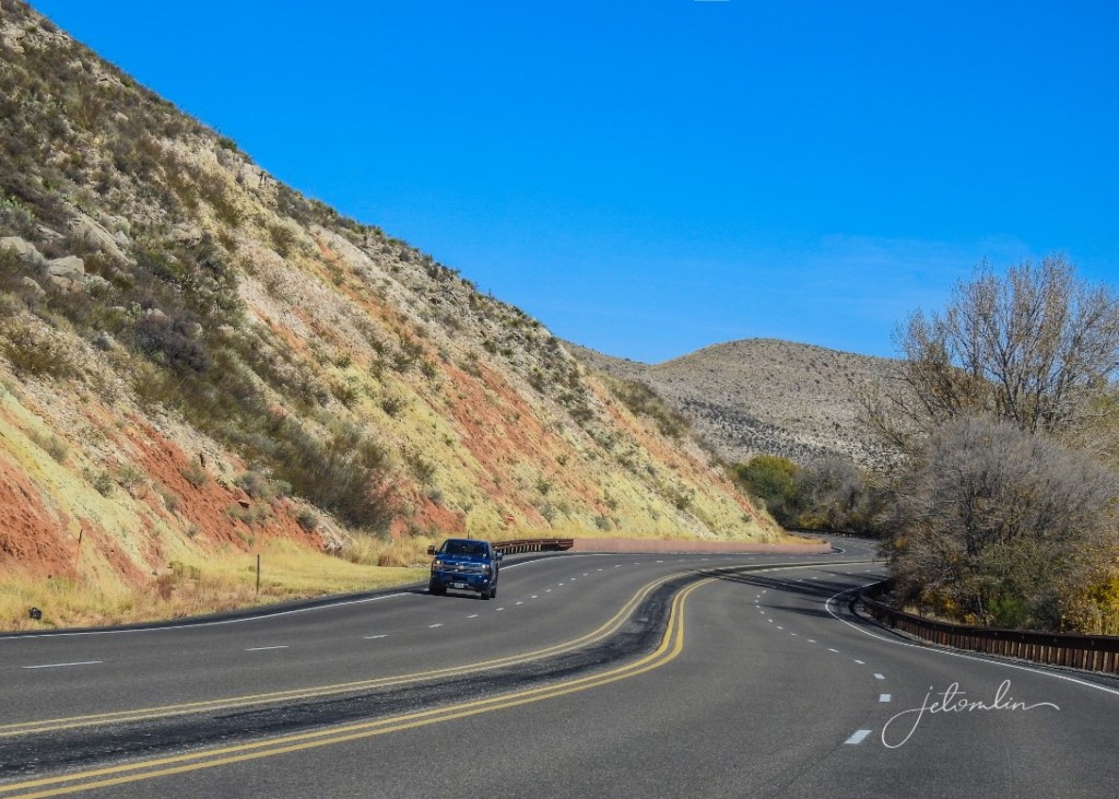
Driving across TX, in much of NM and a chunk of AZ, 75 MPH speed limits are the norm, even on 2 lane country roads…we liked it, especially with the new set of rubber we installed on Pepper before the trip.
Speaking of Pepper, she ran like a top, only burned a quart of diesel oil, which was expected based on my conversation with the VW dealership where we have her serviced…averaged 33 MPG for the 7,700 miles about 4,000 of which were with a 64 x 40 cargo basket holding a 63x38x18 cargo bag and contents…kind of like driving down the road with a refrigerator on top of your car.
New Mexico is truly The Land of Enchantment.
Taco Bell cheezy bean & rice burritos are the cheapest and best road food.
The Grand Canyon in November is sublime and uncrowded.
Pietown, NM is the only place to get Pecan Pie Muffins….and that is a good thing, because I would weigh 450 lbs in short order if they were in Okeechobee.
Tallahassee, FL is a beautiful little city.
Piñon coffee.
Hyatt Hotels are simply the best for road travel.
Some Cons: Not all Best Westerns are even close to Best.
Monument Valley is not worth the time, unless you enjoy a highly controlled , yet unpoliced experience.
Cigarette smokers congregating near your hotel room.
Cigarette smokers letting their dog run free and straight for Oscar & Maddie.
Roswell, NM is not worth the visit for a few cheap and crappy souvenir shops and a lame UFO museum.
Traveling more than 10 hours in one day is not worth it.
All in all, we can’t wait for the next adventure in 2022.
If you’ve stuck with me this far then a huge Thank You! And if you want to look at all our photos, the links to our Flickr sets are below:
TG:
jet: